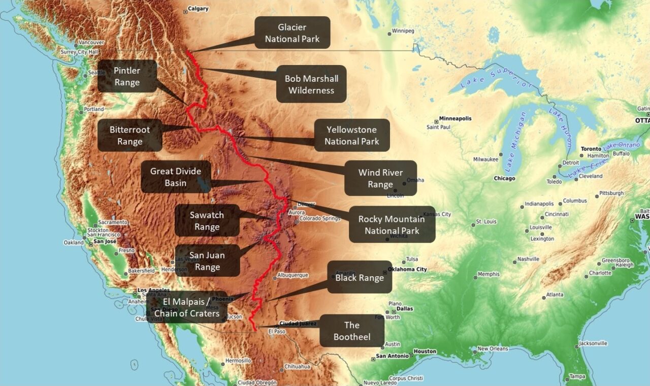
This text below is a match between a satellite view over the Continental Divide and my own memories of the outstanding geographical units along the way on the grand scheme of CDT things.

A tight fit of CDT highlights
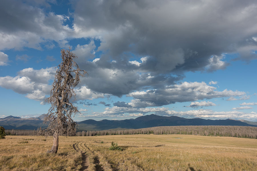
Glacier
A spectacular start to a Southbound hike. Nowhere else along the CDT the mountains get this craggy and vertical. If you’ve seen the films set up among powerful mountains of the wild west, this is it: high peaks, massive walls, dark rock, terraced lingering snow, long valleys and the endless arrangement of woods, lakes, rivers and waterfalls, it’s all here to welcome you onboard.

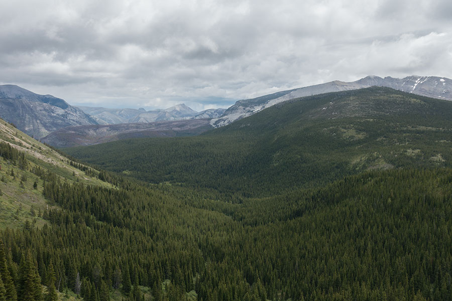
Oldman Lake, Flinsch Peak, Glacier National Park
Glacier is a National Park and this means good trails, well designed and maintained. It also means plenty of backpacker traffic even though it shouldn’t be too bad if you stretch the southbound window opening, as it’s often the case anyway, just because you need to get going as soon as reasonably possible. Maybe the worst part is the permit-enforced, designated campsite scheme, which takes away a good part of the freedom inherent to such a long trip as the CDT where you get used to just keep walking and see what happens each day. The permit scheme forces hikers to a planning effort that somehow feels alien. At least this is at the very beginning of the trip. Full freedom later on.
The Bob
I’ve been asked several times what was my favorite section of the trip. Most of the times I mentioned The Bob. Some other times, I don’t know what I was thinking. This is the most unique area on the Divide.
Picture this: a 10K square km roadless area, half the size of Wales, of which 6K are designated wilderness. Right here in the mid latitudes. The scenery may not be as postcard perfect as in the alpine-looking mountain ranges but the power is in the knowing that those valleys, those rivers, those woods and all the peaks in between are what they are and that’s the same as what they used to be. Then see the prints in the mud and know that they’re all there, even if you don’t see the actual bear, elk or mountain goat.
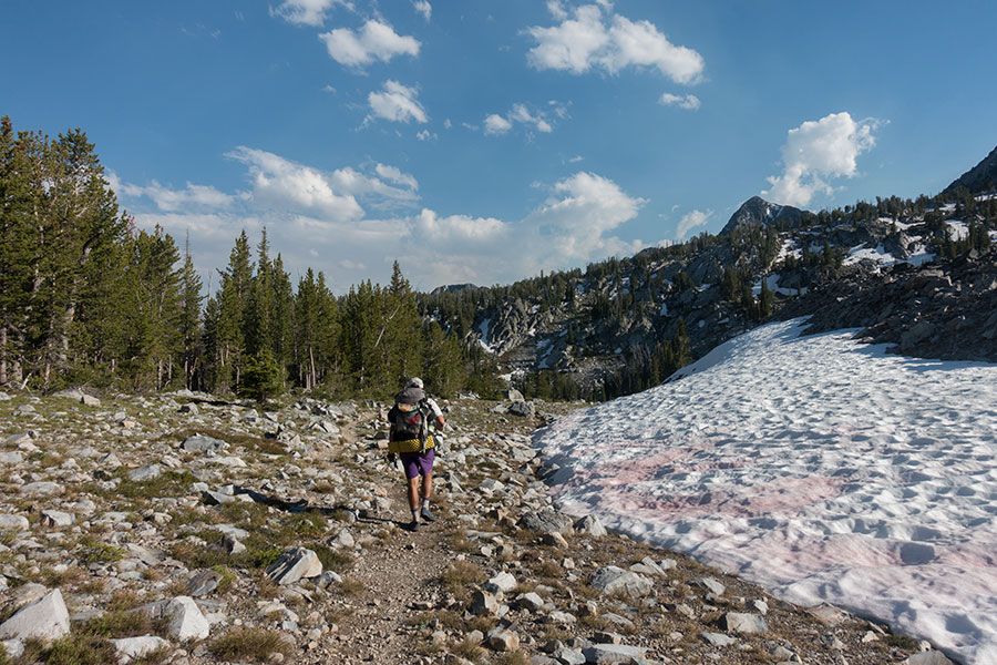
The Bob under stormy skies
It’s still early spring in the Bob when the Southbounders go through, it’s cold, dump and stormy and the pack feels heavy under an initial load of 8 days worth of food1. In 2019, at least the lingering snow was only enough to keep your feet wet.
Helena and the Butte Orbital
In Glacier and most of The Bob, the CDT follows the typical series of valleys and cols. The Helena National Forest is a transition area on the Divide on its way to the alpine further south and you find yourself hiking either on a faint crest trail or through deep woods, still uncleared from the winter season blow downs. The weather is hopefully getting drier and warmer.
Spot the hiker
Butte is a rather big town and one of the few you actually see from the trail as the CDT follows the divide over the crest just above the urban sprawl. As of 2019, this section has just got new trail and it makes for very relaxed, pleasant hiking through endless woods and some brief, early encounters with the eerie vastness of the grasslands as the route crosses two interstate highways with big trucks buzzing along like ships from another planet.
The Pintlers
One of the handy resources for hikers along the trail is the snow reports, most critical in the far north but still worth a check later on, it seems. As the route gets closer to the Idaho-Montana border, I was puzzled to see a wide spread of white on the snow map, sitting on top of a mountain section I had never heard of, how cool is that?
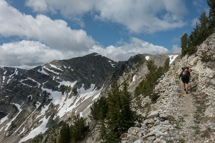
Climbing high on the Pintlers
It’s as I approached the Pintler Range that I realized how the land along the Divide keeps getting higher on average and I started wondering if having already sent my snow tools home had been a good idea. The Pintlers are truly alpine, rugged and steep but luckily for 2019 southbounders the on-trail snow was not an issue by the time we were there and the mountains were looking splendid, never mind the afternoon storms. Here is also the home of the tamarack larch, the deciduous conifers of the alpine and among my favorite trees anywhere.
The Bitterroots
Unlike the Pintlers, I knew about the Bitterroots beforehand, what I didn’t know is that the CDT would go through them. It’s actually a corner of the main range where it takes the Divide along the Idaho-Montana border and you feel the change of scenario after yet another stretch on the alpine, wetting feet on the thawing snow, then off the woods and up a sea of grassy hills as you wave goodbye to Montana first, Idaho shortly after.
Spring in the Bitterroots
Yellowstone
When the volcano underneath eventually blows, we’ll get a new mountain to climb along the CDT. Meanwhile, the Divide goes across the haunting Madison Plateau, then down to tourist central in the Firehole River Valley.
Yellowstone would probably feel like the middle of nowhere if it wouldn’t be for all the boiling mud, boiling water, boiling everything, the colors and the smells. And there you go, crowds, cars, rush, stress and a certain need to get out of there while still enjoying how amazing nature is.
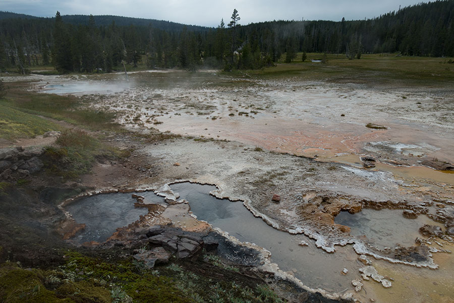
Shoshone Thermal Basin, away from the crowds
Yellowstone things get quieter after the crowd hub, then you’re out onto good trails across a beautiful landscape with woods, lakes and rivers. Watch out for the warm bathing opportunities.
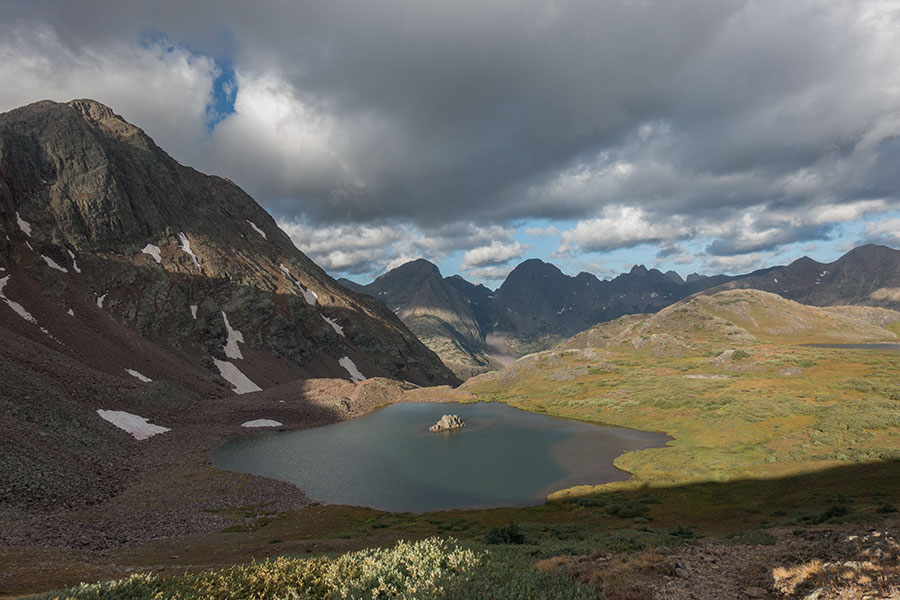
Wind River Range
Big mountains strike again but the flavor is different from anything before on the Divide. The rock here is all granite and the landscape reminded me a lot of the California Sierra but The Winds are in the middle of Wyoming and there’s not one big town in the whole state.
The place is remote and wild, yet well traveled by heavy backpacker traffic by the time Southbounders get here in the middle of the summer. At last we can feel like we are in the right place at the right time! Never mind the bugs, which were actually starting to get less active by the time I was through.
The Winds are a daze of polished rock pinnacles, grassy gardens and alpine lakes. If you stray off the official CDT track once, do it here and go through the Cirque of the Towers. It’s what the name says.
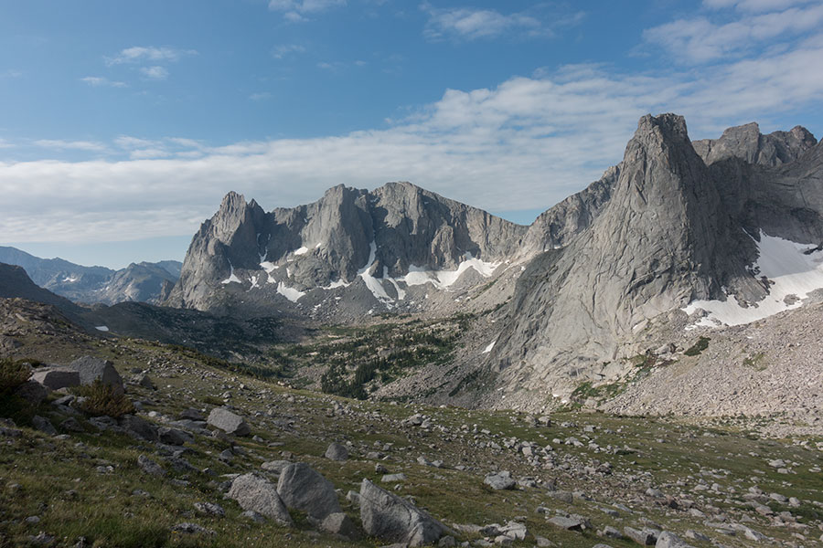
The Cirque of the Towers
Great Divide Basin
Coming down from The Winds would be shocking if you wouldn’t already know what was next: an empty, dry, desolate grassland where the Divide actually splits but you wouldn’t notice as the terrain is undulating to flat with no signs of ever ending.
The Basin is tough. It takes about 4 days to cross at typical thru-hiker pace but it’s just the size and the emptiness that make it special and sort of spectacular. The key thing here is that despite the lack of scenic appeal the place is still wild. There’d be absolutely nobody around if it wouldn’t be for the thru-hikers and even though this is true for many other transition areas on the Divide, it becomes most outstanding here where the views are wide and you can actually feel the emptiness.
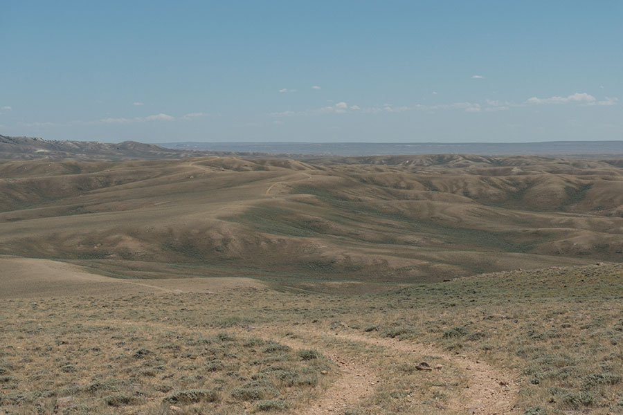
The Basin at its hilliest
There are wild horses and antelope and you’ll certainly spot them sometime. It was windy as heck when I was there. In mid-summer 2019, the water sources were all running but they’re quite far apart from each other, you need to keep your water information handy.
Mt. Zirkel Wilderness
There are some beautiful mountain areas as the CDT leaves The Basin on its way to Colorado, back to woods, meadows, lakes and rivers. It’s not until the Mt. Zirkel Wilderness though that the trail is back on a high mountain scene, climbing above the treeline onto long crest sections that you’d rather plan to hike before noon in typical Colorado hiking fashion.
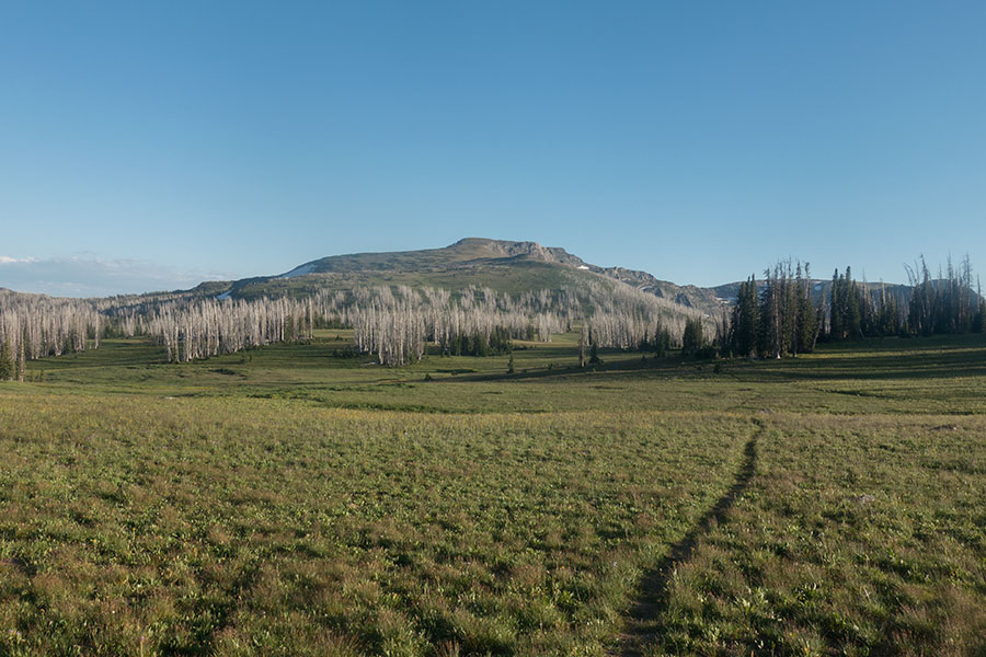
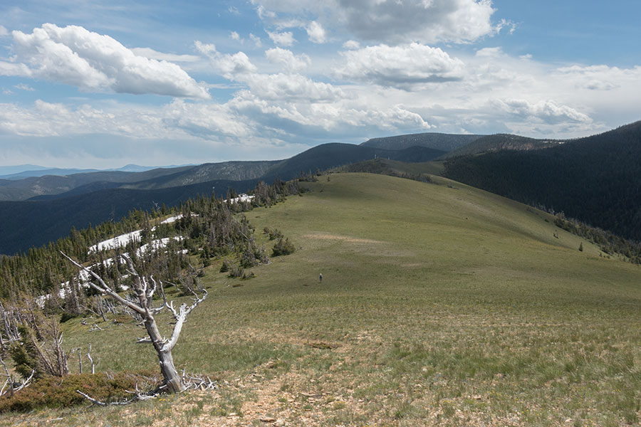
Lost Ranger Peak
The Mt. Zirkel area is also an intro to what’s about to become the Colorado business as usual, exposed ridge walking with spectacular views, a persistent cold westerly and the phantom menace of the afternoon cloud buildup. The latter two are optional, the views are granted.
Rocky Mountain National Park
It’s a relatively short stroll for the CDT through the park that most thru-hikers will do within a single day, if only to bypass the permit scheme that applies to all overnight stays. It’s still a quality hike on good trails through some scenic highlands and along watery, forested valleys that offer the hiker good shelter from the summer heat. Actually, you’ll feel the value of such shelter when you leave the park southbound, even if the trail barely goes below 9 K feet but even that may feel torrid in the middle of the day.
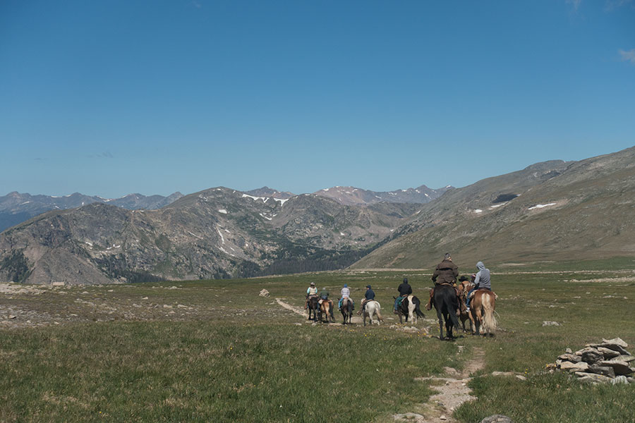
Only foot or horse traffic on the National Park
The Front Ranges
You can feel the presence of the big urban areas to the east even if you can’t see them and the whole vibe reminded me a bit to the European mountains where you need to get really deep into them to be somewhat away from the human things. The relief along the Divide is relatively smooth so the CDT stays on the crest for long sections from where you can see the dirt roads in the valleys. It’s spectacular hiking but a tad far from the alluring emptiness that had been the norm so far.

Crest trail, afternoon clouds and day hikers in the background
There are several Wilderness areas along the way but they’re rather small in size. The most outstanding feature in these ranges is the exposure, no way to limit the crest walking to the recommended window of the morning hours. It became stressful at times.
Grays
This is just a peak but it feels worth mentioning if only for the fact that it’s the highest point on the CDT at 14278 feet or 4352 m. It must be one of the most popular fourteeners in Colorado as the trailhead is just off the Interstate coming from Denver. I was unlucky to be there on a sunny day on Saturday, Labor Day weekend and the crowds where a real shock. The main route up the mountain from the northern side that the CDT takes is on a very good trail and I can imagine it’ll be a superb climb on a weekday.
Grays Peak to the left, highest point of the CDT
Oddly enough, just off the summit as you proceed southbound, you find the most challenging terrain of the whole CDT along a narrow, rocky ridge where you’ll need to use your hands occasionally. No trail and no crowds, great mountaineering fun as long as the weather holds.
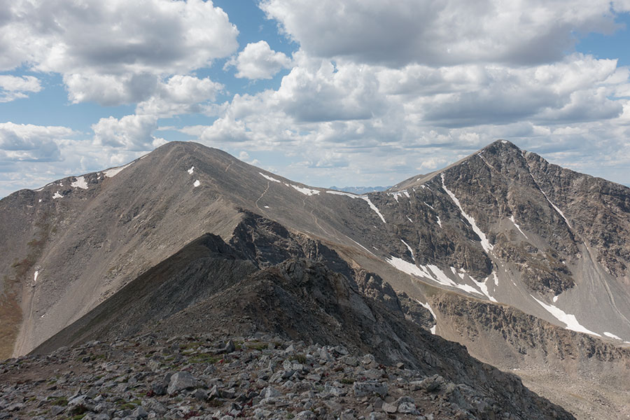
The Sawatch Range
This is where Colorado and the CDT are at their average highest and the Rockies among their widest around the Divide area. A sea of mountains in all directions is a common sight as soon as the trail gets high enough to get a view, which it often does even though ridge walking becomes less common than in the Front Ranges and the route often climbs up to the saddles, then down on the other side and not the other way around.
It’s also the area where the CDT meets the now popular Colorado Trail and the backpacker traffic increases considerably. It’s a kind of a fun game to guess whether southbound thru-hikers you meet are CT or CDT. The Sawatchs are still close to the big urban areas and they’re a popular recreational destination for all sorts of hikers and mountaineers. By the time the CDT southbounders are in the area, bow hunting season is on so hunters are also around.
The Collegiate Peaks, part of the Sawatch, as seen from Hope Pass
I had mixed feelings about the Sawatch. The scenery is spectacular, the trails are good quality and the presence of vehicle-worthy tracks is more discrete than in the Front Ranges but the trailheads are abundant and there is plenty of day-hiking traffic that makes the place feel somehow less special.
Nights and early mornings were hardly ever warm anywhere else but it’s in Central Colorado that they start to get really cold.
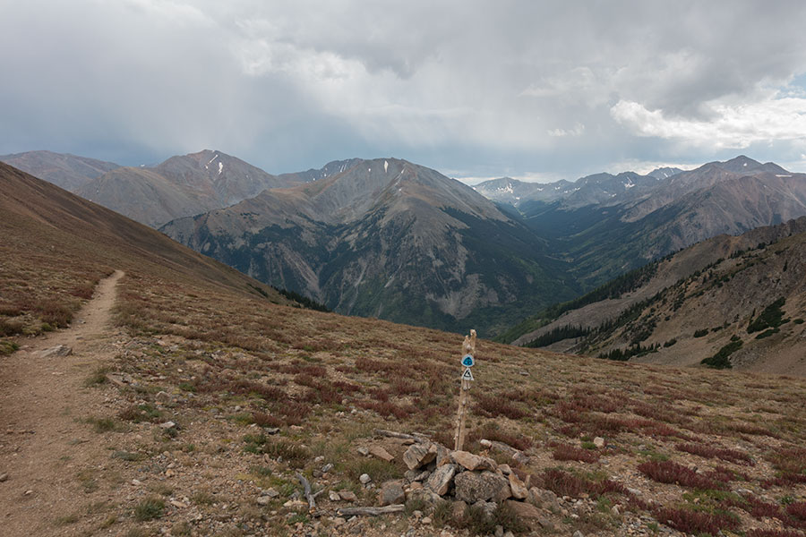
Cochetopa Hills
The Cochetopa hills is a transition area between the big mountains in the Sawatch, to the north, and the San Juan, to the south. As it’s often the case all along the Divide, where the hills are less prominent, the environment gets drier and there are even some sort sections of dusty grassland with the inevitable grazing cows.
In between big ranges
Water availability can be a bit of a concern, take it as some good training for what comes ahead. In 2019, a very wet year, most streams were still running fine by mid September. The temperatures were dropping, if not dramatically, and it was here that I recorded my coldest morning of the whole trip at -5º C, under trees, in an area that wasn’t particularly high.
San Juan Range
This is one of the highlights of a CDT thru-hike, up there with Glacier or The Bob in pretty much all accounts: it is remote, wild, super scenic and it is one of the main obstacles for both northbound and southbound thru-hikers to the point that it shapes the whole trip. Northbound, you can’t usually be here before late May/early June if you don’t want to turn it into a tricky snow fest but any later and you’d need to rush the hell out of it to get to the northern terminus before winter arrives. Southbound, the whole trip all the way here is a race against impending winter in the area. Anytime after late September is risky business.
For the Southbound hiker, the San Juan Range is where Colorado gets wild at last and this, together with the season, felt daunting and elating to me in similar amounts. The northern arc of the San Juans is high and exposed and it was here that I got the only real wintery weather of my whole trip but the paths are still good, still shared with the Colorado Trail. The southern leg through the magnificent Weminuche Wilderness is much wilder and alluring, with rougher trails that mostly avoid the high ridge walking. You won’t find much shelter in the beetle decimated woods though.
Deep into the Weminuche Wilderness
It was damn cold in the San Juans in late September. It was among the best hiking anywhere along the CDT and I was relieved when I was finally through.
San Pedro Parks Wilderness
Shortly after entering New Mexico, the Southbound CDT leaves the 11 K feet mark behind for the last time. The mountains get progressively lower and the trail emerges onto dry mesa country for a first time. The change in scenario is shocking, as it can be the midday heat and the beating sun that the open woods can’t stop from hitting you.
It’d feel like it’s gonna be all downhill from here and it’s gonna be only desert ahead and you start checking for rattlesnakes across the dusty trail as the brown wins over the green but then it gets hilly again. As you climb the San Pedro Parks hills, you find running streams and as the woods get thicker you’re back into spruce and fir trees. There’s even some marshy meadows that could leave your feet wet and it all looks like you’re back in Montana with a major difference: bulging elk. It’s the season.
Back in the deep woods
Mesa Country, Cabezon & Taylor
If the mountains along the Divide can feel like an island of green/woods, the New Mexico mesa formations take that feeling to new heights, despite the limited prominence. It is common that the flattop mesas are forested while the surrounding terrain is rather barren and you can see this from the CDT as it traverses long sections of Mesa rim with wide, unobstructed views over the arid land below.
One of those panoramas includes iconic Cabezon Mountain. Cabezon is Spanish for “Fat Head”. The giant, lonely monolith stayed in the horizon for a long time as I was starting to enjoy the hiking through this land of odd rock formations and fascinating emptiness.
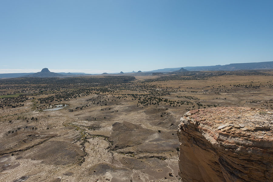
Cabezon Peak on the far left as seen from the Mesa rim
Once again the trail climbs and you can see the change in vegetation that comes with the elevation, transitioning from shrub to juniper to pine woods. The high land is there to stay as the CDT approaches, then flanks isolated Mt. Taylor. The sun is almost welcome again as nights and mornings are getting really cold.
El Malpais & Chain of Craters
Lots of place names are in Spanish in New Mexico. Malpais stands for “badlands” and it’s easy to understand why the early European explorers named it that way, it’s a huge lava flow where walking through is as fascinating as it is tough. The lava solidified yesterday, in geological terms, and the whole area is a mess of sharp, convoluted, oddly cracked, dark rock. You can clearly feel how the whole thing was a flowing liquid once.
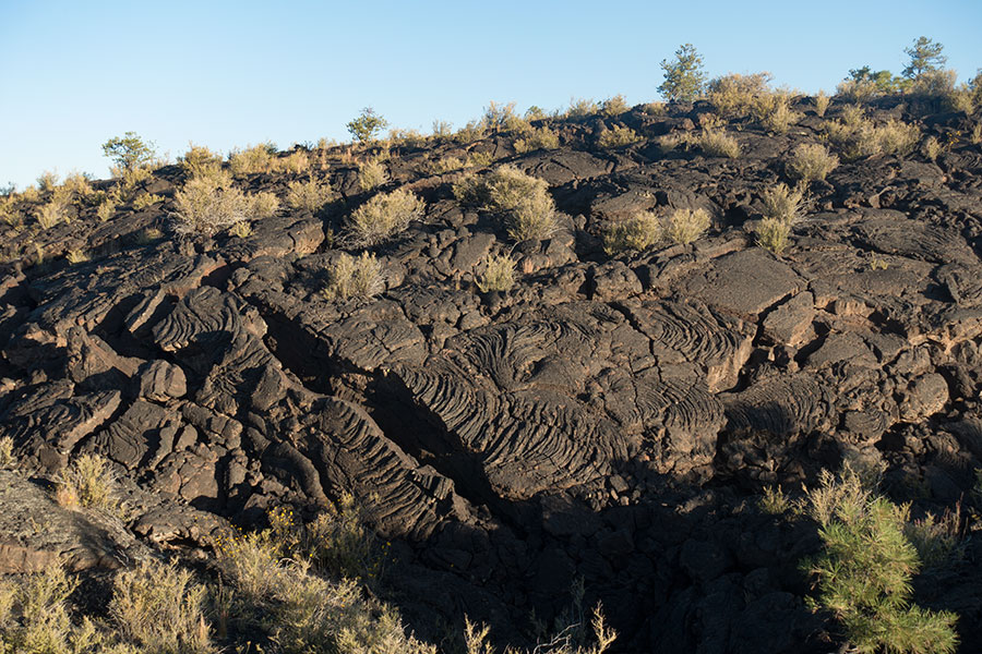
The lava fields
The crossing of the main lava flow takes only a few hours of rather slow progress but the whole El Malpais National Monument area is much larger and includes the traverse along the line of volcanic cones that spouted it all, now a series of perfectly shaped, forested hills.
The Chain of Craters is a beautiful area of welcoming pine woods and rough trails that not many southbounders take. I didn’t meet any other hikers in this stretch and the CDT started to feel very solitary.
The Black Range
The southern half of New Mexico is a mess of options as far as the CDT route goes. The official way keeps close or over the actual divide, as usual, land ownership and rights of way permitting, and it seems it’s by far the less popular option for thru-hikers.
This is particularly true for the Black Range, which gets powerful competition from the Gila River Canyon. The Gila offers wilderness, scenery and running water and I can understand how this latter wins over most thru-hikers who, by this time, haven’t met a running stream for weeks. I’m not aware of any other southbounder who took the Black Range in 2019 and if I judge from the Guthook App comments on water availability, it seems no southbounders have taken this route since the app came over in 2015.
The Black Range is a remote place with no towns nearby and not many hikers around. I didn’t meet any. It’s a straight north-south main divide of heavily wooded mountains. At the one point where the CDT strays off the ridge down to a side valley, there’s also running water and these deep valleys can be surprisingly lush with an abundance of oak and other deciduous trees. Lots of wildlife too.

Lush valleys of the Black Range
I loved hiking the Black Range. It felt very special, so much that it made for a good story of its own.
The Bootheel
The name is a reference to the shape of the borders between New Mexico, Arizona and Mexico so, yes, this is the end of a southbound CDT trip. The most distinct feature of the area is the high desert environment. As the trail crosses a line of hills, the chaparral suddenly ends and you can see ahead to a flat, barren expanse of yet more emptiness which will be the scenario for the final days of the southbound CDT journey.
The high desert was tough, with rough trails and very limited shade but, by late October, temps were mild enough during the day, mornings were damn cold though! The hiking can be mentally arduous with limited sense of progress in such an open land. The place is wild, the early/late day lights were awesome and the water shouldn’t be a problem anymore thanks to the officially maintained water caches.
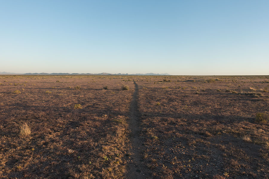
The alluring emptiness of the high desert
If anything, I was sort-of-deceived by The Bootheel after my wrong expectations of a good trail and easy hiking, it wasn’t any of those! In hindsight, it was cool that the CDT stayed true to its wild spirit. It was a challenge to the very end.
 RSS – Posts
iyashike
Hello there, I wanted to ask (should you not mind) if you could compare the San Juans to the Swiss “Via Alpina” mountains in terms of difficulty. l’m planning on doing the CDT next year (2021)… Thanks in advance!
Viajarapie
Hi, it’s a good question and a difficult one to answer. They’re very different and the difficulty of each is in very different aspects. In the Via Alpina, the terrain is rougher, on average, meaning the mountains are craggier and the elevation gain/loss is considerably bigger than anything you would find along the CDT on the San Juans. On the other hand, the trails are much better on the Via Alpina and the signage is very good. I’d say exposure is similar, maybe less on the Via Alpina because you go up a pass, then down. On the San Juans, you stay high and exposed for long stretches, particularly on the northern half.
Which brings me to the main difference point, the remoteness. On the Via Alpina, which I guess you know already, you’re hardly ever far from built up areas, you go through villages almost daily, then there are the huts, the ski resorts and there’s people on the trails. In the San Juans, it’s really wild. Between Spring Creek Pass road crossing (access to Lake City or Creed) and Wolf Creek Pass road crossing (access to Pagosa Springs or South Fork) it’s about 120 miles that are quite remote. The northern half is very high an exposed but the trails are still quite good, this half has quite some traffic because the Colorado Trail takes the same route. The southern half is less exposed on average but the trails are rough and it’s really remote there, not many people around and not many escape routes. The real difficulty of the San Juans is in the rough trails and particularly the remoteness, not that much on the terrain.
South of Wolf Creek Pass it’s still remote and rough. The terrain is gentler but some trails are very rough and there’s still exposure. It’s only 3 more days though to Cumbres Pass road crossing.
All taken into account, I think the San Juans are more of a challenge than the Via Alpina but nothing a good hiker/mountaineer can’t do. If you’re hiking the CDT, by the time you get to the San Juans, you’ll be a hiking machine anyway 🙂
Speaking about the CDT, hiking direction is actually key in how you find the San Juans. If you go Northbound, you’ll get snow in the San Juans. It depends a lot on the particular year but it’s not uncommon that northbound hikers skip or shortcut the San Juans. If you go Southbound, in general, you have a better chance of hiking the San Juans in good conditions even though it’ll typically start to get very cold.
Hope it helps! Anything else you think I could help with, don’t hesitate to ask and the very best luck with your plan for the CDT in 2021, it’s a great trail and a fantastic little adventure.
iyashike
Dear Iñaki,
Thanks a lot for your thoughtful, thorough and quick reply, l truly appreciate it.
Yes, you guessed it right, l did the Via Alpina last year. I was asking because l don’t have mountaineering experience (other than having hiked in Switzerland many times and being somehow exposed at times) and everybody seems to be so intimidated by the Colorado mountains and, specifically, the San Juans. l’ll do my best to be ready for the challenge (ATM reading books?). I can’t wait to feel that remoteness you’ve often mentioned throughout your CDT posts. The closest to that l’ve experienced myself is hiking in Scotland, specifically while doing the SUW: https://www.youtube.com/watch?v=7x2I47IYux8
Thanks also for the NOBO/SOBO advice. l still haven’t fully made up my mind as to which direction to follow. Let’s see what life brings next year and what suits my circumstances best. As of now l’m more inclined to do it NOBO. Truth is l actually would love to experience the snow in Colorado, yet l have very little ‘snow hiking experience’…
BTW, l’m Spanish (although l’ve lived abroad for many years, including the US). I wrote in English not only because l read your entries in English, but because your answer may then be of help to many others (who’ll probably understand English but not Spanish).
Again, thank you very much!
Viajarapie
Nice vid from the SUW, I’ve never hiked in the area, I thought it was more forested! Congrats on completion, Scotland is beautiful but damn tough hiking.
Pretty much nothing on the CDT will be more difficult technically than what you’ve done in Switzerland, actually Scotland is more difficult. Then the CDT goes through pretty remote country and the San Juans are among the most remote. If you go NoBo, you’ll probably hit snow, I’d recommend you take the following winter to get some practice in the snow, if only the basics about safe progress, crampon and axe use. You could go without, some hikers do and they’re fine most times but you’d feel more confident and resourceful and that’s a very good thing.
Other than the snow and the remoteness, the crossing of the San Juans is not difficult. If you go NoBo you’ll probably have the chance to team up with other hikers, it can be a great morale booster.
Good luck with the planning, be sure to reach back, either via comments or the contact link if there’s anything I could help you with. Cheers!
iyashike
Hello there! Thanks, the SUW was my first thru-hike (if only a short one). I used it as a training ground having in mind other hikes l want to do with my wife where resupply isn’t possible, so l was carrying 20kg (+ water) then heavy old school hiking boots, etc. For the CDT l’ll try to go as light as possible, as pretty much everyone else.
Mixing up with other hikers surely helps, but oh that feeling of pride and fulfilment when you face it all by yourself. As always, l’ll go with the flow…
Again, thank you so much for taking the trouble (and the time) to answer my question and beyond.
¡Un fuerte abrazo desde Londres!
Yeah Yeaj
On the CDT right now and just came across this, super helpful for the rest of CO and NM!
Viajarapie
Glad you found it useful. Best of luck for the rest of your hike.