
Distance covered: 25 miles
I get my promised good weather window, it is calm and sunny in the morning. My first sunny day in Iceland 2016!!! Look at that blue sky:

Brilliant blue skies at last. Vatnajokull hides behind low cloud
The lack of clouds lowered the temps during the night down to almost freezing. Water didn’t freeze but the olive oil did:
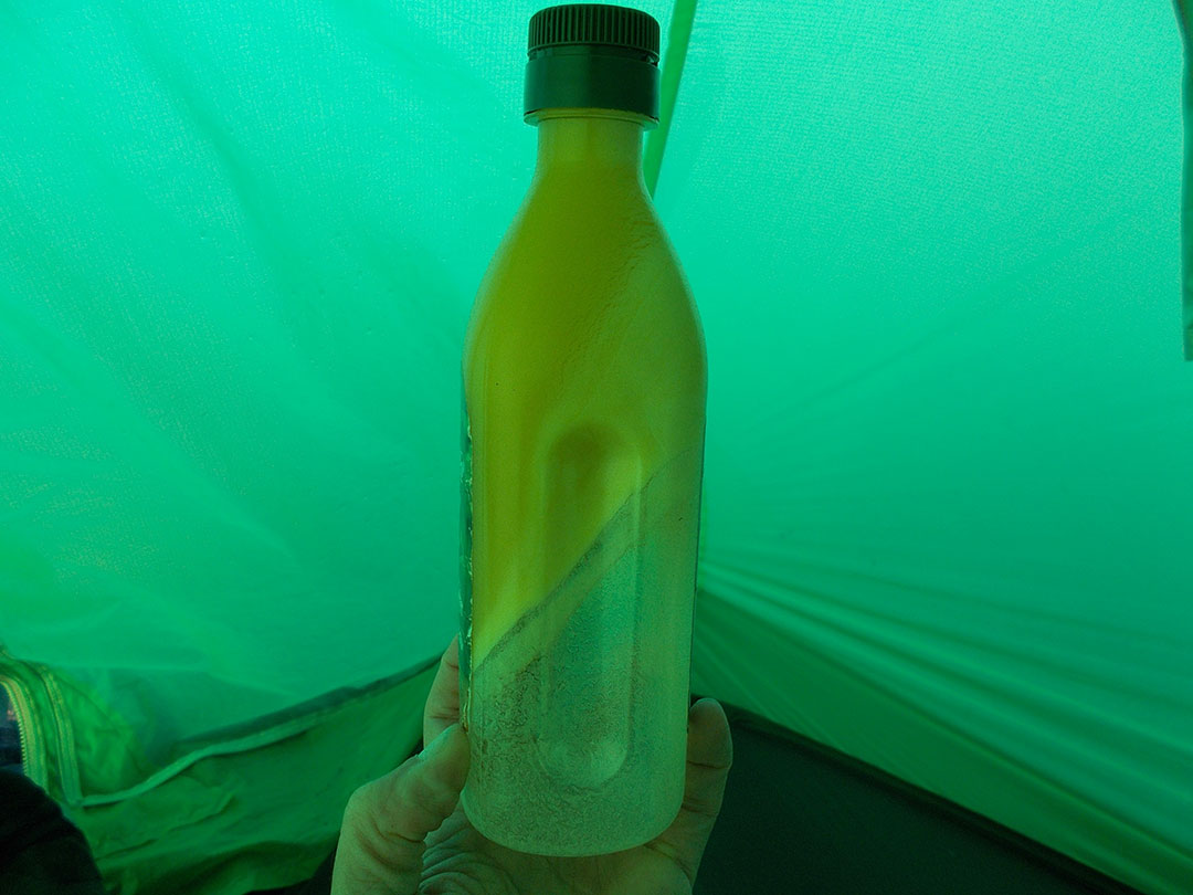
Don’t ask where all the black sand was clinging on to…
As I resume hiking down the good track, I should be relaxed and happy but something’s not right and I know what it is… the quiet weather means I no longer have a valid reason to skip my initial plan and take the easiest possible way instead. At the same time, it is itself relaxing to know that I probably needed worry not anymore about route finding for the rest of the trip. It has become a sort of comfort zone within a trip meant to be a step out of my comfort zone. This itself feels awful.
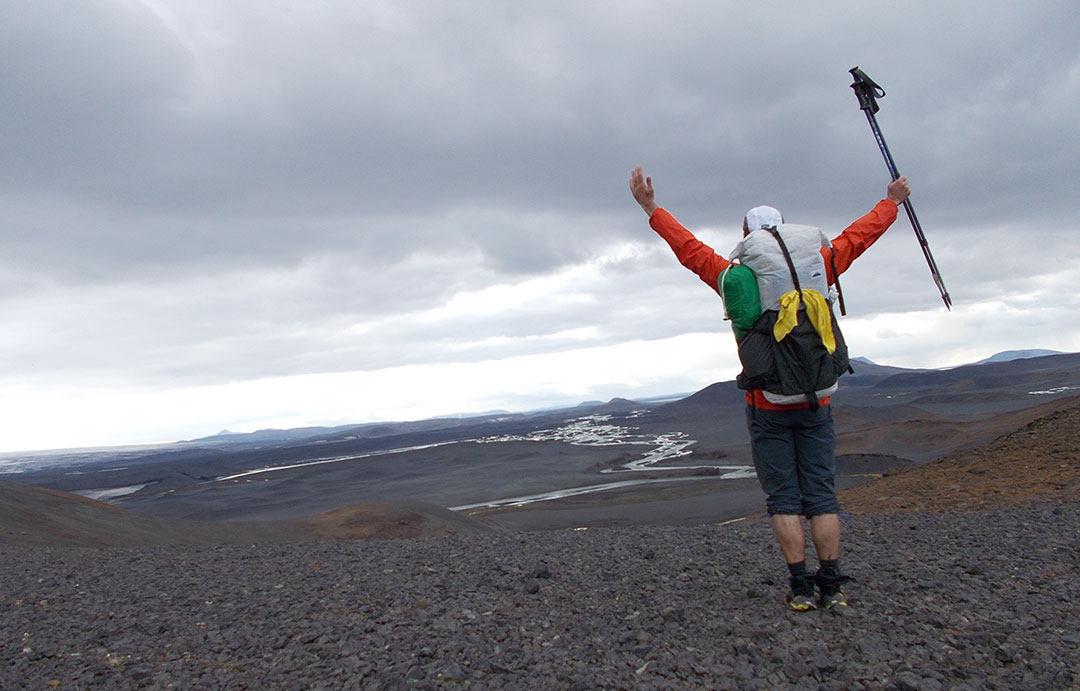
Out of comfort zone again
I try to convince myself that whatever I decide is OK but I must face the fact that it is not. Sometimes it just is not. I stop, look over the terrain on my originally intended route and I check the map. I ponder how it’d feel to take that way and how it’d feel not to and I see it clear. I must do it. I don’t give it a third thought, step outside the track and don’t look back.
It’s exciting to be off-track and to need some basic navigation. It’s actually a welcome relief from the look-down-and-just-hike that’s so useful when the weather is tough but not needed otherwise.
I need to head back to the side of the icecap and join a secondary track that I’d follow into some intriguing mountain terrain. I still don’t know if I can trust the track being there, the map shows it as a dead-end.
The only obstacle on the way is a stream. The map representation didn’t get me ready for this:
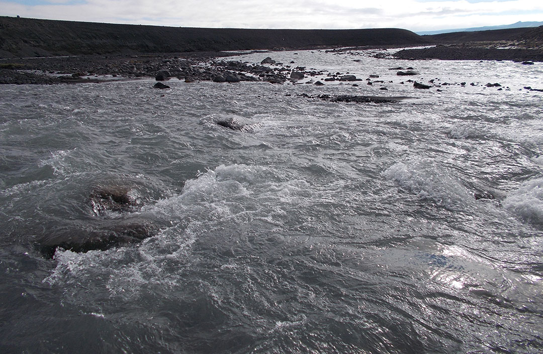
Rjupnabrekkukvisl. Welcome to my first serious ford
It wasn’t difficult or particularly dangerous but it needed great care and got me more worried than I anticipated before stepping in. It showed me how a single, thin blue line on the map can mean anything from a tiny little stream to a raging, powerful torrent. More to come about this.
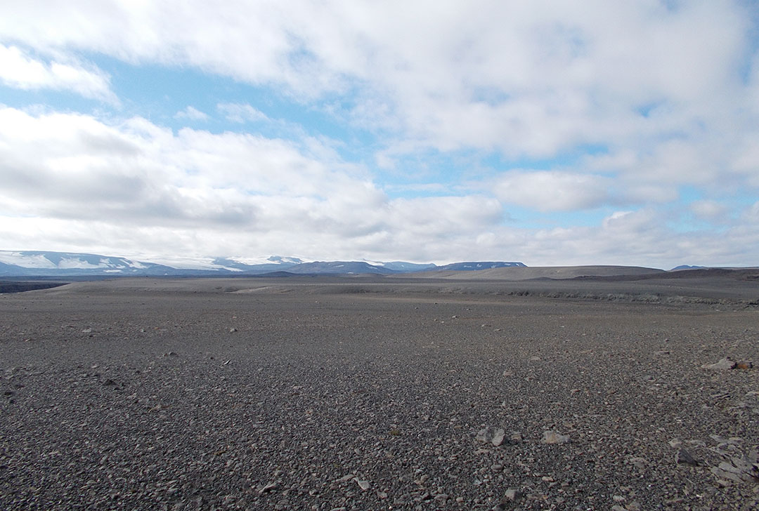
Coming out of the riverbed, I aim for higher ground for a view ahead. My intended route squeezes between the Vatnajokull on the east and the Tungnafellsjokull on the west. It’s stunningly beautiful land and it shines bright under the sun. I tread on the known mix of gravel on top of sand, a bit on the soft side but mostly fine walking. It’s neat to be off-trail in such an open land where there are literally no barriers for endless miles.
Walk wherever
I come down from one last hill to meet the track and there it is, lightly printed on the gravel and sparsely marked by wooden posts. I’m glad I found it if only because it gives me confidence on the maps. I can now fully relax and just enjoy the ride.
The track veers right and uphill when I didn’t expect it to. I re-check the map to find out how easy it is to misinterpret the topography when reference points are few and far between, or maybe I should say how easy I misinterpreted the topography. It usually takes time and practice to get used to a place and mapset and I’ve been following tracks for too long.
The Vonarskard
The map is right once again and the track takes me uphill over the shoulder of a pointy, major hill to an obvious saddle where it’s bound to end. The climb and the sunshine provide killer views of the Vatnajokull:
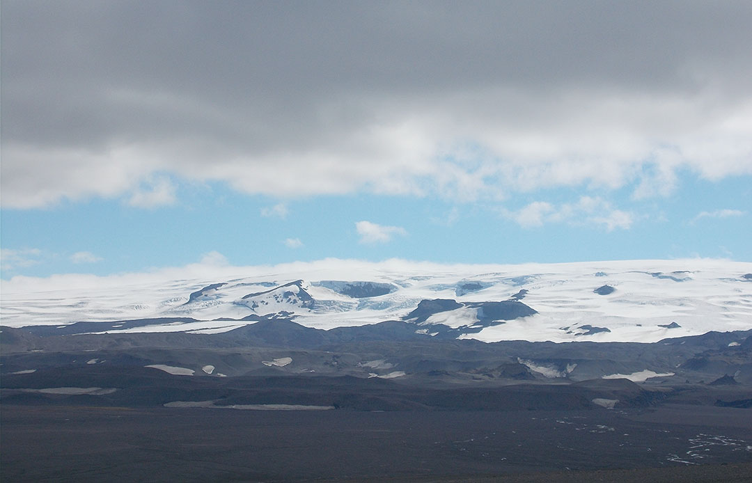
Dark cloud, white ice
The track does indeed end on a rustic parking area equipped with an info panel, something I wouldn’t expect this far from everything. In front of me lies the most amazing basin I’ve seen on this trip, a huge flat criss-crossed by the typical braiding river, flanked by the Vatnajokull on one side, on the other some amazing, light brown hued peaks with distinct names such as Raudkula, Laugakula or Hverakula. I see a pattern here.
I feel like in the middle of a Lord of the Rings plot again.
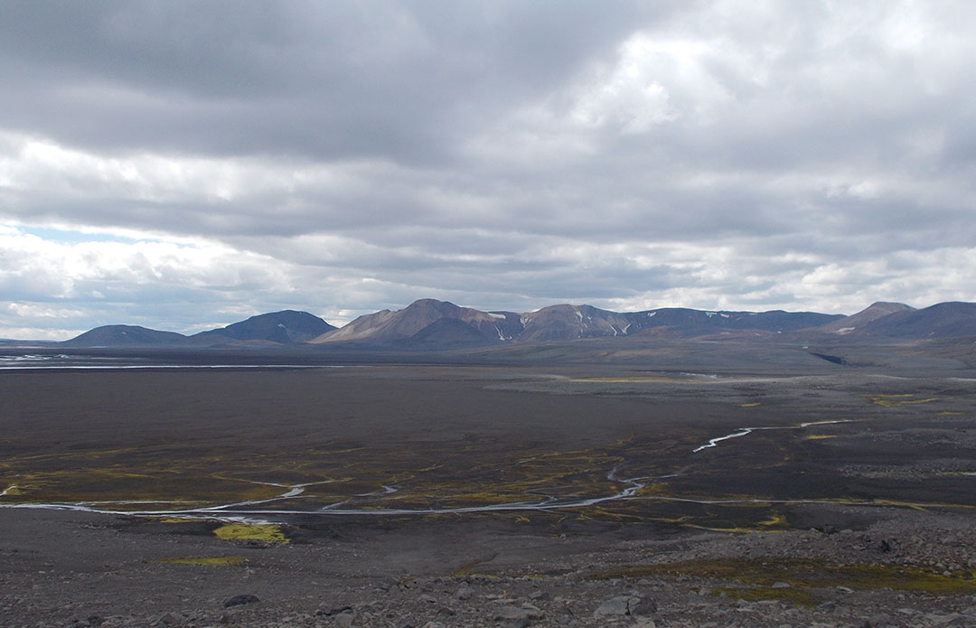
The Vonarskard
The panel explains it all: it’s the Vonarskard region, a sort of huge volcanic caldera turned into a hiking paradise on this side of the field where the water courses are shallow. My vantage point is good not only for contemplation but also for planning as I can see a good deal of the three options I have from here. I stop. For lunch, planning and contemplation.
Nyidalur or not
Nyidalur is a summer outpost on the F26, it’s right behind those rhyolite mountains to the west. There is a trail across the mountains that gets there. This was my intended alternative to the icecap-side, potentially dangerous Jokulheimar route. There is a hut at Nyidalur and a daily highland bus stops there. There must not be much more to it but hikers commonly use Nyidalur for a resupply by sending a parcel there. I didn’t mean to do that so I have no real need to go through. There’s a technically better alternative that’s shorter and saves me a good part of the long trudge along the F26. It involves crossing the Vonarskard the same as in the Jokulheimar route but then taking a track out to the F26 along the massive Hagongulon lake.
I had no references about this track but now that I know I can trust the mapped tracks, I’m confident enough to take it. The info panel at my lunch stop shows a trailhead parking on the other side. It can’t go wrong.
Crossing the Vonarskard was one of the most amazing bits of the whole trip. I was following a mapped trail that was essentially non-existent on the ground. The route would rely on rather spaced-out markers. The place was magnificent and the feeling of isolation was enhanced by the absence of a track. It’s not like being on a mountain wilderness of the mid latitudes, where you may feel like or even be the only human around but you know there’s much more life in many forms. Not in the Iceland highlands! I’d look around and feel like the only living thing in sight. Other than some moss patches, this was probably about right. It was peaceful and beautiful. I remember it fondly.
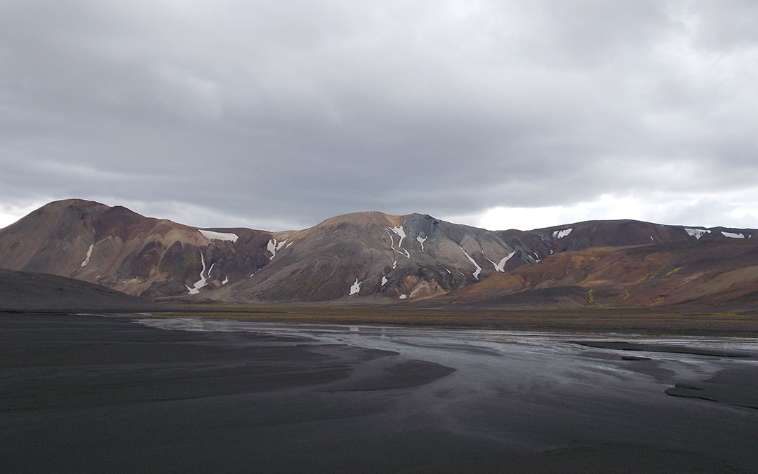
Wonders of the Vonarskard
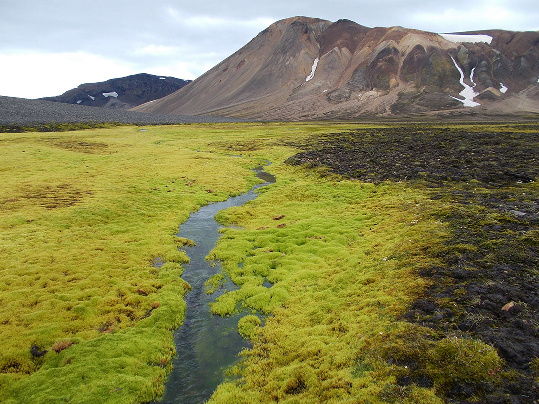
Iceland moss at its brightest
The rhyolite hills were otherworldly, it’s probably the closest you can get to feel like in Mars without leaving the earth. Iceland is the place where you can travel from Mars to the Moon just by hiking.
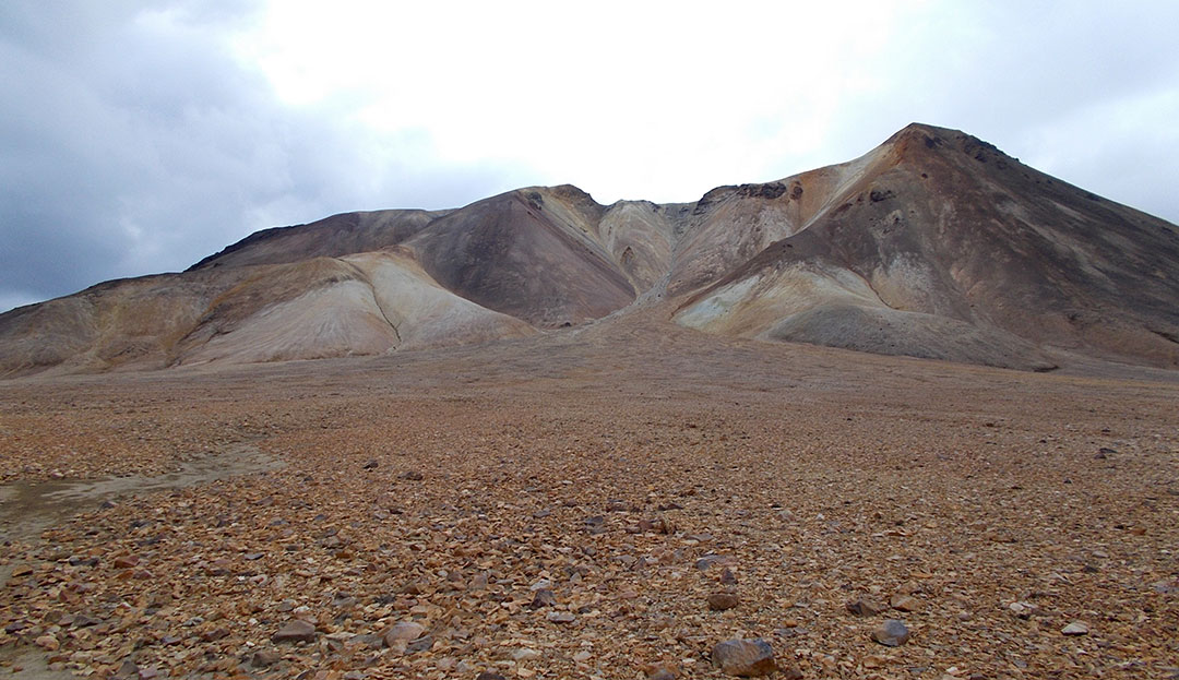
Rhyolite hills
I leave the route that crosses the hills towards Nyidalur, get into a narrow valley and eventually climb towards a saddle from where I’ll exit the Vonarskard and which means a major milestone: it’s the N-S divide. When I get to the saddle and look ahead, I see the most common, braided river and it flows south to the Atlantic. It should be all downhill from here!
Standing on the divide, looking south
I can also see the Hagongulon track. It looks as expected, a wide track good for vehicles. I check the map for potential show-stoppers and I see a river but it seems too close to its headwaters to be a concern. I say goodbye to the north and proceed down the steep mountainside.
I get to the track and the trailhead. Left it’d be doom with the Svedja and Sylgja river fords. I could try my chances given that it’s been not too rainy, not too warm on the last days which is probably good for lowest flow but I’m aware that giving up at any of the fords and needing to come back would mean I wouldn’t have time to complete the traverse so I’d probably feel under pressure to try the crossings. I don’t like the prospect. I turn right.
The track is as good as it can be. The landscape is far bleaker than the Vonarskard, rather dark rock, sand and gravel in a hilly environment. It’s been getting cloudy, now it’s already overcast. I keep hiking to day’s end and pitch in a hardly inspiring but sheltered shallow valley. This is part of the deal: at roughly 30 miles per day, I can’t choose where to camp. I stop when and not where.
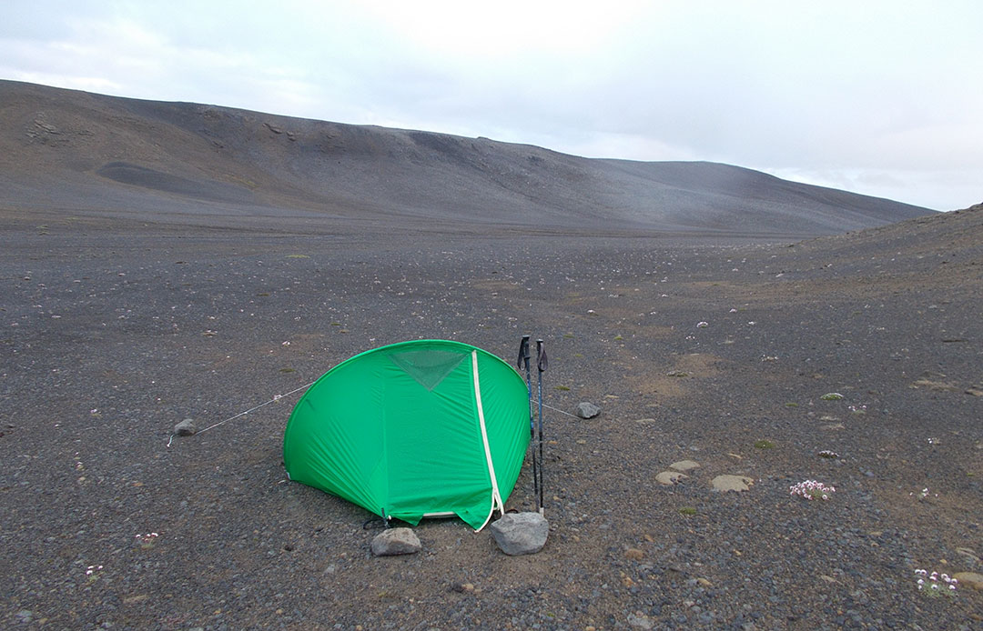
Adding color to the landscape
It was gonna be the day that I met nobody and it didn’t rain. I met nobody. It did rain a bit in the end.
 RSS – Posts
Say what you want