Because I needed to do something with all the pics I took…

Just arrived
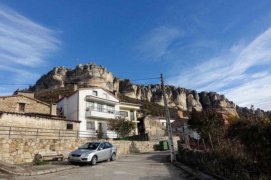
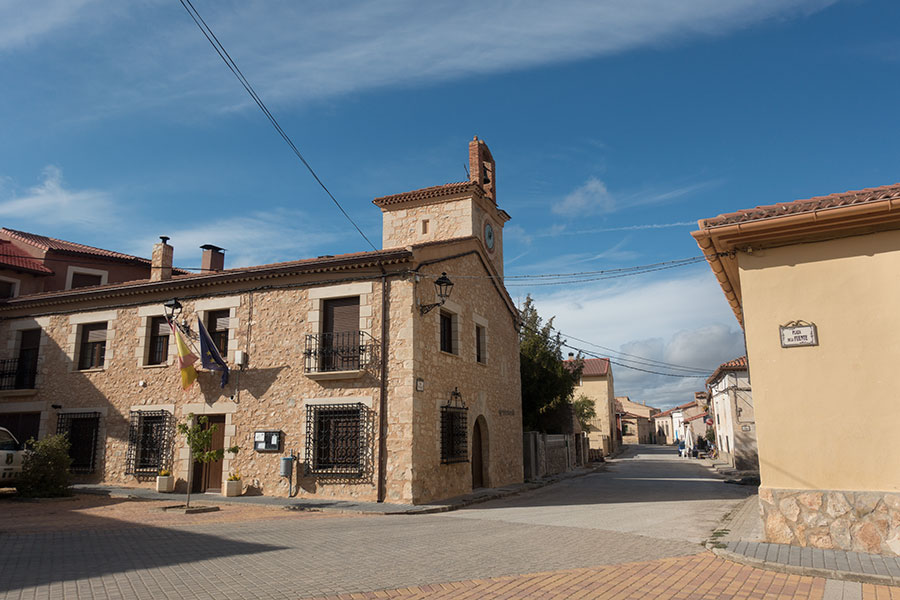
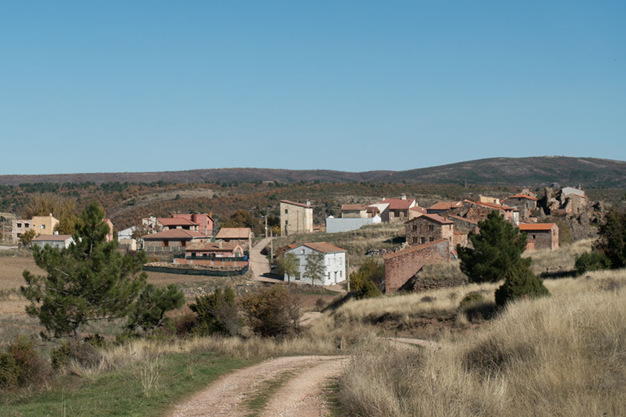
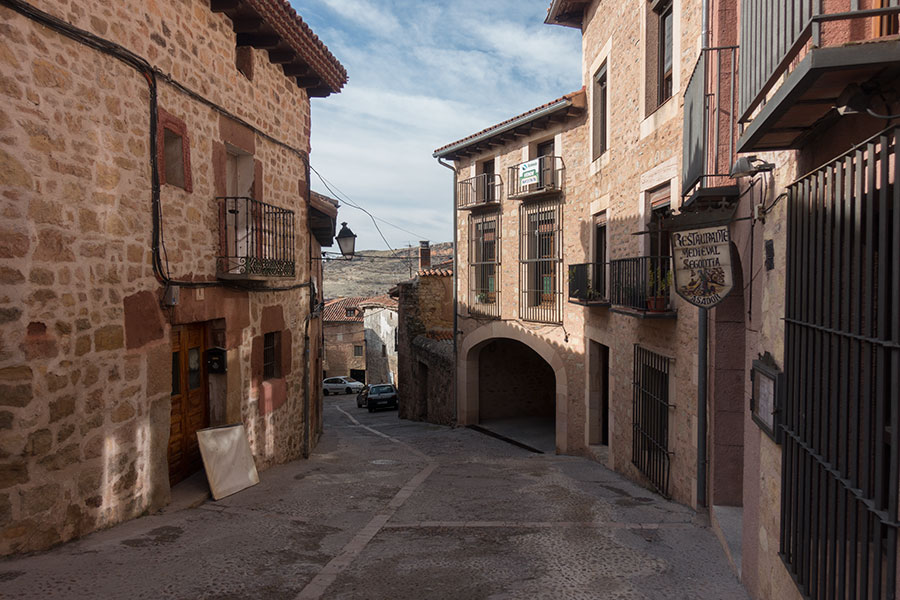
I arrived in Cuenca mid morning on a Saturday and started hiking right away. Cuenca is a great place to start a trip with quick access to hiking trails just off the urban area. The old town sits on top of a escarpment at the confluence of two river gorges with steep cliffs on both sides. An outstanding location, cobbled streets and some old, beautiful architecture to make the urban traverse very scenic and interesting.

The old quarter
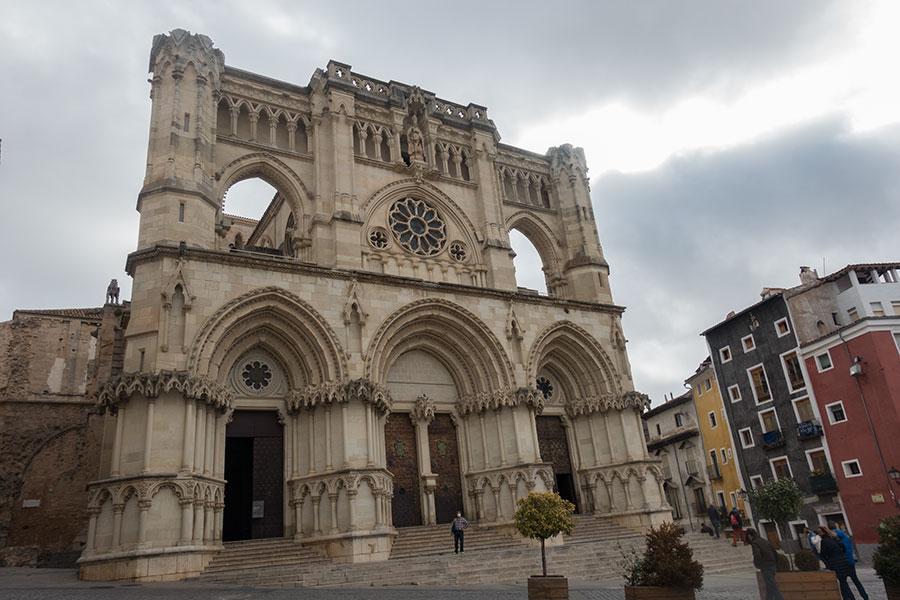
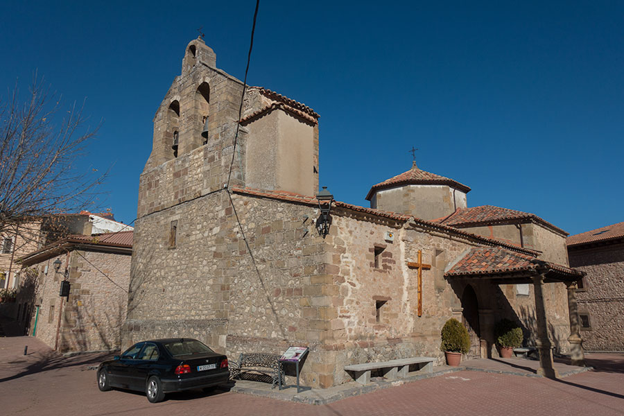
Cathedral
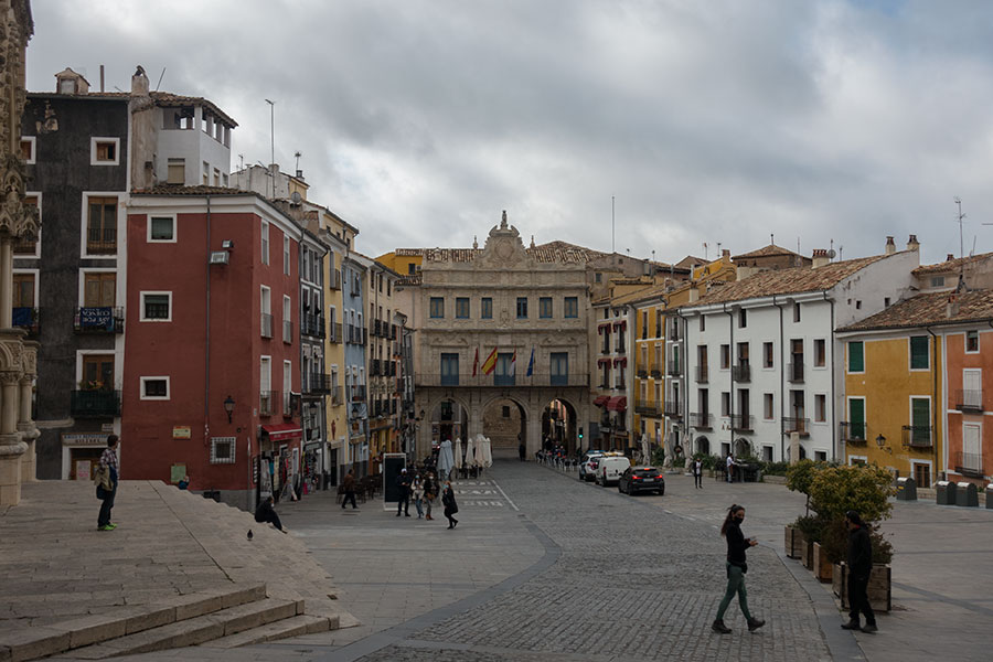
Downtown main square
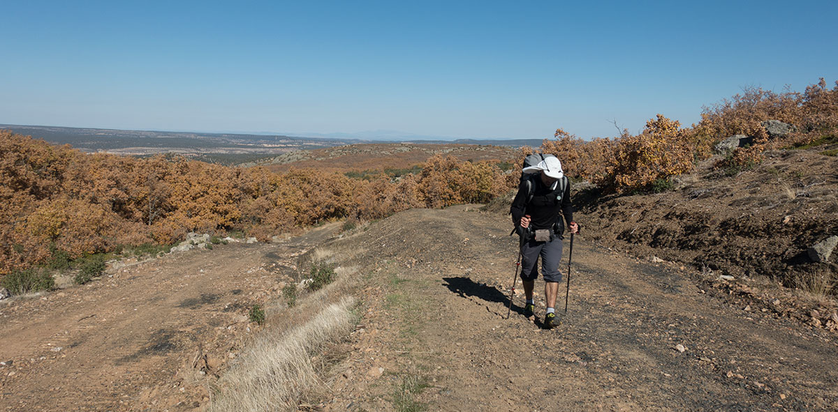
The vibe in the streets is odd, as it’d be expected in pandemic times, maybe it’s also me not feeling right about going through town in such circumstances. I rush under the heavy weight of my pack, still fresh enough to carry it as if it’s not the burden it will become in the following days/hours.
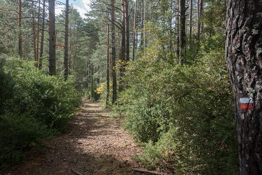
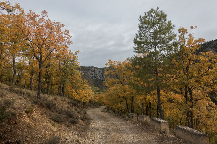
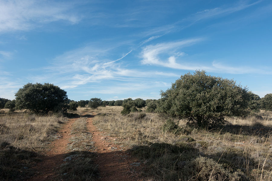
Right off the city walls, I can take a designated trail. Unlike mountain areas with an established hiking tradition, hiking trails in this region are often not purposely built, mostly set over existing tracks of varying quality. Whenever there’s a gap in the track system, designers seem to have no problem sending hikers over sections of paved roads, hopefully lightly travelled but still far from ideal. Here’s where the no-fence nature of the land starts to help by allowing going cross-country through the woods. It may be rough underfoot but it still beats walking on tarmac.

I’ll be meeting the GR 66 several times along the trip

Off-trail through the woods
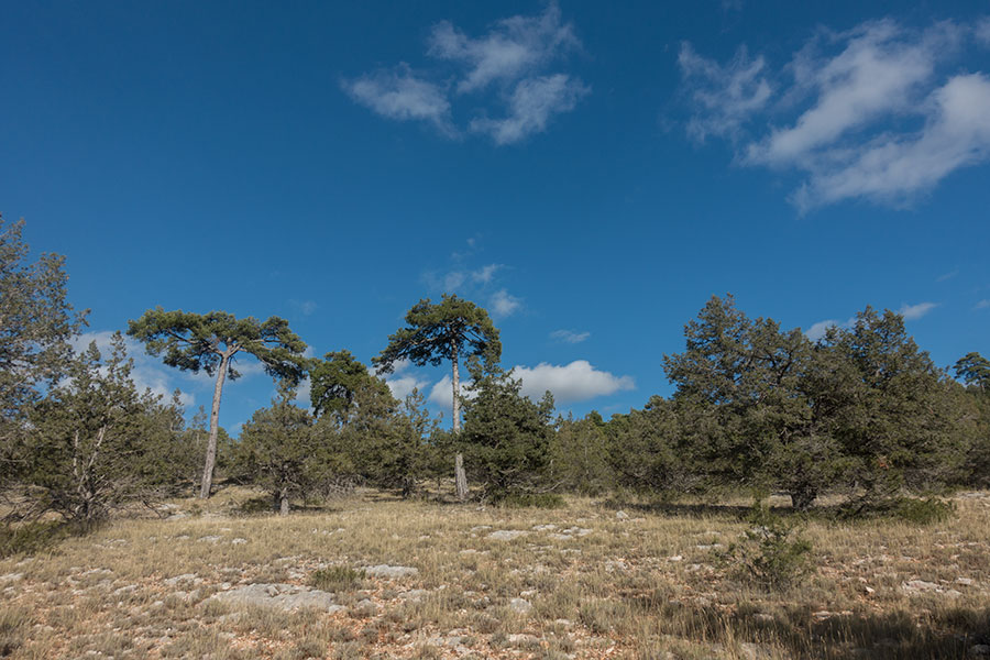
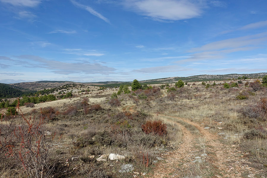
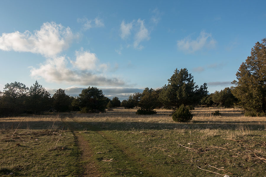
The route takes me up to the highlands straight away. With a weather system moving in, it’s cloudy and rather chilly, good hiking weather but I need to keep moving and sunny spells don’t last a lunchtime. The landscape is wide and open despite the wood cover and I can see far away to endless woods covering the uplands.

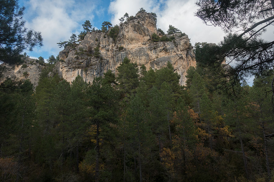
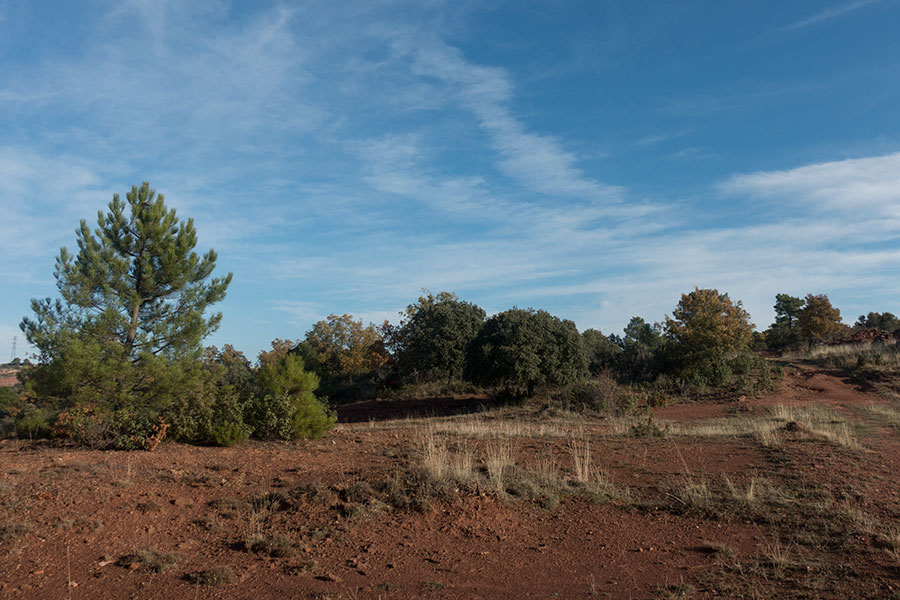
Highland terrain
As I enter the depths of the Serrania1, I leave the tracks for a proper cross-country section among pine, juniper and shrub as the clouds lift. I trace a straight line to a mapped small body of water that turns out a cattle pond and now I have the picture complete: just one year before, I was hiking the New Mexico section of the Continental Divide Trail, thinking how much the hill areas in the New Mexico divide reminded me of the Iberian Peninsula highlands, namely places like the Serrania de Cuenca. The cattle pond, a very common sight along the CDT, now brings me back to those days.
A bit of easy cross-country
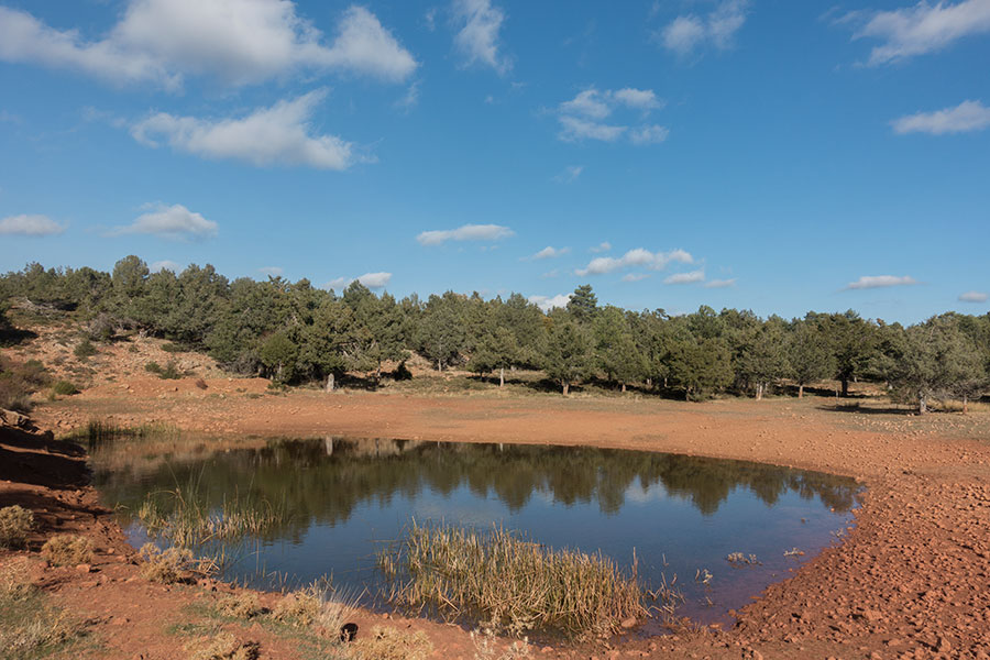
Cattle pond
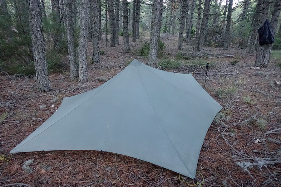
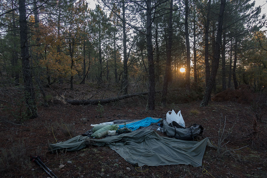
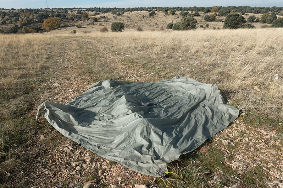
I rejoin rough tracks deeper into the hills in this amazing area. Villages and roads are far away and it’s very solitary up here. As the sun sets and the temperature dips, I try to find shelter from wind and dew under a big juniper tree. Only minutes after the pitch, the Trailstar is thoroughly wet.

Limestone dirt and the green carpet
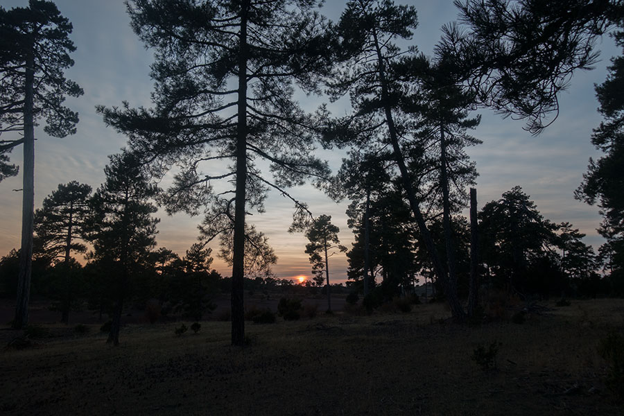
Sunset
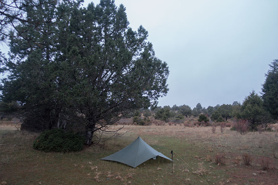
Trailstar under juniper tree
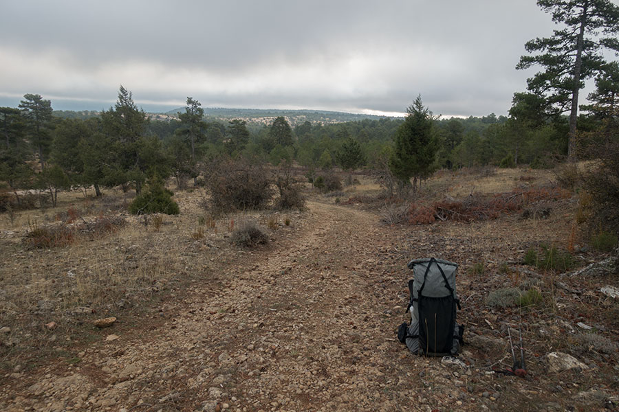
Day 2 starts dark, windy and cold as forecast but rain is not expected until early evening. The upcoming area is bound to be among the best in the whole trip and I’d like it to be memorable but I’m feeling the cold and I can’t be comfortable. It’s odd because the conditions are not too bad for hiking but I need to accept I’m not having a great time. In such instances, I know what I have to do, just keep going and hope for a better mood.
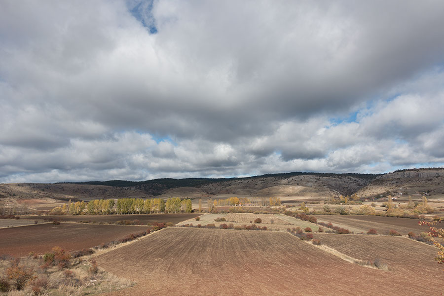
I need to come down from the highlands to cross the Jucar River valley, then up again for the next highland section. The Jucar is the main stream in the region, flowing south and eventually east all the way to the Mediterranean. I’ll be crossing the Divide the following day onto the Tajo River drainage. For the time being, a recreational area near the valley road offers some temporary shelter that I infinitely welcome and do an early lunch and warm up stop.
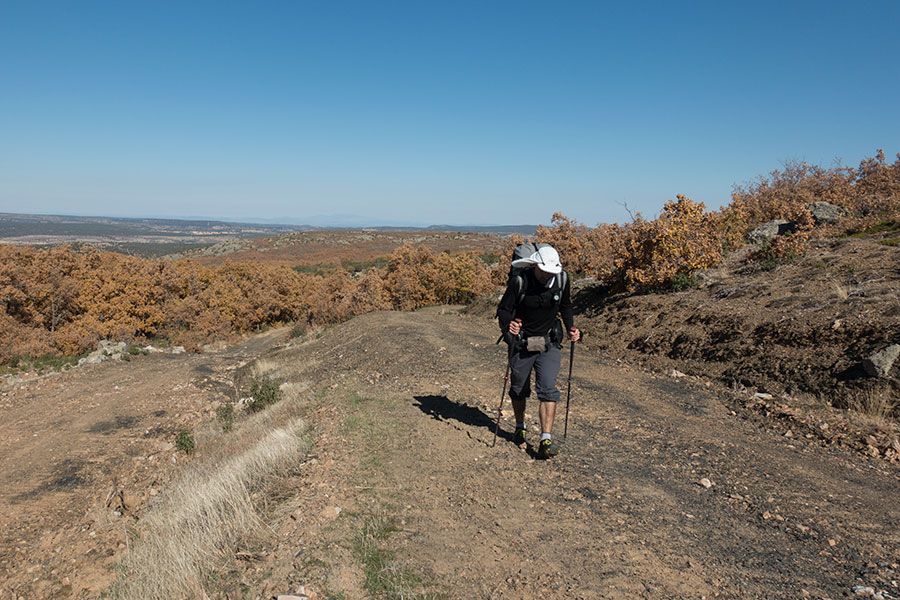
Coming down to the valley with my only companion on this trip
The Jucar River, flowing to the Mediterranean
On my lunch stop, I check the map and take note of a hut that’s right on my way and I’d hit by day’s end. Huts in this region are uncommon and often not for recreational use but this one is located by a section of designated trail and it looks like it might be open for everybody’s use. If not, the area would be as good as any for a camp. The prospect of a possibly comfy shelter at the end of the day helps me find purpose in what I’m doing and I resume the walk to reach the highlands again.

Looking back across the Jucar Valley
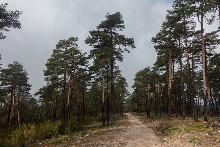
I mix some cross-country with different tracks of varying quality through beautiful pine woods, occasional meadows and less enticing logging clearances on the sides of the main track. A brief sunny spell doesn’t offer any hope, the cloud cover is getting thicker. A high ridge offers wide views to the the southwest.

The pine woods

Meadow
Logging clearances

View back to where I come from
Down from the ridge I get to a beautiful area of big pine and aspen trees flanking grassy meadows. It’d be great camping but I’m still happy to find the hut, in excellent shape and open for use.

Meadow and pine

Meadow and aspen
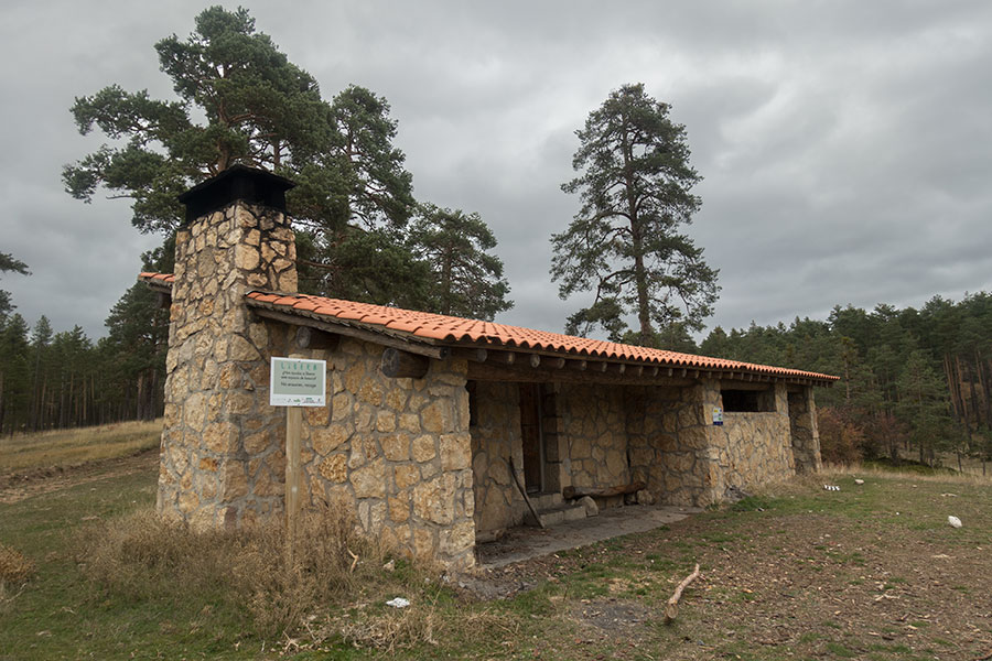
Forest hut
Half an hour later, freezing rain starts. It would fall down throughout the night. At times, I could hear the wind howling and I was happy to be inside. I can be fine with being a wimp sometimes.
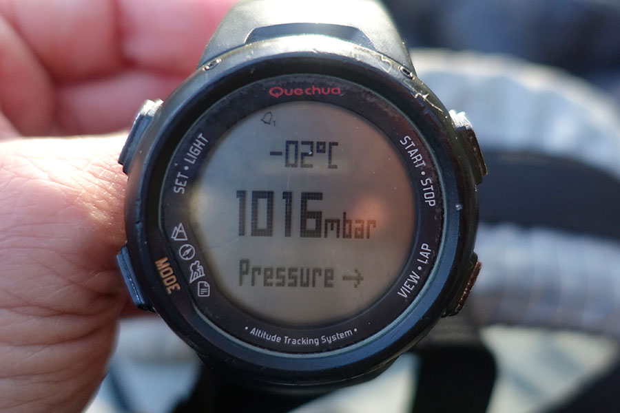
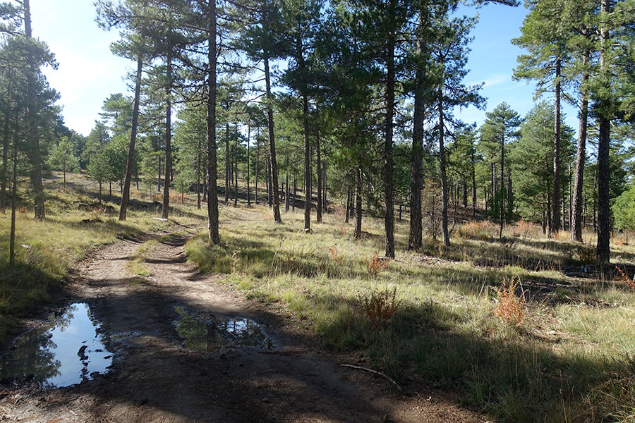
The following morning is still dark and chilly but at least it’s not raining. As I climb to the highest point on the trip at 1700 m, temperature drops down to freezing and once again I can do nothing but keep moving. I’m on a good track and the woods keep me sheltered.
More woods of the Serrania de Cuenca
I come down from the highlands at the northern edge of the Serrania de Cuenca, drawing a close to this geographical unit and ready for the next. I walk along what looks like a naturally occurring meadow, a rare sight in this region, then leave the relative openness of the uplands for a narrow valley and a short section of designated trail through much thicker vegetation. I’m glad for the trail, this wouldn’t be the place for cross-country.

A naturally occurring meadow
Good trail through the thick woods
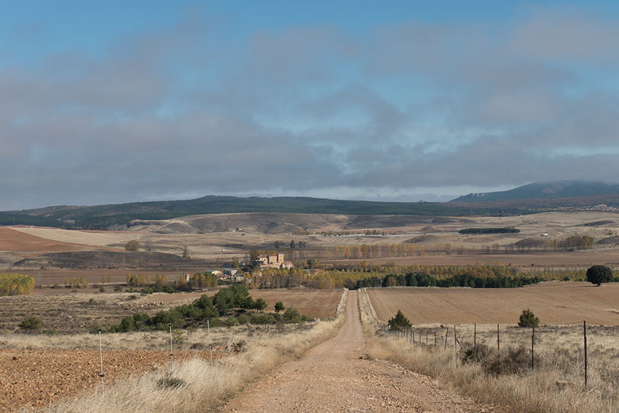
I eventually emerge from the depths onto a wide tract and close contact with inhabited areas. The flat valley floor is fully taken by farming fields with a few small settlements on the side opposite my route. At 1300 m. high, this is a rather inhospitable location but the riverbanks provide for good arable land. The clouds start breaking and I can start to layer down and enjoy some lovely light.
Riverbank farming
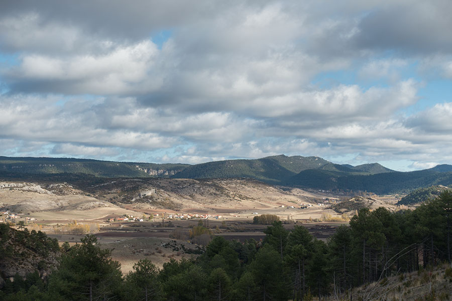
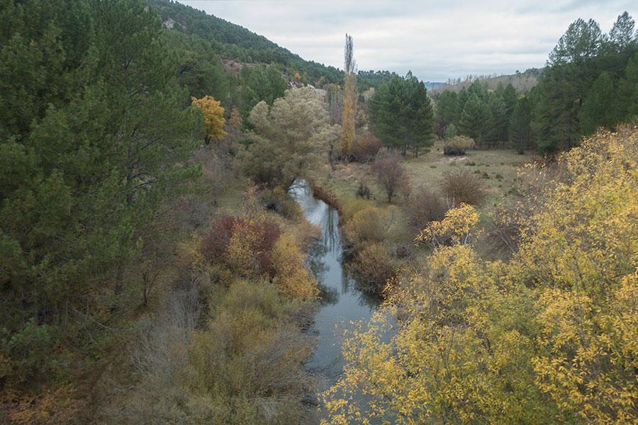
Vega del Codorno
The valley closes in again as the river Cuervo makes its way towards the Tajo, the longest river in the Iberian Peninsula and my next big milestone to the north. For the rest of the day, I follow its Cuervo tributary downstream across blowdowns as the valley narrows and becomes a steep walled limestone canyon. Did I mention New Mexico before? Here I feel transported to the Black Range and the Gila Wilderness of Southern New Mexico and I love it just as much as I did while hiking the Great Divide of North America. Then I can camp in the woods.
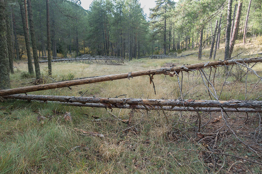
Modest blowdowns
Limestone walls

Under the pine trees
I climbed up and away from the valley floor for camp to avoid the cold air sinking and trusted this move and the tree cover to keep my shelter dry but it was hopeless. Sometimes you just have to accept condensation is unavoidable. By early morning, the temperature dropped below freezing and I had to consciously remind myself why I was doing this.
Typical morning cold
I resume hiking downstream as the canyon widens and oak trees take the place, filling it with color. The past days’ instability is gone and there’s a feeling of peace and calm unprecedented on the trip. The freezing cold is much easier to live with and I can anticipate the sun will be balmy once it can shine on the valley bottom.
Cuervo River canyon
Cuervo River canyon
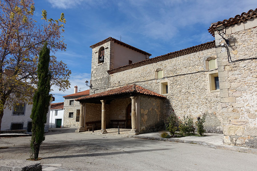
I go through a village for the first time on the trip. I don’t feel comfortable about it but it’ll come handy for access to drinking water and it also saves me some uncomfortable cross-country. Santa María del Val is a very small place, on a Monday morning I wouldn’t expect to meet many people, if any at all. I produce my face mask and head straight to the village spring where I fill bottles before I keep going, only a few elderly around on their morning stroll. Past the town, my route leaves the valley and offers a great view of the location.
Santa Maria del Val village

Santa María del Val location
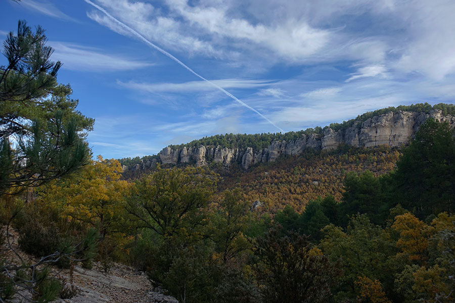
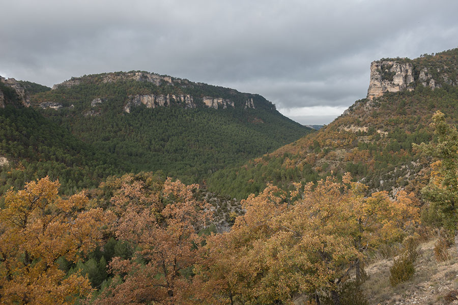
Next section is predominantly over dry, high moorland with less trees and closer proximity to inhabited areas, always about very small villages. The area is locally known for some interesting limestone formations, impressive sinks that are very difficult to capture in pics unless from up in the air. There are a few intersecting, designated local trails to guide visitors through the most remarkable features.
Dry moorland

The white stripe applies to all of them
I go across Masegosa, a necessarily small village where I can only spot a couple persons in the relative distance and I make it my afternoon water stop, filling bottles for the rest of day and the following morning.
Masegosa village
North of Masegosa, I climb back to the highlands proper where I meet the pine woods again. It’s rather wild and solitary up here, quite like it felt for the first 3 days. It’s bound to be the last such traverse before I cross the Tajo river whose narrow valley appears like a deep scar in the upland scene.
Being in the trees always makes me happy

The high plateaus
Crossing the Tajo will be left for the following morning. As the temperature dips, I make myself comfortable in the welcoming pine woods.
Good camping in the sheltering woods
The Tajo is the longest river in Iberia, running for more than 1000 km. all the way to the Atlantic in Lisbon. If you’ve been to the Portugal capital or seen pics of its majestic river estuary, that’s the one. Close to its headwaters it’s certainly far more modest in size but it’s still a major geographical feature as it digs 400 vertical meters into the highlands plateau in a crooked course whose bottom I can’t see until I’m almost there. The track I follow down turns into a wide dirt road as the oak trees mix with the ubiquitous pine.
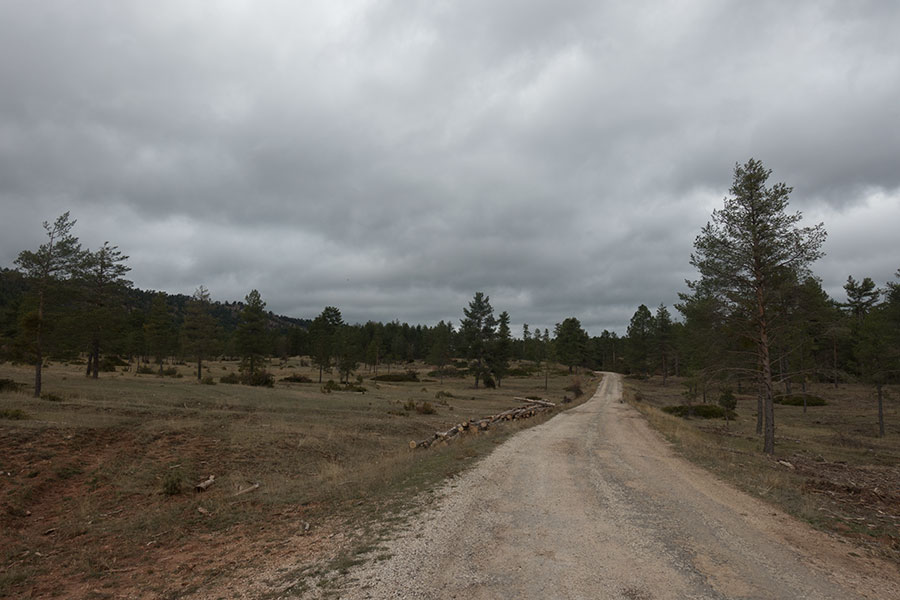
Good track going down
The Tajo River valley
I get to the riverbed to find the pedestrian suspension bridge closed due to risk of collapse, according to the relevant sign. There’s no visible damage but there’s an easy ford just downstream anyway. I can imagine it could get tricky in high water conditions but in this instance I find slow current, water level below the knee and a perfectly smooth gravel bed so I can safely go barefoot and keep my shoes dry.
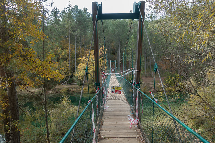
Closed bridge
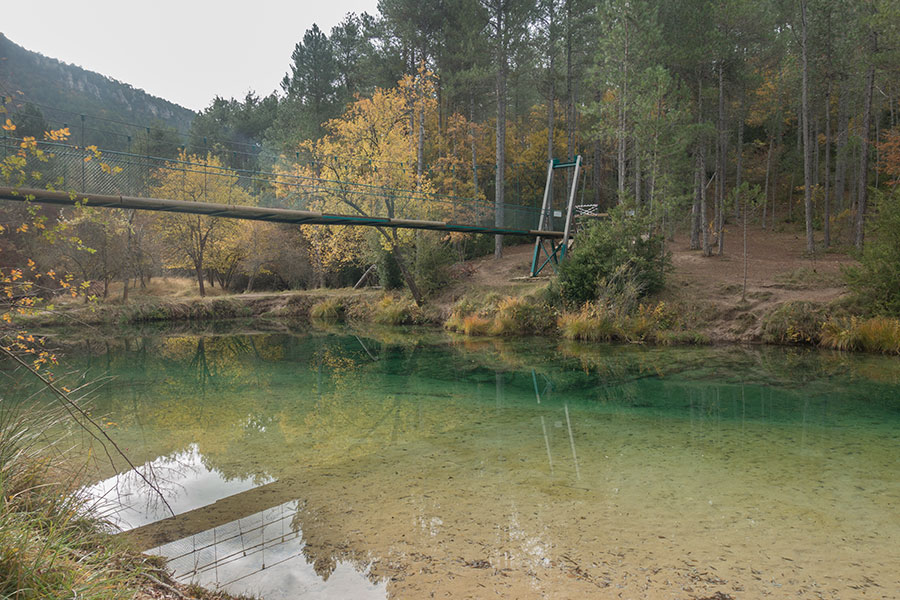
Deep green Tajo river
Past the river I rejoin briefly a designated trail section featuring GR Trail 66, that I’ve been meeting on and off from the beginning of the trip, and GR Trail 10, a work in progress that will cross the whole of the Iberian Peninsula from Mediterranean to Atlantic, when completed. I soon part with both to climb back to the highlands on a cross-country section to avoid some road walking and a village crossing.
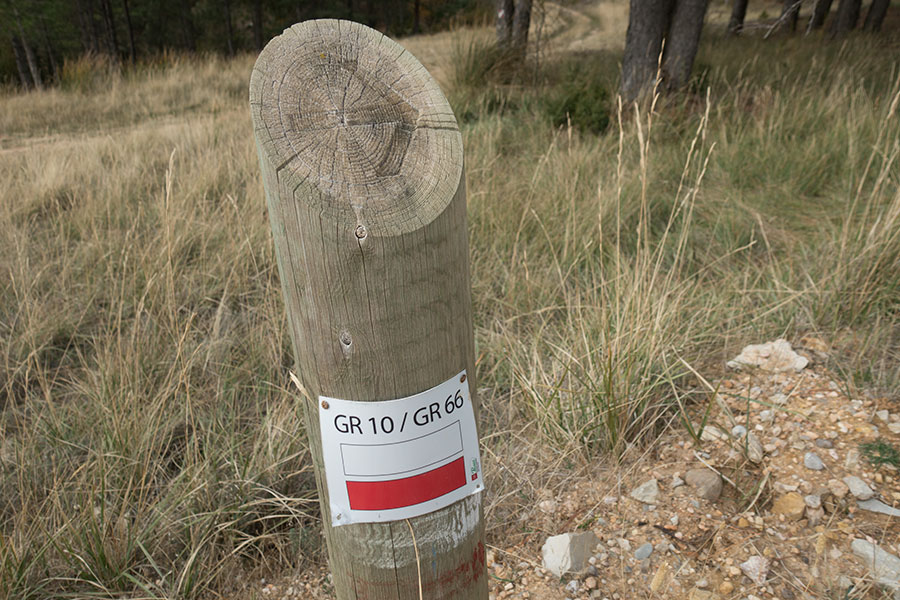
Meeting GR Trails 10 and 66
Easy cross-country through the woods
Next on my course is Terzaga village, another tiny hamlet at nearly 1200 m. surrounded by farming fields. I go down, once again to get fresh water. It’s early evening and I fill bottles for the night and following morning until I can meet the next safe source.
Coming down to Terzaga
Terzaga village

Town square spring in Terzaga
One of the main factors in choosing this region for hiking was the absence of fences, the freedom that goes with it and the interesting hiking scenario that develops. It was late on this day 5 that I met the one fenced-out area in the trip, a hunting estate whose southern access cut across the track I was following:

The one fence
I needed to take a cross-country course around the enclosure, eventually altering my route, albeit not dramatically. I would rejoin my digital track the following morning not before finishing the day’s work over a high plateau with meadowland, pine, holm oak and juniper for company. Once again, I set up under a big tree trying to gather warmth and avoid the dew but as usual it was hopeless, the Trailstar was wet inside and out before I went to bed.
Long shadows by the time I’m back up the highlands

Holm oak tonight
Dawn is foggy and dark, which adds a bit of drama to the scene. I like it even if it makes everything chillier, the moor looking mesmerizing in the mist. The forecast is for sunny weather later on.

Foggy at dawn

Mist is beautiful
The upcoming section will take me through Molina de Aragón, the only sizeable town in what became my effective route. At this point, I’ve already decided on a final update to stay within regional limits, according to regulations current at the time, bound for a train station that I’d reach by day 9 so there’s still plenty of hiking ahead. The area around Molina is the lowest in altitude and the most populated I’ll find in the trip with some small hamlets around. It’s still foggy when I come down to Tierzo to pay the compulsory visit to the village spring an refill bottles.

Tierzo village

Clear, cold, untreated

Old church in Tierzo
It’s a shallow, wide valley just west of the Med-Atlantic divide. The lesser altitude, just over 1000 meters, allows good farming and the environment is radically different from the wooded hills to the north, a nice view in beautiful light once the fog shifts.
Molina Shire
Despite the name, Molina de Aragon is not located in the Aragon historical region, which lies a short way northwards. It used to be a very important town in ancient times, as still evidenced today by the imposing, huge castle on top of the hill above town.
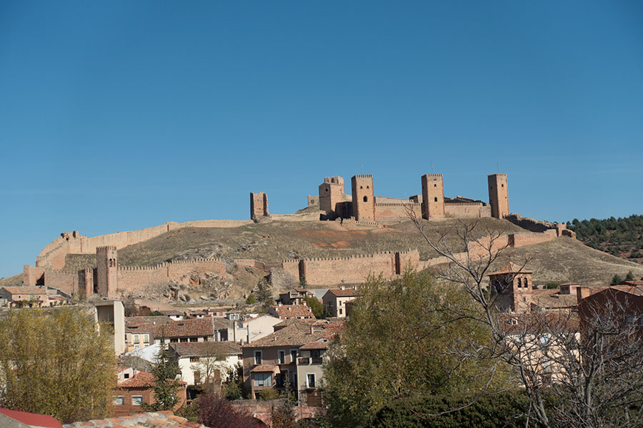
Molina de Aragon castle
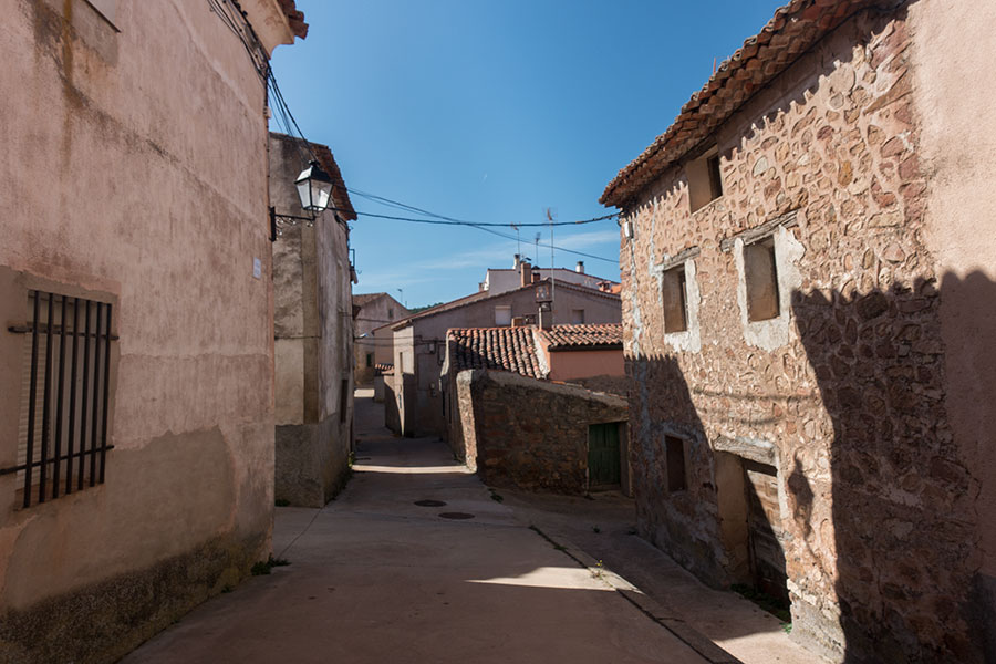
The old quarter is a very interesting walk with its ancient, narrow streets:

Molina de Aragon
I still have enough supplies for the rest of the days ahead but given it’ll be my first and last opportunity I play it safe and do a very quick resupply before leaving town as quick and discreetly as I can. If I wouldn’t feel comfortable in the small villages, you can imagine I won’t here either.
Just north of town I climb onto a east-west alignment of hills that mark the divide. To the south, streams flow into the Tajo watershed. To the north, water runs into the Ebro river which in turn flows to the Mediterranean. The view north is most typical of Spanish highlands with cereal fields as far as you can see, small villages scattered around and some hills in the far distance. There’s almost always some hills.

Cereal fields all the way to the next hills
I’m mostly among trees with colorful oak taking the place of evergreen pine. It’s eventually a secluded pine grove where I make myself comfortable for the night.

Oak trees and meadows

My spot among the pine trees
Morning day 7 reproduces the usual pattern of temperatures in the negative and heavy condensation on the Trailstar. This time, I took a pic of the very orderly water drops:
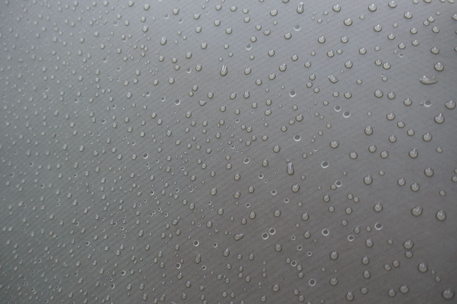
Condensation on the tarp
And the everyday chore of packing a wet tarp in subfreezing temps with the promise of upcoming warmth from the rising sun.
Dawn in the pine woods
I keep following the line of hills that mark the divide along a mostly wide track. Here I somehow found some good enough vertical support for the camera so I could be in the pic:
Limited selfie chances when hiking solo
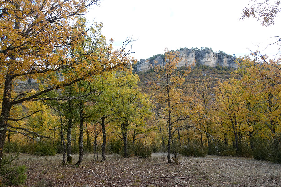
The hilltops are far from lush and the vegetation alternates between shrub and some very small size oak trees. Further down the slopes, the oak woods are thicker and the fall colors are at their best.
Small size, scattered, beautiful oak trees on the hilltops

The fall colors
By late afternoon, I come to the point where I must leave my originally planned route. The border with the Aragon Region is a stone throw to the north and I need to keep hiking west. I leave the divide proper for good even though I’ll be paralleling it for the rest of my trip.
I head down for the main valley and one village crossing in the small, sleepy hamlet of Selas where, you guessed it, I fill bottles before I climb back up the hills on the opposite side.
Selas village
The next highland section is one of these most loved, mesmerizing uplands, a limestone substrate and a mix of dry meadow and open woods with pine, holm oak and juniper, a delight to walk through anytime and particularly so in the dwindling light of the evening.

Open woods in the solitary highlands, one of my favorite environments for this trip
I’m tempted to camp up here but my schedule would welcome one final push so I keep going until dusk and I’m still rewarded with a secluded hollow and beautiful oak woods. I litter the view with all my wet stuff hanging from tree branches for a brief few minutes before the condensation cycle starts again.

Camp in the oak woods
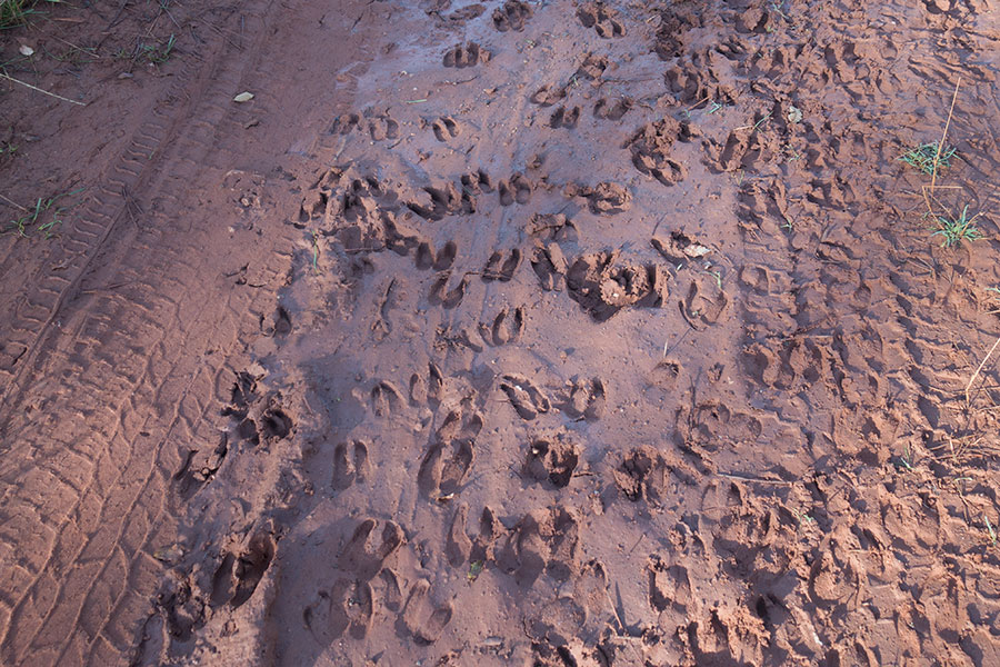
Instead of the usual hilltops or uplands, my line of travel today takes me along a narrow valley. There’s a good track all the way, yet it feels very solitary. The water puddles are still frozen by midday if they stayed in the shade and the mildly muddy sections offer some interesting wildlife print collections. This one below is most likely fox, relatively common in the region:
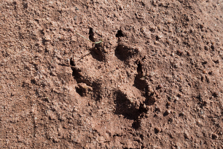
Most likely fox
This other guy is probably a badger:

I’d say badger
I love wildlife prints. They’re the gate into the world of the locals when actually meeting them is not straightforward. It’s often the best way to know they’re there.
The valley gets narrow, canyon-like at times. A small stream runs along and it’s lush compared to the rather dry slopes and lands beyond. There’s poplar and elm and I particularly loved this big guy here:
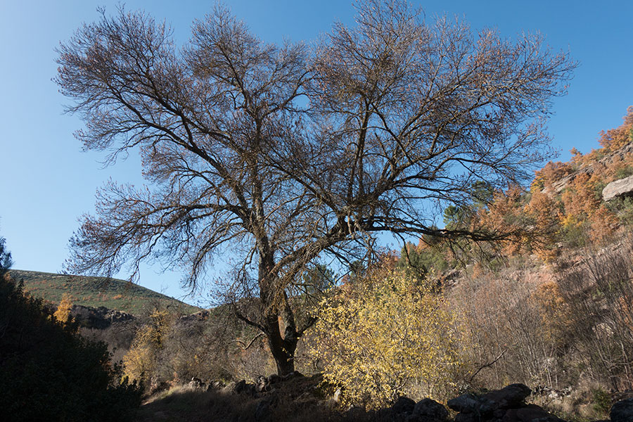
Big, old elm tree

Canyon section ahead
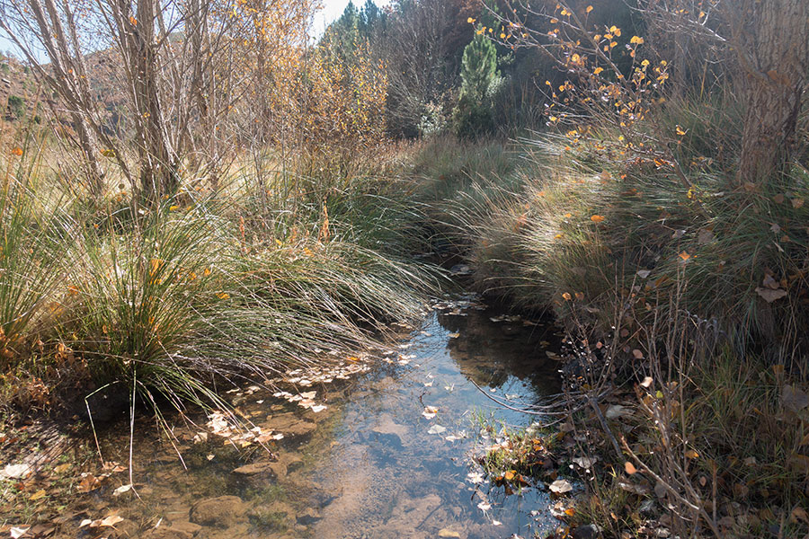
Running water in the dry highlands

Fall colours
Past the headwaters, I emerge onto undulating farmland. I’m very intrigued by the upcoming village, Santa María del Espino, a tiny hamlet at the end of a tiny road, probably not much different from the many other little villages I’ve already gone through but this one somehow feels more off the beaten path from the map view and the name sounds cool.
Sitting on top of a minor knoll, the main street is one carriage wide and the spring flows free in the village square.
Santa Maria del Espino
Santa Maria del Espino

Santa Maria del Espino
Next section takes me back to the pine woods and I welcome being among big evergreens again. These pine trees must be particularly rich in resin as evidenced by the ongoing extraction works.
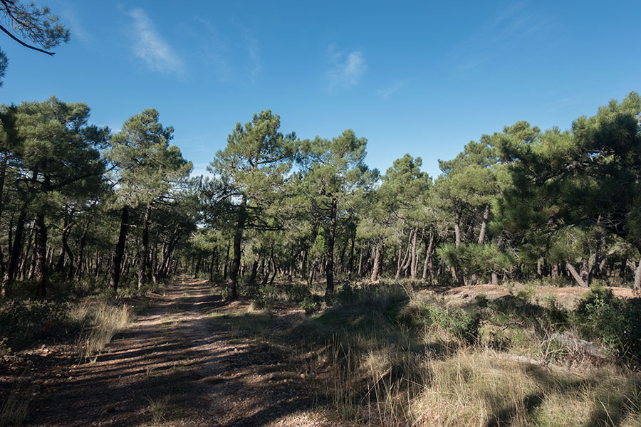
Back to the woods
One final camp in mixed woods where for some reason the soil is so loose that it gets difficult to give the Trailstar proper tension without the stakes coming undone. It won’t be windy and it won’t rain but I still need a roof to hold the inevitable dew.
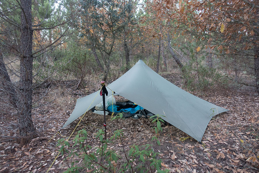
Final night on the trail
The final day is bound to be less wild than average but still attractive. The early morning light always works and the sky is a great mix of blue and white. Meanwhile, deer were doing their thing in the clay.
Bright morning
I guess deer
I need to go across a trunk motorway. With travel heavily restricted, the road appears oddly empty. I surely don’t miss the noise.
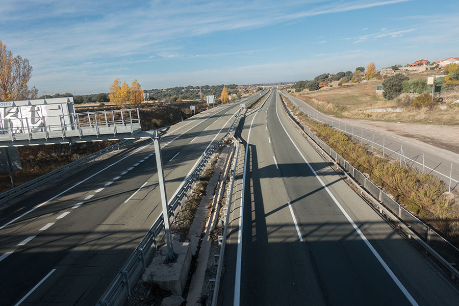
Empty motorway
The rest of the day I’ll be hiking on a section of designated trail set up after the alleged journeys of the Cid Campeador, a medieval historical character. As usual, the route is only loosely signed over existing rural tracks, starting with some cereal fields, past multi storey haystacks and taking a gear drying break in the sun.

Cereal fields
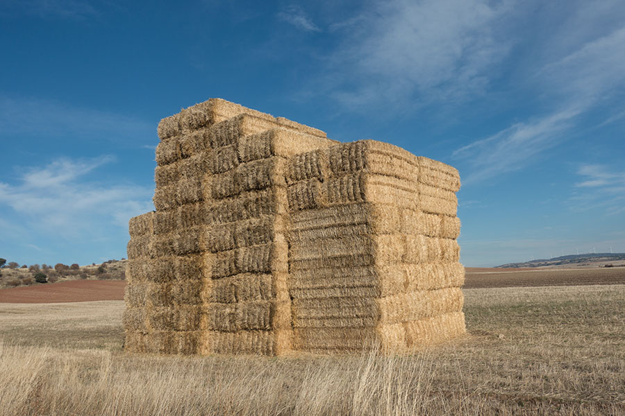
10 storey
Gear drying session
The woods are not over though. In this undulating highlands, the hilltops are often left to the trees and the holm oak are among the most representative of the ancient Iberian forests. Holm oak trees are very resilient and well adapted to the dry summer season.
Holm oak woods
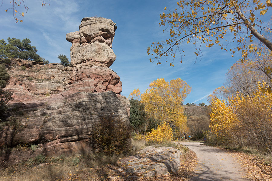
I always pictured Siguenza, my final destination, amidst semi-arid land from the perspective of previous visits on the train or in cycling trips so I’m pleasantly surprised by this approach from the east through some beautiful pine woods and amazing sandstone rock formations. It’s a Sunday and for the very first time in the trip, I meet people, day hikers enjoying the balmy afternoon.

Pine woods approaching Siguenza
Sandstone and poplar trees
Siguenza is a sizeable, medieval town, head of the shire. The old quarter still makes for most of the urban plan, sitting on a hillside with a massive castle on top. It’s a truly spectacular place and it makes for a classy end of the trip.
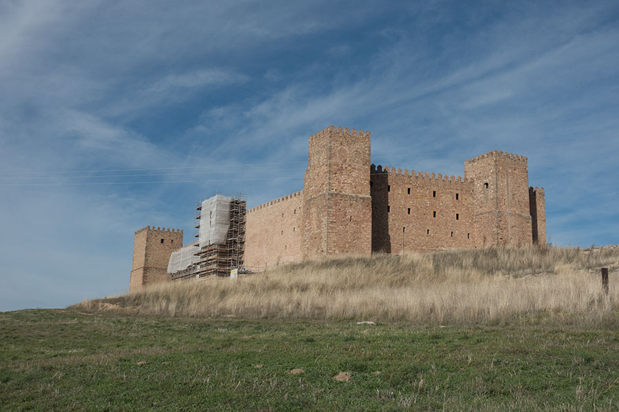
Siguenza castle

Medieval town
Old quarter streets
This was a difficult trip in many ways, mostly related to the whole situation around the ongoing pandemic with the associated pressure in both physical and emotional planes. I carried a load higher than usual on a body that wasn’t ready for it after many months with no backpacking and I suffered the consequences throughout the trip. The heaviest weight though was on my mind, the distressing feeling of doing something that wasn’t ideal, maybe not even right at all, no matter how much I’d abide by the rules, which are meant as a framework from where we all build our behavior. I left home fully conscious of this conflict and ready to carry the emotional weight but it was still heavy and my travelling experience certainly suffered.
In hindsight, I can say I bear no regrets. I really needed to be out there and let the hiking help save my life as it always does, more so after so much time of withdrawal. In a somewhat wicked way, I was also glad for the chance to take on a route like this, a trip waiting to happen, so far taken over by more glamorous options. I greatly welcome the new perspective it brings over past and future trips, home and abroad.
 RSS – Posts
Say what you want