In July and August 2023, I hiked for four straight weeks and 825 km in Norway between Sulitjelma, County Nordland and As i Tydal, County Trondelag. I broke the route down into four sections based on time criteria with the associated part-day break and resupply. This is the story of my fourth and final week on the trail when I walked from Holden farm to As i Tydal town.

Fourth week
The Holden stay was healing in all accounts. Taking a break always is but this time it was full of additional meaning: the most difficult terrain was behind and I was only 1+ hiking day from rejoining the trail and hut networks for good. It was a job well done feeling.
The food fest, that key part of the healing process, was limited to the hut’s pantry offer but I can be more than fine with a canned stew, which is what I had for breakfast after a 6 AM wake-up call. Then I’m on the (off) trail again.

Leaving Holden
After the instability of the last few days, the atmosphere feels quieter and there’s no clear sign of rain in the short-term forecast so I tackle the start of the section with confidence. The initial stretch is still off-trail, about 8 km to change valleys over a short highland section and lots of open marsh. Beware of the potential for deep pools!

Don’t step here
Gaundalen is another valley draining east into nearby Sweden. The namesake farm at the edge of the marshy valley bottom is accessible on a dirt road across the border.

Gaundalen farm
My route stays in Norway, heading northwest on a well-signed trail going upstream, alternating marsh and thick, beautiful conifer woods.

Gaundalen woods
Shortly after the trail leaves the trees behind, I need to turn southwest to leave the signed route and go for the last off-trail stretch I’ll need to walk, 18 km to Setertjonnhytta and a trail network that I won’t need to leave for the rest of the trip. The terrain is a highland, where the ground is firm and the vegetation is no obstacle. With only a breeze and no rain, it’s among the finest hiking time I’ve had for some time. Lots of lakes, big and small, and some steep, rocky hillsides.

Big highland lake
The clouds thin and break for another evening of magical sunset light as I come down enough to meet the trees and marsh combo again.

Marsh and trees

Mostly marsh
I could have pushed for the hut area but no need, it’s a great night for a camp. About 4 km short, I find the proverbial rise in the wetlands with room for a lone pine tree and my tent. It will be a beautiful camp.

Lovely scene

Lone Pine camp
I had staked all the ridge lines down to assist with the exposed location but it was a quiet night in my sleeping quarters.

The Locus Gear Khufu mid
The area has been left out of the National Park owing to a dammed lake and its use as farmland, most likely incompatible with the park status. I’m certainly not alone:

Good morning to/from the locals
One easy ford later, I finally reach Setertjonnhytta and the end of my off-trail days. I celebrate with a good break and an early lunch at nearly breakfast time. Unsurprisingly enough, it starts raining again but I won’t get upset about it. It’s a day to not get upset about anything.

Setertjonnhytta
I leave the hut in intermittent rain and it’s clear the route scene has changed dramatically: heavy signage and wood planks over the marsh in strong contrast with the last two weeks.

Back in popular hiking grounds

Trail infrastructure
And a nice milestone I wasn’t aware of, Norway’s geographical mid point:
I go through a couple of trail junctions and a hut in short stretch, which emphasizes the contrast with what’s been my routine for a good while. As I reenter the National Park, the route takes along Skjaekerdalen in a mostly forested setting under beautiful light.

Skjaekerdalen

Skjaekerdalen
The route leaves Skjaekerdalen for a highland crossing and the light is truly amazing with the mix of blue sky and assorted clouds in different flavors. Hiking life is good.

Southern reaches of Blafjell-Skjaekerfjell National Park
By the end of the day and in typical Norwegian fashion, clouds gather again and I get some showers but it’s mostly just so I can get another rainbow. A highland plateau is the perfect setting for a camp in quiet weather conditions.

Pine tree, heather, rainbow and Khufu
Sunset is outstanding from my vantage point.

Colorful sunset
Veresvatnet below is profiled by its own cloud cover in the early morning. The mountains in the background are across the border into Sweden. My camp happened to be literally at the southern border of Blafjell-Skjaekerfjell National Park. As I resume the hiking, I leave the park behind for good.

Cloud over the lake
Down in Veresvatnet, there’s the dead-end of a road with a lively farm area and a DNT hut that I won’t need to use this time. Most farms I’ve met so far in the trip have been about cattle in grazing fields, it’s interesting to also see crops.

Norwegian farming
There’s data reception and I check the weather forecast which announces the lull is over, rain is on the way later in the day with more to come the following. I prepare for rainy weather by checking the hut scene and I find no good match with my timing. I’ll meet a hut for a lunch break but not for the night unless I go for a terribly long day.
I’m not sure whether making haste or not. I do while taking advantage of a rare stretch of trail provided with never-ending lines of wood planks over the marshes where progress is easy and quick but the plan, if there ever was one, is ruined when I need to fork into a much poorer trail with no visible tread where even signage is lacking to the point that I loose it completely. In a haste-induced, bad decision making, I go across a marsh section that was too deep, if only for a few critical meters, and find myself stuck, both legs sunk beyond my crotch and unable to move.
If there was one time on this trip when I was in trouble, it was this one. I didn’t know if I’d keep sinking and, even if I wouldn’t, whether I could get myself out or not. I moved slowly trying to find a hold and get my last leg in, first out onto more stable terrain, literally 40 cm behind me. Luckily, it worked.

Cruising over the swamps before getting stuck
It starts raining literally minutes before I arrive in Bellingstua. I have my lunch under cover and ponder my options. It’s early afternoon, there’s another 28 km to the next hut and I certainly don’t feel like pushing that hard so I take my time and leave Bellingstua under intermittent rain two and a half hours later aiming for a wet weather camp.

Ghost selfie in heavy waterproofs
I walk 16 of the 28 km in very damp conditions even if it’s not raining much and make camp in a miraculously firm grassy spot with some sheltering relief. Heavy rain was forecast for the night but it never happened.

Comfy camp after all
In the morning, it looks like it could rain anytime and it does literally minutes before I get to the Ferslia hut. My very early wake-up call is paying off.

Welcome porch for the wet stuff
Ferslia is close to a road and a farm area and I have reception so I can make plans based on good data. Heavy rain is expected for the next few hours but it should ease in the afternoon. With only 13 km to the next hut, I decide to wait the weather and hope to leave on time to cover the distance and be under a roof for the night.
It does rain heavily and it seems like it’ll never stop. By mid-afternoon though, it’s only a drizzle and I set off. It’ll be a climb to the highlands followed by a hillside traverse, a pass and a climb down into the same watershed I had climbed up from. The air is heavy.

Very grey
I could expect the highlands to be misty and I could only hope the signaling was good enough. I concentrate on following the trail under horizontal drizzle.

Thick fog
I keep wondering if it was a good idea to try this when I could have just stayed in Ferslia. Other than the obvious need for progress and avoiding a very short day that would ruin my stats, the next hut in Angeltjonn feels more attractive, being in a more remote location and I’m fixed on going for it. However, the trail had other plans. 5 km into the death march, I meet this:

Swollen
It was a mountain stream whose headwaters were just a few km upstream, just a thin, seemingly harmless blue line in the map representation but it was heavily swollen with the ongoing rain.
I prepared for the ford, waterproofing all my electronics and paperwork, then got into the water. It was clear it wouldn’t be easy and it immediately became clear it would be dangerous. I got almost crotch deep right from the first few steps, barely manageable in the relatively slow flow near the bank. The current was powerful in the middle section, which I could also expect to be deeper. No way I could go across.
I scouted for an easier ford, found none in close proximity and decided it was not worth the risk or even the bother of travelling upstream fighting wet vegetation in the ongoing drizzle with no clue about for how long.
I didn’t even consider camping in the area. With a known hut 5 km behind, I had it clear I’d backtrack all the way to Ferslia and try again in the morning.
I was back in the hut by early evening, got the fire going, hanged everything in the drying room, relaxed and hoped for the best for the following day.

Drying room in Ferslia hut
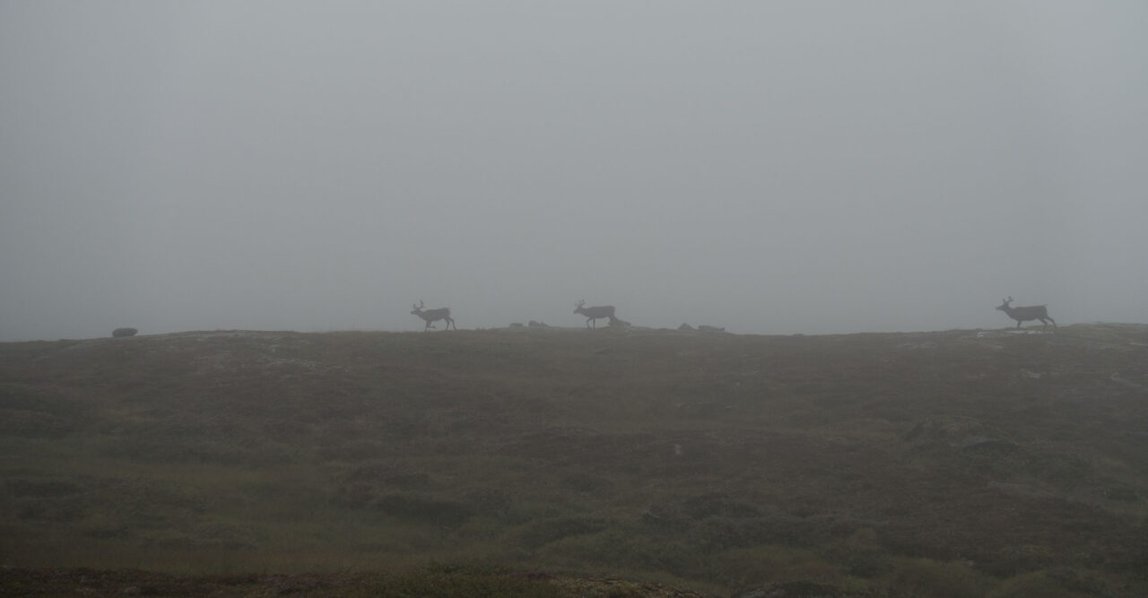
I resumed by 7 AM. It was still misty in the highlands but not as much as the previous afternoon and it wasn’t raining. I was not alone in the area:

Reindeer
I got to the problem stream and the difference was dramatic:

Back to normal
It was an easy ford, far less deep and with a pretty quiet flow that meant no risk. It’s well known how much conditions can change in a few hours but it’s still remarkable to verify on the spot. No matter how much of a commodity hiking may seem to have become, Norway is still a tad of a wild place that can easily bring the hiker back where it belongs in the grand scheme of things.
The fog lifted and I could have an eventless highland crossing followed by a downclimb to the shore of Fjergen lake, where I’d meet the hut I was aiming for the previous day.

Light and dark yet again

Fjergen
Angeltjonnhytta was a lovely backcountry hut that I certainly missed staying in. It was busy with some local hikers still in the process of recovering from the previous day beating. I could empathize with them. I had my lunch in the bench outside and kept going.

Angeltjonnhytta
The trail climbs high for a long section where it literally borders Sweden for a good while. I met some more reindeer. The clouds started breaking and it was even warm.

Hiker under the clouds

Hiker in the sunshine
I eventually come down to Teveldalen, a main east-west valley with a trunk road and railway track, both crossing into nearby Sweden. This place was, in normal hiking conditions, the least ambitious of my possible ending points, there’s a railway station a few km into Sweden where I could have taken transport straight into Trondheim. As it goes, I still have one and a half day hiking time in front of me.
There’s also a lovely mountain lodge in the area but the current sunny conditions are not to be missed and I keep going onto the following highland aiming for a camp. It was an obviously good move.

Camp above Teveldalen
Sunset was spectacular from my hillside bench, together with that gift that’s a cloudless sky in Norway.

Sunset

Sunset
Sunrise was not too shabby either:

Sunrise

Sunrise
My last full hiking day of the trip is an actual gift in virtually perfect conditions, it has it all: mostly cloudless throughout, calm, mildly warm and what’s more, almost unbelievably dry underfoot to the point that it wouldn’t look like I’m in Norway anymore if it wasn’t for the low light angle, even at midday.

And a good trail
I visit lowlands below 600 m with some lovely birch woods, then climb again for a final highland section that at times looks like a designer garden with the stunted birch and the colorful heather.

Riverside birch

Birch and heather

Birch, heather and hiker
My latest wide panoramas have the background of the Sylan mountains across the Swedish border.

Sylan hills
By late evening I come down to the Storerikvollen hut complex by the shore of giant, dammed Esandsjoen.

Storerikvollen hut by Esandsjoen
The place is too lovely to skip but the conditions are also too good to stay indoors and I prefer to camp for my last night on the trail anyway so I go for some middle ground by staying in the hut complex area and pitching in the camping corner, which is always an option in Norwegian huts.

Storerikvollen

One last camp
Sunset was lovely once again:

Last light
Come morning, it’s only 21 km, most of them on a gravel road, to come down to the Tydal municipality where I’ll hit a road and a one-trip-a-day bus line that I need to meet by mid afternoon. Perfect hiking conditions once again.

As i Tydal

Gravel road
I actually made it a bit longer by avoiding a most probably wet final trail stretch and taking the gravel instead so I could walk my feet dry before coming back to the urban world. I made it to town before noon.

Gravel turns to tarmac, As i Tydal
Only a handful of trail mix and half a block of biscuits were left in my pack but they weren’t appetizing anymore. I had some initial celebration meal while waiting for the bus.

Leftovers

Pizza & coffee
In a little more than 2 hours, the bus would take me to Trondheim where I’d do some proper partying, ie walk around with no pack, eat plenty. Celebrate a trip well done.
 RSS – Posts
Say what you want