The Northern Traverse and the Long Range Traverse are the two flagship wilderness routes in the Gros Morne National Park. They’re a great way of experiencing the highlands of the Long Range Mountains in a sort of controlled environment while keeping the wilderness flavor. The area is high enough for the vegetation to be passable so all you need is an access trail from the lowlands, then you’re good to go.
This section is bound to be the grand finale for my Newfoundland trip. It will include the now popular Long Range Traverse, that I already hiked in my previous visit in 2003, and the Northern (formerly North Rim) Traverse. I have a limit of 5 full hiking days that will account for days 12 to 16 of my trip.
Day 12: The North Rim
The Long Range Traverse is strictly one way, north to south, with the northern trailhead far from town so pretty much everybody drives to the southern trailhead and leaves a car there, then gets a taxi to the other end. Hopefully a shared one as it’s a long ride. I must be the only one among today’s starters with no car but I won’t need to walk the road again, the group I’d be sharing taxi with offered to pick me up before I could say anything. Newfoundlanders are too kind to start with and then there’s this implicit solidarity among fellow hikers.
The weather was brilliant the day before and the forecast is not too bad for the following days. Some clouds later today (Monday) with likely rain on Tuesday, getting drier after that and rather quiet all the way. There’s some cloud over the highlands as we ride north but the sky is clear towards the gulf of St. Lawrence.
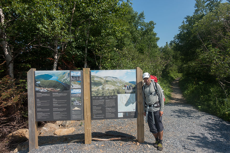
The taxi leaves us at the northern trailhead, which is shared for both Northern and Long Range traverses so I start hiking along with everybody else. The souvenir pic:
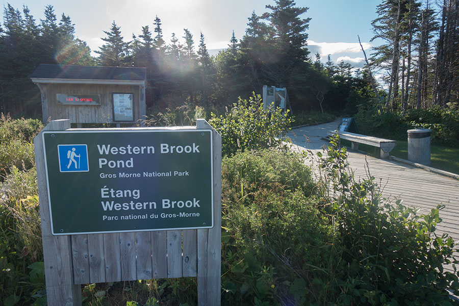
Trailhead for the masses
Long Range Traverse hikers will need to get a few km inland to the shores of former fjord, now cut-off from sea Western Brook Pond. The Long Range Traverse starts with a boat ride to the far end of the fjord where a faint trail follows the gorge and leads up to the highlands. My own route parts ways at the very pier, skirting around the fjord and climbing its northern escarpment to the highland plateau. It eventually meets with the route coming up from the glacial valley bottom.
Hiking again
The trail to Western Brook Pond is as good as a trail can be, wide, gravelly and provided with boardwalks over the marshy areas. The Long Range escarpment and the mouth of the land-locked fjord are visible as you get closer until you reach the shore and the view finally reveals it all:
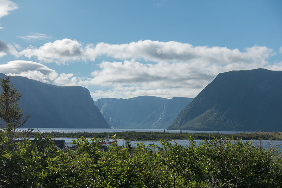
The mouth of the former fjord
Here’s the pier and the boat waiting for its morning schedule. There’s a also a nice cafe that would make a great last stop before heading into the wilderness but I don’t have a boat schedule to wait for and my own trip plan is quite demanding so I say goodbyes to all my fellow hikers and start walking right away.
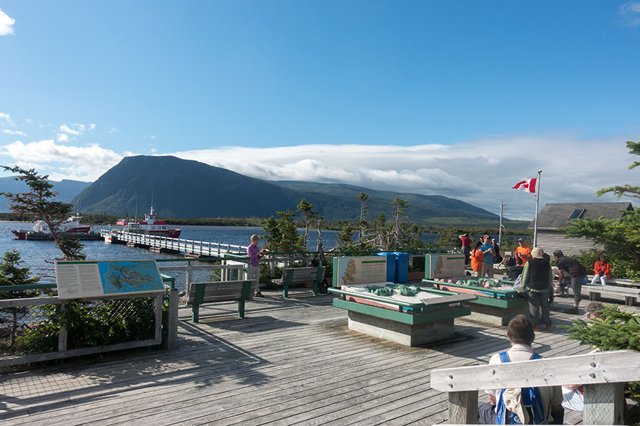
The pier on Western Brook Pond
I’ll join paths about two days behind them so it’s very unlikely that I’ll meet any of them again.
Wilderness hiking again
The backcountry route starts skirting the shore of Western Brook Pond. At the time of my hiking, this could be done on the pebble beach. If high water happens at all and hikers are forced onto the vegetation, it’d be far harder work.
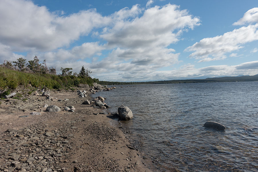
Nice beach walking on Western Brook Pond
The most potential for trouble though comes right after, when crossing the lake’s outlet. I showed concern to the rangers about this ford as it appears wide on the maps. The advise I got was less soothing than the fact that this is still a well trodden route, even if far less popular than the boat ride + gorge follow and I highly doubt the park would send hikers to potential demise too easily.
I also heard some horror stories about water up to chest level and an overhang cable to hold on to. When I got to the river I found nothing of the like. There was no cable in sight and the ford was easy enough to not even need to scout for the best crossing line. Wide, moderate flow, good tread underfoot and water up to knee height. Mid thigh would have been fine with reasonable care.

Western Brook Pond outflow
I wasn’t sure how the route would be going forward so I was pleased to find a trail marker and an actual trail cut through the vegetation. It’s still a long way to go to the base of the escarpment and it’d be too early to start fighting the bush.

Proper sign, real trail
The trail is very good for Newfoundland standards, easy walking except for the marshy bits.

Boggy tread
The route keeps going around the lowland end of Western Brook Pond. There are a couple of sections over sandy beach that are very scenic. At some point I can see the boat in the distance while it heads for the fjord mouth and I remember my own trip in that same boat 14 years back, the awe for the scene and the excitement for the upcoming trip. Today is different, I’m bound for more difficult terrain this time but I’m way more experienced, I know better what I’m getting into and I feel more confident than I did back then. I travel lighter but on a more demanding schedule. I’ll be responsible for just myself but I’ll have nobody to rely on to when I’m feeling down. Compared to 2003, this time is less about excitement and more of an intimate relation with the place.

Beach walking on the way to the North Rim escarpment
Snug Harbour is a beautiful cove with a backcountry campsite and a couple of tents up. It’s the last lowland shore area before the fjord mouth and the trail starts climbing here towards the highlands across thick woodland.

Snug Harbour and the clouds getting stronger
Low cloud has engulfed the summits and the day is turning dark and unsettled. The trail emerges from the forest for a wide view of the coastal strip and the Gulf of St. Lawrence beyond. Shortly after I climb into the cloud or the cloud comes down to me or both. Visibility is gone and the environment turns wet cold. Not a good omen before the highland traverse but route finding is not yet a problem as I keep climbing on a clear track with rock ptarmigan as my only company.

Rock ptarmigan
The terrain starts leveling, the bush getting shorter in size and the trail fading but the fog stays. The end result: I find myself in a featureless flat, green underfoot and grey everywhere else. I’m back in the highlands and I can’t see a thing. This is where GPS makes easy what would otherwise be an unnerving prospect. I reach to my pocket and start checking my position against the blue line on the screen. I look around and think how it’d be without such technology. It’d feel daunting.
The mist gets me wet and cold, it keeps my head down and I concentrate on the walking. At least the terrain is easy, mostly grass, some rock and a few tuckamore groves that I can happily go around. It’s a bit of a bummer that I can’t see much but the foggy landscape feels mystical and holds its own beauty.
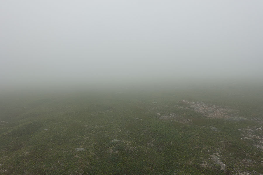
Foggy North Rim plateau
Just as I stop for some snack, the fog starts shifting. In a matter of minutes, the sun is shining through and I meet the Long Range Mountains at last:

Green shines again in the highlands
The world around me turns from darkness into bright green as low clouds keep shifting around. It’s truly beautiful. It makes me glad.
Tuckamore warning
The next section in front of me is the basic reason why the Northern Traverse is less popular than the other route in the park, the Long Range Traverse: tuckamore is the Newfoundland word for the groves of stunted spruce trees that grow in the highlands, creating an impenetrable maze of interlocked trunks and branches that won’t yield, no matter how hard you push through. Moose apparently can go across but if you’re a human you’d rather avoid it. The Northern Traverse is infamous for its tuckamore so much that it makes for the main piece of advise from the rangers and it is these upcoming miles that concentrate the warnings.
I’m not worried though. I know it’s tough and it takes a long time and lots of patience to hike on tuckamore terrain but I know it eventually works out. I don’t think it will be any worse than what I found on the North Arm Hills on the previous leg of the trip and today I’m not in a hurry.

North Rim tuckamore
What really does help is the weather and general conditions: it’s dry, calm, mild and sunny, i.e. perfect. I can imagine crossing tuckamore in rainy weather can be two times miserable. Actually any difficulty factor that’d be tolerable on its own would make this bush maddening. It happened to me on the North Arm Hills when I was consistently pressed in time for a whole day and this made the hiking an exhausting and frustrating experience. It may be the same bush but if you take it easy and naturally, it all flows much better.
There’s indeed quite a lot of tuckamore but the terrain is otherwise easy, rather flat and along a lake. I alternate shore with inland. None is easy but the variation helps psychologically. The lake shore has a bouldery strip that can often be traversed by rock hopping. This is not too fun with a big pack on and it gets tiresome eventually, then I go inland and face the bush. It is a sort of relief at first to be able to tread on regular ground and it’s sort of fun to try to link clearings across the thinnest bush stripes but it also gets tiresome. When I’ve got enough, I aim for the shore again. I’m enjoying this.
Rocky strip or the bush
About mid-lake I meet the first highland campsite. It has a few wooden platforms and a pit toilet. If I mean to camp in one of these, I should probably stay here because the next one is too far away for the day but it’s still too early for stopping. I actually don’t know whether it’s mandatory to stay in the campsites or you can camp anywhere. I didn’t ask the rangers. It’d be odd to ban camping off site, given how wild and solitary this is. Maybe it’s different over the Long Range Traverse but the terrain I’m on looks really far from excessive human pressure to justify camping restrictions.
I keep going. I sort of celebrate the end of the lake-side section so I can try a different thing, linking meadow areas as I go up, then downhill. The terrain turns into a constant up and down gullies and outcrops. I try to navigate on direct observation, which is best for small scale obstacles like the tuckamore groves, but I keep an eye on the GPS track. I get badly stuck once, needing to go across a long section of 2+ meter high bush that takes a long time and some swearing. It turned out I had drifted slightly away from the digital track but I’ll never know if there was any easier way. It didn’t look like.
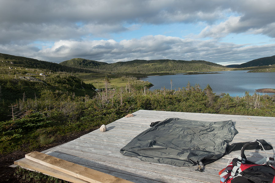
I start scouting for campsites. The grassy bits are often boggy so it’s not as straightforward as it could appear in pics or from the distance to find suitable pitches but it doesn’t take long to find some minor rise that’s dry enough. When I’m coming down to a stream, I find such ground and I know it’s my place.
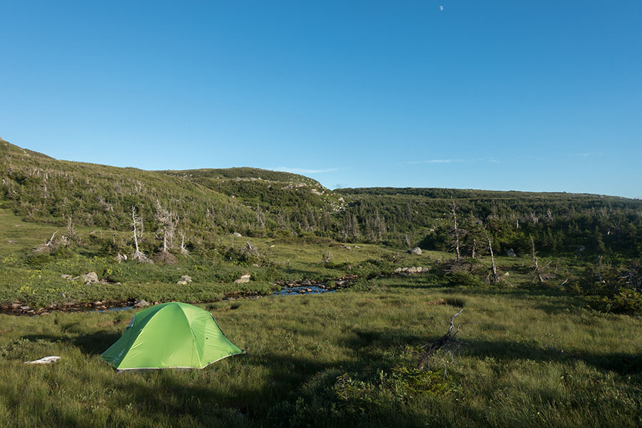
Campsite day 1, evening light
It’s beautiful and peaceful and I feel incredibly happy to be here.
Day 13: The North Rim (again)
Tuesday starts dark and rainy. It is no surprise as such weather was in the forecast. It’s quiet, the rain falls gently and I’m snug in my tent.
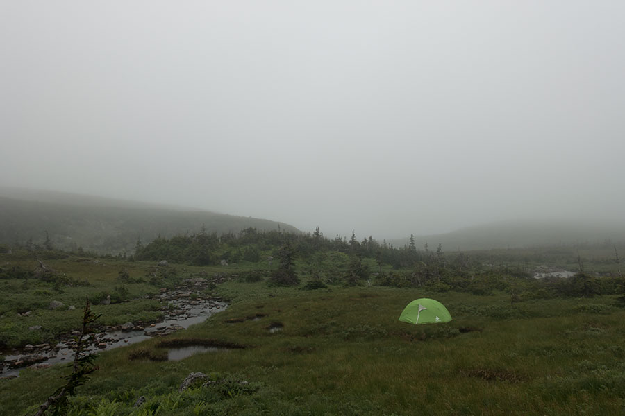
Campsite day 2, afternoon dark
I had been doing my math: the Northern and Long Range traverses combined are about 60 km for which I have a 5 day window before I start my fly-home procedures. 5 days may look like a lot for a mere 60 km but it turns out as not so much for off-trail, often difficult terrain where the going is slow and 20 mile days are out of the question. The National Park recommends 6/7 nights for the whole traverse, something to consider even if it’s necessarily conservative advise meant to be suitable for all hikers.
The best perspective for me comes from my own previous experience in the Long Range Traverse where I followed the NP advise by the book and took 4 nights. Back then I was hiking with a slower partner, packing much heavier and took it leisurely all the way. My rough estimate is that this time around I should be able to complete the whole thing, both traverses, in 3 committed days but being trip’s end and with a flight home in the horizon, I wouldn’t like to push things tight. 5 days sounds about right so I have some cushion in case anything goes wrong.
Day 1 was quite fine distance wise. I’m in a position such that I can take it easy. Rainy, quiet weather is fine for hiking and it can actually be very nice on easy terrain but I can still expect rough going for at least another half day until my route meets the Long Range Traverse.
Pushing through saturated vegetation is not an attractive prospect. I’ll do something I hardly ever do: I’ll wait the weather.
My trips are usually about pushing hard, not so much over speed but constancy and long days with no zeros. It is very odd to me to stay put in camp, it’s like I feel a certain guilt for betraying my own stance and I tend to not feel comfortable, yet this time I have it clear. I have it so clear that I’m perfectly ready to allow myself to enjoy my inactive time in the North Rim plateau.

Tent life: socks hanging and a brew
I don’t have books to read or pods to cast, I don’t need them when full on the hike-camp-sleep cycle so what would I do when tent bound for hours? As much of an action bound person as I can be, I can say I actually enjoyed lying in my tent, listening to the rain falling, doing nothing, relaxing my mind, keeping awareness of the privilege of being in such special, beautiful place, quiet, still, as if I was a part of it.
It rained for several hours straight. It only stopped at about 4.00 pm. I briefly considered packing up and covering a few miles before darkness but I quickly decided against. I didn’t need the miles and everything outside was soaking wet, so would I become as soon as I started moving, even if it didn’t rain again. Which of course it did later on, keeping me happily tent bound.
I did go outside hoping to meet some fellow highland dwellers other than birds and, sure enough, there it was, quietly looking in the direction of my odd-green shelter arrangement:
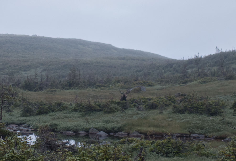
Moose
Moose are very common in the highlands.
The forecast is favorable with dry conditions tomorrow, at least overhead. My credit is gone now so I’m certain I’ll be leaving in the morning whatever the weather brings.
Day 14: Hardings Pond
Last night has been a bit more restless than usual as I didn’t have the day’s beating to push myself into sleep. By early morning, I’m eager to go. It’s still overcast but not raining.

Campsite day 3, morning haze
I’m already past the worst problem area for tuckamore as per the rangers’ advise but even if I’m not expecting any easy going, I find the terrain surprisingly tough and progress slow. It’s a constant up and down over rocky, bushy and convoluted ground with occasionally thick vegetation that’s still wet from the previous day’s rain. Once again and in hindsight I think the key to successful hiking in such conditions is mental adaptation and it somehow doesn’t work fully well for me this time. The dark-grey, cloudy vibe is probably affecting my mood in addition.
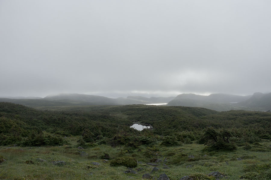
Moody Long Range mountains
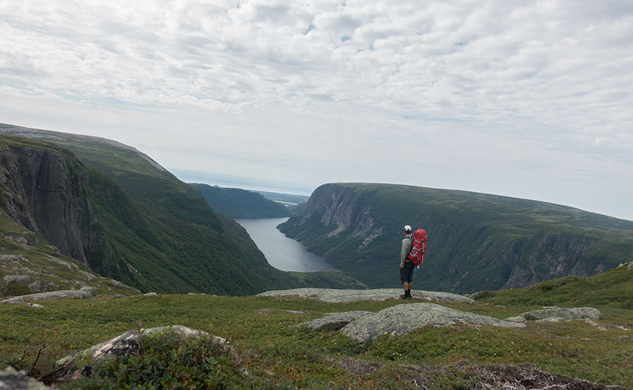
The good thing is I know the difficulties are almost over. Once I meet the route that climbs up from the fjord and so join the Long Range Traverse, progress will be easier. This is what probably makes me anxious about the latest stretches of bush-fighting, I feel like I need to upgrade my experience to type 1 fun. Eventually, I emerge from a long, thick grove into open land with an evident sinkhole void to my right as I walk south and I know I’m just getting to the spot with the coveted view of Western Brook Pond:

The great land-locked fjord
Western Brook Pond
It’s not only the view but what it takes to get there. The scene itself is awesome but you can probably get something similar for much cheaper somewhere else more spoilt than Newfoundland and it wouldn’t mean the same. It’s the view of the landlocked fjord and it’s also the wilderness setting that makes it special. It was very special 14 years ago, when I took the boat along the lake and departed up the gorge without actually knowing if I could do it until I eventually turned my head back and realized that I was in the spot. And it’s very special today, even if in this instance I was quite positive I would make it. I remember the sense of achievement and the deep sense of peace and serenity in that first visit. This time around nothing is so intense but it still means a lot to be here and I’m so glad I made it, so happy to be back:

Western Brook Pond
I hang around for a while, such a meaningful time can’t be long enough, no matter how much hard work I still have, and I have plenty. Eventually, I say my goodbyes and, same as 14 years back, I do the short climb to the opposite side rim and take in the view of the Long Range plateau:
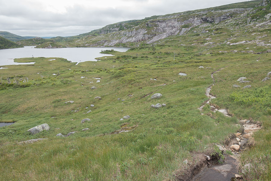
The Long Range plateau
This are my upcoming hiking grounds. Convoluted, a mix of rock and grass and not much bush. Just as I remembered it except for one thing: this time around there’s a narrow but clear trail going forward. There wasn’t a hint of it in 2003.
Impromptu trail engineering
It’s still cloudy, preventing the brilliant green display of the sunlit grass but otherwise excellent hiking weather and it becomes apparent I’m in the very last leg of my trip where I can walk worry free and just enjoy the ride. I take it as a well earned prize.
The hiking is indeed easy and worry free. The trail is so consistent that it looks purposely built even though it is not. The rangers would later tell me it’s just hikers consistently following the same line, many of them likely over the same GPS track, which tends to concentrate the footprints even where the due course wouldn’t be so straightforward on the ground.
Nearly continuous trail in the highlands
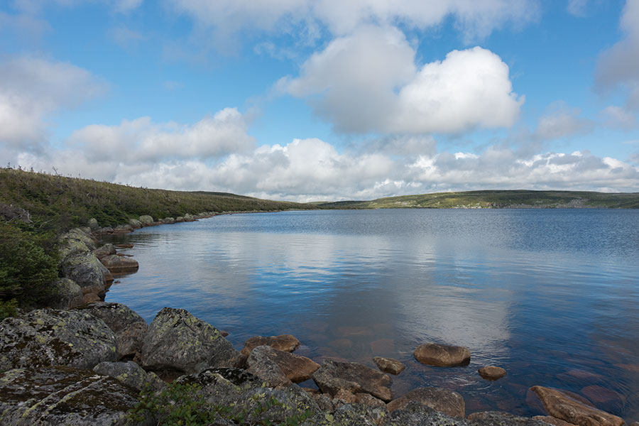
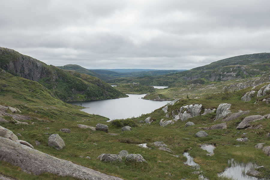
The route goes south along a series of lakes over undulating terrain where route finding would be easy even if there was no trail on the ground. It’s beautiful hiking up here. I remember how much slower would our progress be back in 2003 and how much bigger the place looked like in return. Today the successive lakes get left behind somehow much quicker. Once again, I miss the awe and sense of achievement of my younger times where every step was damn exciting but I still feel so happy to be here and I find it super interesting to see myself through time by making ends meet in space.
Fellow backpackers
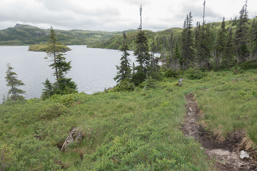
I walk along Little Island Pond where the “little” is for the island, the pond is actually quite big. Here is the first highland campsite and this is where we stayed in 2003 after climbing up along the gorge. That one was an early camp, today I must follow.
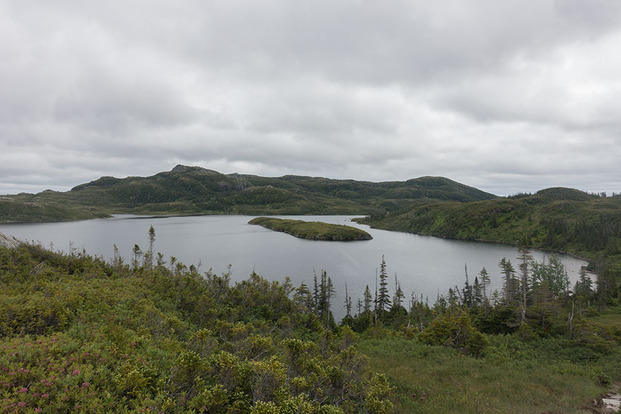
The little island in the big pond
The route goes past the lake and follows the drainage to reach Marks Pond where there’s a second camp area. Guess what I found there: a hiker! taking a break in one of the wooden platforms. Of course I knew but I was not actively aware of the fact that this was the Long Range Traverse and there would be people around. It was the first backpacker I had met in my whole trip other than the people overnighting near the trailhead in Western Brook Pond. It was the realization of a change in the whole vibe. I wouldn’t be on my own anymore.
It was still early to stop and there is no shortage of campsites along the Long Range Traverse so it was clear to me that I’d keep going another 4 km to the next one in Hardings Pond.
Leaving Marks Pond, I was glad that I kept awareness of general direction of travel when the trail started heading downstream along the drainage when it should have started climbing the hills to the south. The downstream course appears more inviting, grassy and gentle, and apparently many hikers take it, who knows for how long before realizing the error, then hiking back and treading twice so the trail becomes more distinct, adding up to the confusion and sending yet more hikers the wrong way.
Climbing up is good news in the long term: the higher, the less chance of thick vegetation. It is a very gentle climb anyway over the ridge, across highland terrain and down to the next drainage. Great views of the highland plateaus that help understand the shape of the land.
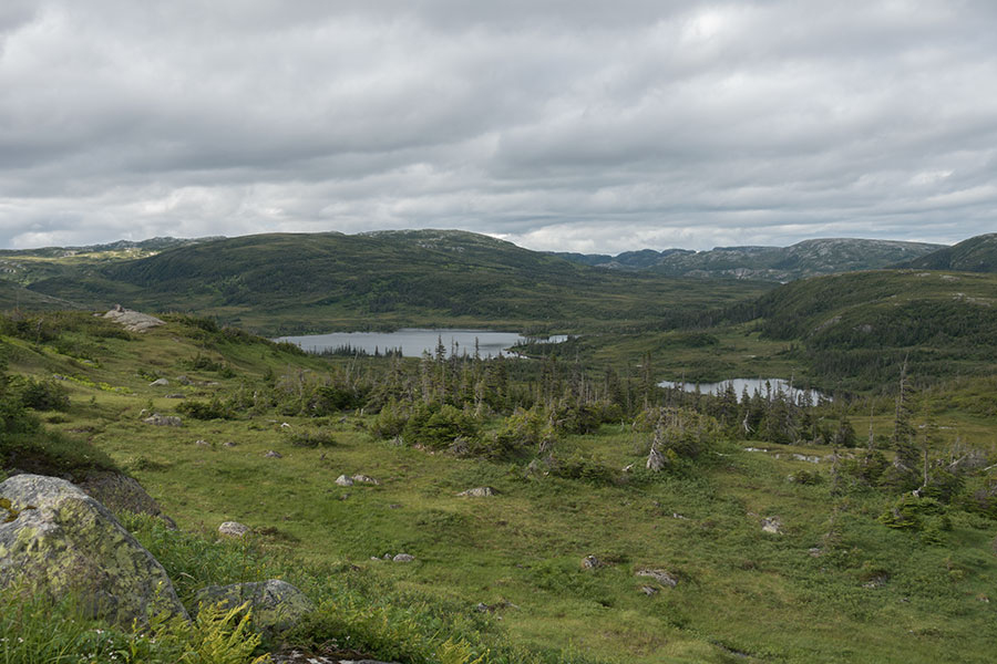
Marks Pond and the shape of the land
The route then comes down to yet another lake basin by Hardings Pond. As the view of the pond unfolds, I come to an unexpected sight: a building.
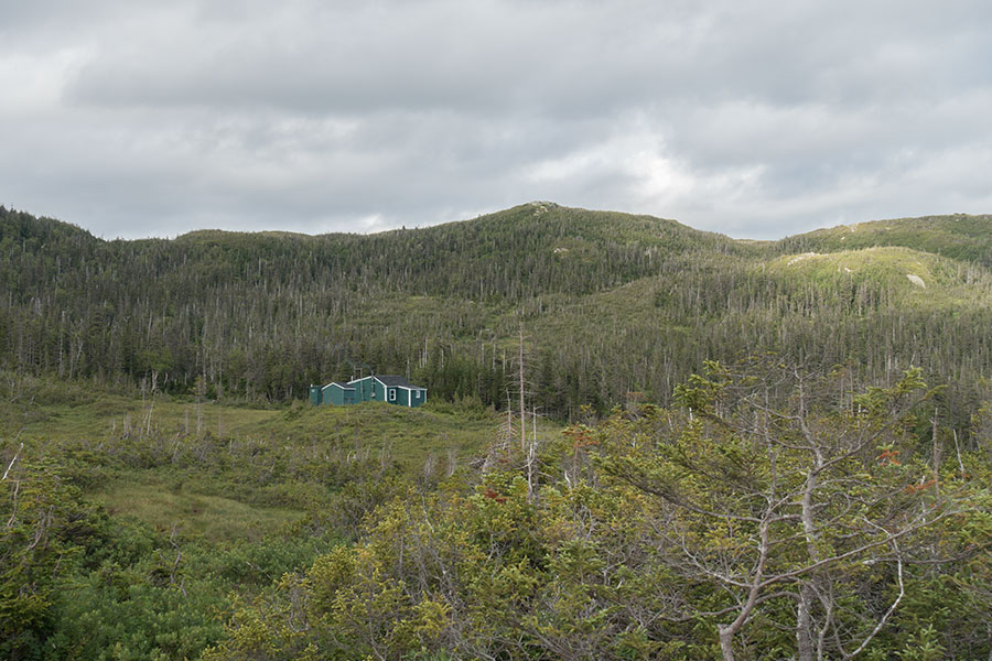
Service hut on the Long Range Traverse
It’s a wooden hut painted in the same green as the dominant vegetation. It wasn’t here in 2003. The rangers didn’t mention it so I guess it’s a service hut, not open to the public. The smoke coming out the chimney shows it’s busy today.
I come down to lake level and pass by the hut. There’s a designated campsite at the far end of Hardings Pond which I have just about designated as my destination for today. There’s still enough light left for some further progression but I don’t need it and I’d rather enjoy some camp time. Yet another well earned prize, paradigm Type 1 fun.
I’d rather avoid the wooden platform pitching challenge so I scout for possible ground pitches as I approach the campsite area but everything is too marshy at first sight. I could surely find a dry, grassy bit on the surrounding knolls but I feel it’s just easier to go for one the official sites. There’s people camping here already. I eventually settle on a small rise nearly over the east/west watershed. The site has great views and it’s perfect for a calm day.
Beautiful evening light in Hardings Pond
My tent is unintentionally free-standing but my camp ethics don’t allow leaving it on without proper anchoring and I don’t have any provision for anything but real ground so setting it up on top of the platform turns into an entertaining challenge:
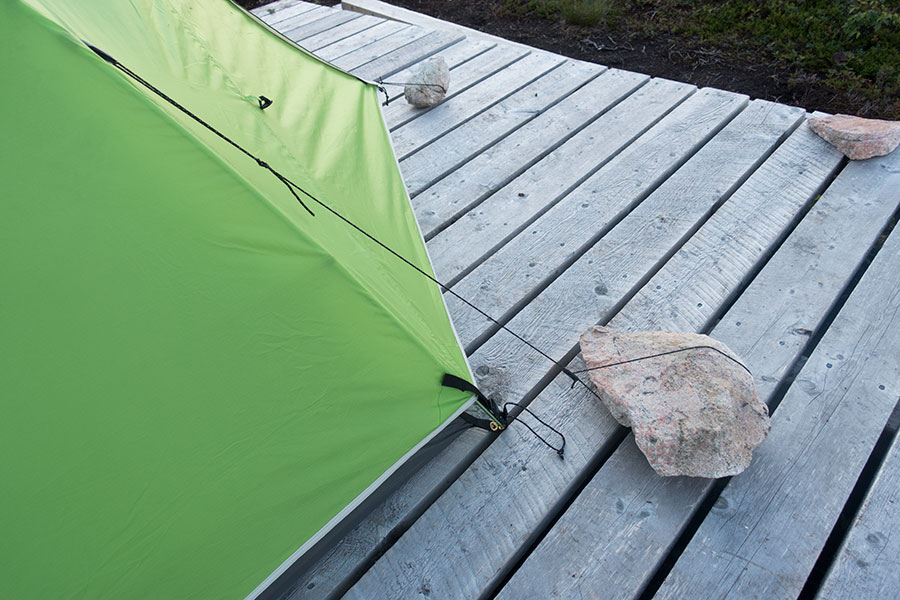
Tent anchoring works
It will look fine in the end but I do hope there’s no wind tonight. Bring some extra lines if you mean to set up on wooden platforms.
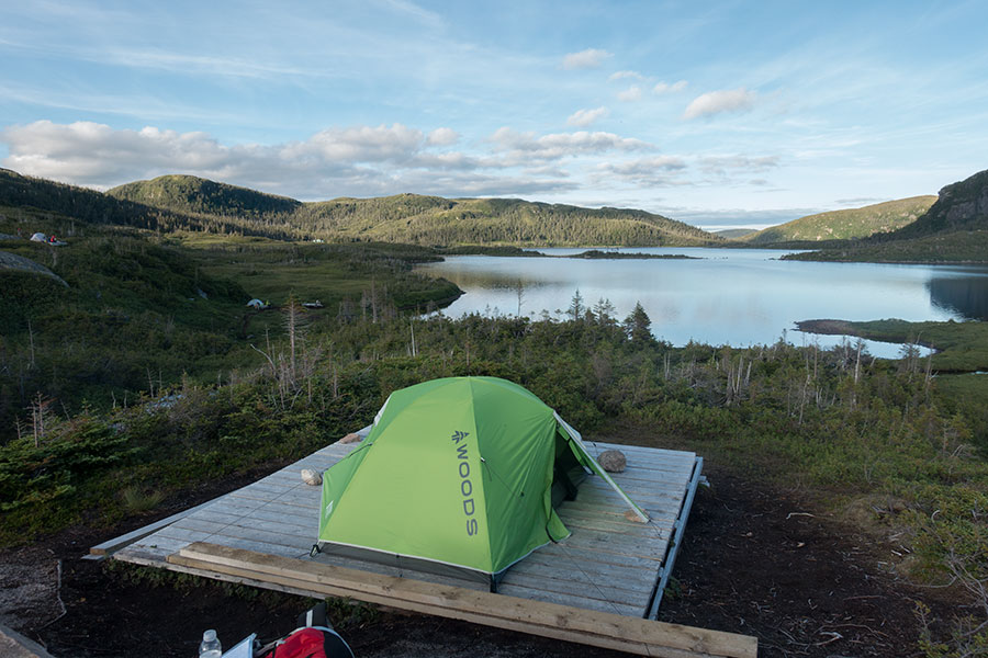
Tent up in Hardings Pond. Two other tent parties to the left
Hanging around camp on this trip is a luxury I’m not ready for and I need to improvise the full bug protection:
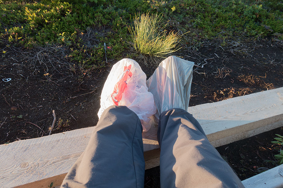
Low-tech bug protection
I camped in Hardings Pond in 2003 on a lakeside site even though I can barely remember it. Today I can watch the sunset and relax before going to sleep.
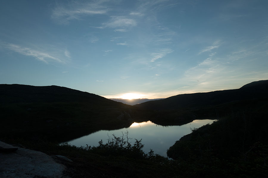
Sunset from camp
Day 15: Ferry Gulch
I wake up to a beautiful sunrise over Hardings Pond after a quiet night:
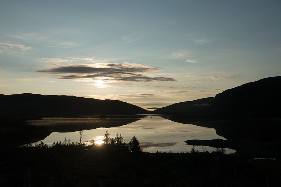
Sunrise in Hardings Pond
No hiding inside shelter today for breakfast or for anything else, outside is as welcoming as it can be and the cool morning temps keep the mosquitos down.
The kettle was the emergency solution for the cooking department after I had to improvise most of the gear for the trip and this time I can take full advantage of its sexy outline over the more functional but boring cylindrical pot:

Kettle & sun
I take it easy. Most of the work has already been done. The weather is bound to be beyond perfect for the day and it feels like nothing can go wrong. I can go business as usual and be out of the highlands by early evening. I get mentally ready for plain enjoyment.
The next section is probably the trickiest in the Long Range Traverse with no clear handrails to follow. It climbs rather high and stays high most of the way to the next campsite near Green Island Pond. Nothing seems difficult on a calm, sunny weather day though. I walk completely worry free for maybe the first time on the trip as I climb away from Hardings Pond and the lake basin at the headwaters of the mighty Humber river.
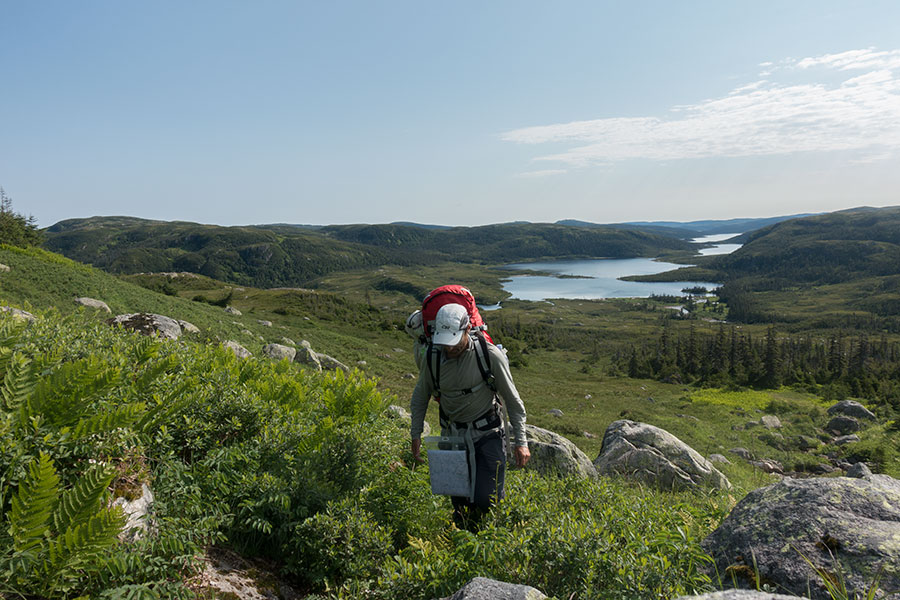
Leaving Hardings Pond
Berries, marshes, moose and a beaver dam
The Long Range mountains are a wet place to hike. There’s rock and solid ground but marshland is all over the place and you need to go through it regularly. Some hikers will go traditional and use waterproof boots and high gaiters, I certainly prefer light shoes and comfy socks. All this to say I kind of like these spongy sections where feet sink into a soup of saturated grass. I find it refreshing and I feel it actually keeps my feet healthy as long as I can alternate with dry walking. This is also where some berries grow. They also like the damp.
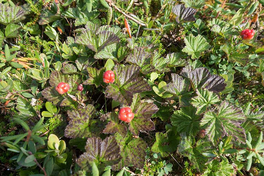
Berries
I go past the daily moose, this time at a distance. You get used to it but it’s still a great feeling to share the place with such beautiful animals. It’s part of what North America means to me.
Beavers are another symbol of wildness or so it feels, did we ever have them in central/southern Europe at all? I haven’t seen any on this trip but when I go past a dammed lake I can only think of them. I can’t see any den though.
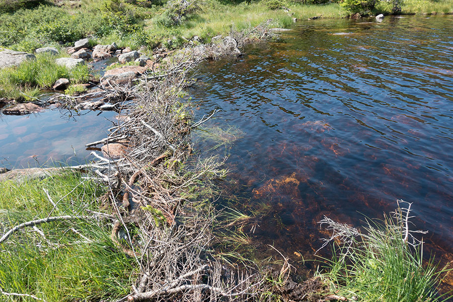
Beaver dam?
Last of the mountain plateau
There’s more lakes than you can count. On a warm day they feel inviting enough for a skinny dip and the water is not even cold on a shallow end with a rocky bottom. Swimming in a wilderness lake and drying in the sun must be among the best things in life.
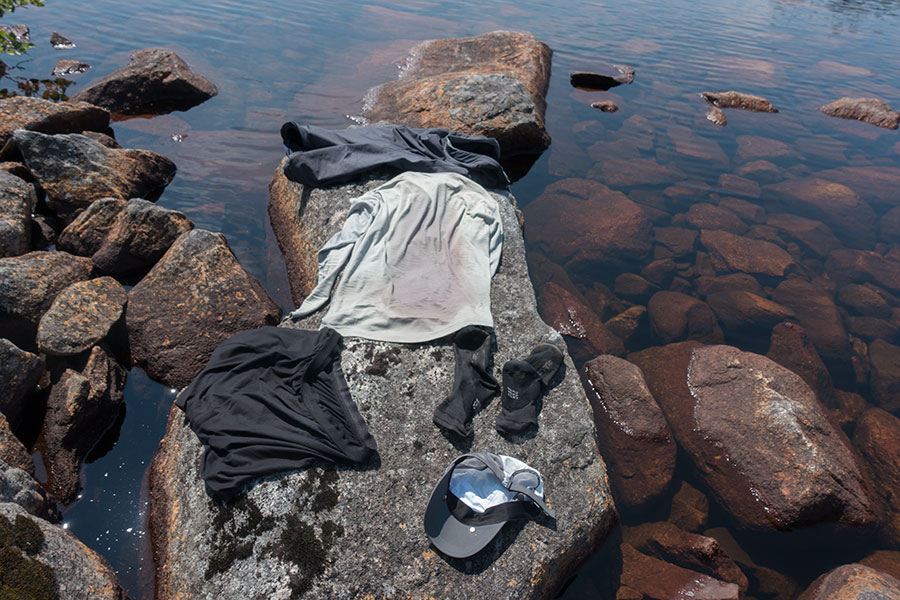
Hiker trash
At some point Gros Morne mountain becomes clearly visible, sticking out of the Long Range plateau with the Gulf of St Lawrence behind. It is a good landmark, that’s where the route goes, still a few hours away:
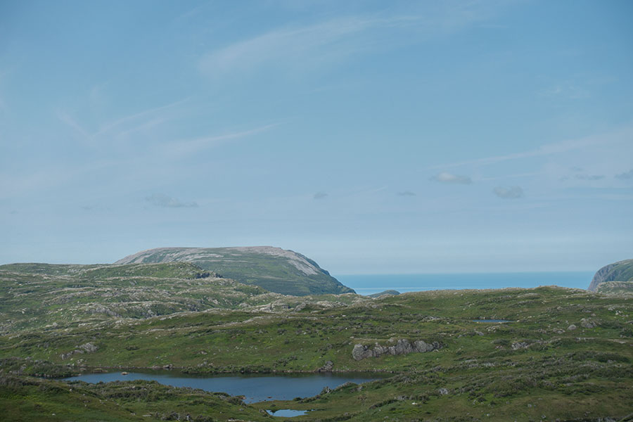
Gros Morne Mountain & the Gulf of St. Lawrence
I go past the campsite near Green Island Pond. It’s actually well off the main body of water in a small valley where a stream spreads into a small, shallow lake, a rather secluded, no-views location where I had a great stay in my previous visit. I remember that day vividly, it was so beautiful and peaceful. This was our tent platform back then:
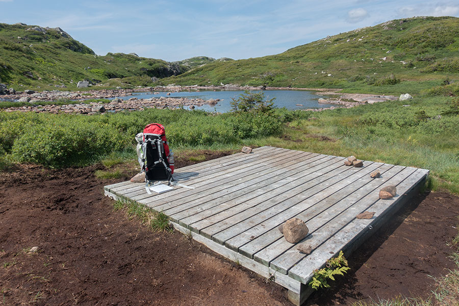
Green Island Pond lower campsite
The route climbs up into open terrain an expansive views in all directions. There’s the promise of some drama to the west, with the chasm of Ten Mile Pond starting to show but I particularly like the view east to the gentle drop of the Long Range Mountains, a huge wilderness of brilliant green and countless lakes lifting my spirits to new heights. It’s incredibly beautiful and I rejoice in the wildness of the place.
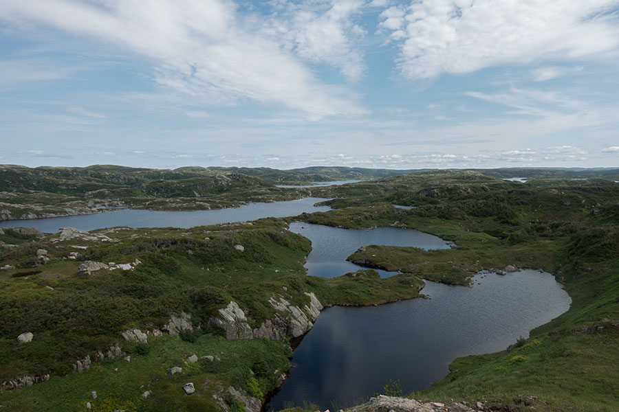
A huge wilderness of brilliant green and countless lakes
The map shows the route skirting the very rim of Ten Mile Pond, the third and last, only the second that’s directly visible of the landlocked fjords along the Long Range Traverse. Despite the name, Ten Mile is the most modest in size but still spectacular:
Ten Mile Pond
I sit down and contemplate, just what the place is asking me for.
I wave goodbye to Ten Mile Pond and go back to hiking with Gros Morne Mountain in front of me and the vast expanse of the Long Range plateau to my left as I approach the point where I’ll start coming down from the highlands. For a moment I consider staying up around here for the night. In retrospect, I think I probably should have. Instead, I decided to keep bound to my original idea, start the descent, make base camp in Ferry Gulch and spend the evening climbing mountains.
I wave goodbye again, this time to the Long Range plateau. This one hurts a bit more.
Coming down
The climb down would be a nightmare without the minimal trail that cuts across increasingly thick bush. Once down on the upper valley floor, the track levels and the bush grows to small-tree size as the going gets rough underfoot but it’s not long before I get to a small lake and join the main trail to Gros Morne Mountain. This is a real trail, up to high standards, that I need to follow just for a few minutes to the other end of the lake and the last backcountry campsite of the traverse.
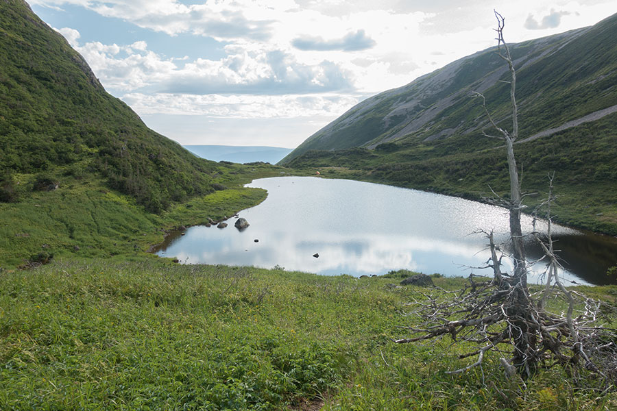
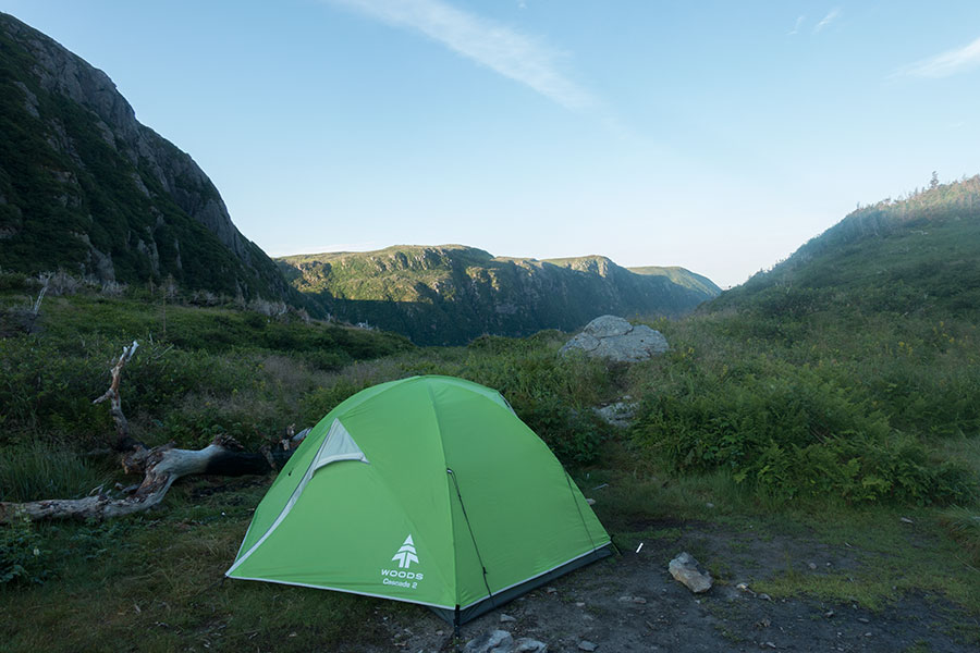
Day’s end at the other end of the water
Two of the sites are busy. This time I pitch in real ground, skipping the dreaded platform but I will take advantage of such luxury as the table & bench combo.
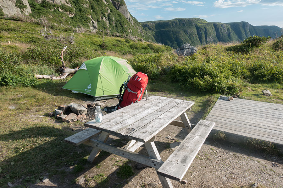
Luxury camping in Ferry Gulch
Gros Morne mountain is iconic and its summit is right above my head so I decide to follow my own steps and timings of 14 years back and spend the evening on the climb. I hike with no pack and on a perfectly well engineered trail. After 2 weeks off-trail and heavily loaded, it’s only ironic that it’s here that something goes wrong: as I’m climbing a series of steps I feel a sharp pain in my right calf.
First thought is that I had hit myself with a stone or something else hard as I walked, it was that kind of pain but it soon became evident that there was no attack from outside and something had broken inside instead.
I did nothing out of the normal, I believe the muscle just gave up to accumulated stress. I had never, ever had such a muscle injury. It probably shows how physically tough the trip had been. Or how unfit I was becoming with age.
Whatever the cause, I verified that I could still walk, even if in pain and needing to rely mainly on my other leg and I boldly decided to keep climbing. It wasn’t a joyful experience but I got to appreciate the spectacular side views of Ten Mile Pond and I set foot for a second time on the Gros Morne Plateau summit.

Lots of rock
I believe this has become a super-popular day hike now and the summit must be a busy place but this time it was late in the day and I had the place all to myself and my painful leg.
Coming back down to camp was a struggle and I arrived late, tired and dirty. That was the price of my stubbornness.
Other than for my injured leg, I had a very nice late evening in camp. I shared table with a fellow camper and it was nice to have some conversation for a change. We were later joined by a party of 3 moose that were quietly browsing around no more than 30 yards away. They were probably used to humans in this area. A pity it was too dark for valid pictures.
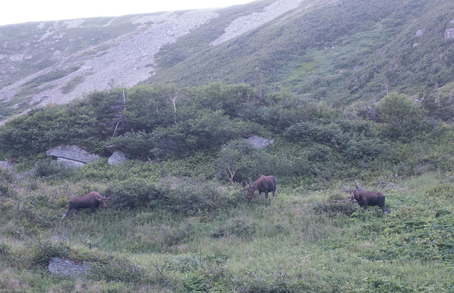
Moose getting social
It was the first time on the trip that I saw moose in a group.
My injured leg got swollen and I tried my best to massage hoping it’d improve enough that the final stretch to the trailhead the following morning was not agonizing. Then I went to sleep.
Day 16: The Visitor Center
I didn’t sleep well due to the pain coming from my right lower leg. When I woke up, I tried to be optimistic and say to myself it looked a bit better but as soon as I tried anything resembling walking, I had it clear it was just as bad. I was in for a tough final miles and I could only be thankful it happened so close to the trailhead and trip’s end.
I take it easy and try to enjoy my last morning in camp. Moving is painful and I mean to not think on the way down. It’s a beautiful morning in a wonderful place and I try to concentrate on that.
Ferry Gulch early morning
It’s about 7 km only to the trailhead, then 4 more on the road to the Visitor Center, that I need to visit to report my finishing and return the beacon. It’s not gonna be pretty but I accept my fate with resignation. I pack up and go.
I drag myself along the trail trying to keep my hiker dignity. The trail is of good quality and proceeds gently down along the glacial shaped Ferry Gulch. I get to a junction that I can’t recall from 2003 and I meet the wave of day hikers coming up to climb Gros Morne Mountain, most of them following a route devised by the park service along a steep gully, straight up to the mountain plateau. The signs recommend using this rough route up, then the regular, easier trail down and that’s what most climbers seem to be doing. As I proceed ahead, there’s a real surge of hikers in front of me enjoying the brilliant weather. It’s a bit of a shock.
It’s yet more shocking when I stop for a break and snack in a sort of rest area with pit toilets and a bench. There’s lots of trash thrown in behind the bench. This is a sign of the quantity and quality of hikers in the area: it’s lots of people and it’s also all kinds of people, too close to a trailhead so nature can’t filter out those who don’t care. At least, the trash is hidden out of direct sight, a sign that they know it’s wrong.
The side effect of the human waste is that some little ones, in between food-searching and confidence, dare to come close enough so I can put them in print.
I resume my crippled descent while I keep meeting day hikers coming up. Every step hurts but every step is one less to go. I try to get distraction on the surroundings. When that fails, I concentrate on the mechanics of walking.
I get a final open view before the trail dives into the woods. A while later I emerge from the green tunnel into the trailhead parking lot. There’s lots of vehicles and barely any person around. It’s oddly warm, I’m tired, sweaty and rather worn out. I gather the last of my hiker dignity while I wait for somebody to show up and ask for a finish-line pic. I try to smile.
Trailhead blues
Finishing a trip when you’re a backpacker is far from glamorous. There’s nobody to greet you, no cheering, no press or flashes. If you’re solo, you can only cheer up yourself. I need to remind myself this was the end of my big trip of 2018 and it meant a lot to me. It was important.
The rest is routine. I need to take the road for a final 4 km push to the Visitor Center, then I’m free to flee south. The road is awful to walk but at least it’s easier on my injured leg than the trail.
The Visitor Center is the actual end of my hiking. The rangers keep a monitor over current hikers on either Long Range or Northern traverses until you declare yourself done. I guess this could be done over the phone/mail but I also need to return the beacon I was lent as part of the pack.

Gros Morne National Park
It’s the same model I own but mine will be waiting for me in some lost luggage office in St. John’s airport.
The rest of the day involves a two step hitch-hiking trip to Deer Lake where I’ll take an early morning flight back to St. John’s the following day. I extend the narrative this far only so I can introduce this late evening pic of my heavily swollen leg:

My swollen leg
It was a tough trip to the very end.
 RSS – Posts
Say what you want