This section was a necessary transition in both space and time. I didn’t want my trip to become a series of unconnected multi-day hikes, I wanted my trip to be a real A to B. I could accept the exception of the Bay of Islands gap, even if half of it was an overland detour rather than a water crossing but I kept to my compromise of hiking every bit that was on my intended line of travel and was not over water.
Now I needed to get myself from Trout River to Rocky Harbour, Western Newfoundland.

To Rocky Harbour
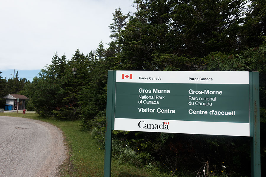
The “time” bit of the transition is about my upcoming future once I get to the town of Rocky Harbour because only then will I know if I’ll be able to hike the next, connected wilderness section or if I’ll need to skip it and move further north. This section includes the now super-popular North Range Traverse in the Gros Morne National Park for which a permit & quota system is in place that was booked out when I pinged the National Park management. I plan to check with the rangers at the park’s visitor center and see what happens. I have nothing to lose and I’ll see if face to face still has any value over e-mail in the digital age.
The story here accounts for days 9 to 11 of my Newfoundland trip.
Day 9: Rocky Harbour
I wake up in a comfy bed in a nice bedroom in the Sheppards B&B in Trout River. It feels strange such luxurious cosiness after the tough times in the hills but here I am.
The Sheppards provide a family atmosphere where the guests are the family members. All of them, perfectly fit into their roles. This feels super nice as well as very weird for me. As in a family arrangement, all the kids fly to school after breakfast and so do I. My class today is about walking the roads.
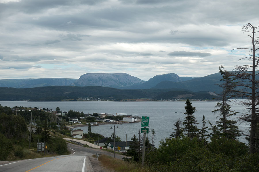
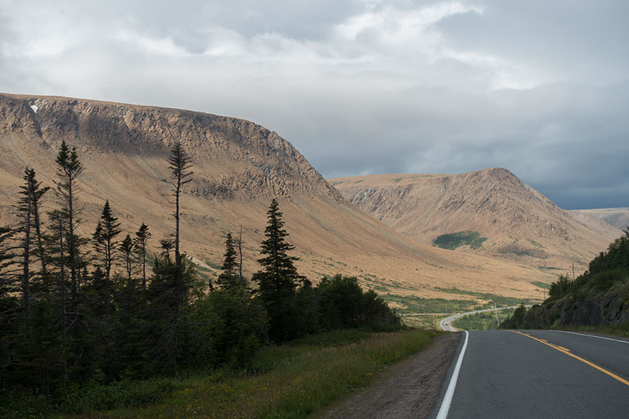
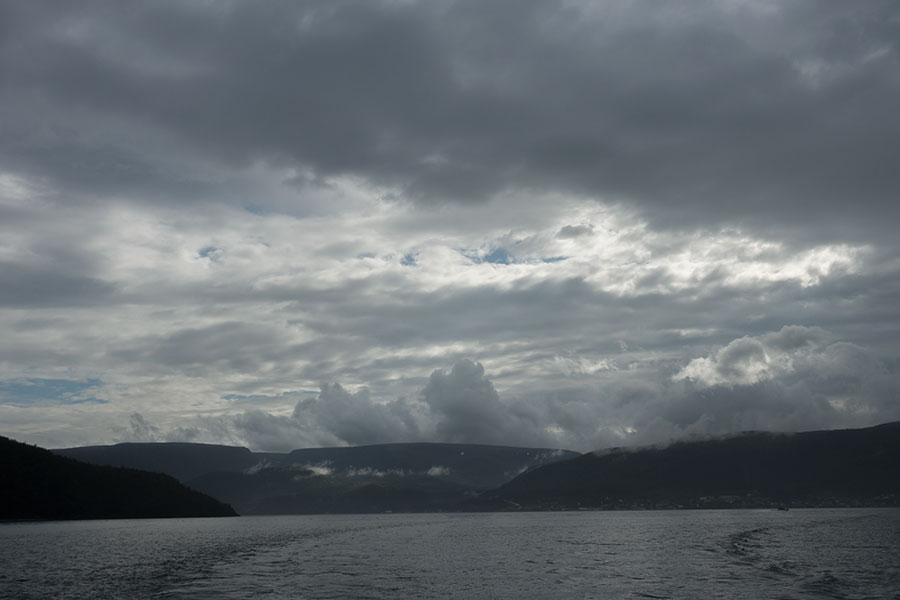
I need to get myself to nearby Bonne Bay, take the water taxi across and keep walking to my first goal of the day, the Gros Morne National Park Visitor Center. Road walking is awful but there are a few factors that help in this instance: the scenery is beautiful, the traffic is scarce, the overcast skies make the mountains feel gloomy, the valley cosier and I kind of welcome this one day of walking where I don’t need to worry about route finding in any way, just the simple, mechanical act of walking.

Not bad for a road walk
I receive several offers for a lift from passing cars. I eventually accept one when I’m warned that I might be late for the last water taxi crossing of the bay, which would mean a one full day wait. It turned out there were still 2 crossings within my reach but I’d compensate the missing few km with further walks in the area in the following days anyway.
I get dropped in the National Park Discovery Center, inconveniently located on the road, just off the town of Woody Point and the bay. The Discovery Center moniker is basically a funny way of avoiding name repetition for a visitor center so there can be two of them, one on each side of the bay. I take a look around and fetch a paper topo map of the Tablelands, the set of mountains I just skipped around, in case I choose to return.
I walk the final mile+ into Woody Point, the little town this side of Bonne Bay.
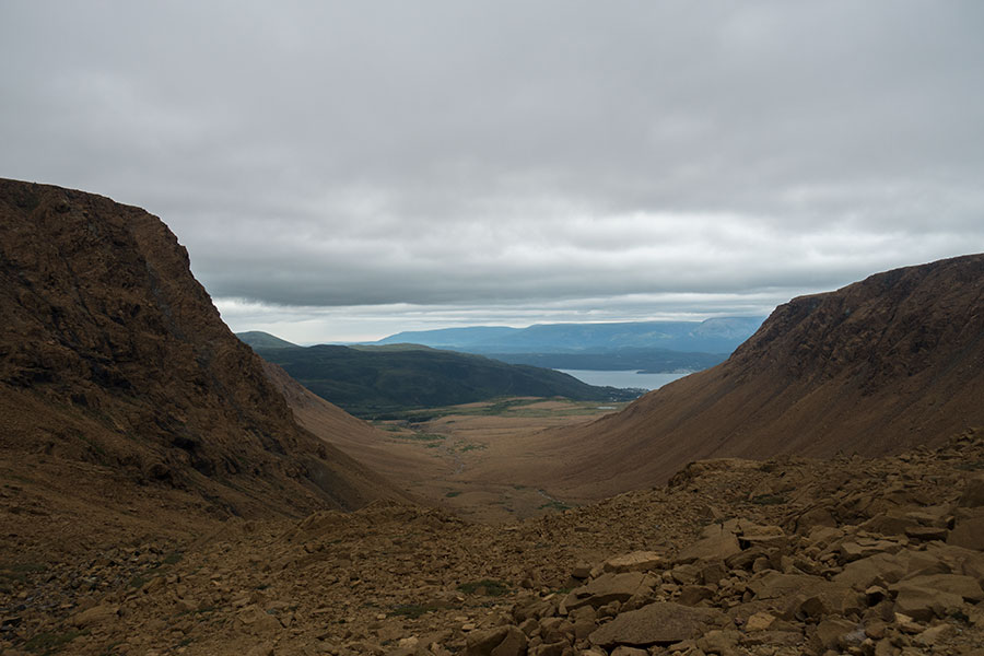
Woody Point and Bonne Bay
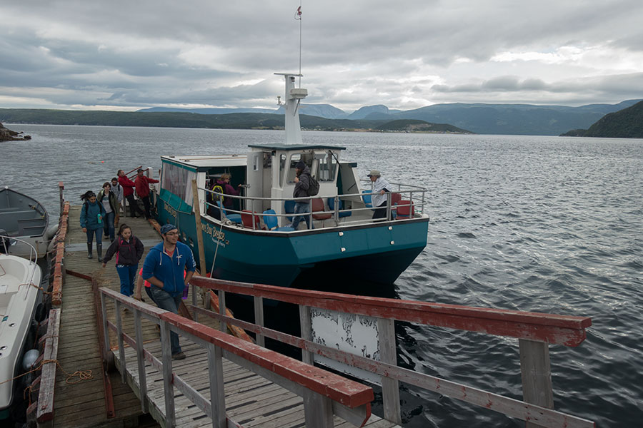
The bay is actually a less dramatic version of a fjord that cuts deep inland. So deep that the drive around is about 70 km to reach Norris Point, barely 3 km apart as the crow flies across the bay. If it’d be Scotland, there’d be a truck worthy ferry here. In Norway, there’d probably be a tunnel under the bay but this is Newfoundland and motorists need to drive the 70 km. The passenger ferry takes people and luggage, bicycles too, and runs 3 times a day, June to September. I hop on and 15 minutes later I’m in Norris Point.
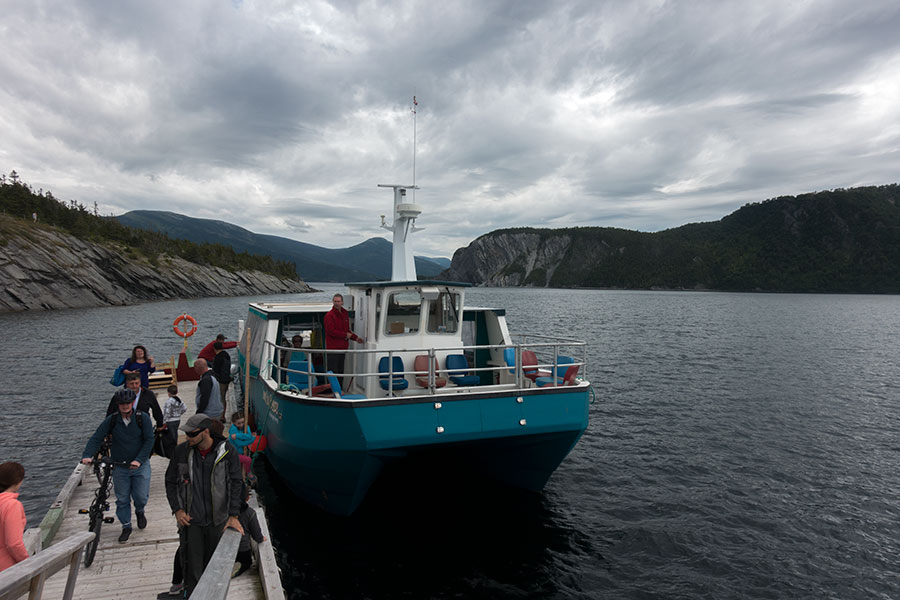
The Bonne Bay water taxi and the pier in Norris Point
Bureaucracy first
It’s only 10 km to Rocky Harbour but my actual goal, the Park Visitor Center is quite a way off town, kind of what you could call in the middle of nowhere if you’re walking. This is one of those subtle signs that show how car-centric North America is. Cars are the default way to get around and only then it makes no difference to place the Visitor Center in town or 4 km away.
I have no idea what I will find on the Visitor Center, just imagine they tell me there’s a spot in the Long Range Traverse for me but I must start today! I need to be ready for anything so I do my first resupply in a small grocery store in Norris Point. I’d be ready to tackle the Long Range mountains right away, if needed.
Anything but fancy grocery store in Norris Point
Gros Morne National Park Visitor Center
I get to the desk and ask away:
- Will you have a spot for the Long Range and North Rim in the coming days?
- Let me check…
Maybe surprisingly I didn’t get a straight negative. At least it wasn’t useless to try! The checking was not just procedural politeness indeed and I get a positive answer in a matter of seconds. If I want to link both traverses, I have a spot available for a Monday start. It’s Friday afternoon.
I take the spot, no second thought, even though it means I’ll need to take a 2 day break, which is something I haven’t done on a trip since I hiked the PCT in 2006. On multi-week hikes like this one I usually take no zero days at all. It’ll feel strange but I’ll adapt. It’s the only way I can go on a sort of a continuous hike.
A “sort of” because the National Park imposes not only fees & quotas but also direction of travel, which is necessarily north to south in order to keep the experience free from crowding. I wasn’t aware of this beforehand even though it probably was already like that in my previous visit in 2003 but I didn’t remember. It’s a bit of a bummer but only a bit.
At this stage, I wonder about how the quota system works. The Long Range Traverse was supposed to be booked out for the season. There might have been cancellations or maybe they keep some spots available for walk-in solo hikers. When I tried the advanced booking system, I got the impression of having the door slammed in my face with no possible alternative even mentioned. Yet when I got to the desk and asked away, it didn’t look like I was asking for anything unlikely. It looked like business as usual.
The Gros Morne National Park traverses come with one final toll in the mandatory briefing session with the rangers, inconveniently scheduled around noon the day before departure. Perfect timing to prevent you from doing anything useful that day.
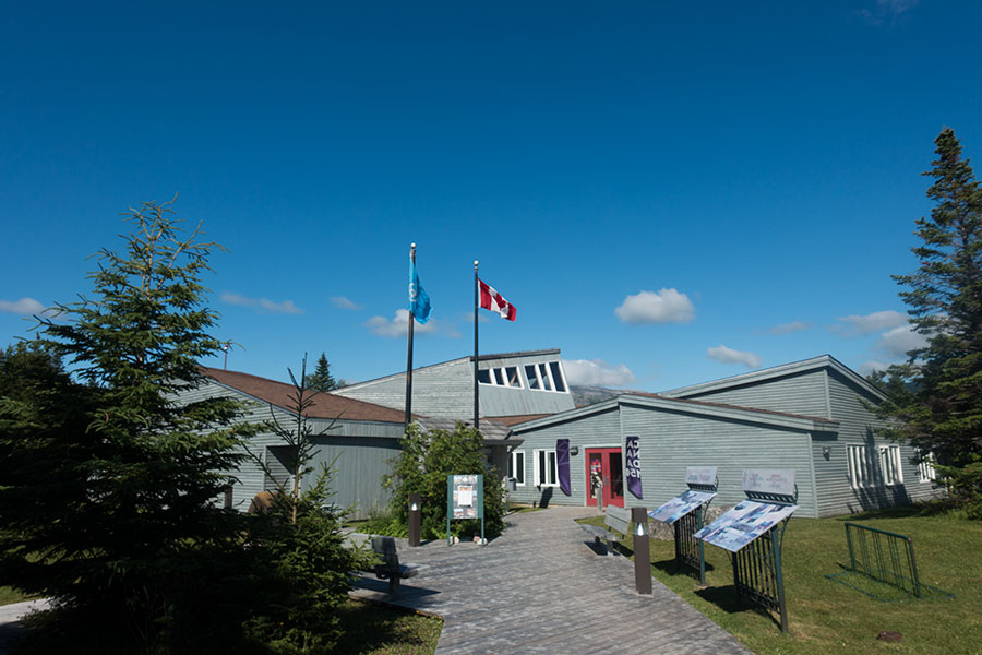
The Visitor Center
Into town
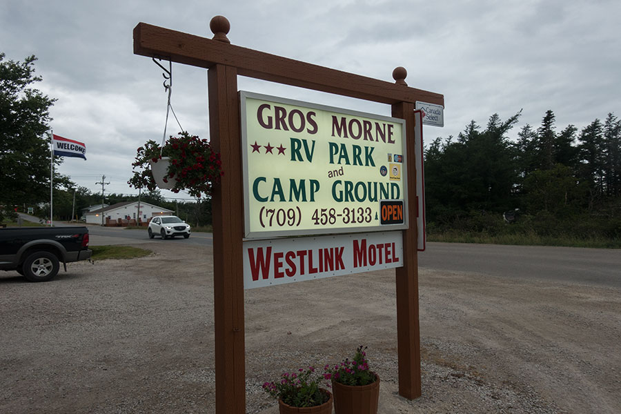
I walk the remaining few miles to Rocky Harbour town where I sign up in the campground. At this stage on my trip, it is not anymore a surprise that the tent sites are full but the manager lets me take one of the motorhome sites for a tent fee. The site is a huge gravel strip that’s useless for me and a grassy corner where my tent barely fits. It’s not the most optimal use of real state but it’ll do.
Home
The rest of the day I can relax.
Mandatory break
I ponder what to do on my two mandatory gap days. Sunday plans will be seriously compromised by the mid-day, middle-of-nowhere (a.k.a. the Visitor Center) ranger briefing but Saturday is free and I could do anything. I think of the Tablelands, those iconic hills I just skirted. I consider a full traverse and wild camp but the weather forecast puts me off. It’s gonna rain and it’s hard to put oneself in such an exposed area by conscious choice. I decide to take it easy and book a proper site at the campground in Rocky Harbour for the two following nights. I can still do the Tablelands as a day hike.
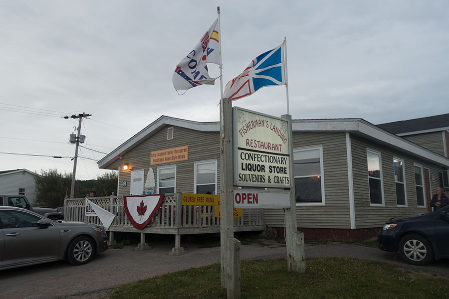
I walk to Rocky Harbour waterfront where I can have a proper pub dinner, my first such treat on this trip.
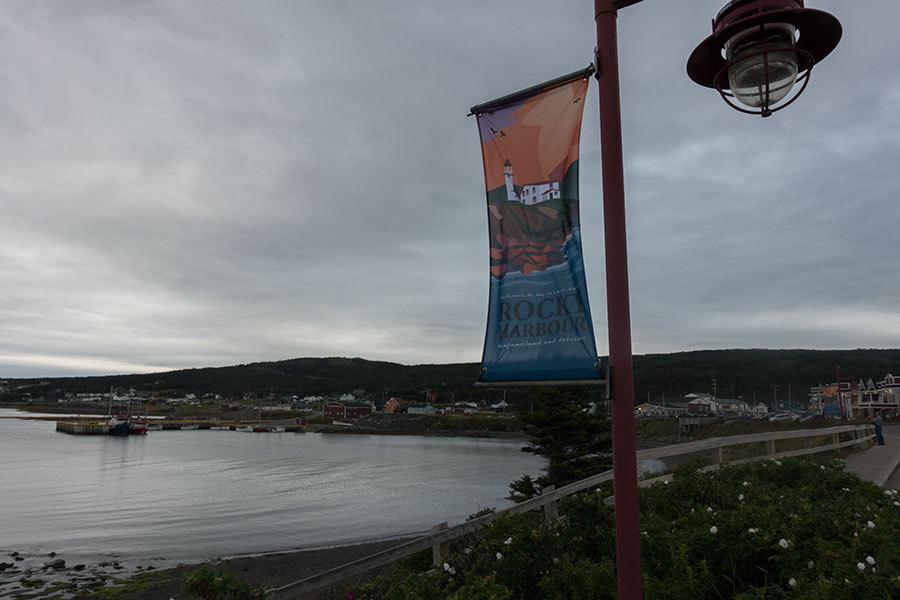
Rocky Harbour waterfront
Day 10: Rocky Harbour
I wake up early and get back to Norris Point in Bonne Bay for the first water taxi. The plan is to cross the bay, walk the road/hitch to the Tablelands trailhead and hike the classic day-hike traverse of the massif as shown in the map I got in the Discovery Center the day before. Then walk/hitch back to the south side of the bay on time for the last water taxi in the day, then walk/hitch back to Rocky Harbour.
Might be too much hassle for a day hike but the Tablelands look like the best option in the area once I take out the terrain in the traverses that I just booked for.
A little story about Newfoundland: it’s 8 km to Norris Point and the bay and I must make it to the water taxi early crossing. I also must move campsite to my new location but I can’t do it until it’s free later in the day so I pack up and arrange with the management to leave my pack in the office which is not open until half an hour before sailing time so I decide to play it safe and call a cab to get to the pier.
For some reason, the cab was late to pick me up. We ride away with 5 minutes to go. The campground manager on duty phoned the pier to announce I was on my way and to ask the boat crew to wait for me. I stepped off the land taxi onto the water taxi where everything was ready to go, just waiting for me.
Back in Woody Point, the crew holds the ship for us
The Tablelands
The Tablelands are pure igneous rock so there’s little vegetation and you can walk anywhere as long as the slope allows. Not everywhere it does.
The Tablelands escarpment
The suggested route goes up a canyon to the top, across the flat highland, then down on a steep but manageable face back to the starting point. There is trailhead parking and lots of people but the vast majority will only walk the well groomed trail to the canyon mouth. From there, it’s classic Newfoundland ophiolites hiking, bare rock, no trail even though there are frequent cairns in this case.
The canyon is just as amazing as those I used in the Lewis Hills and Blow-me-Down Mountains in previous sections.
Access canyon
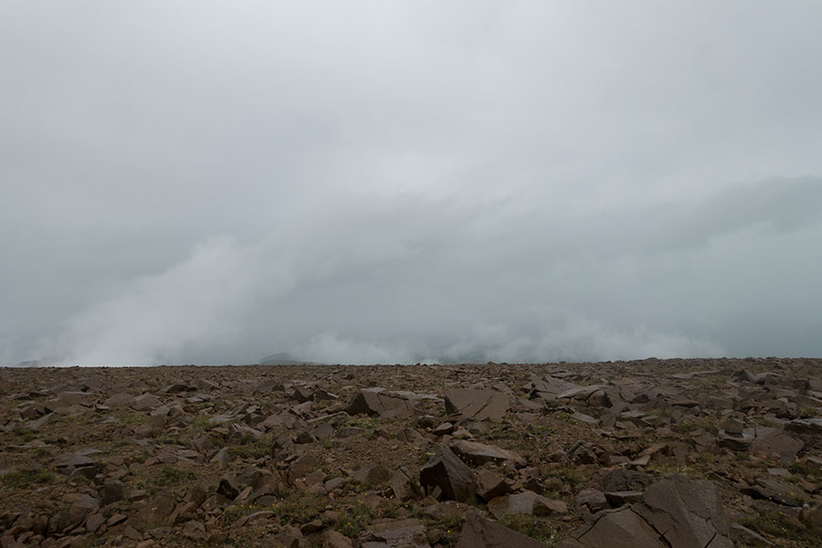
Just as I reach the top, it starts raining. Really bad timing! The top is a vast, featureless, rocky flat, very exposed to the weather. I consider going back the way I came but the weather is not too wild, just damp and cold and I decide to keep on. I feel bad enough about doing this as a day hike and not a backpack.
The good news is that I have the chance to test my new waterproof set. I don’t have any high expectations but even then I find the performance poor. After a while under moderate rain, I’m wet and uncomfortable. It’s good that it’s a day hike and it doesn’t matter but it’s not encouraging for upcoming days when it will. The jacket is particularly bad, it feels damp inside and outside. I get very wet overall.
The hike is spectacular though, just as much as any such stretch in the massifs farther south. The route loosely follows the highland rim over the familiar mix of rock and grass underfoot. The peridotite is still quite grippy when wet but I’m not as keen on rock hopping as on dry days. The upland rim provides a loose handrail, fog permitting. Other than that, I walk in a weird, bi-dimensional universe with a flat surface and a dark grey nothing all over the rest.
Flat, featureless Tablelands
There are occasional rock cairns to show the way but they don’t seem very consistent in either density or direction. I produce the GPS when approaching the descent to make sure I don’t screw it. Then it stops raining, which works wonders to make me feel better. Then clouds start shifting so the uniform grey makes way for shape, light and eventually landscape. Feels great to get it all before I leave the highland plateau.

Clouds shifting, Bonne Bay below
The climb down is fun and uneventful. I dry up except for the damn jacket that shows a stunning capacity to hold water and feel like it.
Back at the trailhead, I take the road again with no hurry as I have plenty of time to make it to the last water taxi. Yet when rain returns I stick my thumb out. I don’t feel like getting wet again. I get picked up in no time.
My driver returns home in Woody Point from a successful trout fishing session in aptly named Trout river. He tells me about lots of things local to Woody Point, among them the boat race that will take place on the pier later today. This is another fun Newfoundland tale: I would picture some sporty, athletic rowing in stylish ships but it turned out much more interesting: town neighbours of all ages jumping in pairs into simple rowing boats and trying to keep a straight line out 100 yards and back. It was the kind of rowing I’d do myself on the pond at the local park in my home town on a Sunday morning. It was a funny and pleasant thing to watch while I waited for the water taxi.
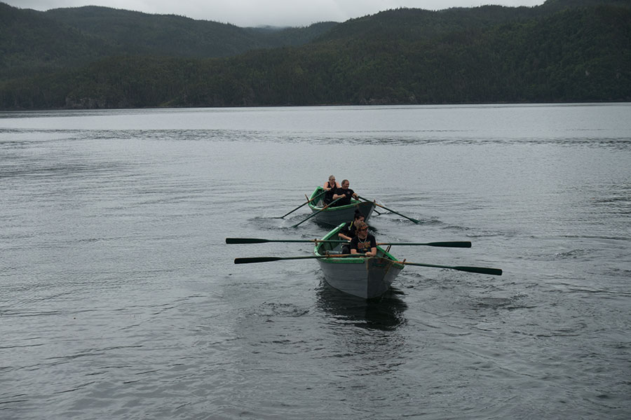
Woody Point regatta
The boat race is no obstacle to pay a last visit to the nice coffee shop in front of the pier. It’s good to arrive with some time to spare.
The trip across the bay offers the usual good vibes from the crew and some excelent views over the Tablelands under dramatic skies.
The Tablelands looking dark across the bay
There’s a beautiful pub on the very pier in Norris Point with traditional music scheduled for tonight but I won’t stay, I must make it home. I walk the road to Rocky Harbour one final time. I’m in no hurry and I welcome the excercise so I don’t even bother with hitch-hiking. From the road I can see panetone-shaped Gros Morne mountain. It brings back memories.
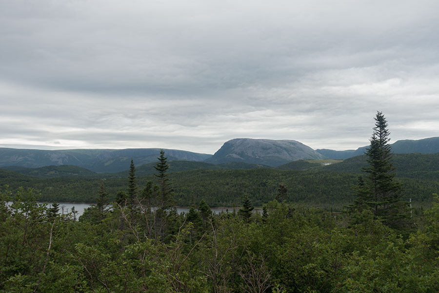
Panetone-shaped Gros Morne mountain
I get back to the campground and pitch in my new, proper location. On the adjacent site, I meet a familiar view, a 6 side pyramid in dark green colour that I can recognise: it’s an original Golite tent, from the time it was still called Hex-3 and before it was renamed Shangri-La. I have the exact same model & flavour back at home. There must be very few left. I’ll need to talk to my neighbour, whoever he/she is.
Day-hiker’s fate
Today it wasn’t a backpacking day but it was hiking intense so I can still justify a hefty dinner in a Rocky Harbour pub. It’s also an excellent way of experiencing the social side of Newfoundland and taste freshly catched fish.
Well deserved
Day 11: Rocky Harbour
Sunday is shaped by the mandatory visit to the Visitor Center to attend the pre-hike briefing from the park rangers, rather inconveniently scheduled in the afternoon so there’s no room for any big plan for the day. I take the chance to relax and have a rather-zero day. I still need to hike 4 km and back to/from the Visitor Center though.
It’s still a rest day. I spend the morning in Rocky Harbour leisurely walking around the bay on a brilliant sunny day.
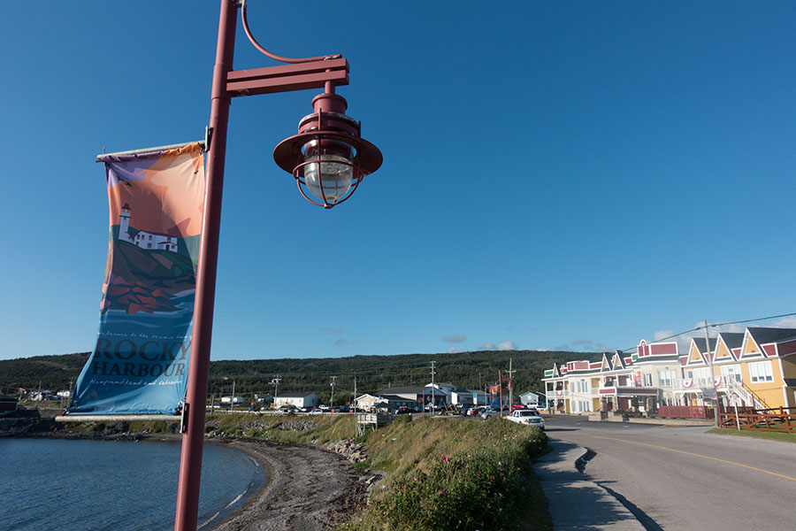
Same place, different light
The road walk to the Visitor Center is a necessary evil. The session with the rangers is very different from that same event 13 years ago when I hiked the Long Range Traverse for the first time. Back then, GPS was not yet a standard tool and there was a compass proficiency test before permits were granted. There were only 4 of us there and the other party of two were actually turned down as they didn’t pass the compass test. We did 🙂
Today there’s about 11 of us and there’s no compass test. Times have changed in several accounts.
The briefing is just informative about the Long Range Traverse, which is what everybody in the group is about to hike. Understandably so, as it’s the most popular route in the area and it looks like it’s become somewhat mainstream. The Northern Traverse (formerly North Rim Traverse) is allegedly rougher and attracts less hikers. Both routes can be combined for a grand tour of the Gros Morne highlands. This is my plan. I’m the only one in the group attempting the North Rim.
The briefing is entertaining and interesting even though I could have spared it. It’s still nice to meet all the other hikers, more so when they’re the first hikers I meet in this trip, even if the meeting is indoors. I believe they were all Canadian, mostly from Newfoundland itself or other eastern Canada provinces, in small groups of 2/3. It was very useful to meet up particularly for me, as I was on my own and could arrange for a shared taxi to the trailhead. It’d have been very expensive for just one.
The rest of the Sunday is holidays.
Holidays
I get the chance to meet my neighbour in the campground and ask about its legacy pyramid tent. It’s a Belgian hiker who got the tent not that long ago, I guess some surplus from the European distributor. I let him know he owns a real gem, beyond the plain functionality of which he’s very much aware. We have some interesting conversation about whatever two European hikers in Newfoundland could have a conversation about.
Holidays end with a magnificent sunset in Rocky Harbour. Sunsets are best on a west facing shore.
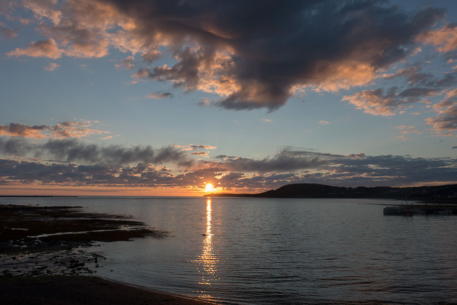
Colourful sunset
 RSS – Posts
Say what you want