The second section of my IAT trip goes across the North Arm Hills, a group of mountains north of the Bay of Islands in Western Newfoundland.
This section is the logical continuation of the trip as it links with the terrain I was hiking before I met the Bay of Islands, which I needed to skip for obvious reasons.
The North Arm Hills themselves are named after their position on the north side of the Bay. There’s an obvious geological connection with the mountains to the south enhanced by the recurrent presence of the odd igneous rocks that make this area so special.
The North Arm Hills will make for a shorter section than the Lewis Hills & Blow-me-Down Mountains, only 2+ days in the wilderness but in a way it’s even more remote country, starting with the fact that there’s no land access unless you’re ready to go cross country through the maddening Newfoundland bush for maybe days. The alternative is to sail across the bay.
This story accounts for days 6 to 8 in the trip and starts in a Corner Brook town hotel.
Day 6: North Arm Hills barrens
It was comforting to spend the night in town. The previous section had taken its toll on both body and mind and I really needed to disconnect somehow from trail life, no matter how odd that sounds. Of course, the one thing I want to do is to be back on the trail as soon as possible.

Corner Brook has a hostel. It was booked out, I needed to stay in a hotel
Which may be tricky. Getting back to the trail is a two step process where I’ll need to rely on third parties. This latter is something I deeply dislike but it’s still part of the plan as the only way to access the most challenging and enticing terrain. There’d be a strictly hiking alternative but I’d go on logging roads instead of over glorious mountain scenery.
First, I’d need to finish my road trip around the southern half of the bay. Then I’d need to get a sail lift across the northern half. For this latter I have a contact number for a fisherman that works in the area and shuttles IAT personnel, he can probably shuttle the occasional hiker too so I start my day by phoning away.
I can’t get hold of the guy so I take the decision to go ahead with the road trip and show up in this small fishing village called Cox’s Cove, hoping to find Kerry Park.
The forecast announces 3 days of stable weather, then rain. I could be done with the section before the rain arrives but I’d need to get to the trail head some time today.
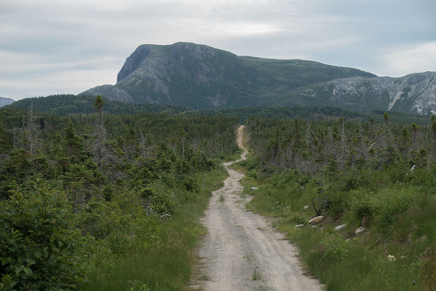
Road
Hitching out of Corner Brook was not straightforward. I walked for a few km under a blazing sun on a narrow road until I got to a good place to pull over. Then I needed a rather long wait for anybody to stop. Most drivers were probably not going my way: Cox’s Cove is at a dead-end.
Eventually a driver stops and offers to take me to the first village in my direction, which is yet far from target but still a very useful ride as it’ll put me in the right road at least. I engage in the typically predictable conversation about my trip and my plan so the driver asks how I mean to cross the bay and I say I have a contact for a local fisherman that might take me.
- What’s his name?
- Kerry Park
- Oh, I know the guy. He’s an old friend of mine
I guess this was part of the reason for what happened next. The driver was visiting family in Irishtown, still 20 miles to go for me, and dropped me off in front of said family’s house. As I was back to hitchhiking, the guy came back out together with his brother-in-law announcing they’d take me all the way to Cox’s Cove so they could visit friend Kerry. That’s the kind of thing that may happen in a small community as Newfoundland.
Kerry Park is at home and he seems oddly familiar with the little party that shows up. Right after the initial greetings and before I even say who I am or what I came here for, he seems to know:
- So it was you phoning this morning?
I must say I phoned several times but the funny part is that Kerry recognized the number from the Corner Brook hotel and phoned back to have reception telling him about a hiker that had just left. He was sort of expecting my arrival.
- So when do you want to go across the bay?
- Right now if you’re ready!
That’s how I wave goodbye to my driver friends, hop on a quad bike with my new driver, soon to be captain sailor and head for the pier.
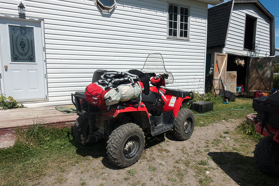
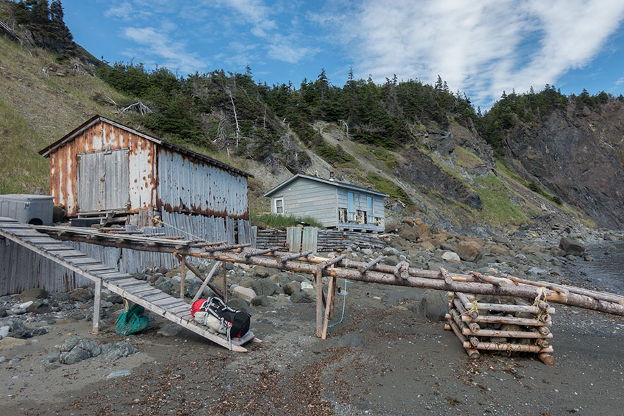
Pack and bike of matching reds
It takes only a few minutes to get there. That’s the Bay of Islands in Cox’s Cove.
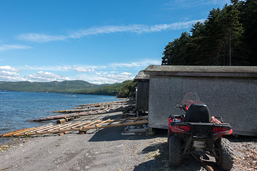
Boathouses in Cox’s Cove
It’s great that I can get across right away. This will give me time to put on some miles today and allow two full days to complete the traverse of the North Arm Hills before wet weather hits. Everything is working out great!
Water
Kerry produces his boat from the boathouse and hands me some fisherman-grade waterproofs. Soon we’re in the water and I get ready for a lovely sail across the bay under brilliant blue skies.

Crossing the Bay of Islands
And lovely it is for the initial stretch in a sheltered area of the bay but soon we get away from landmass and the wind starts blowing, then the sea gets rough and I realize I wouldn’t make a good sailor. The little dory jumps up and down over giant waves while I get the best hold I can of my stool and try to cope with dignity.
I trust Kerry Park, it’s his damn job and I guess this is business as usual for him but I’m not used to this beating. I can’t stop picturing my pack flying away and disappearing into the depths of the bay. I make plans to try to save my camera and phone when the boat eventually tips, which to me feels about to happen with any of those waves coming sideways.
It’s obviously all in my head. I tell myself so but it doesn’t work to make my trip better. I’d certainly need some (figurative) immersion if I’d mean to become a sailor. For the time being, I can only wish that the sailing stage is over as soon as possible and I can set foot on solid ground again. I keep telling myself this had to be done so I can earn my own glory in the hills framing the bay to the north.
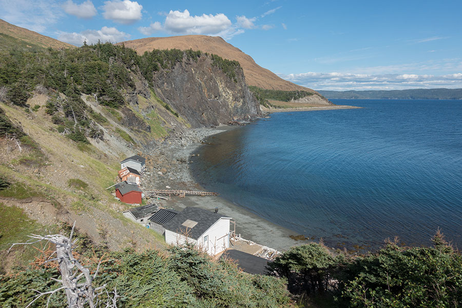
Eventually we get into sheltered waters again, waves die down and I can relax until dory, fisherman and silly me arrive in Back Cove where Kerry has his fishing base and the IAT has established a base camp. It’s a lovely place. I can’t believe I’m here after all.
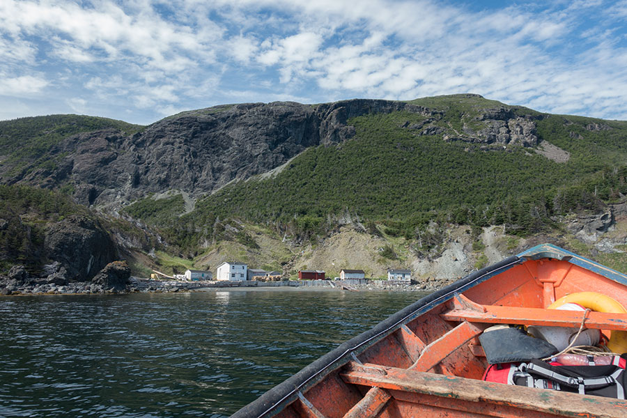
Approaching Back Cove
Kerry tells me lots of interesting stuff about this place and his work here as well as the IAT’s. He talks about the easterlies that once took the roof away from one of the houses and how they’re building this dam to hold the water when the big storms hit. He also tells me about how beautiful and peaceful it is here.
We say goodbye as Kerry jumps back on board and sails away, leaving me there on my own, 2+ hike days away from the next human thing.
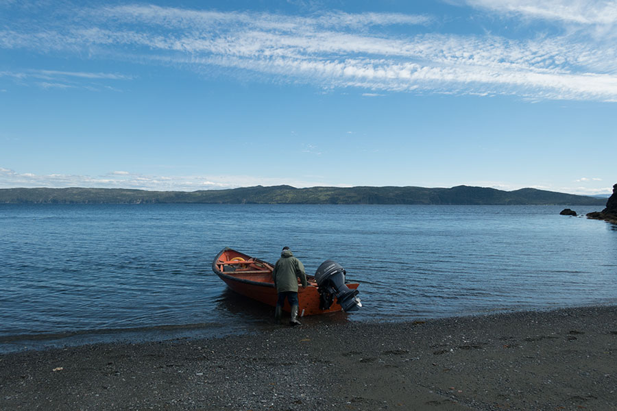
Last person I’ll see for a while
This is a very special moment. The odd logistics behind, now it’s all on me, I have a very attractive hike to do and a good weather window in the forecast. I have my lunch in Back Cove while I relax and watch the bay, now seemingly quiet. It feels great.
Back Cove
Trail
It’s time to hike again. I have 2-3 hours left before dusk which I’ll use to climb up to the highlands. The hills rise steeply behind the cove and I see peridotite barrens higher up, not far away, which is a good thing as far as the walking goes. I still need to fight some vegetation above the cove with some little help from my friends via pink tape bits to show me the way.
Back Cove is left behind
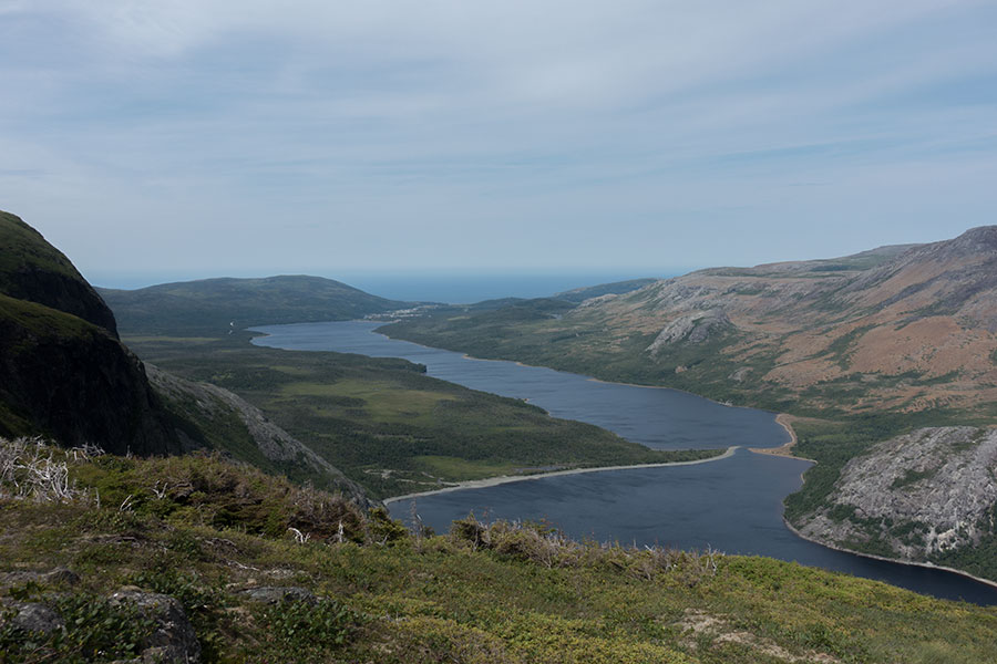
I soon get to the barrens which means freedom to roam! So I do roam on the steep uphill to gain the highlands while stopping often to look back over the increasingly scenic view of the Bay of Islands.
Islands in the Bay of Islands
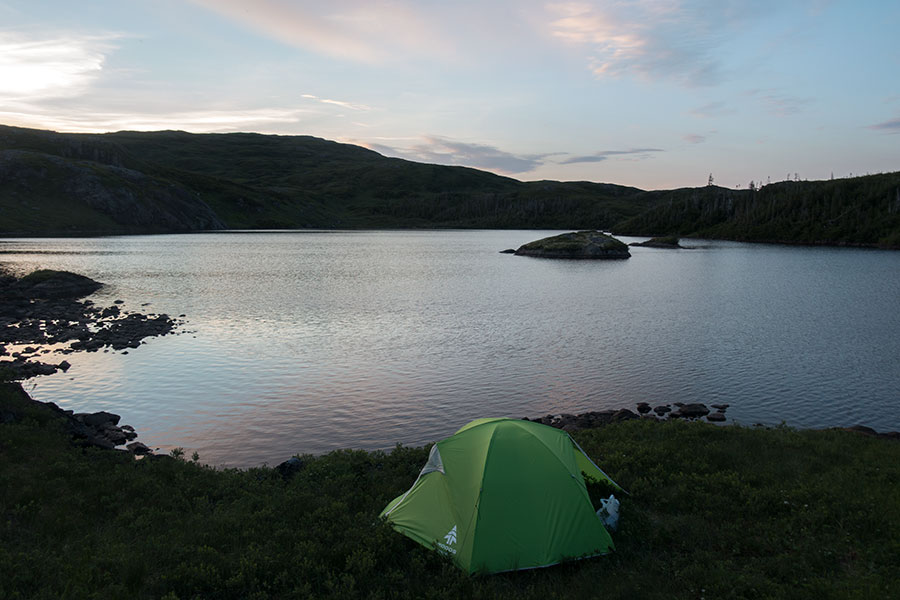
One final, steep push and I’m up in the North Arm Hills. Vegetation returns in the form of thick grass and marsh. I get to the base of the highest peak, a truly barren peridotite outcrop that I need to go across and I decide to stop for the day before the grass ends so I don’t need to find a pitch in gravel or rush it down to the next marshland area. Camping on this side of the hill also offers a first row view of the impending sunset and the bay. Premium scene.
North Arm Hills & the Bay of Islands
Bench or trench
It’s been windy earlier but it is calm now, which is good because I’m on the windward side of the mountain. I know how uncomfortable it could get if the wind picks up again so when I find a natural trench with a grassy floor, I install in there despite it being the buggiest place around.

Protected but buggy campsite
I climb out of the trench for dinner and contemplation. In the present circumstances, I’d be much better off pitching in the more exposed bench but you never know with the breeze.
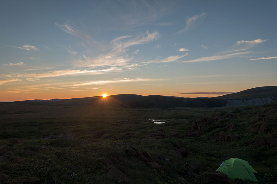
Sunset in the North Arm Hills
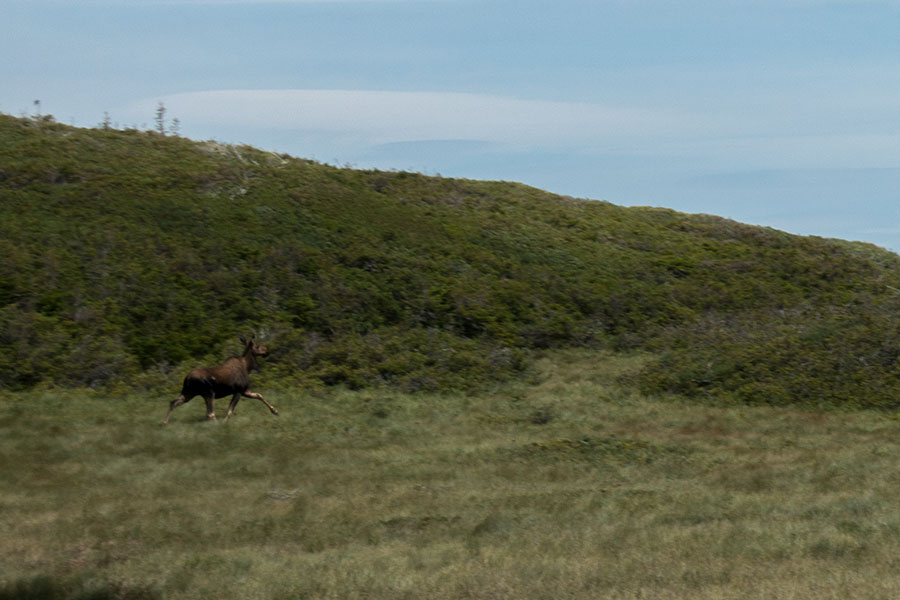
As darkness closes in, a moose comes around the marshy area. It wanders about the place for a while until it notices me, then leaves discreetly. My first moose sighting on the North Arm Hills, it won’t be the last.
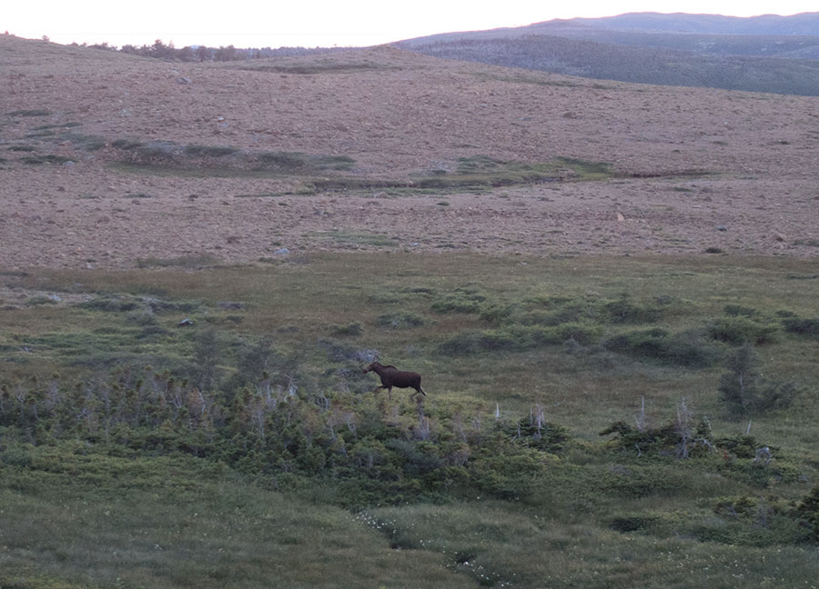
Moose in the North Arm Hills
Day 7: North Arm Hills greens
Morning is just as quiet and brilliant as the previous evening, it’s even warm and the mosquitos are waiting for me outside. I don’t have any repellent and I need to use the barrier method.
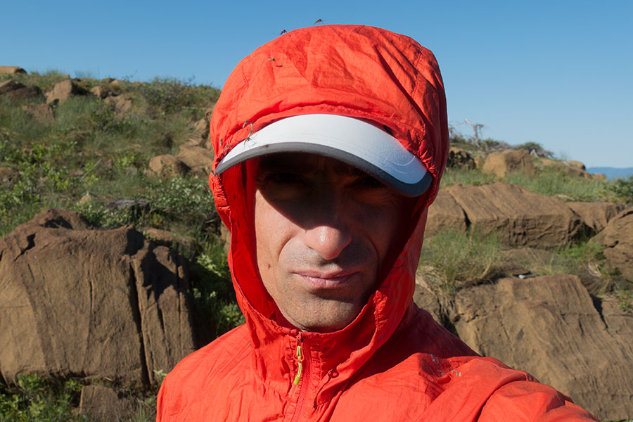
How many mosquitos can you count?
It gets stuffy as soon as the sun warms things up so I have a good reason to start hiking right away.
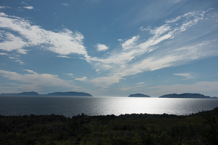
It’s a moderate climb to the top of the hill, all of it over bare rock so the hiking is easy. I get the final views of the Bay of Islands.
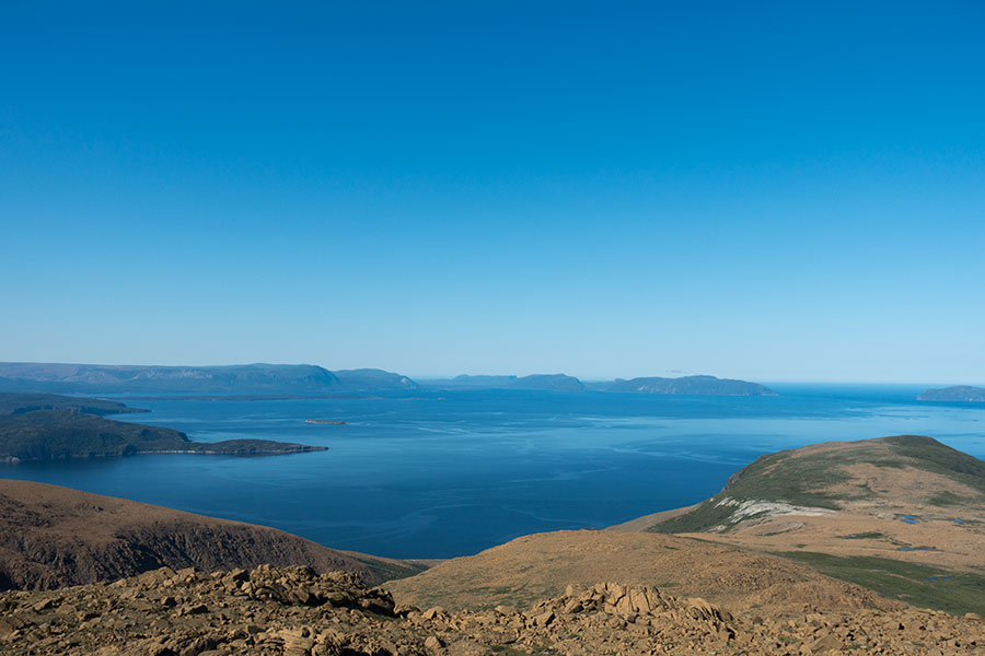
Final views of the Bay of Islands
The summit area is the usual wide and flat with some gravelly bits that would have made for good campsites in fair weather. On the other side of the hill there’s a shallow saddle with marshy ground in the also usual highland configuration of grassy floor over solid ground and small, shallow ponds dotting the landscape. It’s even better hiking than the bare rock even if the ponds force a rather tortuous itinerary sometimes.
Marsh mud holds the weight of some
As I climb up again, the terrain changes, even if only subtly. There’s more vegetation, most of it is still only grass but there are scattered bits of tuckamore1. When I have the chance to see the underlying rock, I verify it’s not peridotite anymore.
Vegetation is here to stay
My route progresses along a gentle gully draining the highlands onto a big canyon that cuts into the massif. It’s a mix of bouldery stream bed and grassy banks. It’s easy to understand why the route pioneers chose the gully as the surrounding terrain is noticeably more bushy.
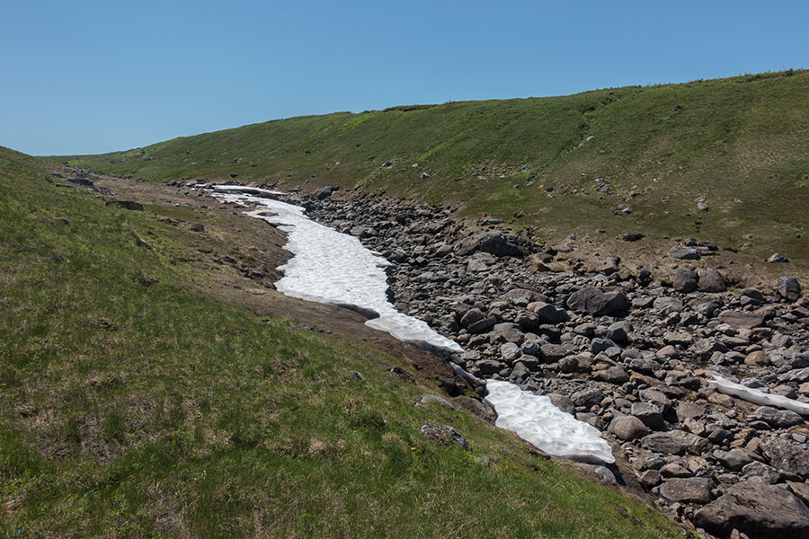
Grassy banks and some lingering snow
Hopping over boulders is fun but not without dangers. No matter how careful you are about picking rocks that look unmistakably stable, there’s no guarantee they’ll never move. This particular one looked solidly placed and I wouldn’t have imagined how it would tilt forward when I stepped on it. I landed on the following rock with three contact points: right hand, left hand and right knee. The hands fared quite well but my right kneecap bumped flat against rock and took more impact than it is designed for. Mildly swollen, lightly painful knee as a result.
My current course would take me to the abyss so at some point I need to leave the comfort of the stream bed, turn right 90 degrees and face my duty: I need to go across thick vegetation.
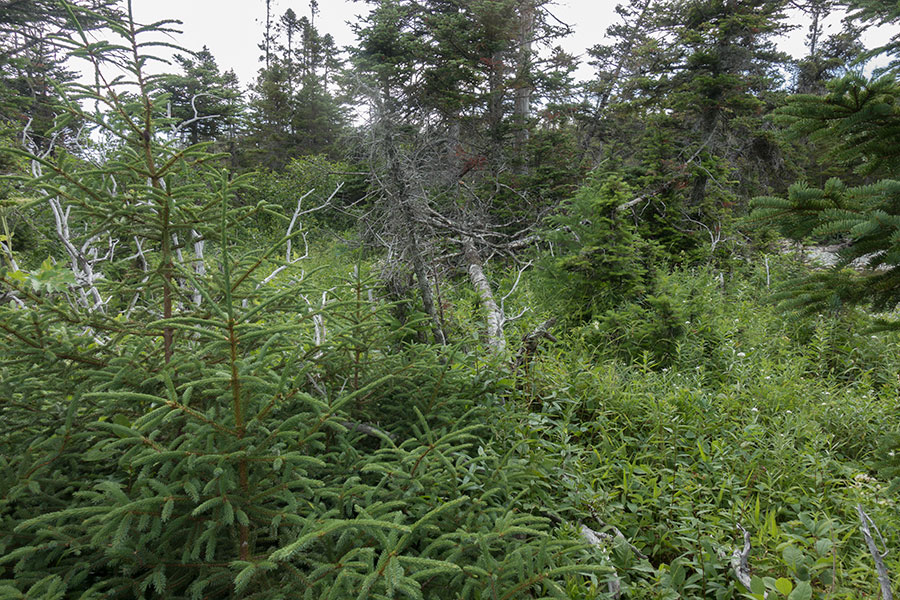
Thick bush again. Can you spot the moose right in the middle?
It’s low bush so no panic yet. I can walk through without much difficulty but it’s a world away harder than grass or rock.
At this point I spot another rogue moose, my second on this section. It’ll soon disappear in the bush.
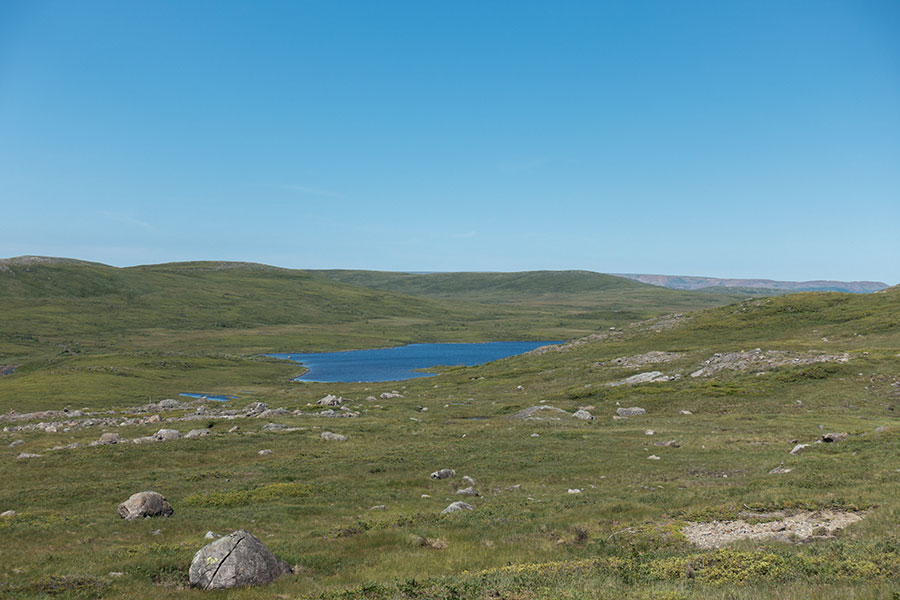
I scout ahead searching for rock outcrops, trying to decide if the winding course to link them is worth the easier hiking. My main direction takes me along the previously spotted canyon and eventually to a lake basin at its headwaters. This is good: lake shores offer some variety over the uniformly vegetated slopes I was traversing and I’d expect some grass sections.
Easier terrain ahead
The first lake in the line is shallow and I’d hope the water to be nicely warm. There’s only one good way to know:
Shallow water in a sunny day should be warm
I don’t really need a dip as for being dirty yet but stopping here for a brief swim is rather symbolic of my new status as a relaxed traveler in the Long Range Mountains of Newfoundland. The weather is calm and beautiful, I need no hurrying up and I can enjoy some stops along the way.
Shallow lakes and caribou herds
The lake shore indeed offers some fun: there’s scattered thick bush that I need to avoid, grassy patches that I try to link, low bush I can afford and eventually I find my latest toy in the rocky strip that surfaces in low water along the very edge of the lake. I find this is mostly walkable, sometimes off, sometimes over the actual water, hopping over boulders that only occasionally are too big to negotiate, forcing me inland. I alternate between the shoreline rocks and the bush, going for one when I fed up of the other. It’s good to have options.
The rocky shore provided an almost continuous corridor of vegetation free walking
As I go along the second lake in the row, I spot a 4 legged one standing in the very middle. It’s clear the lake is consistently shallow. I think of moose as I know they like to search for food in shallow waters but it’s caribou this time, three of them.
There’s a beautiful sandy beach at the upwater end of the lake. I go off-track to visit the beach and take a break there when a caribou herd shows up from the other end. They were coming my way when they spot me and stop to take a look, I guess trying to decide what I am and whether I mean any danger. I don’t know what they thought but they started trotting towards me, maybe thinking I was a rogue caribou, maybe just curious. They came as close as 30 yards before stopping again. Then I got their pic:

Caribou
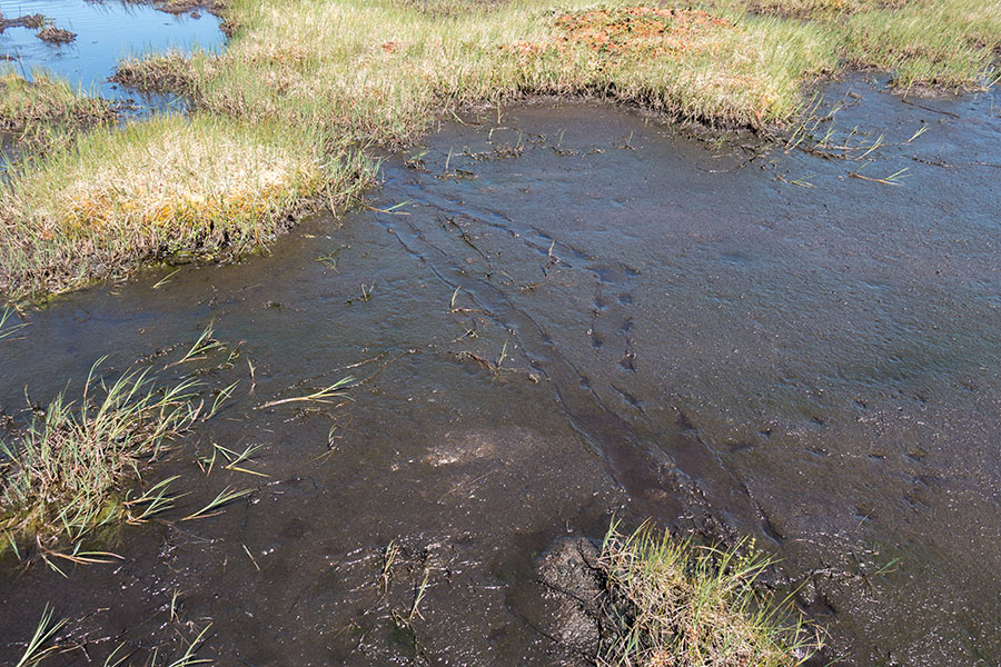
They probably decided I was not what they were expecting, then quietly turned back and trotted away. The herd was treading on sand so I had a good collection of brand new prints to check. This is what a caribou herd feels like:
It was a beautiful encounter that made me very happy. I was just passing by and they came to me. I could see their faces, I could look them in the eyes and as a bonus I had the chance to snap a couple pics. Just what wildlife watching is really about.
As I walked away from the lake and up the next hill, I could look back and see some caribou again as they went back to the water and walked in, coming to meet the smaller group that was still hanging around in there.
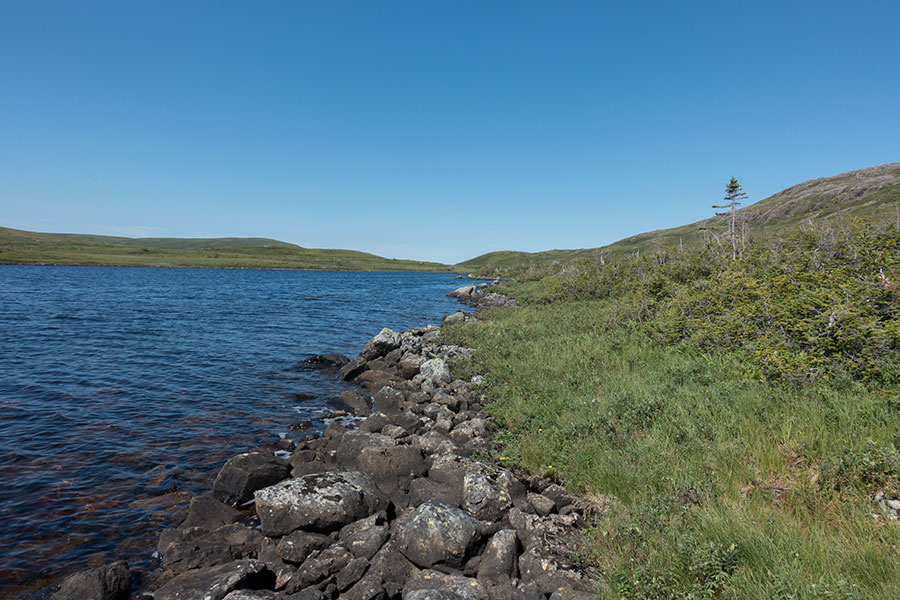
Watershed
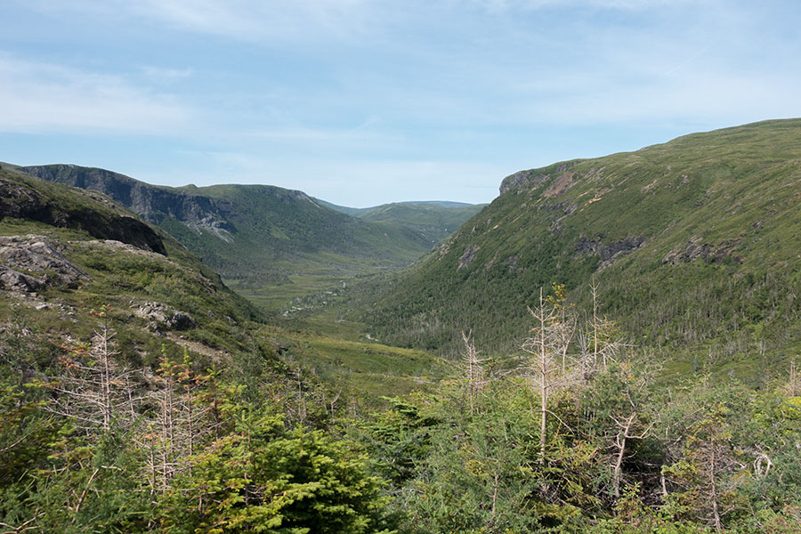
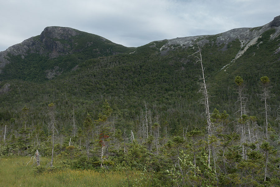
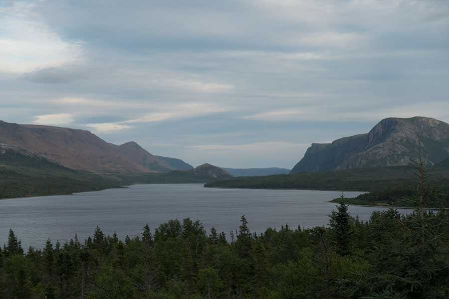
I climb over the divide between the catching area for the Bay of Islands and the one for Trout River Pond2, a big lake filling the valley between the North Arm Hills (my side) and the Tablelands (the other side). The rest of this section will be about following the rim in the North Arm Hills over this valley, eventually down the escarpment onto the coastal shelf.
The Tablelands are the flat topped mountains at the far end. A deep valley in between
Another interesting option which would make even more sense in the wide scheme of my trip would be to leave the North Arm Hills for the valley floor, around the lake end and up the Tablelands. Then I could go across Tablelands and down on the other side. This latter mountain group is another striking example of the igneous rock massive outcropping and it’s probably the purest of the whole lot because unlike the Lewis Hills, Blow-me-Down or North Arm, the Tablelands are consistently igneous rock with no other variety in the mix. From my vantage point in the North Arm, the Tablelands appear as a giant brown block of barren peridotite rock with a wide area, flat top.
I have no information though for such a traverse, neither the local knowledge to assess the potential difficulty so I decide to stick to my plan and complete the traverse of the North Arm.
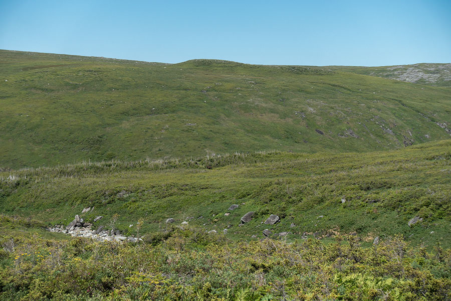
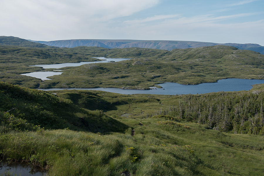
My trip is at one of its finest: I’m traversing a convoluted area full of small mountain lakes, the bedrock must be non-toxic because the place is consistently green but it’s also surprisingly grassy so the hiking is easy as well as very entertaining as I pick up my route through the grassy corridors. The weather is sunny and nicely warm, just about perfect.
Postal perfect, hiking perfect too
At some point I meet traces of a faint trail that grows more reliable as I progress until I’m consistently walking on it. There are even a few rock cairns that verify this is not –or not only– a wildlife corridor.
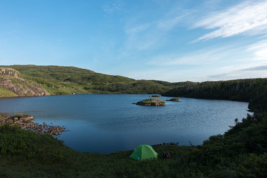
I start picturing an easy course for the rest of the traverse, at least to the edge of the escarpment for what’s about to become a glorious highland route as I keep enjoying the greenery and the many lakes. It’s about time to camp and it couldn’t be easier neither more scenic on any grassy bench besides any of the ponds. I check watch and map and decide to keep ahead for a while longer, across a minor ridge to the next basin so I make sure I won’t need to stress it tomorrow. It’s all good.
At some point I notice I’m going towards the rim, not along. I check GPS and realize I’m veering off-track. That’s strange as I’m still following some sort of trail. I backtrack and recover my due course but there’s no trail to follow anymore, neither any grass corridors. On the contrary, I need to consistently walk over low bush with the occasional not-so-low bush that’s really tough to go through.
Bush strikes again
I stop my beautiful progress and need to go down to a crawl to the point that I struggle to get to my target lake basin before dark. I eventually get there after dusk, soaked with sweat after a big effort and truly worn out, in strong contrast with the complacent hiker I had become just an hour before.
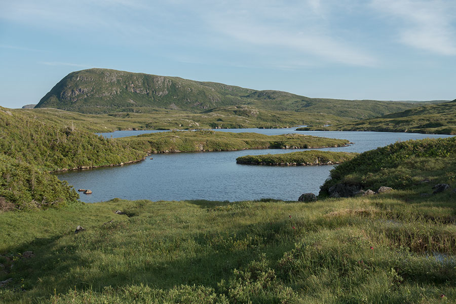
At least I find a nice grassy bench over the pond and I watch ducks on an evening stroll as I pitch my tent. I’ll be able to have a well deserved rest.
Well deserved rest, scenic spot
I make a quick count of the distance left for tomorrow. It’s perfectly doable but I see one thing clear: if these last few miles are a sign of what I can expect next, I’m in for a hard time.
Day 8: Trout River
Dawn is quiet and peaceful under clear skies. At least, the weather is still on my side.
Same spot, different light
The hiking is tough and I’m not expecting it to get any easier. I must adapt mentally and get used to 1 mph, anything else would be an excercise in frustration. If I get to take it easy, it can actually be quite entertaining: it’s very creative hiking where you have a clear direction but no obvious track and your micro-choices of route may make a big difference.
Grass is good. Bare rock is scarce but good. Low bush is tough but acceptable. Big bush a nightmare. Tuckamore is utter hell.
With these premises, the route finding algorithm goes something like this: aim for the grassy areas or corridors, linking them across low bush and trying to avoid the deep bush at all costs. This would often mean a tortuous itinerary but the detours were worth every step. Sometimes there’d be no visible way around a tuckamore grove and there was no viable alternative to going across. This was difficult and needed plenty of patience. Luckily, it’d only last for a few yards most of the times.
The North Arm Hills in all their green glory
No amount of swearing would help, just accept 1 mph is the new normal and enjoy the ride. There’s actually plenty to enjoy along this section of the North Arm Hills: the scenery, so green and lush, the remoteness and isolation, the truly beautiful weather I’m blessed with and the views of the Tablelands across the valley with magnificent Trout River Pond filling the gap below.
There’s also the wildlife as I cross paths with the ubiquitous moose. This particular one took no time to hide in the bush that’s so alien to me. Moose probably fair much better.
Already familiar moose
It’s tough going but I keep aware of how fortunate I am of being here.
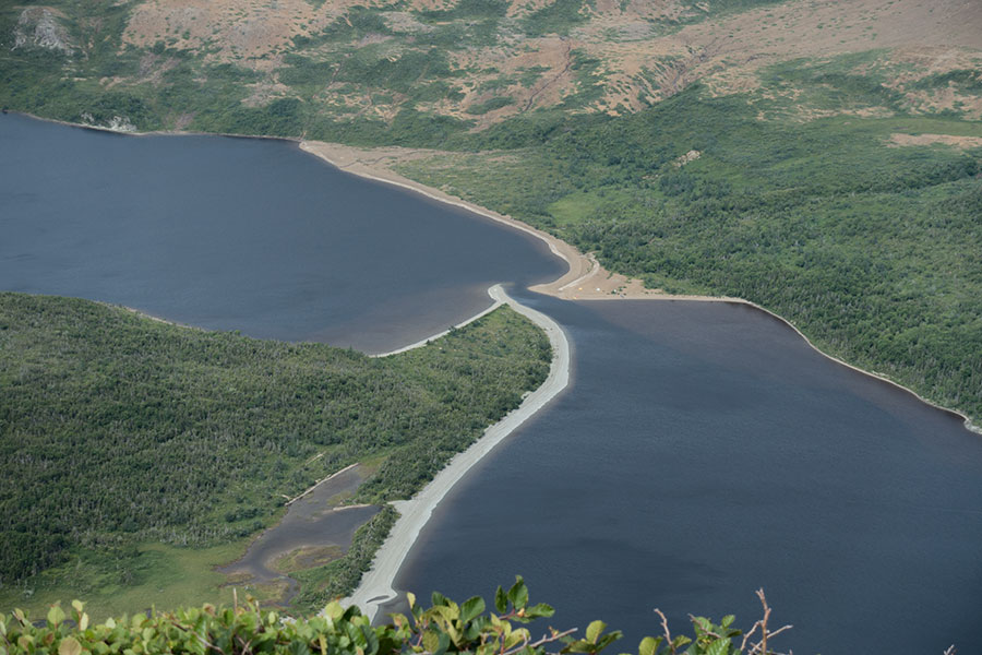
Along the rim
The route keeps close to the rim with occasional views of Trout River Pond and the Tablelands. The lake itself goes through a sandy bar that divides upper and lower ponds. The view west is my best beacon and measure for progress as I can see the narrows, the lower pond and the gulf of Saint Lawrence beyond:
Lower Trout River Pond and the sea beyond
I eventually get to Elephant Head, the last peak in this line along the North Arm Hills before I climb down to the coastal shelf. I take one last break before I leave the hills, sit down for a snack literally hanging above the vertical drop above the pond. I spot a few tents down on the beach, probably belonging to a kayak party I had noticed earlier on the water.
Sandy bar, kayak party
It is this stretch in front of me that I was concerned about when I read reports about the North Arm Hills needing some “minor bushwalking”. It turned out the highlands were part of a fight I wouldn’t have deemed “minor” but I understand my standards for bushwalking may not be up to Newfoundland categories. Then I’m aware that as soon as I leave the uplands I’ll meet the woods and then the real bush fight will start.
Leave the hills, into the woods
I scout ahead for my route down as well as for the dirt road that I’ll eventually meet and loosely evaluate the effort of crossing all those woods in between. I’ll be following my digital track and I have no idea if it’ll be flagged or there’ll be some kind of trail on the ground.
I start climbing down as I enjoy my last grassy bits. Soon I enter the trees, as chaotic as usual but luckily not too thick. Then spot a flag:

Tape shows the way across the bush, track almost non-existent
Crossing the woods is arduous and slow but this at least I had expected. I try to stick to the digital track even if there’s no big difference with the rest of the terrain, if only in hopes there’s some kind of physical track somewhere later or it takes me through easier terrain that may not be obvious to the naked eye or the map.
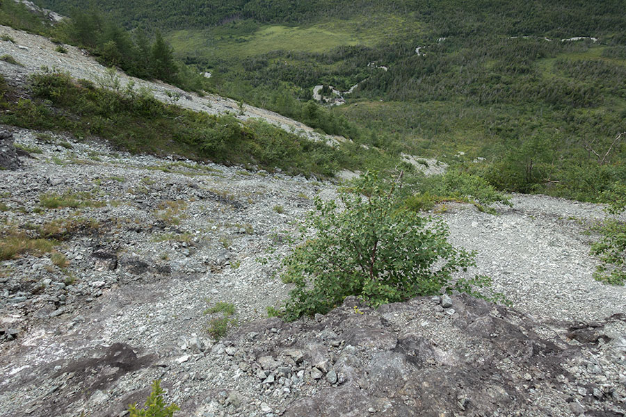
That’s exactly what happens on the core of the climb down which goes over a very steep slope. I guess a consistent 40+ degrees. The digital track takes me along a dry stream bed that’s free of vegetation which is a big advantage. The terrain is very steep with some loose rock to be taken with care, slow going to destroy what’s left of your quadriceps but not really dangerous.
This way down
I need to climb down to the river below, then climb up the minor hill beyond. I’ll meet a dirt road on the other side.
Before the bottom of the hill I need to face the inevitable fact that I have to leave the stream bed and go through the trees again. My digital track and eventually some scattered flags confirm this.
It is a minor relief to get to a river and find some gravel bars. It’s the only open terrain I can hope for in the next few hours.
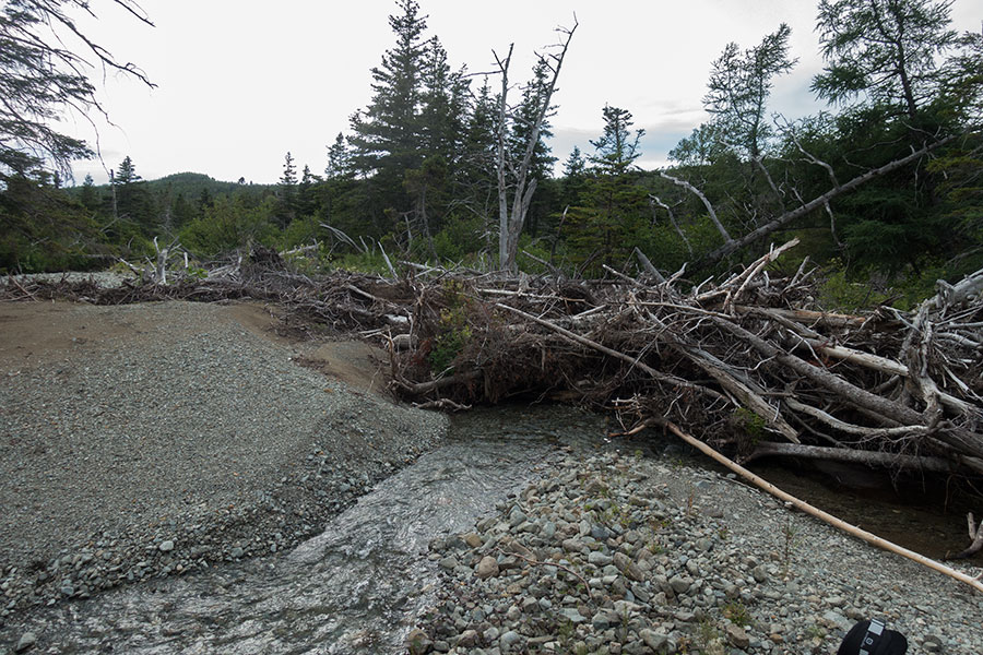
Log jam in the river
I can follow the riverbed for a short while but the holidays are soon over and I need to go across the jungle again.
Fight time again
There’s actually some natural clearings in the woods where the terrain is too wet for trees. Walking on marshland is not nice but still much better than the bush fight and I can have a view back at where I come from with Elephant Head on the left and the narrow clearing of the gully I used to descend clearly visible on the right:
I was up there a while before
Progress through the woods is painfully slow. I keep following loosely placed flags with some traces of a track underfoot. Sometimes the best way through is across deep mud and it doesn’t always end up fully well:
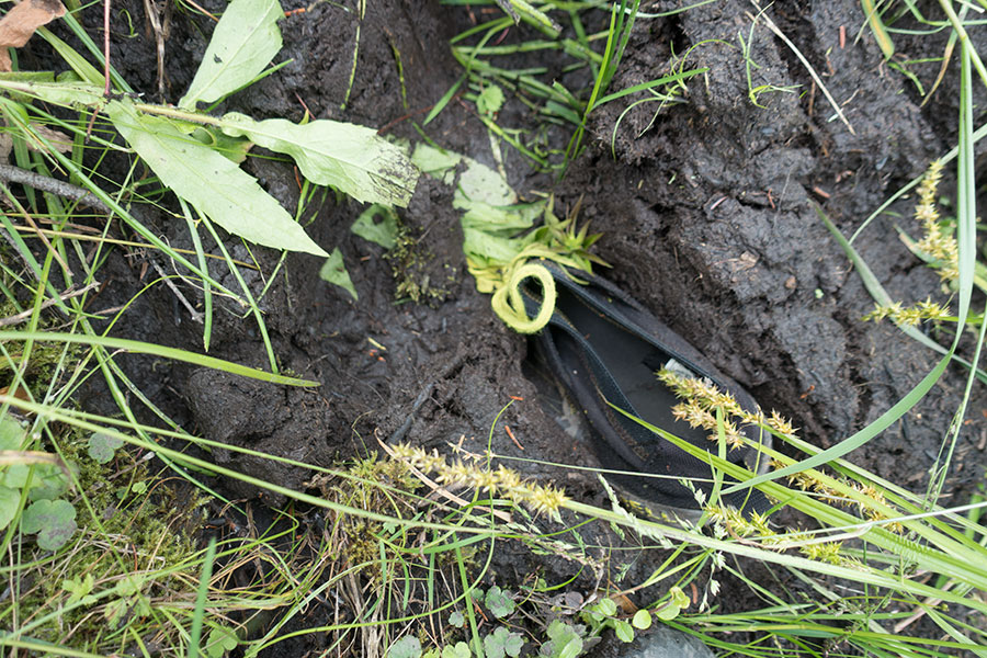
Foot came out, shoe stayed
I see signs of woods works and this clearly tells me there should be a track nearby. Only minutes later I emerge from the trees to this superhighway:
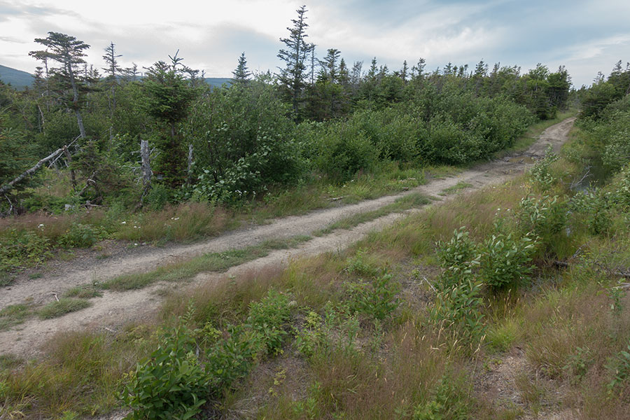
About to walk like normal again
Victory
There’s still a couple of hours to go if I mean to get to Trout River town but at least I know there’ll be no difficulties left other than my own fatigue. I feel rather worn out by the time I hit the dirt road but I actually recover somehow by just keeping walking, this time just plain, normal walking with the occasional glimpse back to where I come from:
Elephant Head at the edge of the North Arm Hills
Left to right: Tablelands, Trout River Lower Pond, North Arm Hills
Getting into town turns into a rather pleasant hiking experience. All the work is now done. I’m aware Trout River is a small town and finding lodging may be difficult but I refuse to worry about it, I’ll just camp around if nothing else is available. I feel overly worn out though and I’d welcome a room or at least a campsite with facilities to wash clothes and bodies, it’d really make me feel much better.
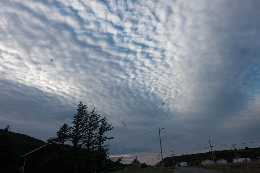
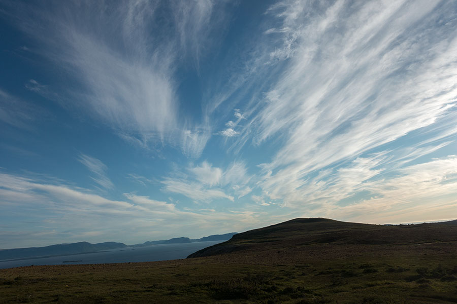
Walking into Trout River town under an interesting looking sky
I ask around to eventually find a local B&B had had a cancellation. Anything else was full, including the campground nearby. I can have all the basics I could hope for plus a very welcoming and charming place to stay at lovely Sheppards B&B.
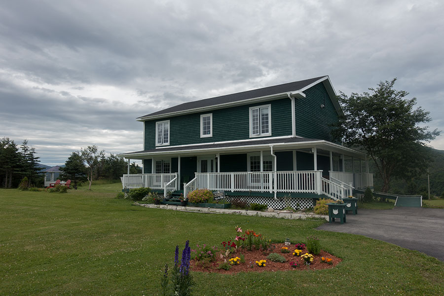
Sheppards B&B in Trout River
I can rest now.
 RSS – Posts
Say what you want