The first section of my hike on the Newfoundland IAT1 goes across two mountain groups: the Lewis Hills and the Blow-me-Down Mountains. Wild and remote country in western Newfoundland.
The Lewis Hills and Blow-me-Down Mountains are the southern half of the Bay of Islands ophiolites complex on the west coast of Newfoundland. It’s the two brown blocks in the map above. It’s a geological wonder, rarely seen anywhere on earth. These mountains are made of igneous rock emerged from the earth’s mantle. It’s an otherworldly landscape and it gets even more dramatic when you think of what you’re treading on. The IAT/SIA website has a great article about the Bay of Islands ophiolites.
A full traverse of the area is rarely attempted, partly due to the remoteness, difficulty of access and ruggedness, eventually due to the low population density and the situation of Newfoundland off the main tourist or hiking hubs.
My final link with the place comes from my previous visit 14 years back when I tried a southbound crossing but quit halfway due to impending rough weather. This time I’d go northbound as part of a bigger plan. I might wait the weather but not quit.
This is a daily account of the trip.
Day 1: Stephenville – Lewis Hills Hut #2
It had been a very tough 5 days since I set foot in Newfoundland, 5 days where everything was wrong or difficult, 5 days where nothing was flowing and where I fought hard to get myself where I was at the moment: ready to start hiking at last.
The one thing that was fine all the way was the weather, sunny and mild, if only a bit too warm at times even for a mid Iberia dweller escaping from the summer heat. It’s only ironic that this Stephenville morning starts cloudy and just as I step outside of the hotel lobby, it starts raining. Mi initial hike lasts 200 meters as the rain gets beyond anecdotal and I decide I don’t want to set out like this. Not today. I walk back to the building I had just left, light a ziggy and sit in the porch pondering on the futility of life.
Back in the lobby I study my maps and re-check the weather forecast trying to see something different from the evident: rain today, more rain tomorrow. There are still two good news: one, it’ll stop raining later in the morning. Two, to my surprise I see what looks like the germ of a hut system in the Lewis Hills foothill area ahead of me. There’s this hut icons in the maps I bought just the day before and I hadn’t had time to read yet. They’re recreational maps so they show stuff like trails and huts that are often not shown on the national grid maps that I had used so far. I had absolutely no idea about these huts or any public hut system in Newfoundland at all. There are 3 of them in the area, one is just off my route and it’d be within my reach today if hike hard enough. I actually don’t know if they’re for public use. All I have is an icon on a map.
After all the hassle of days past, I’m eager to start hiking, it’ll be my best therapy but I also feel mentally weak still, my morale hanging from a thin line. Rainy weather feels too heavy but at least the hiking today should be easy, all dirt road and now I have this chance of a hut at the end of the day. It’ll be a long hike to get there but that’s something I feel like doing.
As soon as the rain eases, I set off for good. I still need to visit the shops for some final key items like my water bottles and a few toiletries and I’ll be ready to go.
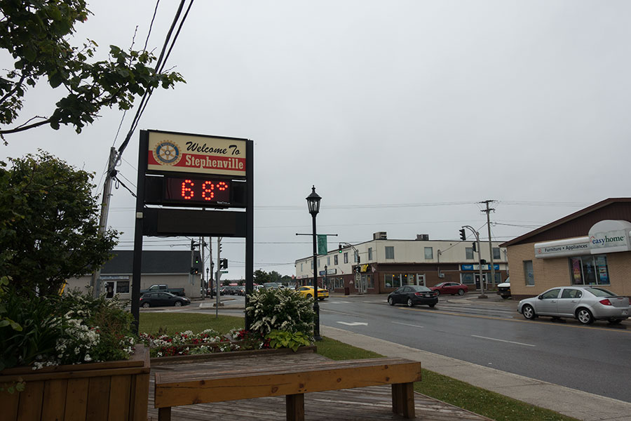
Stephenville in Farenheit
Hiking at last
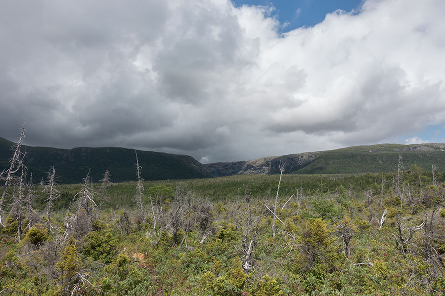
I need some road walking to get out of town. Walking on the roadside is never nice but it’s only temporary and everything else is fine: it’s overcast and dark but it’s not raining and the temperature is actually very nice for hiking. I should be feeling fine but I’m not. It must be a mix of the grey, moody weather and my own demons as I leave the urban world behind and step into the unknown. Unknown to me at least. There should be nothing wrong with it all but the mind plays its own game. I stick to the mechanics of walking and make gregarious progress.

Tarmac road through the endless woods
The main road gives way to a secondary, cul-de-sac road where traffic is almost nil. Soon I get to leave the tarmac for a dirt road that will be my guide for the rest of the day, a wide corridor through the endless, dark woods of Newfoundland.
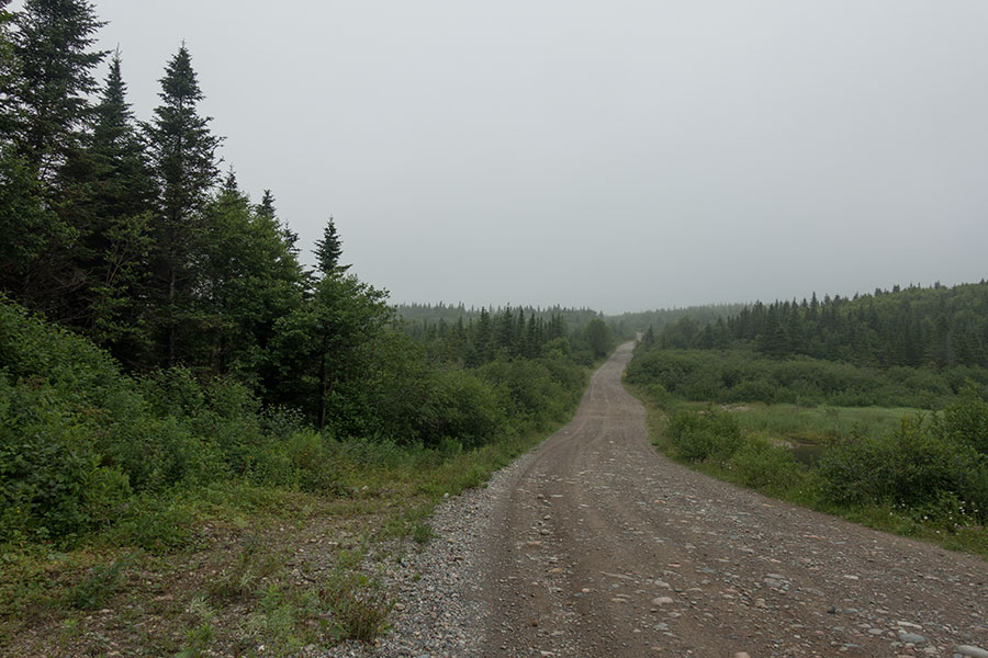
Dirt road through the endless woods
I meet a few ATV vehicles, some recreational, some on working duty, whatever that is. No other hikers. Only once a driving party stops for a brief chat and I feel rather alone, my main company being the home-made road signs that point to the Lewis Hills. I guess the signs are meant for snowmobiles rather than hikers except for the odd, charming appearance of the IAT logo which I really appreciate. It feels like some simple kind of a good omen.
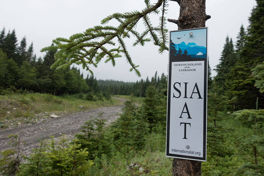
My first IAT sign
The road approaches the foothills with a very gradual height gain. The horizon is as grey as the sky so I have no visual references to help my progress. Cloud turns to mist at times and I feel the cold embrace. I keep to following my track.
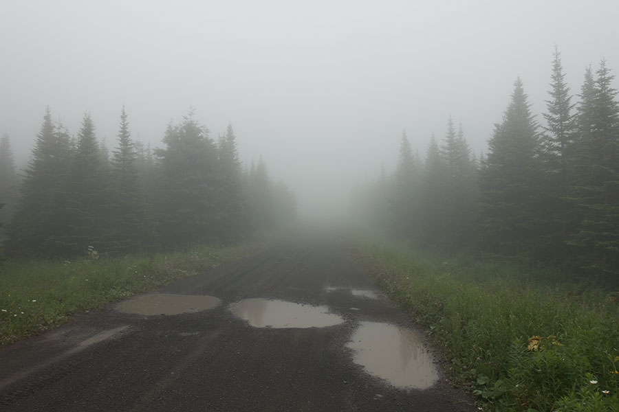
Misty trail
I concentrate on hiking steady and keeping control of my progress with the goal of finding the hut before it gets dark. After a crossroads, the road turns to a narrower track that climbs up from a river valley as the mist closes in again. I don’t see much ahead but I feel something big moving away. I guess a moose, theory confirmed by the print in the dirt I find a few yards away:
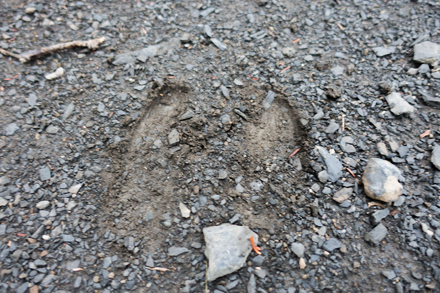
Moose print on gravel, circa a few seconds before the shot
There’ll be better moose prints along the trip but this was the first one.
I go past the Lewis Hills hiking access trail. This was easy to identify as it is tracked in my smartphone. It’s reassuring to find several flags and an IAT marker together with a narrow track that enters the thick woods. It’s getting dark and the mist makes it even darker, ideally I’d camp right here but my map shows the hut just ahead and I have it clear that I’ll go for it. At this stage, all I want is to find the hut. I could camp, I know, there’d be nothing wrong with that, I’d be comfy, that’s what I came here for, never mind the forecast for heavy rain tomorrow but this is emotional and I don’t care about logical reasoning, I feel like I need to find hard shelter.
I don’t even know where it exactly is as all I have is a loosely placed icon in a not very detailed map. I keep hiking on, hoping the map is accurate and the hut is indeed open to the public while I keep my eyes open for anything that’s not a tree wall. I feel relieved and happy for the first time on the day when I turn a corner into a clearing with a distinctive roof shape at the far end:
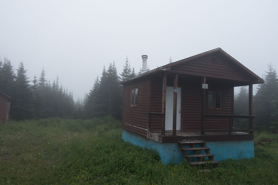
Hut #2
The hut is indeed open and meant for public use. It is a small wooden building, clean and in good shape. There’s a fireplace but no firewood. Outside everything is dripping wet. I gather some fallen branches and store them under cover for future use.
It was a long day with easy hiking in a straightforward route but if felt heavy on me. It usually happens on day 1. I’m now comfortable in a safe environment and I stop any forward thinking. It’s time for dinner and sleep. Anything else, I’ll see tomorrow.
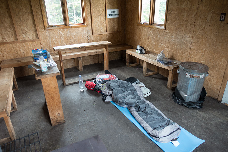
Cozy home for the night
Day 2: Lewis Hills
My expectations for this day were for heavy rain and an easy decision to wait the weather in the hut. Instead I wake up to light cloud, good visibility and some cold breeze as the only sign of instability.
By mid morning it becomes clear I’m wasting my time by letting a nice weather window pass by without hiking. I pack up and leave.
It’s about 1 km back to the junction with the Lewis Hills access trail. Once there the real thing begins.

Lewis Hills trailhead
Through the woods
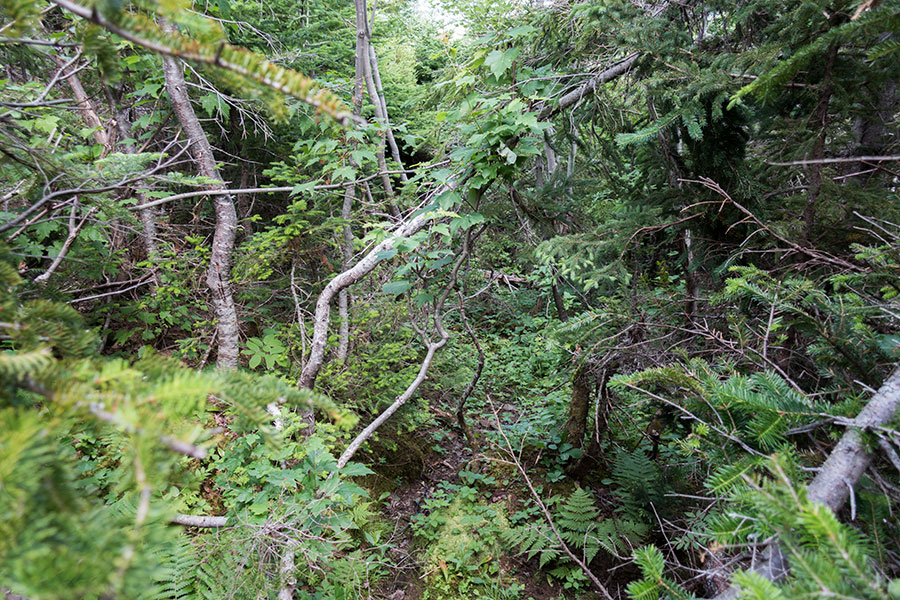
The trail is narrow, sometimes faint and as convoluted as the terrain it goes through, the thick, chaotic woods of Newfoundland where the ground itself is a rather loose concept. It is still a good trail for local standards, reasonably well flagged with color tape and a real blessing through the mess of trunks and branches.
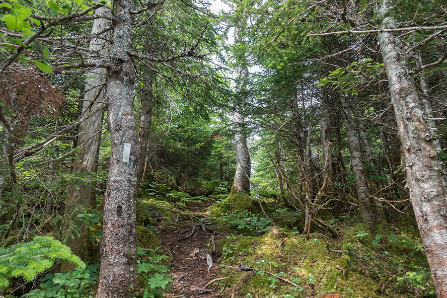
Trail through the woods
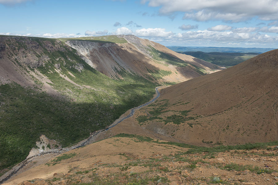
I go up and across a minor ridge, happily off the forest and through marshland to a view of the Fox Island river valley and the mountains beyond. That’s the Lewis Hills proper.

The Fox Island river and the Lewis Hills
As I start coming down, the terrain becomes rocky and barren with the distinctive light brown color of the peridotite igneous rock that forms the hills themselves. As far as the hiking goes, this is a blessing: it’s much easier to walk through and to scout ahead.
I need to cross the river and head for the mouth of the canyon on the other side. The Fox Island river is a big one but its summer flow is easy to wade. The weather still holds. Everything is going well.
Into the hills
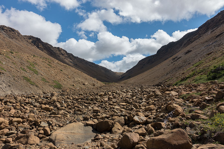
The next few hours pose no problem: rather easy, albeit rough underfoot hiking and straightforward route along the canyon floor towards the headwaters. No vegetation, only occasional signs of a trail and some scattered cairns.

Access canyon to the Lewis Hills
The canyon ends and the steep climb begins towards the Lewis Hills highland area. It’s here that the cool breeze is most welcome to avoid the uphill sweat. The weather keeps rather luminous despite the cloud cover. No signs of the forecast rain.
I get to the highlands and everything changes: the bedrock, the vegetation and, unrelated but very relevant, the sky. The rock is indeed different and plant life returns, mostly grass and low bush so progression is still mostly unhindered. The clouds get thicker and darker though.
It’s beautiful up here, with small lakes all over the place. The terrain is more rocky than hilly with a constant up and down that’s barely visible on the digital maps. The paper ones at 1:100K are totally useless to represent such detail. I start making heavy use of the GPS to find my way. There are some cairns but not enough for proper route following.
The wind is cold and bitter and it looks like it could start raining anytime. Next is a climb that would take me over the highest point in the area, also highest in Newfoundland at 811 m and across rather flat and very exposed terrain. I don’t want to camp up there and I’d probably have no time to climb down to more sheltered land beyond so I start looking for a camp right away. I spend a while searching for a spot that’s not only flat and grassy but also sheltered. It really makes all the difference to be in the downwind side of this steady, cold breeze. I eventually find a narrow but otherwise perfect spot overlooking one of the many lakes and in front of some remaining snowfields. Shortly later, a caribou herd will show up across the snow. I feel in company.
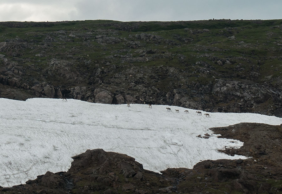
Caribou herd in the snowfield
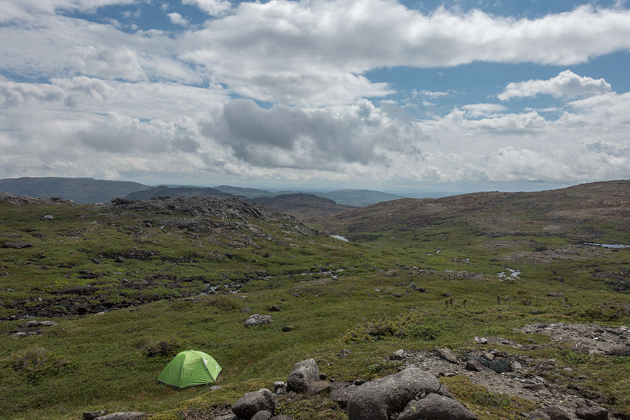
Time to see what my new tent looks like
I had checked my tent in the store to make sure it had poles and stakes but other than that I’ve only seen the packing pics for a guess of what it looks like. I set it up for the first time. Inserting the floating pole is a royal pain as it’s a really tight fit, otherwise it’s all fine. I have a home now and it looks like a comfy one.

Beautiful, sheltered spot
Day 3: Unnamed canyon off the Lewis Hills
It’s been raining during the night and the morning picks up with the same pattern: breezy, cold & dark. There’s still some brief clearing so I can at least take a camp pic with better light.
Lewis Hills highlands, looking southeast
As I start taking the tent down, it starts raining again and I abort the operation to wait the weather inside, a worthy move as it’s just a shower. I’d rather not be out there at the very top of Newfoundland in wet and windy weather but if it gets me, at least, do so while I’m already hiking.
I eventually pack up and leave. I feel once again the value of a sheltered spot as soon as I emerge from behind the relief and into the wind. I proceed uphill while the clouds cover the mountaintops occasionally.
Here’s the convenience of the GPS thing. The terrain is featureless, a grassy upland with no reference points. When I climb into the cloud, my visible universe is down to a few dozen, blurred meters. It’s the kind of situation where traditional navigation on map & compass still works fine but you really need to trust your instruments and your skills, particularly in a place like Newfoundland where coming down any way will take you nowhere useful.
The climb ends as the land flattens in a wide area as far as the eye can see and the mist allows.

Shapeless land approaching Newfoundland’s highest point
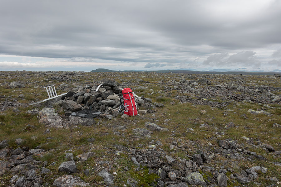
Cabox
It wouldn’t be possible to discern the highest spot if it wouldn’t be for the simple, rather decrepit structure marking it. This is Cabox, the highest point of Newfoundland at 811 m. We could set up a table and play snooker.
Just as I stay on top of the world, the fog shifts and I get a wider view even though I don’t see much else other than the horizon.
Cabox, Newfoundland’s highest point
The wind is still blowing so I don’t hang out for long, eager to come down to more sheltered land.
I get a good visibility spell as I descend, with the cloud covering the top again and chasing me downhill. The sky is very dark and the wind cold, all of which affect my morale but other than that I’m starting to have some fun: I’m off the most exposed section, it’s not even raining, the walking itself is not too bad and the landscape is getting scenic. The digital track goes down to the edge of the Lewis Hills’ northwest escarpment, then around the rim, instead of cutting across the main body of mountains in a shorter route to the exit canyon. From the map, it doesn’t look like the most logical route unless you count on the scenery factor.
Mixed feelings about digital navigation
Even with the unmistakable reference of the escarpment’s edge, I find it difficult to interpret the terrain from the digital map. The fog doesn’t help. It’s no problem to stay on course as I follow the digital track but I don’t like this feeling of not really knowing where I’m going. In a normal navigation situation, I’d have been expecting to meet the dramatic cliffs in Molly Ann Brook Canyon but this time I walked unaware so the awe factor was even bigger:
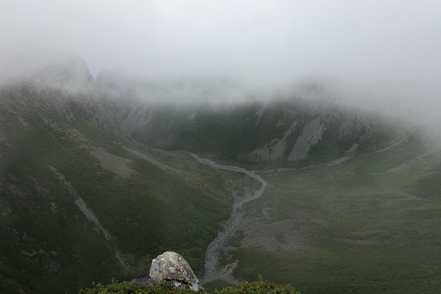
Molly Ann Brook Canyon in misty times
At some point there’s an opening in between the canyon walls and the low cloud and I can see this deep blue surface in the far background:

Blue sea, the sun is shining over there
It’s the sea in the Gulf of St. Lawrence. This starts telling me about the weather pattern today, as it seems the sun is shining over the sea while the hills are overcast. I may guess the cold wind, forced upwards by the mountains might be generating the cloud cover so it could be a local thing and not a full weather system. This is potential good news.
The rim traverse is spectacular but the constant, cold wind has this capacity of ruining any attempt at contemplation. It’s just uncomfortable no matter what you wear. I keep hiking as the best/only way to keep warm.
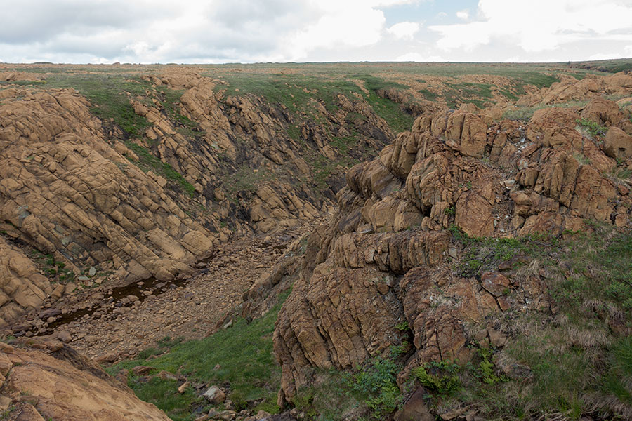
The rim traverse is also very short lived, just the width of the canyon, then it’s cutting across towards the next notch, a very different animal: while Molly Ann Brook Canyon was grey rock with vegetation, vertical walls and a crooked course, Rope Cove Canyon is barren, straight and soft-U shaped.
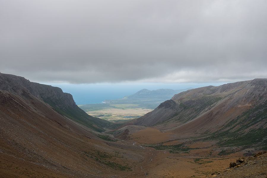
Rope Cove Canyon, Serpentine Valley and the Gulf of St. Lawrence
There’s something quite remarkable about this pic above. It shows the Serpentine valley beyond the canyon, then the sea. In Europe, the canyon would certainly have a name, you could walk down it to the valley where you’d hit roads and villages. There’d be a coastal town, maybe a resort. This on the other hand is Newfoundland. The Serpentine valley down there has no roads or villages and the only chance of moving along would be to follow the river, the rest is impenetrable woods, maybe some marsh. There’s certainly habitation down there but it’s about moose, beaver and no human.
In Europe, I could be tempted to go down the canyon and have dinner in a pub tonight. It would help with this somewhat oppressive feeling of no escape from the constant wind. If I did that here, the best way out would be to turn around, climb back up and follow my intended route to exit the hills at a point in the Serpentine where I could at least meet a dirt track that’s suitable for walking humans. No valid shortcuts.
Way out
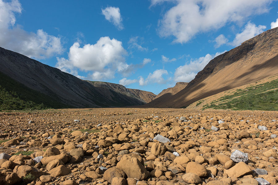
The next canyon is actually my way out of the Lewis Hills. I need to cross long barren sections of the peridotite rock before getting there:

Treading on the earth mantle
Still unable to understand the terrain from the lacking representation in a 4.5″ screen, still battered by the wind. It is a blessing to find my way down and start descending.

My exit canyon
Coming down the canyon is among my finest moments in this trip so far. I’m out of the wind, I feel the protection, clouds overhead are starting to show breaks, the place is amazing and I feel like I’m getting into this journey now. I feel relaxed and happy to be here. All I need to do for the rest of the day is finding my best way across the barren, rocky ground and eventually a spot where I can pitch.
Boulder hopping is fun
This latter was tricky. I scouted several potential sites until I found one that was just barely suitable with some real ground and only grassy vegetation, if only wide enough for my tent. I smiled to myself when I noticed a short section of line tied around a boulder, most likely left behind by a previous camper that found the same spot.

First suitable spot coming down the canyon
By the end of the evening, the sky is mostly clear. The wind has probably come down overall. I’m tired, relaxed and happy.
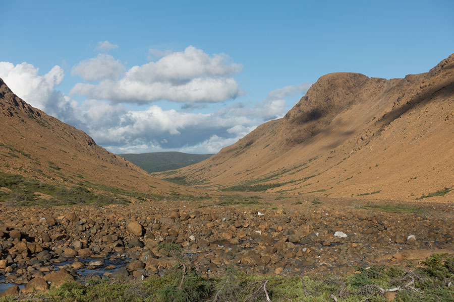
Day 4: Simms Brook Canyon
The day starts clear and bright, which is excellent news. I face potential for hard work today: crossing the Serpentine valley may be among the toughest tasks of the whole trip. Once I get into the trees, I’ll be in the hands of the IAT org and the quality of the trail built through the woods.
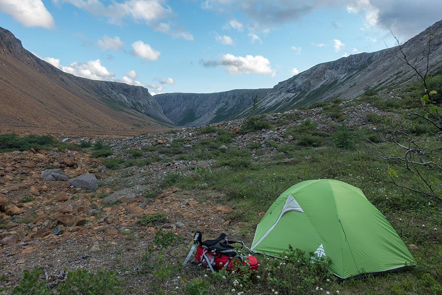
First I still have some vegetation-free walking as I follow down the canyon. I get to a truly lovely area with plenty of flat, grassy ground where camping would have been more comfy than where I eventually pitched. Next time I know.
At this point my digital track shows me the way out of the canyon over a low ridge on one of the sides. Once up on the ridge, I finally get a view of the Serpentine valley that’s known to me. It’s an emotional moment and I celebrate:
Good to see you again
It’s rather a way of saying hello 14 years later, when I hiked across the mountains on the other side of the valley, all the way to the foot of the Lewis Hills, very close to where I’m standing now. It’s like closing a circle. Almost.
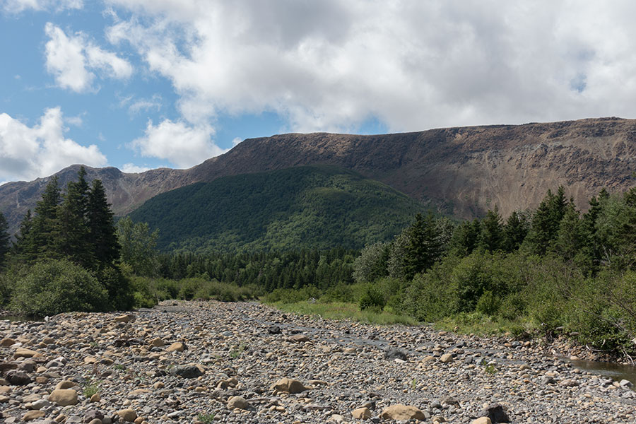
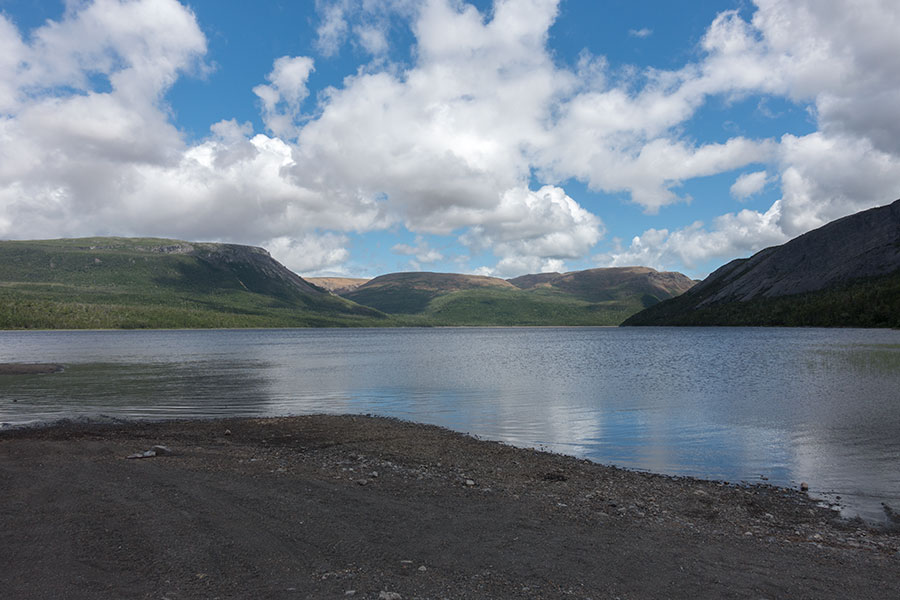
I’ll actually see myself standing in a known spot but I still need to come down to the valley floor and the big Serpentine Lake for that to happen. I can see the lake, the Blow-me-Down mountains in the background and the deep notch of the canyon I’ll use to enter them.
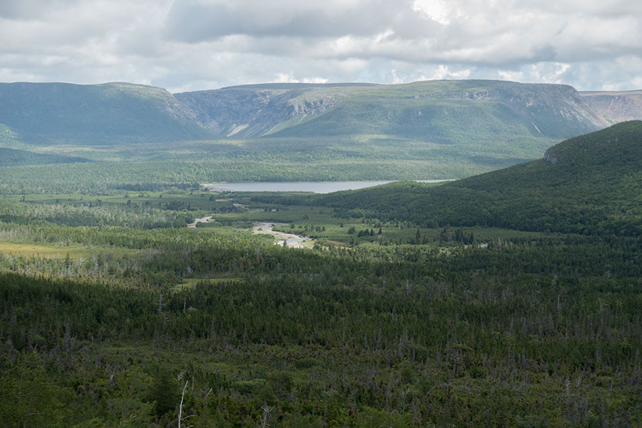
Serpentine Valley & Lake with the Blow-me-Down Mountains in the background
From my vantage point I can see a brook2 that flows straight into the head end of the Serpentine Lake, which is my target. I’m tempted to follow its bed as the low level water provides some rocky shore stripe that’d probably be better to walk on than crossing the woods but the map shows some marsh areas ahead whose walkability I don’t have clear. I play it safe and follow my digital track that takes me uphill around the edge of the woods, as if it didn’t dare to enter, something I would fully understand.
Through the woods again
Eventually the track sends me downhill and into the trees. What a moment! Newfoundlanders must be used to this but I’m not. I try to find some trace of a track through the trees, maybe some tape hanging from a branch, if only to confirm this is the way the IAT gods meant hikers to go through. In the absence of any, I cling to my digital track, even if it sends me straight into the big tangle.
Crossing the woods
The very first stretch is by far the worst, very thick over steep terrain. I’d wonder if the dry stream bed to my right was the way to go until the slope eases and the trees seem to leave more room to move through. Then I find some color tape and eventually what appears as a real, albeit faint track.
It’s indeed a very faint one to the point that I’m often not sure if I’m still on it or not anymore but the woods are reasonably passable. It’s tough and slow going but I take it easy and progress is not traumatic.
I eventually come down to a wide riverbed with bouldery banks that are much better for walking. I step out of reclusion into this wide, brilliant swath of treeless land.
You understand the value of the open space after fighting the forest
I particularly like this section, it feels gentle but also remote and wild and the sun is shining beautifully. For the first time in the trip, I do a proper stop for a proper lunch, I take off my shoes and wet them on the river as I enjoy the sunshine.
Route finding musings
I relied heavily on my GPS to guide me through the woods and I wonder how I would had dared without it. It’s difficult to say but my guess is that it wouldn’t have been more difficult and it might have been even easier. Mind you, I say that after having gone through it. Before that, I could have expected to find a good track that would have made a difference and the GPS could have been a big help to find it. There was no such thing and I wonder if the faint, rather intermittent track I did find really made any major difference. In a no-track situation with an easy target (a river to cross first, eventually a dirt road I’d meet no matter what navigational error), it might have been easier to just follow a bearing loosely and concentrate on choosing the best way through the tangle. I didn’t have proper paper maps with me though in this occasion so it was not so obvious to take bearings and follow them.
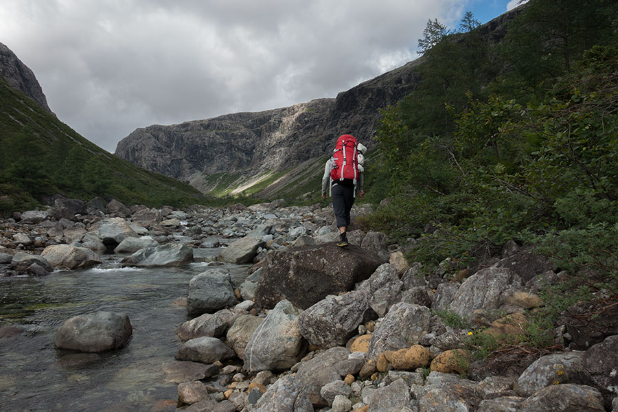
Back in the ground, my river meets the main flow of the valley that I need to wade. On the other side, the green wall looks impenetrable. I look for tape but find none so I just enter. It’s about 300 m to a dirt road that I meet in a right angle so I can’t miss it. Eventually I find a rough track that takes me to the trail head:
Lewis Hills Trail Head
I can’t help thinking that it feels too much of a sign for such a faint, loose track but I understand my perception must adapt to the local circumstances. This is Newfoundland and these are its trails.
Infrastructure
I just reached a dirt road. It is a spur on the logging road system that ends at the Serpentine Lake and it’s used by boaters/anglers and paddlers to access the lake and its outflow. This road was my escape route back in 2003. Now I use it to walk the last couple of km before I get to the Serpentine Lake.
Serpentine Lake Road
Near the end of the road I pass along some human stuff: a few parked vehicles, a kayak trailer and a couple of stranded trailer homes but nobody around. A few yards later I get to the shore of the lake.
Serpentine Lake
It’s a beautiful, open view of the big lake flanked by the mountains under a sky mixed with blue, white and dark grey. Once out in the open valley, the wind shows up again, blowing inland from the gulf of St. Lawrence. I enjoy some beach walking along the shore.
I get to the outflow where I need to wade across to the other side. It’s an easy, knee deep crossing this time of the year.
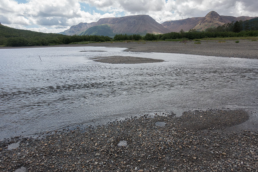
An easy wade at the outflow of the Serpentine lake
The open field walking is short lived though. As I leave the valley floor I get into vegetation issues again. I need to climb out of the Serpentine through a strip of forest before I get to the mouth of the Simms Brook Canyon that I’ll use to enter the Blow-me-Down Mountains. After some recent reports I checked before my trip, I expect a viable track through the woods. I know my fate if I don’t find it so I search for markers to show me the way in. There’s pink tape at the very edge of the bush:
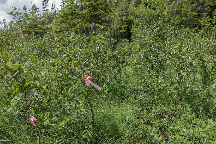
This way
The subsequent track is much better than it was on the Lewis Hills side, still rough underfoot but wide enough through the trees to provide for consistent upright walking.
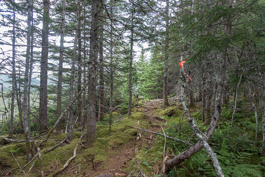
Good quality trail
A minor ridge provides an open view of the Simms Brook Canyon mouth ahead and the woody area still left to cross. It’s easy to imagine how costly it’d be to get there without some kind of track:
Target canyon at the far end
Back in 2003, I didn’t know about this trail, it probably didn’t even exist yet. We followed a few coordinates that we had gathered beforehand as a recommended route out of the canyon towards the valley floor (we were hiking in the opposite direction). I remember how thick the woods were at times and how big of a test it was for my motivated but inexperienced party to get to the Serpentine River. It is so much easier today.
I eventually get to the bed of Simms Brook and it is here that I finally meet my own steps of 14 years back.

Simms Brook and the mouth of the canyon
The trail above the river bank goes on for a while longer. It stops before the narrows section of the canyon mouth, sending hikers down to the stream bed.
Entering Simms Brook Canyon
The rest of the day is a walk down memory lane as I recall my downstream hike from 2003. It’s such a long time ago for the human scale but everything looks the same. It’s no time ago in geological terms.
Simms Brook Canyon
Simms Brook Canyon is truly spectacular. It’s a deep notch in the Blow-me-Down Mountains massif that will start with a shallow gully up in the highlands. The bedrock is completely different on each side of the canyon, with peridotite igneous rock on the north side and some regular rock on the south. The canyon floor is wide and oddly flat, uniformly bouldery. It’s a huge stream bed even though only a small channel has flowing water as I walk the area. A few narrow strips on the sides have some vegetation.
Simms Brook Canyon
To my surprise, the wind enters the canyon and blows all along. I’d guess it feels even stronger than on the main valley. This is a concern as there’s not much shelter here if the canyon itself doesn’t provide it, neither much ground to pitch. I could rush it and climb to the highlands before it gets dark, as far as memory goes about the Blow-me-Down Mountains I’d have it easy to find good ground to set the tent up but not much chance of a spot sheltered from the wind neither much light time to look for one. I don’t like the prospect so I decide to take it easy and camp down in the canyon, hoping for the wind to come down or find some natural shelter.
The rest of the walking day is about backpacking at its best. The place is magnificent and I’m starting to really feel at home here.
I proceed up the canyon with no rush, which is very welcome when the ground underfoot is an endless rock field. It’s fun rock hopping but it needs constant attention to avoid a bad step. I veer to the true right side of the canyon, the one with non-igneous rock for a better chance of finding a campsite. There’s some very limited choice of consolidated ground as well as some fine gravel sites, the latter right over the super-wide stream bed but with a safe appearance. The main concern is the wind, which comes and goes with calm periods that alternate with strong gusts. I need a good hold that the gravel bars probably wouldn’t offer. I could tie down to rocks or deadmen instead but I’d have a much better night sleep if I can find some natural shelter.
Camp
I intensify the campsite scouting as I get closer to the head of the canyon and the chances get more scarce. I stop by what looks like the last green area before only rock is left and drop my pack in a grassy spot that’s good enough if only except for the wind exposure. As I look ahead one last time, I see some old rockfall that has created a shallow ridge and looks like it could hold some hollow behind. I get myself there and I get the planets all aligned: some vegetation, decent ground, a level spot big enough for the tent and the rockfall creating a windbreak!
Simms Brook Canyon camp. The very minimal ridge behind the tent was good enough for a windbreak
Spending the night in Simms Brook Canyon was magical: silent, calm, barren and remote and it felt home. That’s when backpacking gets beautiful.
Day 5: Blow-me-Down Brook trail head and Corner Brook
Morning resumes where evening left it weather wise: clear and windy. The prospect for the hiking day is rather favorable this time: I just need to get up to the the Blow-me-Down Mountains plateau, go across and follow another canyon out. The highland traverse is relatively short and I remember it as easy walking. It should be fine as long as the weather doesn’t get too rough. At the end of the day I should get to a trail head and a tarmac, public road at the southern shore of the Bay of Islands.

Simms Brook Canyon camp in the morning light
I’ve slept at the foot of the climb to the highland plateau. The canyon walls are steep and most wouldn’t be climbable for a hiker, if only for the upper section where the walls are steepest. The IAT track follows a ridge that separates two side canyons where they join to become Simms Brook Canyon proper, this ridge appears hikable all the way up. In 2003, I climbed down a side wall further downstream that was quite sketchy on the upper part. This time it should be easier, if only because I’m going uphill. As in Egyptian folklore, the rising sun shows the access point to the highlands:
The rising sun shows the way
Simms Brook Canyon views can only get better with the climb as I gain perspective. It’s outstanding the difference in bedrock, side to side
The upper section is certainly the steepest but nothing to worry about and I happily set foot on the Blow-me-Down Mountains highland plateau for the second time in my life. I celebrate this and my new status as a confident hiker in Newfoundland with a break and a chance for contemplation.
Across the plateau
The wind is still on, it hasn’t calmed down for 4 days but at least today the sky is mostly clear and the sun warms me up nicely. I set off across the plateau.
I set off across the plateau
This sector of the Blow-me-Down Mountains is made of igneous rock but the surface is partly grassy and not completely barren. It’s a gentle uphill, not too rough underfoot and progress is quick and easy compared to previous days. The recommended route is close to the rim of the upper reaches of the Simms Brook Canyon and it’s very interesting to follow it until it becomes a shallow gully.
On my way north I need to cross another gully cut about 15 m deep into the peridotite bedrock. It’s like a giant trench and provides for a very welcome relief from the constant wind as well as fresh running water.
Shelter and water where you wouldn’t expect them
Right around the highest area (I refuse to say “the top”) there’s the already known highland marsh configuration that’s so beautiful and entertaining to walk through. I vividly remember the first time I saw anything like this, just on this very same area in my previous visit.

Highland marsh
I take a brief side trip in search of the highest area. I don’t mean to summit anything, it’s more really because I don’t want to leave, some sort of active travelling procrastination. Not even the wind discourages me from hanging around this time. Then I resume my way down and that’s when I rebel against leaving so I take my pack off, lay down on the long grass and stay there for a while doing nothing. This is as close as I can get to the land.
Grassy uplands in the Blow-me-Down Mountains
One last canyon
I eventually say goodbye to the highlands and face down. Same as on the climb up, I need to find a ridge in the confluence of two canyon branches to use it as my way down. If you think of water eroding the landscape, it’s easy to imagine why such ridges are less steep. The upper part is to be taken with care but no need to use my hands.
On the way down, there’s this beautiful view of a big waterfall on the other side of the valley:

Water falling from the Blow-me-Down highlands
The other obvious view is that of Blow-me-Down Brook Canyon, the already familiar, forever bouldery valley floor of the igneous rock kind:
Blow-me-Down Brook Canyon
I remember and can recognize the side wall I took to climb up in 2003, it wasn’t the same one as today and it actually looks easier and more logical unless leaving the highlands quick was a priority. I remember the long and exciting trudge along the canyon from back then, today it’ll have a very different meaning as I’m leaving the hills in a daze in between fulfillment, relief, tiredness and craving for a break. I had this feeling of being nearly done and it’s in front of the long stretch of brown boulders that I realize I’m not.
Blow-me-Down Brook Canyon boulders
So far I’d had too many things to worry about and bodily issues wouldn’t matter much. Now that I’m relaxed tiredness kicks in. Mind trumps body every time.
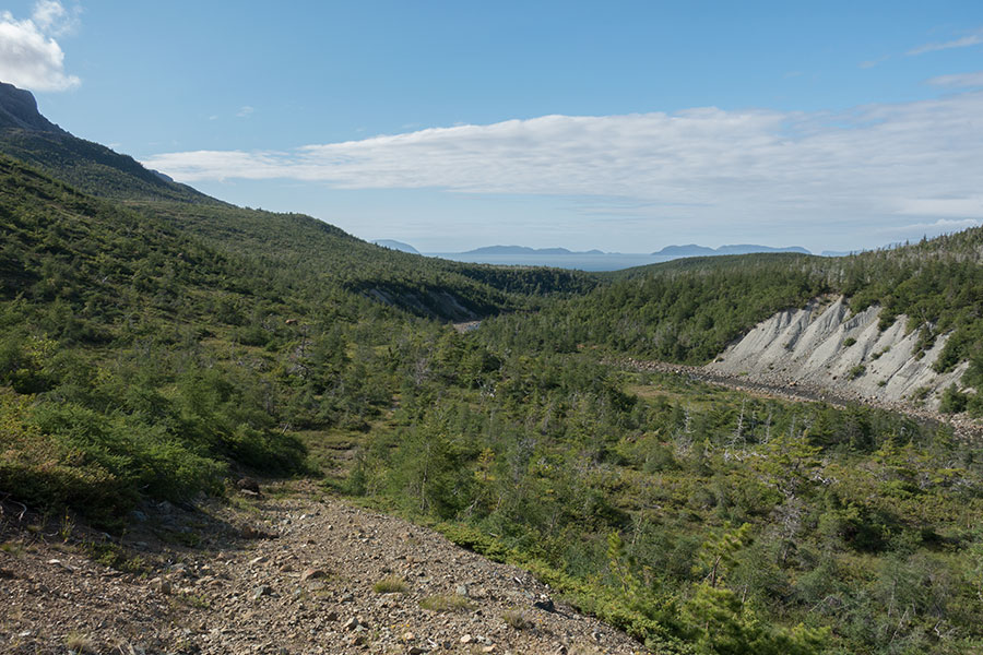
It is indeed a long but this time less than exciting trudge to the canyon mouth. I have the chance to get sick of the rock hopping but I need to stick to it, more so when I leave the peridotite behind and the vegetation starts filling everything that’s not the stream bed. Then the valley makes a sharp turn and I say goodbye again, this time to my last canyon in this leg of the trip. I step onto the coastal shelf.
Final push
I remember an access trail that would take me all the way to the road avoiding any conflict with the bush but by this time around I’ve noticed my digital track had a different plan for me: it took me along the stream for too long, easing my progress at the expense of a good bush fight to link with the trail. I wasn’t counting on this and I hate it deeply but I know I need to be patient with the vegetation or I’ll have a really bad time. Eventually I hit the trail.
On trail at last, the Bay of Islands in the background
It’s all easy from here but I’m too tired to enjoy anything.
There’s a turning point when something happens that’s real news: I meet hikers in front of me. It takes me a split second to realize it’s people. It’s the first people I see in 4 days. They’re not backpackers. I need no GPS to know the road is close. It’s only a few more minutes that look like a long time.
Back to civ
The good part of an open plan is that it’s easy to improvise. The tricky part is that I have to take decisions on the spot.
I face one of those typical North American hiking deeds: getting to a road gets you nowhere. There’s nothing here, there’s no traffic, the closest village is just a few miles away but there’s probably not much there either and Corner Brook, a proper town, is about 20 miles away.
I could walk to Frenchman’s Cove, the nearby fishing village and stay there for the night, even if it must be in my tent but if I’m camping I might just as well do it anywhere else. It should be OK to camp but I’m so done that I can’t even fathom the idea, even if 5 days outdoors is far from a long time. But I’m so done.
The one value in getting to Frenchman’s Cove and not Corner Brook is that I could try to find some fisherman to boat me across the southern arm of the Bay of Islands so I could resume the walking on the other side while keeping a straight course in my global journey. Not even my local contacts know of such possibility. My alternative option is to hitch rides around the bay for the same end effect.
I feel there’s less uncertainty in the ride hitching plan so I take off my pack extend my thumb at the sound of motors.
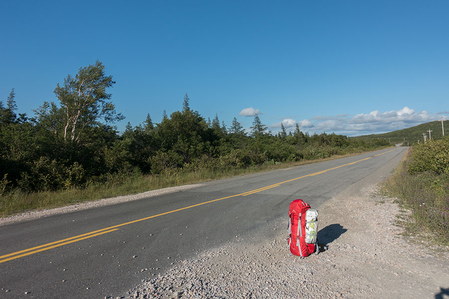
Waiting for a ride
Anybody going through should be able to take me to Corner Brook where there’s a hostel. I don’t really need any supplies but I do need to shower, wash some clothes and feel clean. I’ll need to go through some urban stuff if I mean to proceed with the purest version of my Newfoundland trip and it’s like I need to feel clean.
It takes a while to get a ride but then I get not only that but an invitation for dinner and a shower. This is typical Newfie hospitality that I remember so fondly from my previous visit.
I eventually get my tired bones to Corner Brook downtown where I find the hostel fully booked. A hotel will have to do instead. Got too late for laundry, doesn’t matter, I do the socks in the sink and I feel all set. Work resumes tomorrow.
 RSS – Posts
Say what you want