
In the summer of 2022, I walked train station to train station between Oppdal, county Trondelag, and Hamar, Innlandet county, taking a high line across 3 mountain regions as well as National Parks/Protected Areas, Trollheimen, Dovrefjell and Rondane, and the high moors in the less renowned Hedmarksvidda region.
The first leg was a 3 full day (plus a half day approach), anti-clockwise jaunt through this evocatively named region in the title, located in the transition area between the coastal fjords and the inland ranges. The name stands for Home of the Trolls, who knows why. It’s a very alpine looking area with sharp peaks, lots of precipitation and deep, lush valleys.

Trollheimen section
Day 1
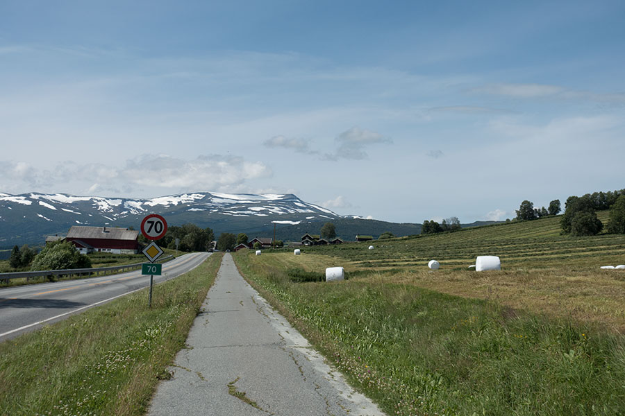
My first day was an approach hike with 10 km on a road (8 of which over a tarmac, pedestrian and cycling side track) plus another 12 km on dirt roads to get to the hiking trails. Hiking on roads is far from ideal but I chose this over overnighting in Oppdal to wait for a bus that would only cover the first 10 km. I took it as an easy intro to trail life.
Before any of that, I had taken an early morning train from Oslo airport, where I had landed late the previous night, and arrived in Oppdal in the early afternoon of a Saturday under blue skies and warm, nice temps. Oppdal is a small, nice town just north of the divide on the main route between Oslo and Trondheim. I stopped at one of the outdoor stores on my way through town to get a gas canister and started hiking right away.
The road is the main route from this inland area to Sunndalsora at the head of one coastal fjord but the traffic was not too heavy on a Saturday morning and I could keep a distance for most of the way thanks to the non-motorized side track while I headed for the mountains.
Heading for the mountains
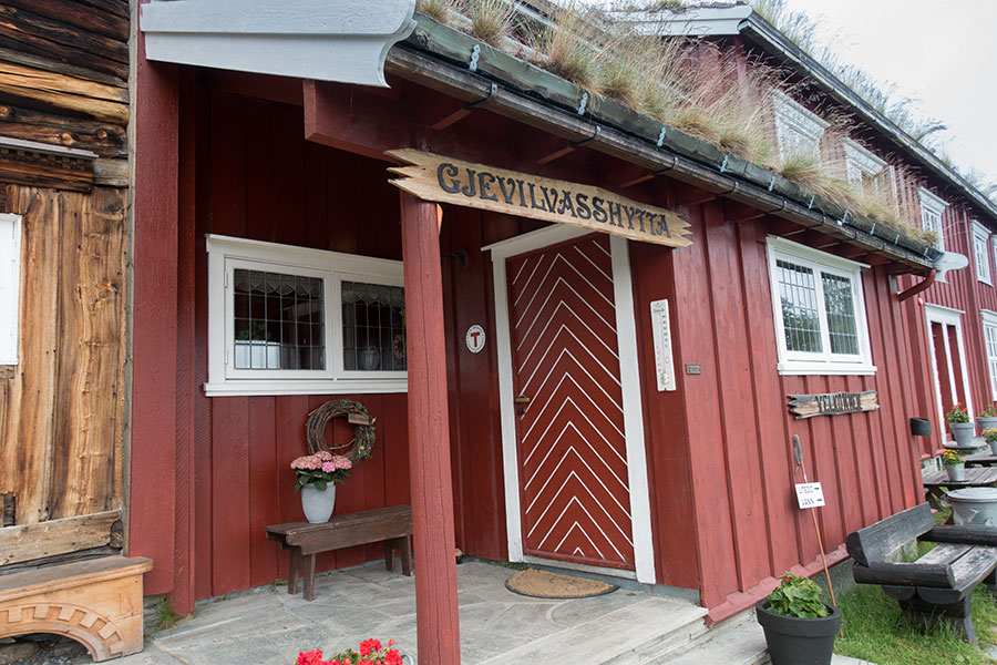
There was heavy rain in the forecast for the evening and I decided to keep it easy for trip start and went for Gjevilvasshytta, a stuffed hut on the shore of Gjevillvatnet. I made a conscious effort to make it there for dinner. I hiked pretty much non-stop for the 22 km.
Home for tonight
Dinner was worth the effort but the forecast rain never happened. I was happy with the decision anyway, Norwegian stuffed huts are incredibly nice, albeit expensive, and I felt like I deserved the luxury of a relaxed first night considering that 24+ h earlier I was still at my working desk.
Gjevilvasshytta
Gjevillvatnet view from the hut
Day 2
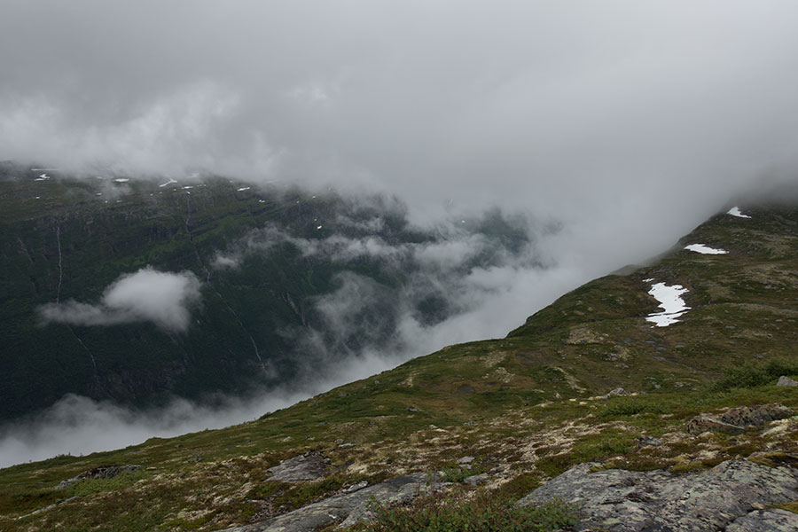
Next morning was cloudy and rather dark but rain was not expected until the evening. I took to the trail right behind the hut with the confidence of being on a main thoroughfare in the hut-to-hut circuits of Trollheimen, nothing could go wrong. Steady ascent through birch woods, soon reaching the tree line at around 1000 m high, this leading to the mesmerizing rocky environment of the highlands while the mist hid the rest of the world.
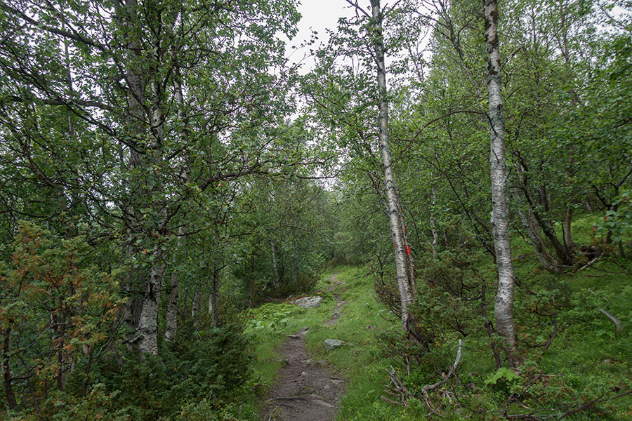
The birch woods
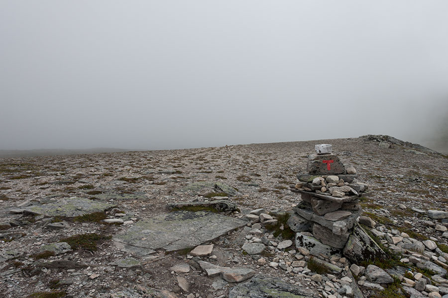
Mostly grey
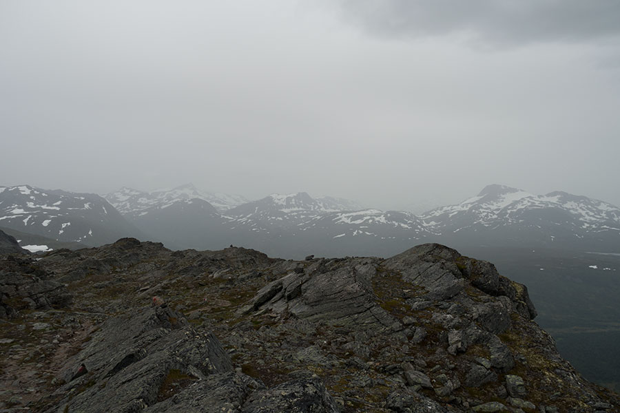
The fog cleared on my way down to the headwaters of Svartadalen (that’s a valley, as everything with such suffix), where I ended my brief jaunt northwards to take due west, first along the valley floor, then up the slope towards the summit of Geithetta under increasingly cloudier skies.
Geithetta summit, center left, barely hidden by low cloud
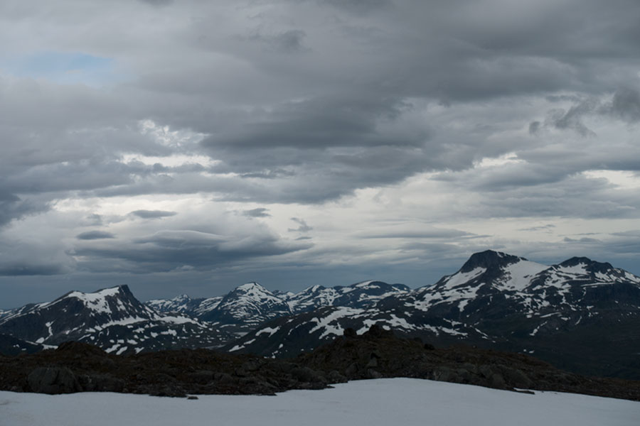
I was close to the top when it started raining. It wasn’t heavy, yet enough to show the potential for misery in these mountains. The views of Grasjoen (that’s a rather atypical name for a lake) and the sea of mountains to the west were worth the exposure though:
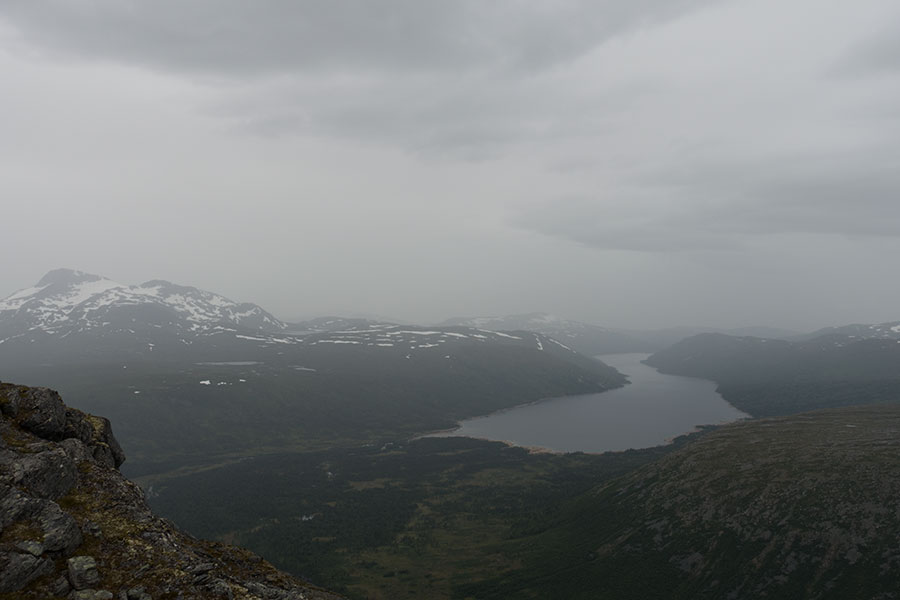
View northwest to Grasjoen and the upcoming storm
Due west, mountains of Trollheimen
I had the easy option of ending the day in Trollheimshytta so I could worry not about getting wet. On my descent from Geithetta, the rain stopped, clearings opened and the wind blew my gear dry so I changed plans on the fly and made myself comfortable on a bench above the main valley floor. It was breezy so I traded the full view for the lee side. Once inside the tent, it was a very comfortable night.

Night two in Trollheimen
Day 3
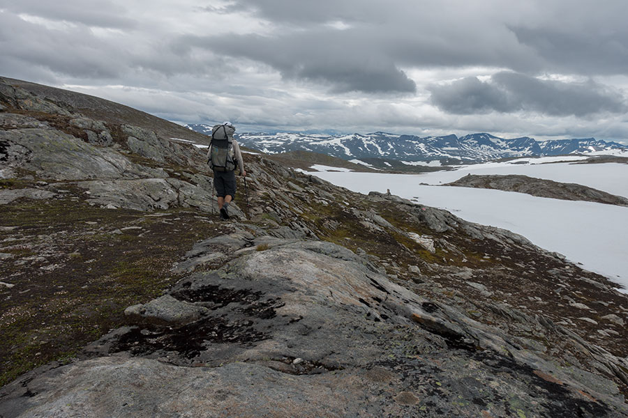
I feel like spending the night outside is the number one thing at building confidence and making me feel comfortable in the place. Come morning, it’s like I already belong in the outdoors and that makes me feel fine. I still welcome the quiet and stillness in the early hours as I head south and upslope towards Mellomfjell but the sky soon turns into different shades of grey. The climb offers great views to the sea of snowy peaks over to the west.
Mountains all over the place
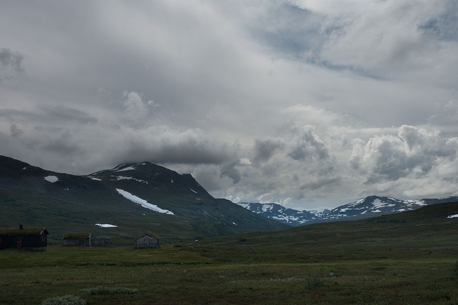
Mellomfjell is beautiful, a high area with peaks, lakes and snowfields. With not a hint of human presence around, it feels remote. I cross three different lake basins in a rock world of deep silence.
At a nearly 1400 m pass I start coming down from the highlands towards Storlidalen (that’s another valley). The view southwest shows another set of mountains and a dark sky.
Renewing the views
Down at the valley there’s a hut complex at the end of a road, there’s also a DNT hut (ie, one of those I can use with my membership) nearby together with a forecast for rain later in the evening but at the time I’m going through the weather looks almost the best it’s been throughout the day with some patches of blue sky so I have it clear that I will keep going with the option of a long day and a hut stay at the end if the weather turns south. The crossing of Mellomfjell however has taken me longer than expected and I’d need to hike hard to keep the hut option viable. That’s when trouble begins.
Trouble number 1 is these odd sore spots at the ball of both of my feet. It takes me a while to realize it must be blisters! I can’t even take the time to stop and check but I can recognize the pain even though it’s the first time ever that I get them while hiking in soft shoes. I have it clear there’s nothing I can do but keep going and I also have it clear it’s gonna be a painful two weeks ahead.
Trouble number 2 is it starts raining. It’s cold, windy and wet. By the time I reach the Storlidalen headwaters and cross over to next valley Innerdalen, I feel miserable and start missing the huts I had left behind a couple of hours before.
My plan for the day was to start going down Innerdalen, then turn south across the range on the true left and cross to the next valley, maybe reaching Eiriksvollen hut if the weather was too wet. It didn’t look like an ambitious plan at the beginning of the day but now it does. I do a quick map check to verify that there’s another hut option down the valley, roughly the same distance but all downhill with less exposure. It means going off my planned track (not off-trail) for several kms but it looks like the safest option.
When I go through the expected junction I’d take if I’d follow my planned track, I find no such junction, I see no trail on the opposite valley side, even when the Norwegian topo map shows one, and no bridge over a huge, raging, seemingly unfordable stream. If I had any doubt, the trail took the decision for me, I’d keep the valley route all the way down to Innerdalshytta. It was gonna be tough enough.
There are not many pics for the following several hours. It’s still raining. Innerdalen is a spectacular valley but the trail is a non-stop boggy mess, progress is slow, I’m tired and miserable and the only thing that keeps me strong is the promise of a hut at the end of the day.
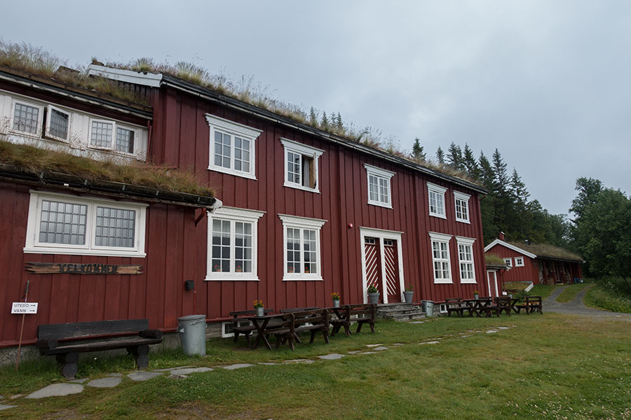
I reach Innerdalshytta exhausted beyond belief but then I enter a sort of paradise. It’s a stuffed hut, hence closer to a basic hotel than to a mountain hut in the classical sense. I can have a hot shower, a hefty, albeit rushed dinner and a gear drying room, not to mention a sleeping one. Misery is over for now.
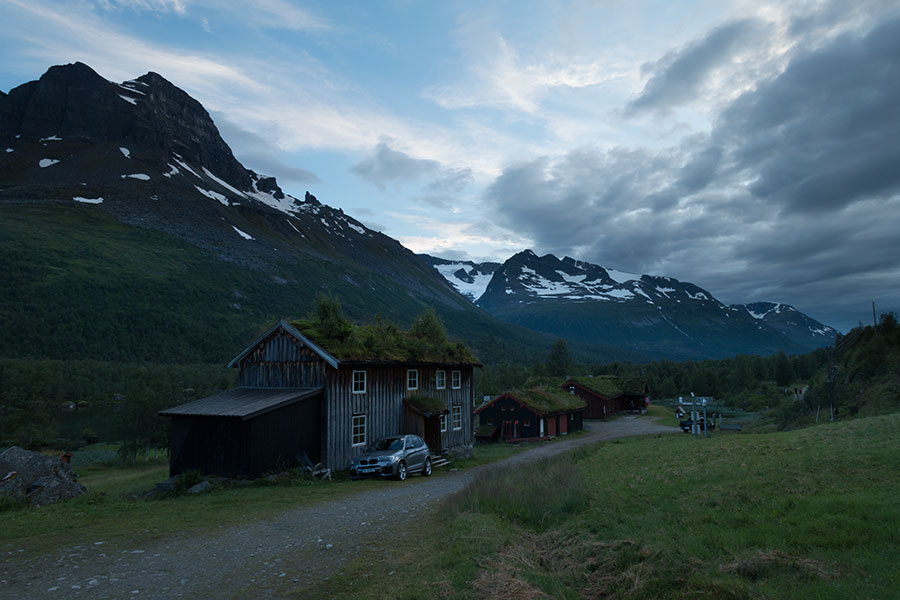
The hut complex at Innerdalshytta
Day 4
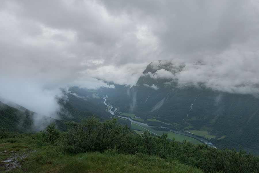
In the morning, I look closely to the weather, both the sky above and the forecast posted on the wall at Innerdalshytta. The sky is overcast but rain is not expected until the afternoon. “Not too bad”, says one of the hut staff guys but it does look bad to me from the information on the wall. Never mind, after the previous day’s beating, I feel fine with taking it easy and just make it to the next hut, Eiriksvollen, thus rejoining my planned track. I’d just need to hike up from the depths of Innerdalen and across a low spot on the southern flank of the valley, then down Sunndalen. Too easy, I’d guess, but past Eiriksvollen the following hut option would be too far away.
Another relevant factor I hadn’t paid attention to so far is that Sunndalen is not any other valley: it’s a main one, holding a road, separating Trollheimen from Dovrefjell and it’s a deeply glaciated valley with a marked U shape that I’ll need to cross at real low elevation, below 100 m. Eiriksvollen hut is near the valley floor and there’s an 800 m vertical drop to get there in less than 3 km. The trail depiction doesn’t show much in the sense of switchbacks so it’s gonna be a steep one to climb down.
Still, it’s a meagre 15 km to Eiriksvollen, less than half my typical daily distance. I promise myself to stop there unless under radical blue skies and no hint of upcoming rain. To keep going would mean another 3 km, 1000 vertical meter climb on the opposite side of the valley and a 30 km day all in to get to the following hut. Leaving Innerdalshytta under dark, grey skies doesn’t encourage me to go for it. Plus, getting the hut breakfast, which is something I wouldn’t skip, means I can’t even do a very early start.
I take it easy and prepare mentally for a short, easy day. It turned out not that short and certainly not easy.
Climbing up from Innerdalen was fine, getting above the tree line offered the views but only for the valley while thick, low cloud hid all the peaks. I waved goodbye to Innerdalen and headed across the hanging valley. At around 1000 m high, it felt desolate despite the grass cover.
On the other side of the pass/hanging valley, it’s the Sunndalen abyss. The view from the edge must be truly spectacular but the cloud is too low to let me see anything. Luckily, I don’t miss it all though, there are brief, partial clearings and I need to be quick with the camera.
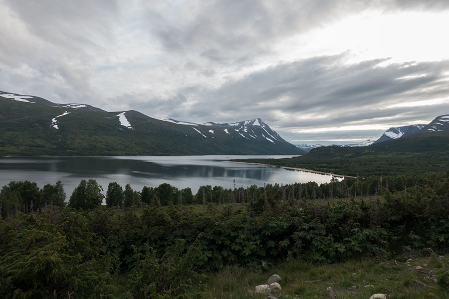
Sunndalen down there
Sunndalen
Just before I start the big climb down, it starts raining and I don’t care because it actually helps me accept it’s gonna be a short day.
The trail is narrow and steep but above all it’s slippery as in maddening-slippery. It’s a very good thing that I can take it easy, I keep thinking how hellish this section would have been if I had attempted it the previous day by following my planned track to Eiriksvollen, late, exhausted and miserable, it’s tough enough with no more hurry than how wet I’m ready to get before I get to the hut.
Let’s say I don’t care much about getting wet knowing I’ll have a dry place later but I do about getting all muddy so I make a conscious effort to avoid slipping. Quad work to hold my weight while stepping, careful footing, one step at a time and take a lengthy time, I tried it all but I still fell 7 times (I did the actual counting). I made yet another conscious effort, this time to avoid feeling pissed off.
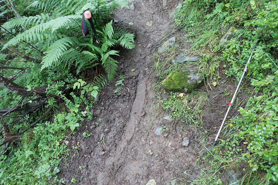
Poles as they landed, the one on the right works for a slip length reference
But I was heading to a hut and it was like I should feel like nothing could go wrong. The feeling lasted until I needed to accept I was too miserable and, yes, also somewhat pissed off.
I got to Eiriksvollen after 7 hours. I welcomed the generous porch so I could take my pack off out of the rain and dig in its depths to find the key. Then I entered paradise.
I was on my own in the hut and, once in, everything was fine again. Got into dry clothes, lighted the fireplace, hanged all the wet stuff to dry and relaxed. I still had several hours of daylight ahead to think about the value of the huts and my own limitations to face the conditions, be them in the gear, the skills, the mindset or all of them.
It felt comfy and safe in Eiriksvollen and it was a charming, comforting time.
 RSS – Posts
Say what you want