
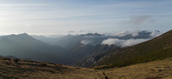
I wake up to a dry tarp and a view of a frosty valley below, fully endorsing yesterday’s camp choice. Actual site and orientation missed the best mountain view but I could see sunset and sunrise instead:

Good morning
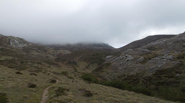
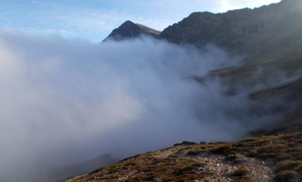
Today’s inversion includes a sea of clouds on the northern side, which is hidden from view from my camp so I do my morning chores unaware of their rising and hitting my area. I finish packing and climb the few meters that separate me from a northern view to find fog clogging my route down:
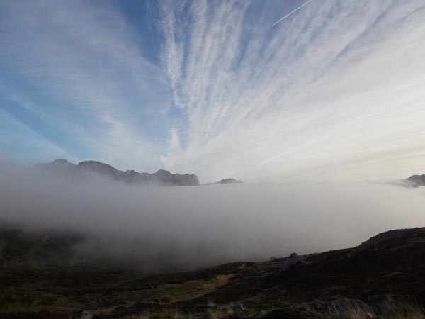
The sea of clouds coming over me tsunamy style
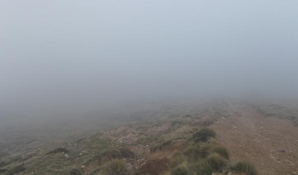
After six days of blue skies in a row, this is outstanding news. It’s amazing how such a little twist can change things so much: I scouted the route down yesterday evening and it looked straightforward. Not anymore. I need to use map and compass and pay attention to avoid descending into the wrong drainage. Eventually I emerge from under the cloud by the time I’m already close to Pandetrave pass.
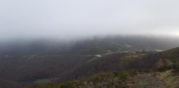
Coming under the clouds, Pandetrave road pass below
Pandetrave pass: joining more dots
The Pandetrave Pass road is the other (shabby) access into Valdeon valley: a narrow, winding road over a high pass, no wonder why these valleys keep their charm. Valdeon drains north but there’s no road access over there: drainage is on a 15 km long gorge with mile deep vertical walls on both sides. It’s the Cares gorge and it’s got a super-popular, super-spectacular walking trail along it -in case you care. Mind you, it’s a busy trail.
My watershed route is best for solitude. I haven’t met another hiker for 4 days now.
The divide takes an odd course here with a wide arc to the north and back. That’s probably why trip reports for the area take the road south to later regain the crest on a side valley. I’ll do the same. The road is empty anyway.
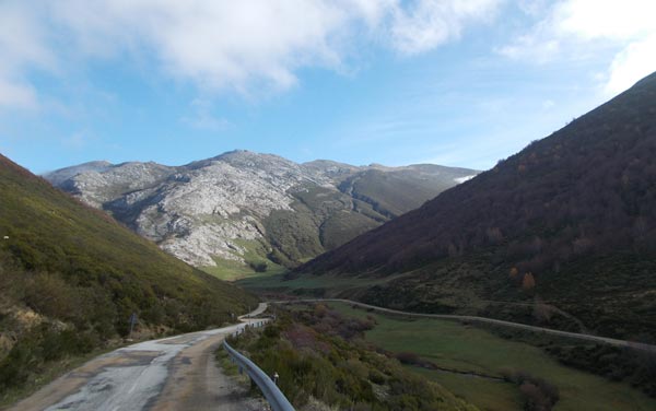
The Pandetrave Pass road. The divide crest in the background
Actually the only trip report I’ve checked for this section doesn’t try to get to the crest as soon as possible at all. It means to climb the highest peak in the area instead, even at the cost of adding road walk and overall length to the trip. On a clear day, I’d have probably left the road earlier on a more logical line back to the crest but the low cloud advices to stick to the valley routes for as long as possible.
I eventually leave the road to enter a narrow valley. Cold air has notoriously glued itself here as I clearly feel but also measure: I record a temperature drop of 13 degrees centigrade!!! compared to the wider valley where the road is. Far from a problem, the single digit temp is a blessing to avoid sweating in the steep access track.
The valley eventually opens up to sun bathed meadows as the clouds have progressively retired back to the north. Close to a million cows are grazing here. A couple of bear-size shepherd dogs send warning barks. These dogs are fortunately clever enough to discriminate aggressors from simple passers-by. I also gather interest from the cows, an assorted bunch:

No idea which species is the native one
The day has turned a bucolic stroll on a green valley flanked by the ubiquitous limestone. There are good tracks all the way up to the cattle herds grounds, some OK paths after that and the route to the headwaters also leads to the Coriscao peak, which is my current, short term goal.
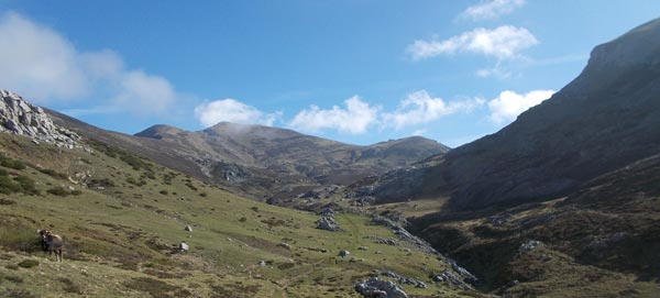
Coriscao peak at the far end
Then the scene changes back: clouds make a comeback and cover the hilltops again, starting with the summit of Coriscao, then the whole divide crest.
It got dark again. Coriscao peak not visible anymore
The plan was to climb Coriscao and proceed on the crest from there but this is a very bad idea in the fog when there’s a lower level alternative that so far is cloud-free. I veer right to a saddle over a shoulder of the mountain so I can skirt around, all on tracks. New scenery awaits:

View ahead: mighty peaks coming up
Down there there’s a trunk road that I’ll need to cross. The mighty peaks in the background are the next section of Cantabrica and a very interesting one.
The Fuentes Carrionas massif stands out as the last great barrier of the Cantabrian ranges to the east. It’s a prominent group of mountains just south of the divide where limestone gives way to other kinds of rock.
It feels great getting here: I know the area from previous trips and I’ll be glad to hike here again. I also feel confident because these mountains are much too steep for a crest route so a reasonable itinerary goes over less exposed terrain and mostly on trails. The wimp in me is happy to be here.
Queensland
The word would remind me of Australia but it is also the direct translation of the spanish “Tierra de la Reina”, incidentally the name of the valley at my feet and surrounding land. It’s a harsh region of cold, long winters due to the altitude and the northern exposure. Everything is kind of rough in this Queensland.
I take the chance of walking on a wide track to make a good time coming down.
The road below is a primary one but it appears completely deserted on a friday afternoon. It feels like some cataclysm had blown humanity away and it was only me left. I wouldn’t feel that way deep on the trails but a trunk road is the place where I’d expect some movement. There’s none.
Eventually a couple cyclists show up. Maybe it’s been only a motorized vehicles cataclysm then.
I get back to the actual crest at the San Glorio road pass:
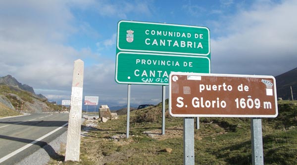
San Glorio pass on the divide
I take a quick look at the northern deep valleys and leave the tarmac to get into big mountains again.
Fuentes Carrionas
The way into the Fuentes Carrionas massif can’t be more spectacular: a sudden chasm in an otherwise impenetrable wall. I’m sure there’s some epic legend regarding its origin.
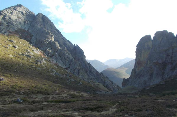
Boqueron de Bobias, the hidden way into the massif
The gap gives way to the Naranco valley, a lovely place and a personal favorite of mine. The owners of the world planned to obliterate the area and build a ski resort here. There must had been some good side to the financial crisis thing that sent the project into oblivion. The headwaters cirque is magnificient. I’m super happy to see these green meadows again.
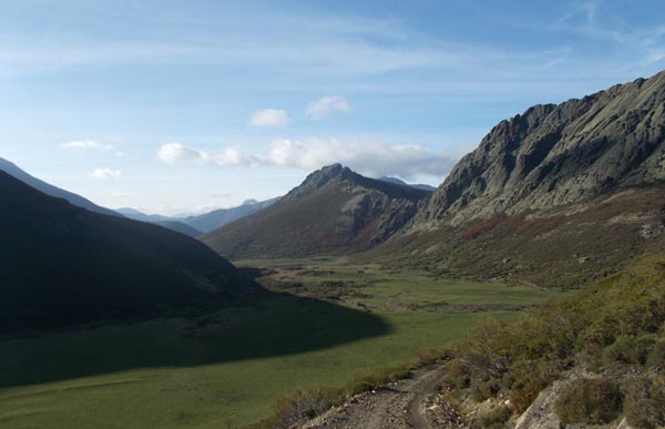
Naranco valley headwaters
I see cows and horses, which I would expect, and hikers, which I wouldn’t. It’s the first hikers I meet since 4 days ago! A group of three coming down. I think they didn’t even see me. They probably didn’t expect anybody climbing up this late.
I’m happy to launch the not-strictly-cresty leg of my High Route by crossing the divide over a high pass. The climb offers fantastic views over a sea of mountains to the west:
View towards my past
The sky is clear but I can see clouds peeking behind the saddle which has me a bit stressed… with a reason. I top the saddle to find a thick wall of cloud bumped against the northern sides:
View towards my upcoming future
Don’t panic. I know area and even though the climb has been off-trail, I remember a good track on this other side. It starts just down from the saddle. I take it hoping it’s indeed as good as I remember it. Seconds later, lights are off and I feel the cold embrace of the fog.
The trail is actually a rough dirt road that looks quite out of place this high in the mountains but it’s my lifesaver. The sun’s out already and the dense fog feels particularly dark.
Walking into nothingness
I hold my breath when the track faints at a meadow crossing but it resumes nicely on the other side. After an odd, unexpected ascent (that I’m reassured to verify on the map), it starts coming down to my intended destination for today, a huge highland meadow flanked by mountains all around. It’s a spectacular place but I can’t see anything today.
A herd of horses is the only thing that makes the place alive. It’s very odd because I can’t see them even though they’re around, all over the place. I can just hear them. Feels like they’re calling each other, which would make sense.
It’s very dark when I get to the meadows and the feeling is otherworldly. The track goes along a shepherds hut and I seriously consider staying inside… it’s open, unoccupied, very basic and in good shape. The first thing I meet when I open the door is a resident mouse hiding away though and I clearly see I prefer camping out despite the grim ambience. That’s right cos that’s what I came here for.
The meadows don’t feel very welcoming tonight. I make myself comfortable in a clearing of a bushy area instead of in open grass. I realise it’s because I look for shelter! It may be silly, it probably serves nothing, but I’m fully aware that’s what it is. A wimp hiker’s mind works in mysterious ways.
Then as soon as my shelter is up I feel good and somehow reassured it’ll be a good night. I smile to myself.
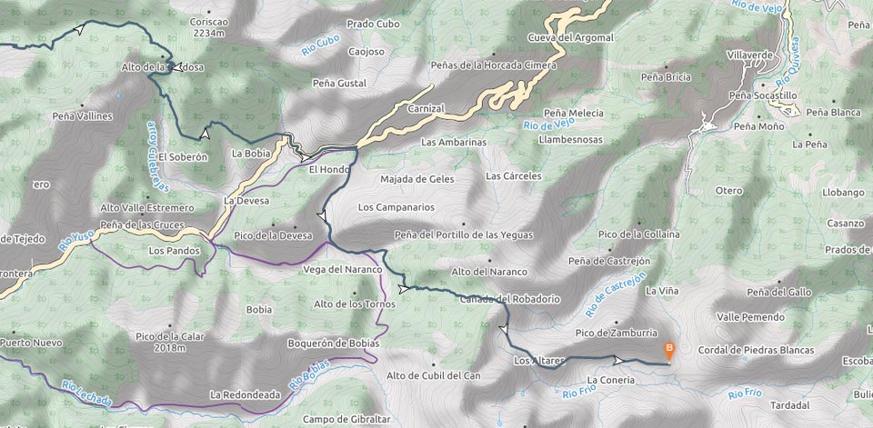
Maps & Track
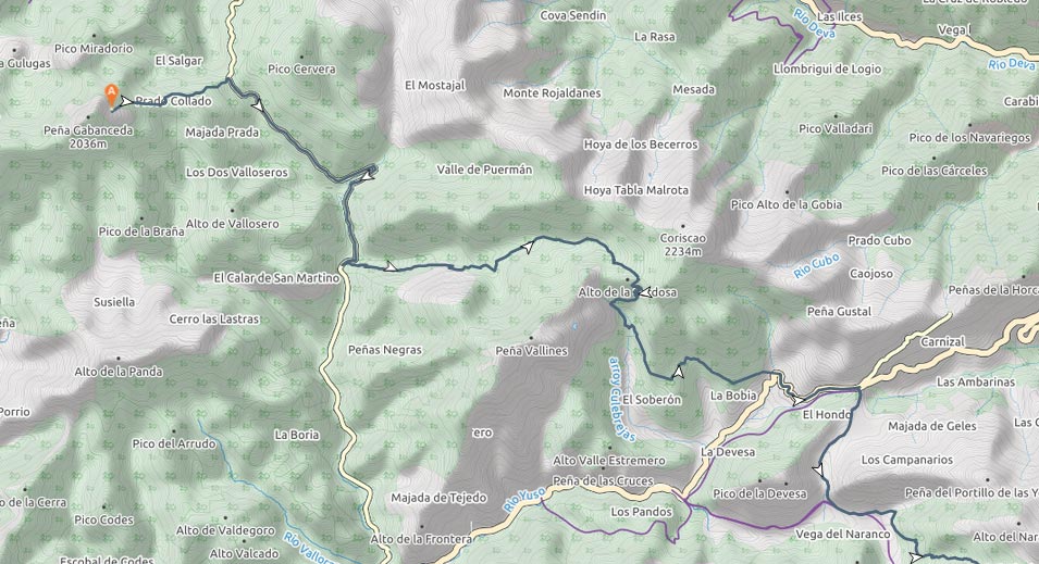
Part 1/2
Part 2/2
 RSS – Posts
Say what you want