
Via Alpina 1 is the newer name for the trail formerly known as the Alpine Pass Route. It goes East to West along the northern edge of the Swiss Alps from Liechtenstein to Lac Leman for a length of about 360 km, more or less depending on a few existing options.
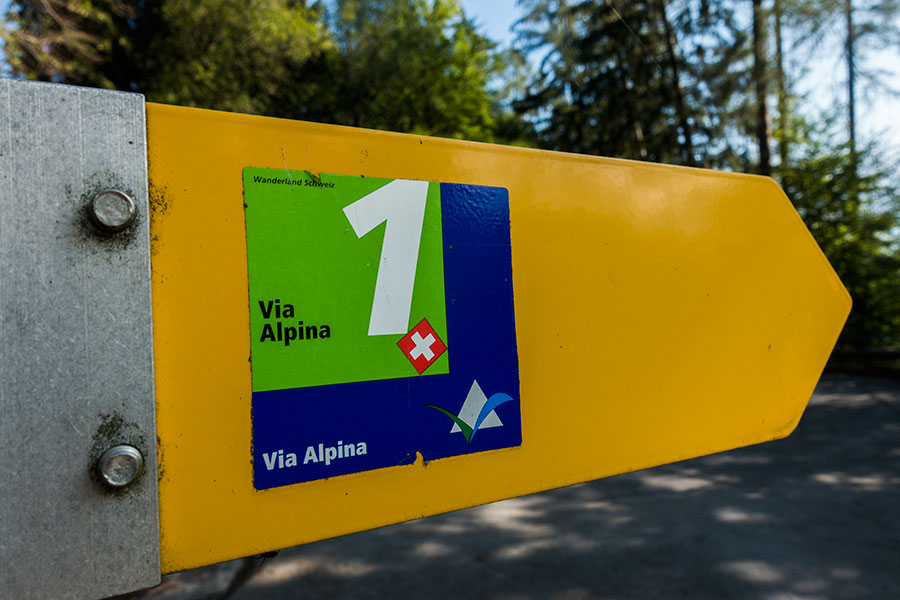
Via Alpina 1 sticker
There must be a million+ resources for this trail already on the web. I mean to offer here a view of most interest to thru-hikers, bum-like hiker trash. Please beware I didn’t hike the whole route but about 2/3rds of it which is as much as I could fit in my 1 week window.
The Via Alpina
The Via Alpina project is meant to devise long distance routes across the Alps over existing trails, taking over them, linking several of them, possibly building connecting trails where a continuous route meets a gap?
The idea behind the Via Alpina is to provide opportunities for hikers to go long distance and experience the alpine environment with no need for technical equipment or training, at least during the summer season.
There are 5 routes, identified each with a color. They tend to feature that color when drawn in a map. The Via Alpina 1 takes the Green.
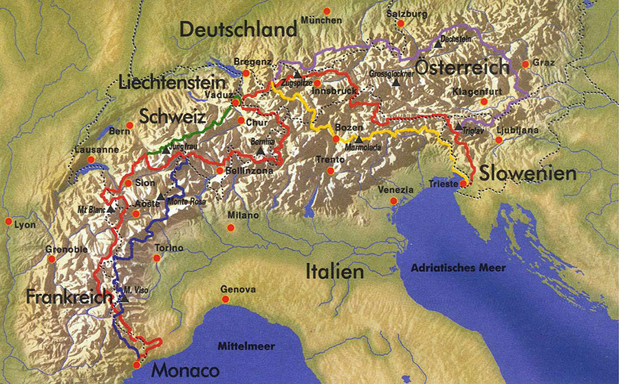
Green, Red, Blue, Yellow, Purple, the five Via Alpina trails
Via Alpina 1 – Alpine Pass Route – The Green Trail
The Via Alpina 1 traverses east to west across ridges and valleys aligned north to south, all of them north of the main alpine watershed, draining north to the Rhine except for the westernmost stretch that drains west to Lac Leman and the Rhone. The yellow line in the map below shows the watershed:

By W like wiki – modified from File:Hauptkamm.jpg (map with watersheds) and File:Alpenrelief 02.jpg (borders), CC BY-SA 4.0, Link
It is not a high route, thus avoiding glaciers or permanent snowfields. It visits every valley at village height, way downstream from the headwaters. It runs over good quality trails all the way.
The Via Alpina 1 falls entirely within Switzerland except for a short stretch in Liechtenstein on the east end that wasn’t part of the original Alpine Pass Route and seems to be there as part of the Green trail to provide a link to the Red trail.
Terrain
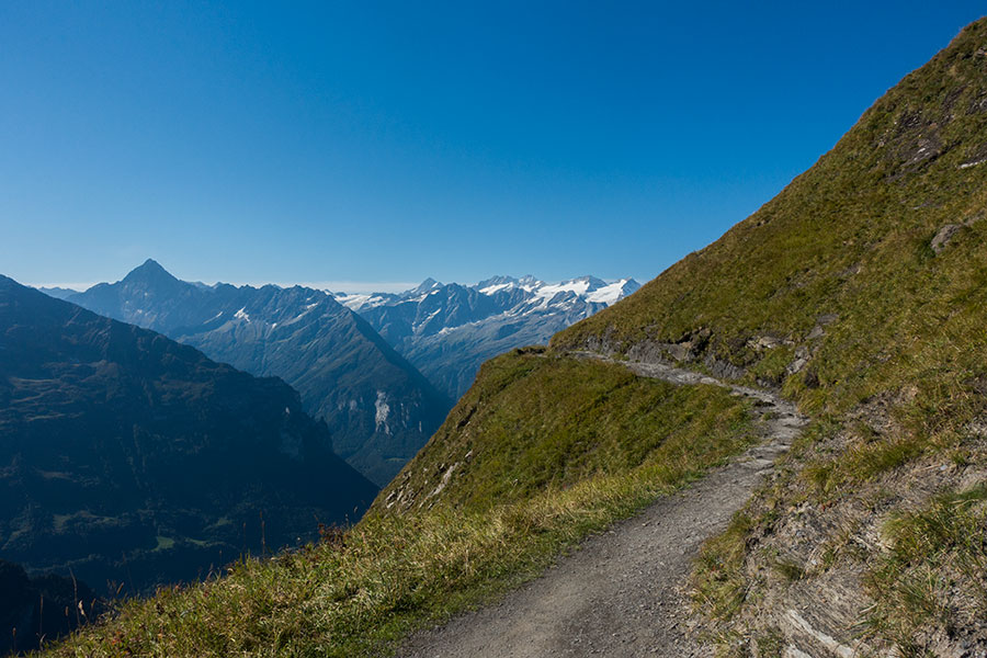
The Via Alpina 1 is classic mountain terrain, a rollercoaster series of valley – pass – valley – repeat. Valleys are mostly between 500-1000 m. high, the passes between 2000-2800 m. The climbs are long, a 1500 m. gain/loss is about normal. There are steep sections below some of the passes. There are also steep sections down to/up from the valley bottom. These valleys are often glacial U-shaped with very steep walls. Sometimes there is a side valley where water has carved its way down to the main valley floor and the route uses this to ease the climb onto the upper platforms. Sometimes the climb up from/down to the main valley is over the escarpment of the glacial wall, then it’s steep. The trails are always well engineered but climbing out of the valley bottoms used to be a tough, sweaty affair.
Woods sections are found in these lower areas, higher up it’s meadows and rock. Woods are heavily impacted by cattle grazing meadowland and even steep slopes have been devoid of trees to make room for grass.
Once out of the main valley, the trail would often level out to a series of meadows and hillside traverses before the final climb to the local pass. Most passes were wide and grassy with a few of them, namely Sefinenfurke, Hohturli and Bunderchrinde a narrow notch on a rocky ridge. Trails were very well engineered in such cases, with rock steps and occasional rope holds to avoid any tricky climbing.
There’s little flat hiking on the Via Alpina 1. I had the impression that I was always going up or down. Your legs will get strong.
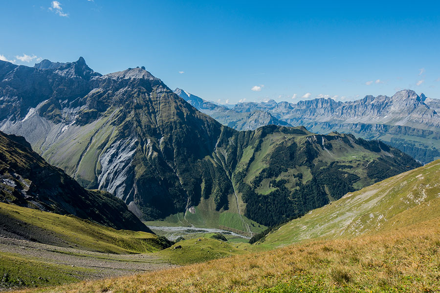
View from Richetlipass, day 2
Iconic sights
If you’re about hiking in Switzerland or doing anything in Switzerland, you’ll wonder if some of the Swiss icons fall near your route and if you like mountains you’ll be familiar with at least these two that you’d skirt while hiking the Via Alpina 1: the north face of the Eiger and the Jungfrau massif. Sorry, no Matterhorn/Cervino, no Monte Rosa or Mont Blanc.
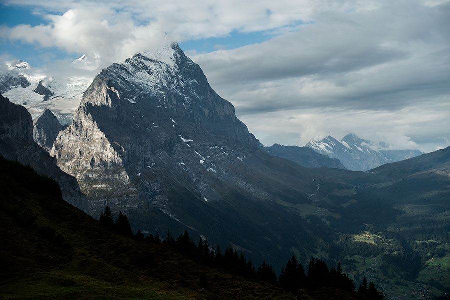
The north face of the Eiger
Direction of travel
All routes have a character of their own and the preferred direction of travel is often part of it. On the Via Alpina 1 it is east to west. All travel resources that I’ve checked, including the guidebook I used, use that direction. I may guess from a western perspective this feels like walking home.
Hiking in the opposite direction would be equally fine. Access to/from trail start/end is just as easy.
Hiking window
This is a summer-only trail if you mean to hike on dirt all or most of the time. I hiked in mid September, found no snow and mostly stable weather.
Hiking conditions I met in September
I had a week of mostly blue skies, little wind and warm temperatures. Storms started brewing towards the end of the period with a heavy, 15 minute dump during one night and a very unsettled day following with afternoon cloud buildup leading to overcast sky with light, occasionally moderate rain.
Temperatures were uncomfortably warm at times even though I partly blame my hiking clothes choice for the discomfort.
The Alps are a surprisingly damp place given the inland location. Hiking uphill used to be a sweaty affair and campsite selection was tricky if I wanted to avoid condensation.
Route finding
A non issue. Unless buried in snow, the route is already found. Your biggest orientation challenge would be navigating the mesh of trails in lower areas but even that is easy thanks to the excellent signaling.
Not all who wander(weg) are lost
Maps
Finding maps for this route is not a problem. The outstanding question is whether to take any.
I wouldn’t like to be in the mountains without some form of mapping, no matter how well marked the way is. This route might be a good opportunity to part with paper maps and go digital only as the potential for catastrophe is low.
I still took both. I’d have enjoyed playing with the paper maps while on the go, at stops or in camp as I usually do but I didn’t have such opportunities on this trip so my paper maps were largely unused. The digital maps did see some residual use to check progress and doing estimates and only once were of sort of critical value when I missed my branch at a junction.
If you still want paper maps, don’t skip the following text because I found some misleading information out there.
I went for the 1:50K series from the Swiss national mapping authority. There is a whole series specific for recreational pursuits identified by a T character after the grid number. This is the list of sheets you’d need for the Via Alpina 1, Sargans to Lac Leman for a total of 9 sheets in light brown cover:
237T (Walenstadt), 247T (Sardona), 246T (Klausenpass), 245T (Stans), 255T (Sustenpass), 254T (Interlaken), 264T (Jungfrau), 263T (Wildstrubel), 262T (Rochers de Naye)
If you wanted to hike the Liechtenstein section, you’d also need 238T (Montafon)
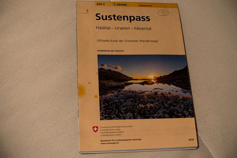
255T Sustenpass
The guidebook I used lists two sheets from the non-recreational grid (5004, Berner Oberland; and 5009 Gstaad Adelboden. Light green cover) while omitting three of the above (254T, 264T & 263T). I don’t see any advantage to this. The non-recreational sheets cover a wider area and the two stated maps weight about the same as the three missing ones while the trails’ representation lacks detail. The trails are mostly there but with no identification, which is a major bummer in an area with a high density of trails. Go for the full list of T maps.
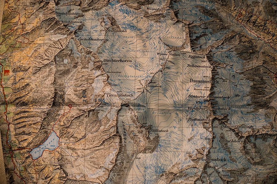
Swiss maps are famous for their accuracy and quality. I won’t argue any, however they’re not my favorite. I found them choked full of information to the point that I found it difficult to interpret the terrain. I prefer less rendering and more focus on plain contour lines. They’re beautiful maps anyway and now part of my collection.
Map detail
On digital I used the Alpine Quest app together with Open Topo Maps topo layer and a trails layer were the Via Alpina was shown.
Guidebook
When there’s a Cicerone title covering the route, I usually look no further. The Via Alpina 1 issue is the usual quality and it’s compact enough to take on the trail.
Access
The Swiss public transport system is beyond excellent, based on a thick railway network that reaches far-fetched places and bus links pretty much anywhere else. The rail network is thick in both coverage and frequencies so it seems it works as a hop-on/off with no need for reservations. The final touch is a user friendly rail connection search engine that delivers quick and accurately. You could just show up anywhere in Switzerland, find your connection and get anywhere else.
If you’re flying in, the most convenient airports for both distance to trail endpoints and density of international connections are Zurich and Geneva.
I flew into Zurich and took a train to Sargans, started hiking from the train station. I flew out of Geneva where I had planned to get on the train from trail’s end in Montreux. My hiking took me only to Adelboden but a quick search was enough to deliver a valid connection: short bus ride down the valley to the railway line and a fine connection to Geneva via Bern.
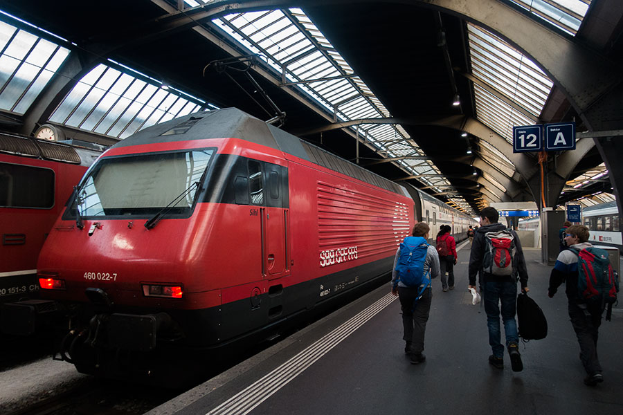
Zurich to Sargans and Chur on a Saturday morning, lots of packs and boots
There’s public transport in every valley the route visits. You can leave or access the trail anytime.
Trails
A mix of hiking trails, dirt roads, AWD worthy tracks and a reasonably limited amount of tarmac. Dirt roads sometimes reach high in the mountains.
The trails are very good quality, straightforward to follow all the way. I found no single point where the route wasn’t clearly visible even in foggy conditions. In mid-September, I found virtually no snow.
The Planplatten trail, riding high above the Gental with the Wetterhorn massif in the background
Signaling
Once again top quality in all accounts. Lower down there’s lots of junctions and the direction of travel was always clear by way of signaling posts bearing multiple, named direction arrows, sometimes lots of them. It is remarkable how the arrow alignment was always spotless, even in tricky junctions with multiple branches departing in only slightly different directions. The Via Alpina is almost always present in the form of a discreet sticker but it’s good practice to be familiar with the place names coming up in your intended route as they’ll be featured in the signs together with an estimated time of travel.
The signs don’t mention mileage, only time. I found the time indications surprisingly accurate and consistent throughout the trip.

The Via Alpina 1 stickers get their own arrows at the Sefinenfurgge signpost
Higher up there’s less junctions and less signposts and it’s red-white-red paint stripes that take the job. They seemed to always be there when you needed reassurance.

Coming down Sefinenfurgge in the cloud
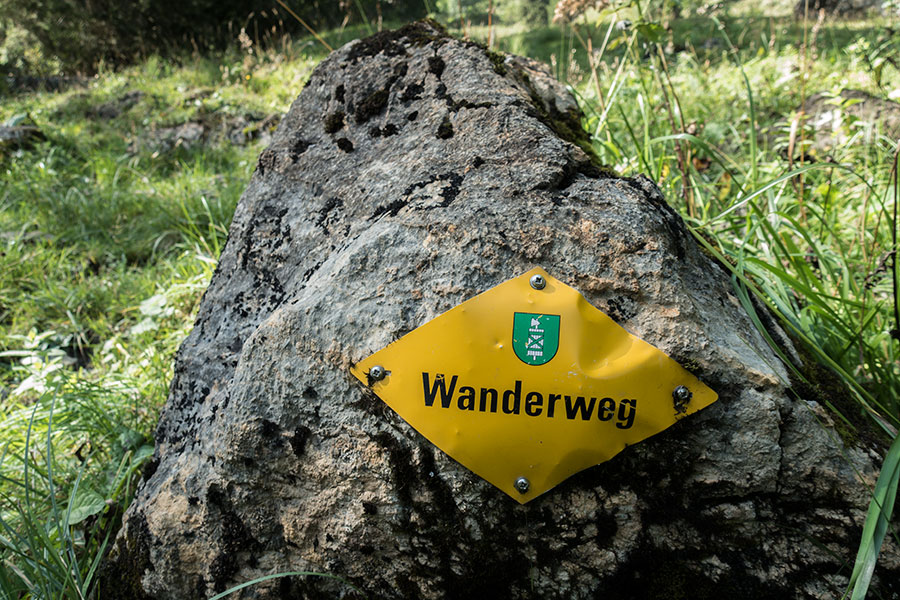
Another familiar presence is the diamond shape, yellow plaque stuck to a tree or rock (also buildings or other vertical supports in urban areas) bearing the Wanderweg sign meaning you’re in a public path.
I didn’t make it to the french-speaking, westernmost part of the trail, I could expect french wording taking the place of german but I can’t confirm first hand.
Supplies
Resupplying on the Via Alpina 1 is as easy as it can get. The trail visits valleys and villages on a daily basis and there’ll always be some town big enough to offer basic groceries at the very least while many of the locations will have supermarkets and a wide offer of shopping, including outdoor stuff.
You can, actually must try local cheese from the farms en route. Cheese is a trail staple (certainly for me), tasty, packed with quality energy and a summer tradition in several European mountain areas where cattle grazes the high meadows and cheese is made on the spot. You can’t get any more glamorous for trail food shopping.
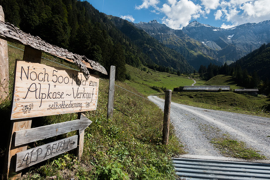
Alpkäse
Apart from the villages in the valleys, there’s a huge offer of mountain restaurants, some just up the hill, with road access, many others on the trails. They’re all cozy, charming places with good, heartwarming food and can be a godsend in rough weather.
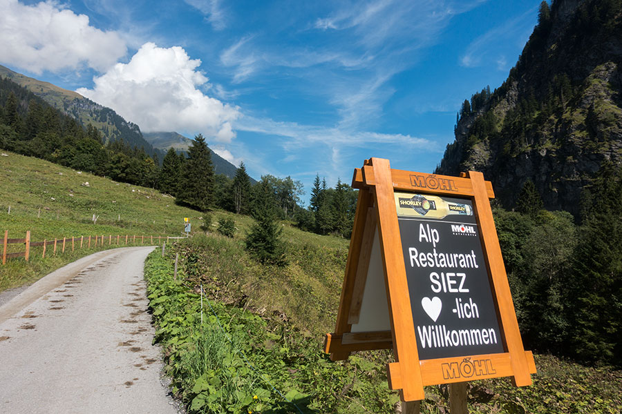
Alp Vorsiez, near the end of the road
I did only one major ressuply in Grindelwald and bought cheese in several farms along the way.
Lodging
I think I’ve never been on a route with more lodging options. It’s very interesting to note that there seems to always be some kind of basic accommodation geared towards hikers and mountaineers that’s an excellent value if you don’t need luxuries. There’s the walk-in mountain huts but also road-accessible mountain inns. Some of them are hut-like, some hotel-like but there seems to always be the option of a shared dorm. Most villages have also some similar option.
I camped most of the nights, only stayed in town once (a super nice hostel in Lauterbrunnen) and also once only at a mountain inn (berghaus) in the Blumlisalp area on the day I was feeling too sick to stay in my tent. Both places were lovely and welcoming.

Matrazen Lager is local for Dormitory Room
Campgrounds didn’t seem to be the best option. Some valleys didn’t have any. I only stayed in one town site on the last night of my trip and it turned out mine was the only tent, the rest were all caravans. I also used a basic, just off-town site on my first night that had nothing but a toilet.
Wild camping
Wild camping is apparently not legal anywhere in Switzerland, which is not a good start. I still can’t fathom how something so basic to human powered travel can be not legal, as if it was anything harmful. That said, and as it’s often the case in many regions, overnighting seems to be well tolerated.
You’d need to go really up high to get away from human print but that’s not the only option. I camped in several other places, including a cattle meadow and a village side, valley location. Never had a problem, slept very well every time.
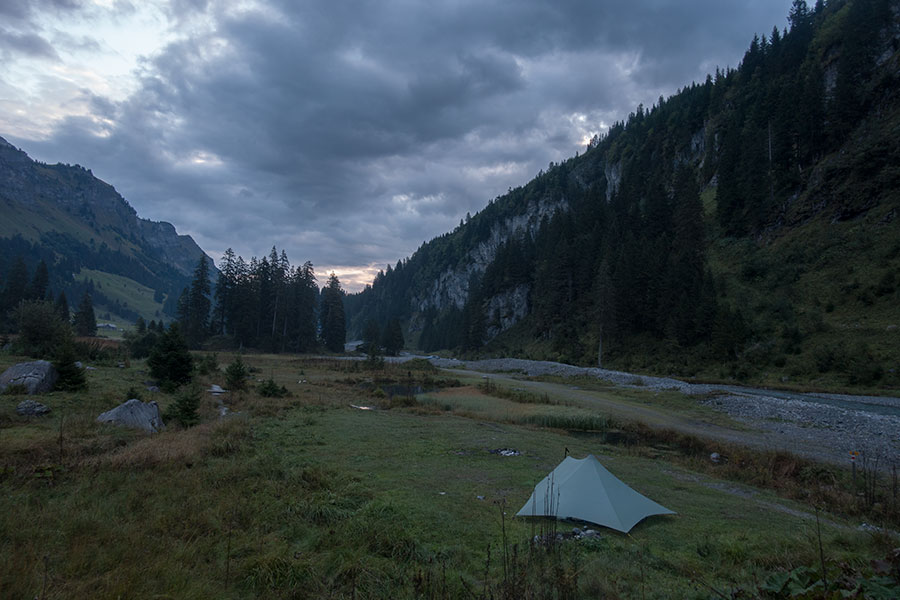
Dawn day 3 near Urnerboden
Water
A highly humanized environment is good and bad for finding drinking water on the trail. On the plus side, there are lots of water troughs where water is piped from some spring higher up. On the minus side, cattle is everywhere and you need to get very high to make sure a running stream hasn’t gone through cow pies. In general, if taking water from streams, you need to get very close to the actual spring to consider it safe.
Many of the available troughs are meant for cattle and in that instance I wouldn’t be sure I can trust the water quality as you won’t usually know where the water is piped from. I drank from all troughs I met if I was thirsty. I’d like to say I was fine but I was actually sick for at least one day and I won’t know if it was from the water I drank.
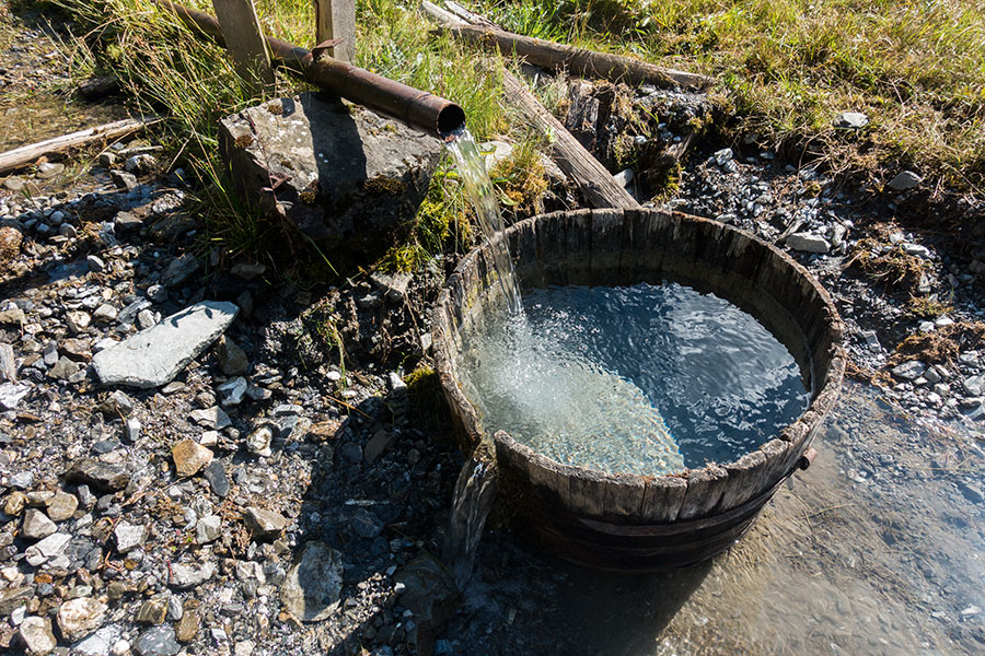
Is there anything better than cold mountain water when you’re thirsty?
Other than the cattle contamination factor, finding water is hardly ever a problem. I’d carry 1 litter at a time during the day and that’s considering I was drinking a lot. I’d only pay attention to potential water sources by the end of the day if meaning to camp in lower ground, then I’d might take care of carrying a couple liters for a while.
Waterfalls
Glaciers carved deep U-shaped valleys in this area. When a side valley didn’t make it as deep, the confluence had a vertical gap. When water meets a vertical gap, it falls.
There are many waterfalls along the Via Alpina 1. I particularly remember those tall, vertical, bridal veil style ones where water falls gently and moves sideways with the breeze. By their own geological nature, they’re mostly found in the lower altitude sections of the trail, sometimes close to villages.
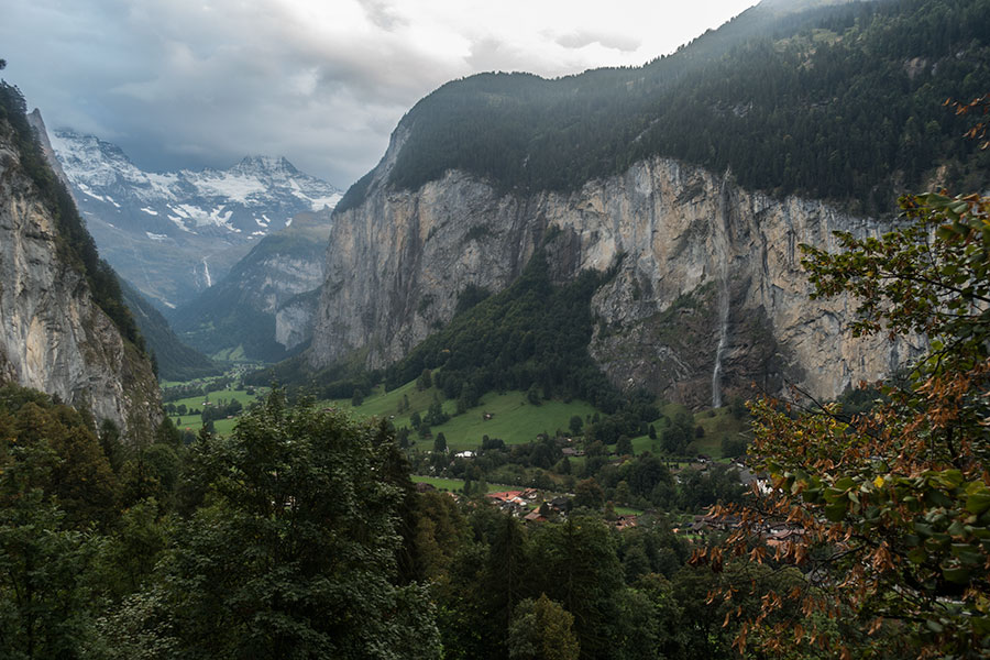
Falling straight into Lauterbrunnen
I took several dozen pics of the first such waterfall I met. My pictorial enthusiasm would quiet down after realizing it was an almost daily event but then it became worthy of this paragraphs.
Section skipping
The public transport network, including the cable cars, offers endless opportunities to skip sections of trail. This may sound very alien to committed thru-hikers and so did to me at the beginning of the trip. Even though I didn’t skip anything, it was so commonplace that I got used to the idea. The guidebook not only mentions but even recommends skipping certain sections, mostly in the lower areas.
I hiked a continuous hike and didn’t find any section that was terribly annoying. Tarmac walking was mostly on village streets, limited to very few miles at a time and in an urban environment with its own distractions, i.e. there’s no road walking, so to speak. Valley sections were interesting and often scenic. If anything, I’d have welcomed sparing the sweaty climbs but for the sweat, not for the climb. In the end I think the entice factor in skipping is a clear case of the facilities devaluing the walking as if the latter is not interesting anymore. I don’t know how a thru-hike would feel if skipping sections but I see a potential problem in that it may be difficult to know where to stop skipping. You may end up walking only half the route.

Postbus getting high into Obererbs, day 2
The Alps
I actually didn’t know where the word came from before this trip. The Alp is the traditional, high meadow location with a hut for the summer season cattle farming. It’s the very same concept I’ve seen in many other mountain areas in Europe, getting different names depending on the region.
Many Alp locations along the Via Alpina 1 are now in between cattle shepherding and tourism and they all have a distinctive name that stands out as a trail feature as much as passes or villages.
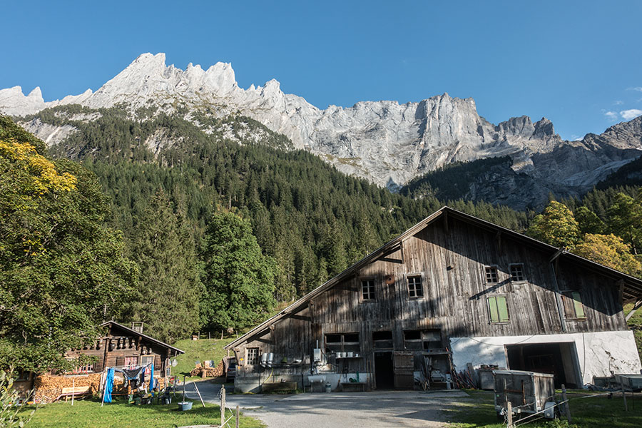
Rosenlaui Alp at the foot of the Wetterhorn
People
The Via Alpina 1 stands out as a busy route. I don’t know how it is in the summer peak. In mid September it was reasonably quiet. Weekdays had low traffic, mostly senior hikers. Weekends were busier with a more varied hiker scene. I found it uncomfortably busy only a few times, always on the weekend and always related to some cable car or road access to a high, scenic area. On a couple of these occasions there were hordes of non-hiker public that would have started to feel annoying if I didn’t flee quick.
After late afternoon, trails would get very quiet and it made for lovely hiking.
I had only one verified encounter with another thru-hiker. I might have crossed paths with more but I didn’t engage in conversation and pack size/shape alone wouldn’t be enough indicator given all the facilities along the way that would allow thru-hiking with a day pack.
Trail life
It felt a bit weird going classic thru-hiker style on a trail like this where the main vibe is very different. Being showerless for a week didn’t feel straightforward anymore. Sweating a climb out would seem normal until I emerged at the restaurant in the upper end of a cable car and met people basking in the sun, beer in hand, looking immaculate. You get the picture.
I quickly adapted though. I identified those facilities that fit into my hiking style and indulged every now and then. Kaffee und kuchen (coffee and cake) made me feel like I was blending in, taking with me some trail essence beyond the plain hiking.
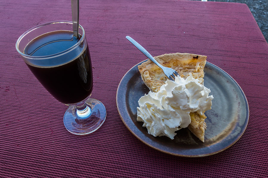
Kaffee und Kuchen
 RSS – Posts
Martin Malina
Great write-up! It brings back memories. When I was a kid, we went to Frutigen a couple of times and did day hikes from there. A lot of the names you mention are familiar – Adelboden, Grindelwald, Lauterbrunnen… Makes me wanna go back 🙂
Katie
This was really helpful! Thank you