
In the summer of 2022, I travelled in Norway to walk train station to train station between Oppdal, county Trondelag, and Hamar, Innlandet county, taking a high line across 3 mountain regions as well as National Parks/Protected Areas, Trollheimen, Dovrefjell and Rondane, and the high moors in the less renowned Hedmarksvidda region.

Rondane section
The third leg was about crossing Rondane, a well-known mountain region as well as national park. In this section of the trip, I keep moving inland and the environment changes significantly yet again with this move. Compared to the previous regions, Rondane is drier to the point that it’s not all either rock or bog, there are real dirt trails as they can be found in the central/southern European mountains. Orographically, Rondane is lower than Dovrefjell on average and the peaks are more prominent. The rock is dark and the scene rather bleak though this latter is an impression maybe influenced by the cloud cover and light conditions at the time.
In the context of the trip, going across Rondane proper took me barely 2 days but this text will cover 3 full days of hiking starting with number 8.
Day 8
On any normal day, I’d get up and start hiking early but the breakfast buffet in the Fjellstue is enough to justify a late start. Thru-hiking drains energy like mad and it comes a point where your body turns into a walking/eating machine. After a week on the trail, my body has certainly come to that point and pigging out goes from well-deserved to mandatory whenever there’s a chance. Very good quality stuff in Hjerkinn and the AYCE feature make it excellent value despite the famously steep Norwegian prices.
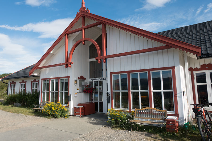
Hjerkinn Fjellstue
According to the forecast, the day should be dry and there’s no rain expected until the following day’s afternoon. The morning is sunny and calm, everything seems to work for me so I can have a relaxed time and I do.
After a while around the tree line, the route climbs gently beyond the trees and onto undulating moorland. The trails are smooth and there’s quite some hiker traffic, a clear sign this is a popular area.
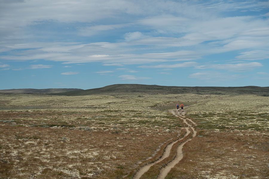
Double carriageway across moorland
Down from the this first stretch of highland, the route takes me to Grimsdalen where I hit the Grimsdalshytta complex, the first in a series of three stuffed mountain huts, all accessible on dirt roads, that I’ll go through on my way across Rondane. The place is busy with hikers and parked cars, quite a way away from the more remote and quiet locations for huts in previous stages. I take a break here to enjoy the sunshine and a coffee while hang-drying my tent after the condensation-prone conditions of the previous night.
Up from Grimsdalen, the route skirts a lesser mountain group before going down to the next valley with some nice birch woods sections on the slopes and a short highland crossing with views to the mightier peaks upcoming on the way south.
Grimsdalen to Haverdalsmunnen
Grimsdalen to Haverdalsmunnen
Down in Haverdalsmunnen, there’s a bridge over the Haverdalsae flow but the water level is low enough for an easy, feet-refreshing ford and I decide to avoid the bridge detour and just go across.
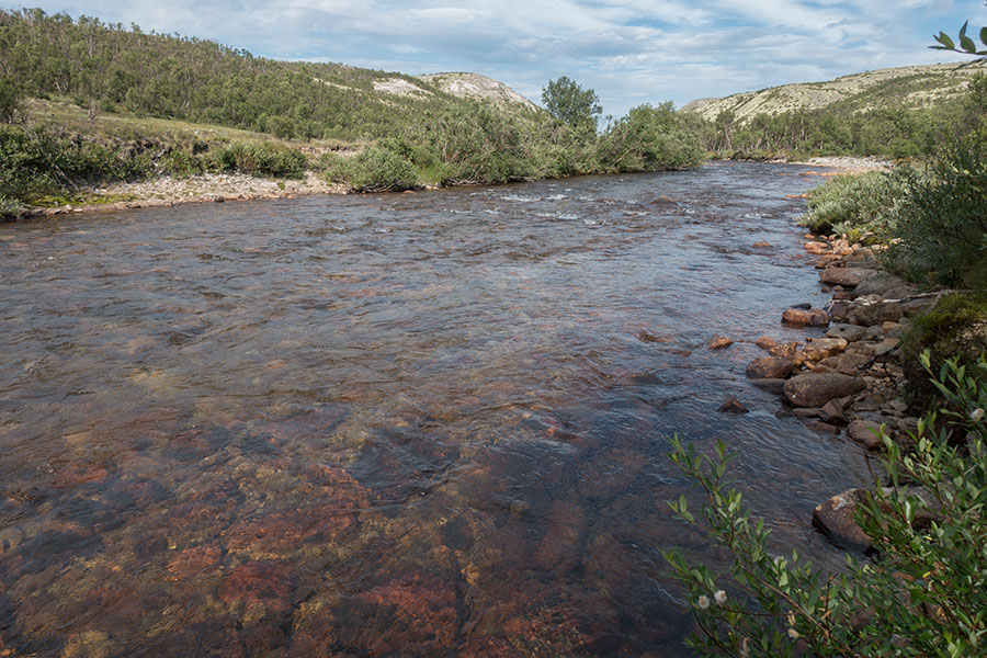
Easy ford of the Haverdalsae
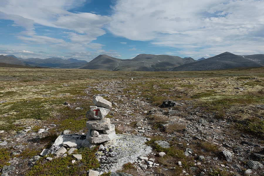
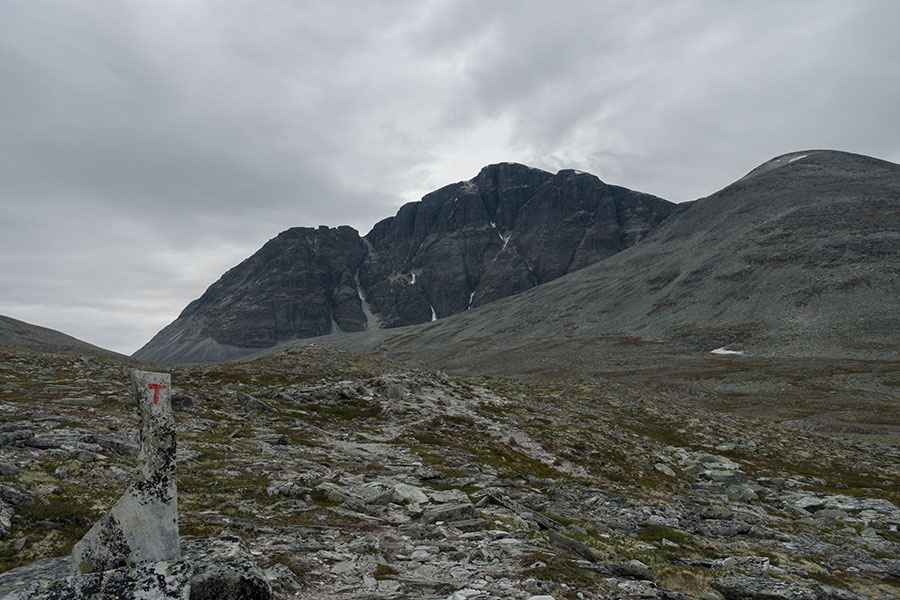
Due south, the trail climbs steady to traverse the Stygghoin massif over a rocky and narrow gap, very alpine-looking Doralsglupen, in strong contrast to the typically long and open Norwegian mountain passes. Be it the more remote location or the early evening hours, the solitude here is stark, I can only hear my own steps as I rock-hop my way across.
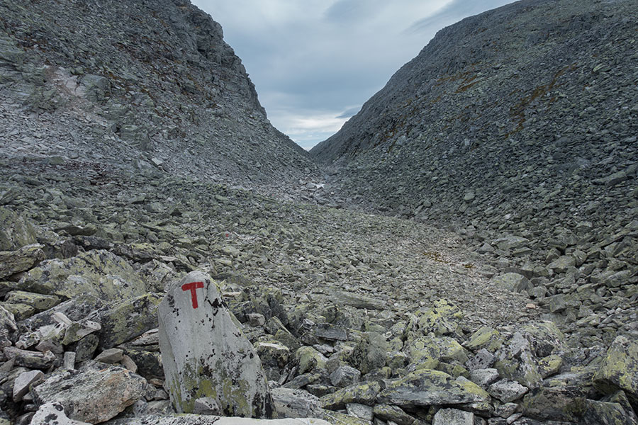
Doralsglupen Pass
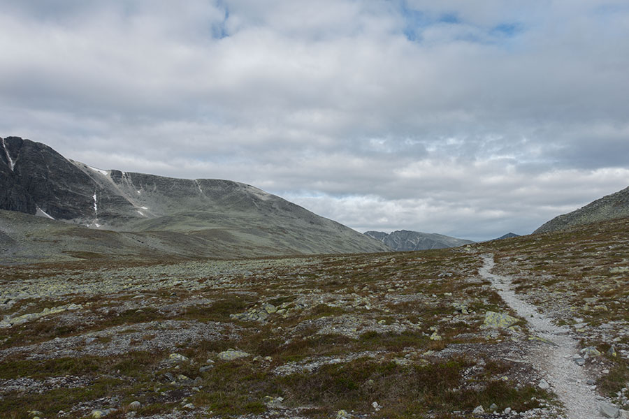
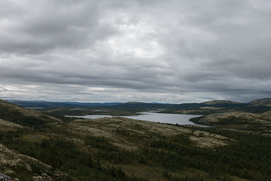
The south side reveals a steep, rocky way down to Doralen and a bleak scene of desolate, stony moors with the background of the big peaks of Rondane.
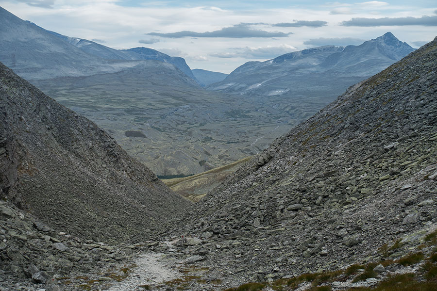
Down to Doralen

Right to left, Digerronden, Midtronden and Hogronden 2K+ peaks
By now, the sky’s gone overcast and the scene appears rather grim. Down in Doralen, I go across the double hut complex at Ovre and Nedre (Upper and Lower) Doralseter which feel like a powerful draw of Norwegian comfort but I’m fully committed to camp unless the weather is too wet, which is not expected to be the case so I just hike along, upstream the Atna flow, this time using the bridge to go across while I start browsing for a suitable pitch sheltered from the steady, cold breeze in progress.
It’s either too wet or bumpy along the valley floor and as I start climbing there seems to be only rock and little shelter from the wind until I get to an area with small depressions holding each some vegetation and often a tarn. I can’t fully scape from the breeze but there’s not much choice in level, pitch-worthy ground and I need to trust the wind-worthiness of the Khufu while securing all possible guy lines tight.
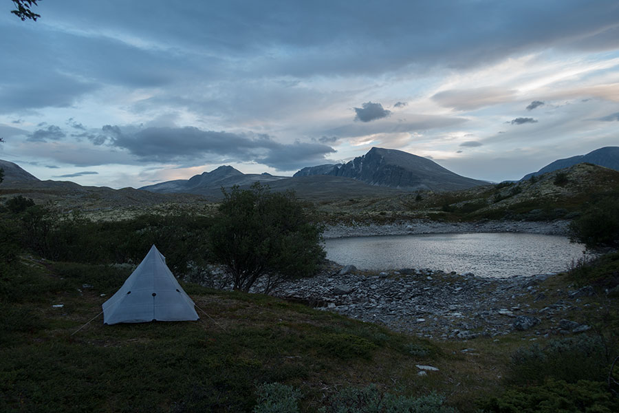
Lush micro-world among the desolation
Once again, the wind will die down at night and it’ll be a comfortable camp.
Day 9
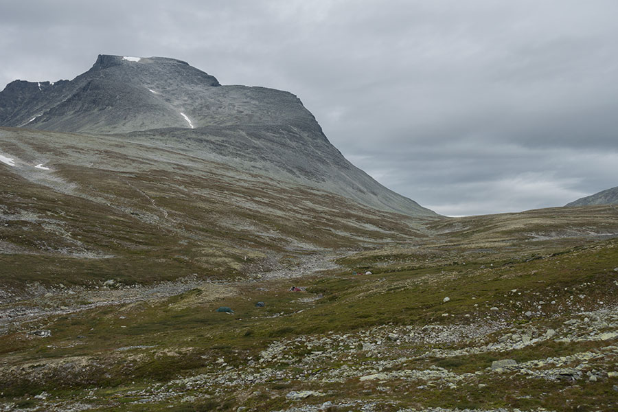
Morning is overcast but quiet and I resume the hike up Langglupdalen, going around and behind the Diger-, Midt- and Hog-ronden that were the background for the previous evening hours and between these and Storronden, main peak in the area at 2138 m high with its impressive, dark and vertical north face.
Storronden north face
The pass is classic Scandinavian this time, a long and wide corridor that stays level for a while before starting the comedown.
Pass area in Langglupdalen
On the way down, I can spot several tent parties still pitched in the grassy banks of the stream, right at the foot of the trail that climbs Storronden.
Spot the tents by the stream and the trail up the mountain
Eventually, my route goes around the Storronden massif and down to the confluence of Illmanndalen and Skjerdalen to meet the dirt road coming up from the main valley all the way to the Bjornhollia hut complex where I had expected to call it a day if there was heavy rain going. Bjornhollia is another fully served, vehicle accessible hut even though there doesn’t seem to be private cars around. Again, it’s more like a rustic hotel than the classic concept of a mountain hut. It’s around noon and the place is very quiet.
It’s still overcast and unsettled but not yet raining. The forecast posted in the hall wall announces rain in the afternoon but I have another hut option at the end of the day so it’s an easy decision: have a break and keep going. The cafe has just opened and I can honor the old tradition of coffee and cake, hungry thru-hiker version, i.e. two full rounds of it.
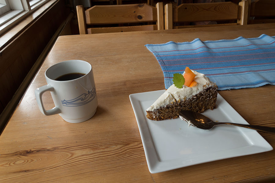
Coffee and cake
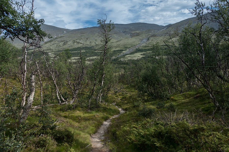
Back to the trail, I spend a good while in the birch woods hiking up the slopes out of Skjerdalen while I leave the core of Rondane behind. Soon I reach undulating moorland as the clouds get darker.
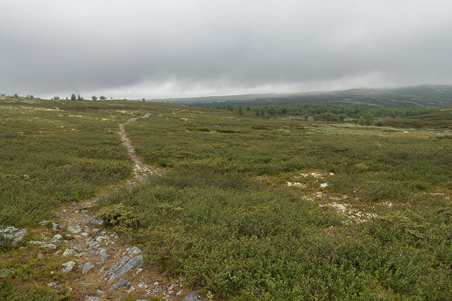
Trail across the moors
It’s a beautiful hike all the way to Eldabu hut over high moorland, a new environment for me in this trip with no big mountains around, an introduction to what’s about to come. By the time I get to the hut it’s already raining, as forecast. I haven’t had the chance to get really wet but I welcome the shelter and the prospect of a comfy evening indoors.
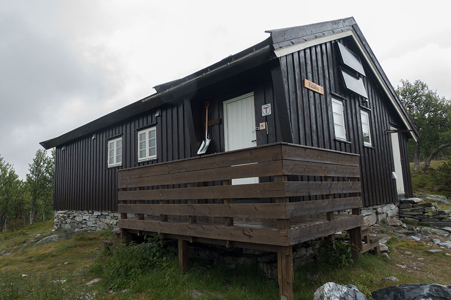
Eldabu hut
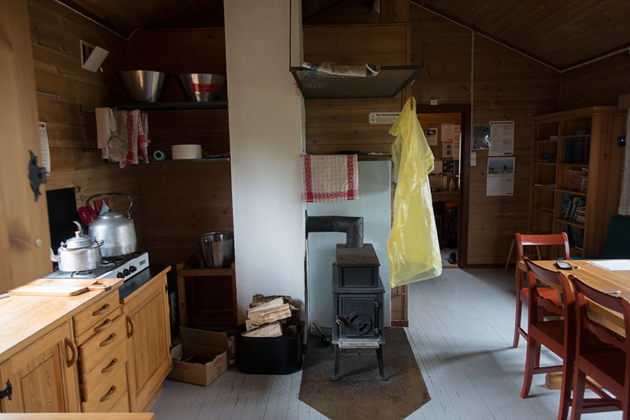
Eldabu is just down from the main trail at the upper end of the birch woods. It’s a simple, self-serving hut, meaning it’s unstuffed but it’s got a pantry room plus all the typical facilities. I fetch water from the nearby stream, get the fireplace going and relax.
Eldabu hut
Day 10
The weather is still a potential issue with rain a possibility throughout the day but I have several shelter options upcoming and that makes it easy to keep the good mood. I leave early under dark skies to resume the hike across open moorland.

No rain yet
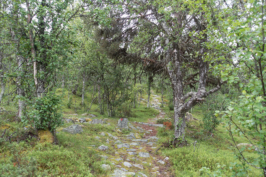
Just off the Rondane National Park boundary, the route takes me down enough to spend some meaningful time in the woods and across pastoral farmland, which is interesting. The woods are lush and delicate, feeling like a designer garden at times. No need to say nature is the best gardener around.
Mixed woods
Upcoming is Spidsbergseter, a service area besides lake Flaksjoen with a trailside hotel and the only grocery store I’d come close to in the whole trip on a few km detour.
Northern approach to Flaksjoen lake
Here road 27 crosses the highlands joining the two main North-to-South valleys in this region of Norway. Spidsbergseter was my only planned resupply point for the trip. I took the previous evening in Eldabu to reassess my need for supplies given my remaining stock and the chances of self-serving cabins with a pantry I’d meet on my way and found that I could go without any new supplies. As hard as it felt to let the chance go, I had to accept the detour wasn’t worth it. No more pigging out until trip’s end. I went by the resort area hoping for the consolation price of a restaurant meal but it was too early and the kitchen was not yet open so I skipped that one too.

Spidsbergseter Resort, just passing by
Since I started this section in Hjerkinn two days back, I had noticed the trail signs consistently mentioning something called the Rondanestien. I had already seen this mention in the maps during the planning stages when I ended up following it as it met my line of desire perfectly. I later knew it’s a newish long distance route devised over existing trails from the capital city Oslo to Hjerkinn itself. I might guess that once the big peaks were behind for me on my way south, the Rondanestien had become more prominent in the signaling and it did feel like I was following a route with a name.
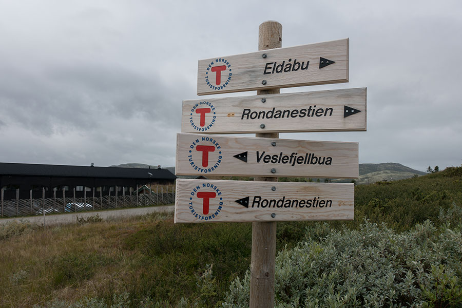
Brand new signaling from the DNT
From Spidsbergseter, the route climbs just enough to leave the tree line and it’s endless moors ahead. It’s bleak but somehow beautiful and I enjoy my being here.
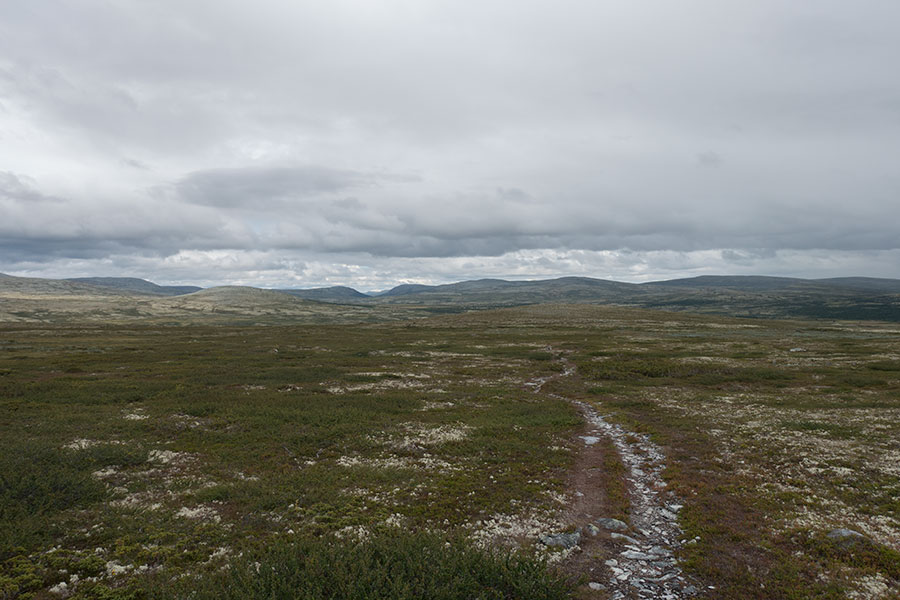
Endless moorland
It was about to be a camp night but it starts raining at the key time, i.e. just half an hour before I go through Jammerdalsbu hut so I’m already mildly wet when I get there while it keeps coming down. There wasn’t a forecast for any heavy rain this late in the day and if I ask myself I’d argue it’s gonna stop before dark but it’s also hard to leave the protection when it’s right there and I decide to stay for the night.
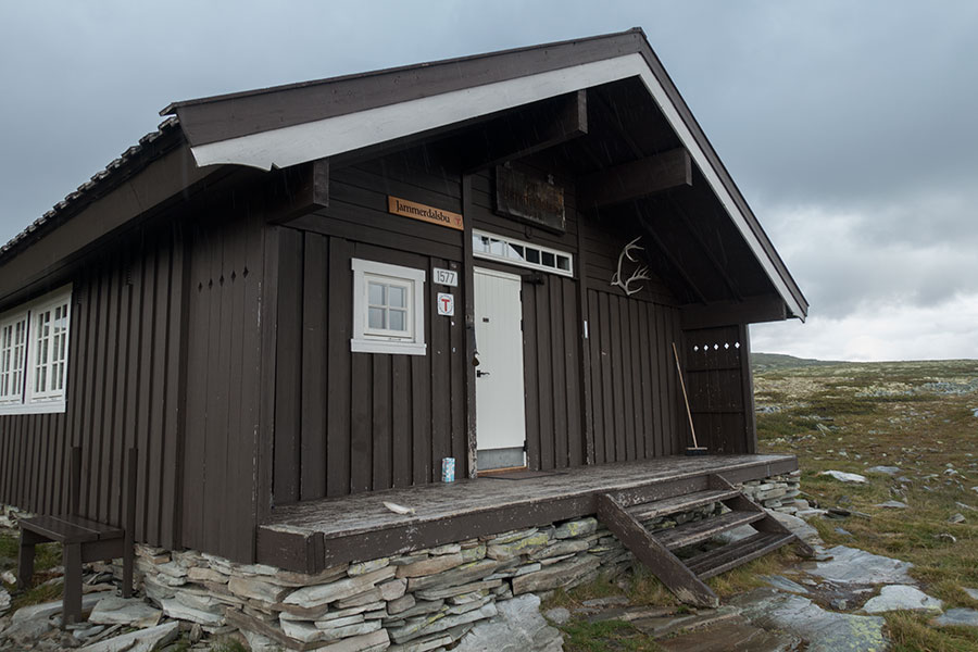
Jammerdalsbu
It of course stopped raining later but I made a conscious effort to avoid regrets and concentrate on enjoying the hut night. For a change, it was a busy one, first time on the trip on a non-stuffed hut. It was nice, I met interesting people and if there was any snoring going on, I must have been too tired to even notice.
Rondane was definitely behind. All the big mountains and big names were behind. At the time of planning, I previewed I’d have several hiking days left and I decided to just keep going south.
 RSS – Posts
Say what you want