
In 2023, I’ll have a full month in summer that I’ll devote to hiking. With the exception of 2019, where I did a multi-month thru-hike, a full, continuous month hadn’t happened for me since 2009, i.e. this is a special one. For such occasion, I’ve chosen to hike in Norway.
Idea
In line with all my hiking trips, I mean to do a continuous hike, camp along the way, be in nature and go with the flow. Norway is a great place for this: outstanding scenery, good network of trails, seamless links of natural areas, virtually no restrictions beyond the natural ones and a hiking/mountaineering culture very welcoming to long-distance hiking.
The latitude, together with the exposure to the Atlantic weather systems, can make for challenging conditions. While this is not necessarily bad, it’ll be a factor for most. In my case, it’s reassuring to know I can rely in the hut network whenever things get miserable. I take it as a safety net.
Summer weather is also a factor why Norway is a good place to hike, maybe in this case it’s more appropriate to talk climate. Places that used to be nice in the summer (Alps, Pyrenees… you get the picture) are becoming uncomfortably warm. This is not something that happens every day or anything that never happened before but the trend seems clear and the risk of having a tougher than expected time due to excessive heat tends to put me down. Not a show-stopper but another factor to consider. In the Norwegian highlands, the potential for heat-related trouble is low.
The final part of my idea for the summer of 2023 is about filling voids. I’ll be following the E1 and Norge Pa Langs itineraries along the mid section of this latter, over ground entirely new to me, no matter how far I make it. I’ll be starting very close to where I ended my 2007 Nordkalott hike (same latitude but I made my way down on the Swedish side back then) and hiking south across the Polar Circle to hopefully get down to the latitude of Trondheim, thus covering the length of this narrow strip of land that Norway turns into, all the way to the very region where I started hiking south in 2022. Not linking steps on either end but nearly.
I’m naming this trip Norge Midt. Not 100% accurate geographically but very close for a short, powerful concept.
Plan
I have a starting point, a clear plan on how to get there, a hiking itinerary and a broad idea of the resupply possibilities along the way, of which I’ll need to use at least 2 or 3, plus several choices for an ending point at distances varying between 800 and 900 km where I could get local transit to the urban areas and transport hubs. The rest will develop as I go.
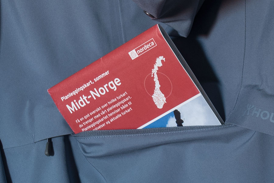
My starting point is Sulitjelma, a mining town in the mountains east of Bodo in Nordland County. Sulitjelma is one of the two defined southern end points for the Nordkalott route that I hiked back in 2007 and it’s reachable on public transit from Bodo. Once off the coastal fjords, the road, in truly Norwegian fashion, needs quite a few lengthy tunnels to reach the upper valley and the town.
My route is entirely based on the Norge Pa Langs (Along Norway) route in this region. Norge Pa Langs is an unofficial route going northernmost to southernmost (or vice-versa) in Norway, described over existing trails, where available. They not always are.
In this particular case, my initial 350 km will follow the trail network. After that, there’s another 300 km where I’ll alternate a few trails, some short stretches over tarmac roads and lots of off-trail. Past that, I expect to be back in the trail network all the way to the southernmost I can get in my 4 weeks allowance. This should fall somewhere between 750 and 900 km total in normal circumstances.
This is the 900 km version:
After the hiking is done, I should be close enough to Trondheim to make it easy and quick to get public transit to get there. I’ll be getting back home from Trondheim.
Challenges
This is a broad stroke at the main ones I foresee.
Self-reliance
When I only had the idea and not yet the planning, I had pictured a seamless route over existing trails with a hut coverage that would span the whole route on an almost daily basis. I got somewhat disappointed to meet this 300 km gap with not much regarding established trails and sketchy hut availability. This would mean potential for slow, tough progress and the need for self-reliance in relatively long stretches, i.e. no safety net in a place where it can get ugly without it. Eventually, I saw this as part of the challenge and the added value of this route and decided to embrace it.
Weather
Everything is fine while the weather is quiet but it won’t be so all the time. Mostly everything seems doable with the safety net of a hut at the end of the day but that won’t be the case every day. Linking directly with the self-reliance issue, I need to be prepared to be safe and comfortable when conditions are difficult and I’m on my own. Mindset should be an important part of it.
Terrain
Most of the route is over high ground, roughly between 500 and 1000 m high, with occasional dips into valleys down to 300 m. I only expect real woods in these latter, the rest should be open, low bush or grassy/rocky. From previous experiences in other parts of Norway, I’d expect the main obstacle to be the marshy ground. I’m ready for consistently wet feet.
Water crossings
Main rivers are bridged and many other smaller ones are too. As a general rule, I count on any major stream to have a bridge and the highland flows are usually spread out and shallow but I’m also aware there’ll be endless chances for stream crossings and that always means some potential for trouble.
A long trip in a rough place
Norway is a challenging environment. It’s part of what makes it great but I’m well aware a month-long trip will take me through tough times. I’m eager to see how I cope.
Gear notes
I’ve given gear choices some thought in preparation for this trip. These below are my main conclusions.
Best gear possible
This is not only about the brand/quality but also the current condition of the gear items. I use my gear until it wears down but I save newer items for the big trips. So far so good, I can imagine that’s what most hikers do. If there’s something I’ve learnt in past trips in Norway it’s that this is not the place to compromise in gear and I’m committed to be strict about this. Mint condition will be a must. Tried and trusted will be another must.
All the batteries will be new: photo camera battery, smartphone battery (I have one of those rare models where you can change it), PLB battery and external battery, this latter meaning a considerable improvement over my previous newest, dating back to 2019. I got new pants and shirt, a new liner bag where the nylon fabric saves some weight over my older silk version. New socks and new shoes, same model I’ve been using in previous long hikes. For the first time in years, I’ve even renewed my stock of quality stakes.
A reliable shelter
This is a must in a place like Norway where most campsites along typical routes will be exposed. Even with the safety net of the hut network that I’ll be happy to use when I see or preview trouble, I’ll need to trust my shelter.
I’ve been tempted to go for a fully framed tent, either the one I already own, the Stephenson’s Warmlite that I used in the Lapland Nordkalott, or a new one that I’d have a great excuse to purchase (read Hilleberg or the like). I’ve eventually decided to stick to my latest mid, the Locus Gear Khufu DCF.

Dovrefjell 2022
This kind of tent puts more responsibility on the user than a fully framed one. In my case with the Khufu, even though I already used it in Norway in 2022, I haven’t yet seen it through really tough conditions but I feel confident enough both the tent and myself would cope. I’ll be using the same arrangement I did in 2022 with a 2/3 plan mesh wall, silnylon bath tab floor inner and 12 stakes that can help support the shelter in 16 points. This time, however, I hope to not leave the V-extender behind so I can use the inverted-V, two pole arrangement that I’ve been trying with success in recent trips.
Waterproofs
There is some major shift here. I still have it recent my last year’s trip in this same Norway, just further south, and how vulnerable and miserable I felt when hard rain hit. I had it clear after that trip that I had to change something in my rain kit, more so when this year’s trip will require a step up in self-reliance. I devised a two step program:
Step 1: get a high quality waterproof top. Sod off weight issues, I’m ready to invest some grams here. Some money too.
Step 2: double barrier strategy. Yes, that means I’ll go through some redundancy here, lightweight paradigm high treason! No matter how much I may trust the main waterproof top, there’s some times the rain is just too much and I dread that creepy feeling of a dump elbow, then a dump shoulder, then a dump anything else as I traverse an exposed moor with nowhere to hide while it keeps raining.
That’s the strategy. The realization is as follows:
For step 1, I’ve got a 3 layer, high water column item. After some search, I got a sale on a Houdini model, The Shelter anorak:

Houdini The Shelter Anorak
I like the anorak style, it gets rid of the potential weak point in the front zip (mind you, Houdini uses a flap over the zip in their jacket models, a surprisingly rare good move) and I like the chest pocket for keeping useful items handy in rainy times. Being a sale item (only one left), I had to take the M size, which is on the big side for me, but I welcome the ample room and the extra length, extending well below the waist. It does give me that shelter feeling. Worst of all about the sale item, I don’t like the pale blue color. It’s 455 gr on my scale.
I haven’t owned a 3 layer waterproof in decades. I don’t expect to stay completely dry in the wrong conditions but I do expect a step up from the paper likes, the paper thin 2 layers or the rough impregnations I’ve been using for those decades. Houdini is a Swedish brand and I’ll be hiking very close to the border throughout the trip so the anorak should feel at home. I need to trust it.
On initial tests, I’m finding rain drops not beading off the face fabric as I’d had expected. I’ll see once on the field.
For step 2, I’ll be taking a poncho. This is not only a second barrier, it’s also a different one, it’s a wearable mini-shelter. I don’t like ponchos on their own in mountain terrain but I do appreciate that out-of-the rain feeling that you can’t get from a more fitted garment. I like how you can take a break, even take your pack off or sit down as well as manipulate things without getting too wet, even if there’s nothing natural around that can provide any meaningful shelter. I see this latter as an important factor in facing extended rain periods.
I plan to wear the poncho over the pack. Not always a good move in exposed terrain if the poncho is your only waterproof top but I’ll have the anorak layered inside. Also worth noticing that I’ll be able to skip the pack cover.
Gear List
This is the full prospect list (or you can see it in the lighterpack.com site), also in a downloadable Excel.
Planning Resources
During the past weeks and months, I’ve been a regular to these sites:
Quality topo maps. It’s possible to upload tracks and to select and print sheets in PDF that you can print on paper. In my experience, this is barely cheaper than buying the paper maps from the issuing authority and I went this latter route.
The interface is available in English even though this seems to need some further work, Norwegian is still found randomly, nothing a quick online translation can’t solve. I haven’t explored the drawing facilities.
I’ve used this to draw the routes. It offers intelligent routing over existing trails and track import/export. The base maps for Norway are the same as those available through norgeskart.no
A database for huts and routes in Norway. I’ve found it useful for hut information. Norwegian only so a good reason to learn some basics in the language. There’s also a smartphone app with download facilities for offline use.
Scandinavian summer
I’ll use a very standard window for hiking in Norway. I leave on July 21st and if everything goes to plan I expect to bag the first few miles on the 22nd.
 RSS – Posts
Say what you want