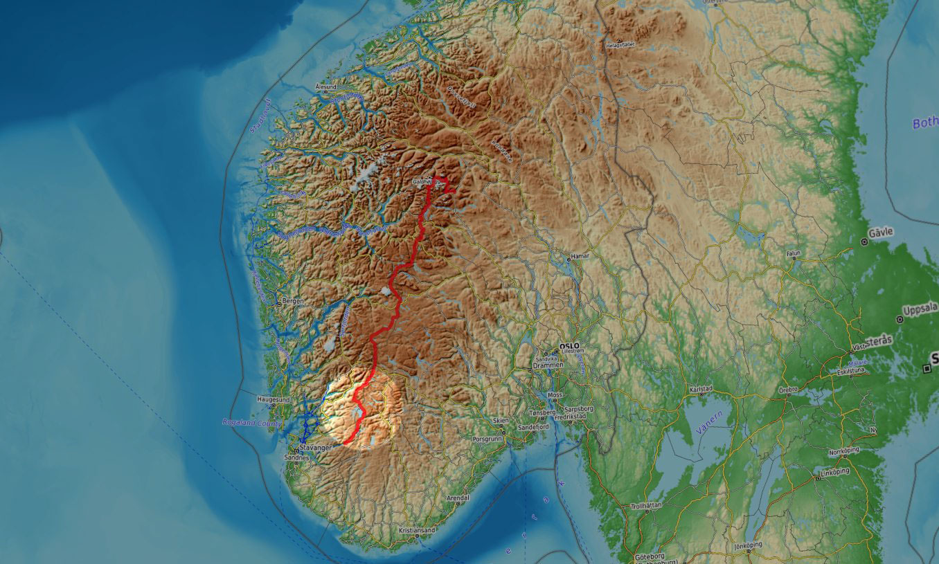
In the summer of 2025, I was back in Norway for some more quality hiking. This time, I went for its backbone, Norges Ryggrad. I started hiking in Jotunheimen, the main mountain region in the southern half of Norway, then across Skarvheimen, Hardangervidda and the Ryfylke highlands all the way down to Lysefjord, in the Stavanger area.
This is an account of days 11 to 15 when I hiked across the Ryfylke highland region.
Ryfylke
It’s the fourth blue sky morning in a row and I’m getting so used to it that I’m gonna get upset by anything else. Not today.
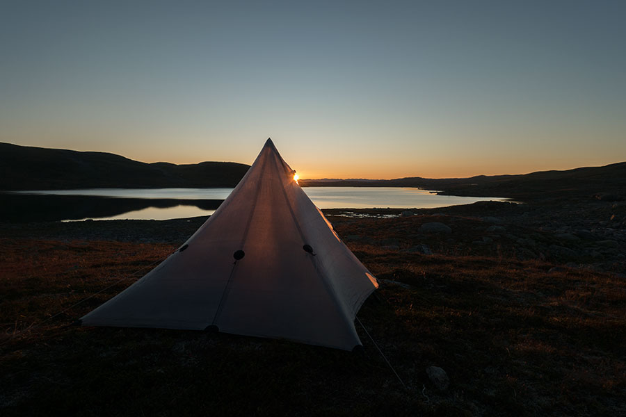
Sunrise
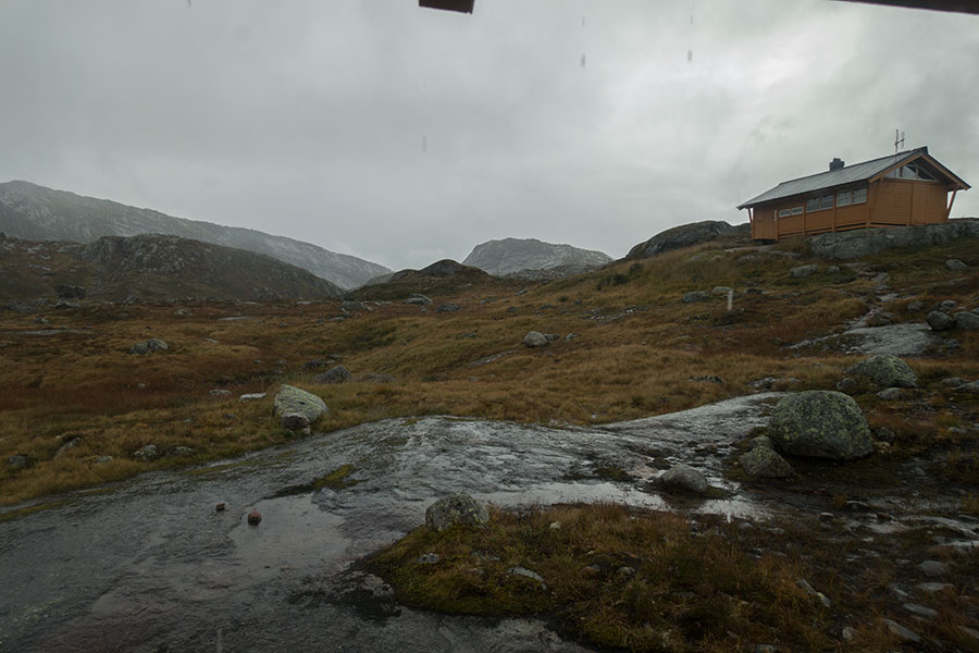
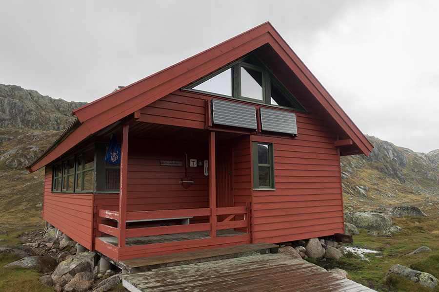
Once on the trail, it’s just over one final ridge, then all downhill to the E134 highway which, in this area, goes under the name Haukelivegen. Right across the road, the Haukeliseter Fjellstue, which is my first milestone today.
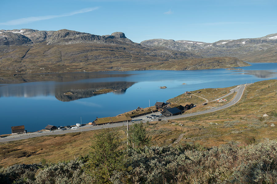
Haukeliseter and vegen
It’s less than 2 h to the hut and I get there on time for a breakfast run, which is the absolute best thing I could award myself at the moment.
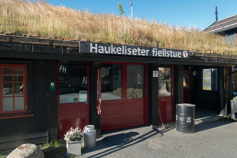
Good food across that door
It’s the amount of food and the tasty variety, it’s the calories and the morale boost and I have it clear it’s the best use of my time, no matter how much pressured I am to cover distance on the day. By the time I leave Haukeli, I feel like I can do anything.
Other than pigging out, I can also use cell data reception to check the weather forecast and it’s about time because this here today is as far as the old one would bring me. It looks like this boring high pressure shift is about to end and the rest of the trip is gonna be more entertaining with the first of the rain expected by late evening. It had to happen sometime.
For the time being, as I leave Haukeli, I still enjoy a cloudless sky and the first ever time in the trip when there’s not a breeze and the lake surface is frozen still.
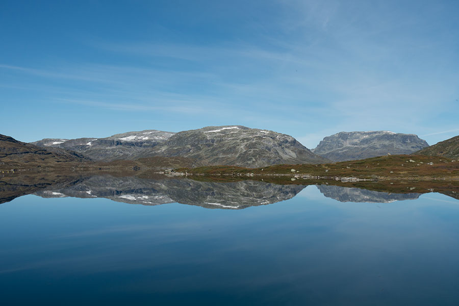
Cloudless and windless
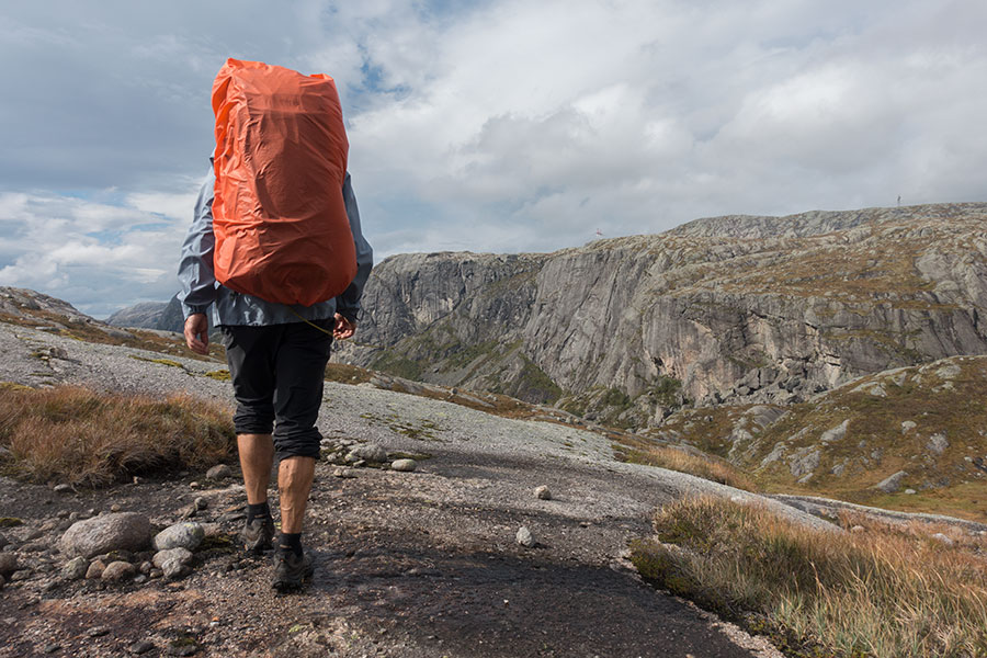
Leaving Haukeli behind feels like a new chapter altogether. When I started planning for this trip as a crossing of Jotunheimen and Hardangervidda, plus everything in between, Haukelivegen was meant to be the perfect end point except for one thing: the trip would be too short. I could have planned for some wondering about, a relaxed schedule, a mid-trip break or a town stay at either end. Instead, I kept drawing on the map until I got to the next perfect end point. That one turned to be Lysefjord, 130 km further south, and I fell in love with that one.
Those final 130 km turned to be the hefty extra at the tail end of my plan and I’d see them as a unit even though geographically, they were not completely so. I would need to get off the highland terrain in a couple of spots and visit a completely different environment, if only temporarily.
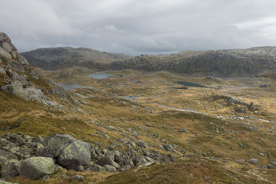
Before that, it’s still the usual mix of water, rock and grass for a little longer, still under blue skies.
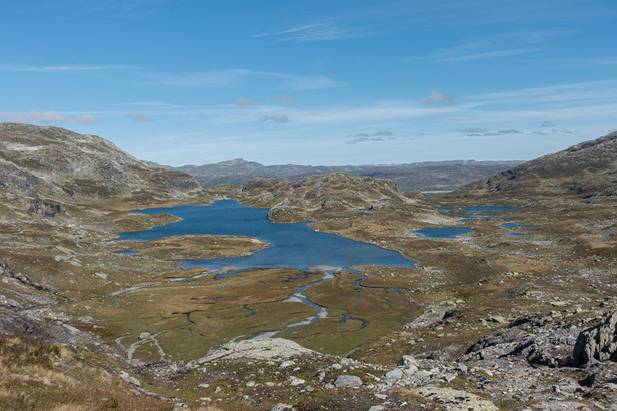
Water, rock and grass
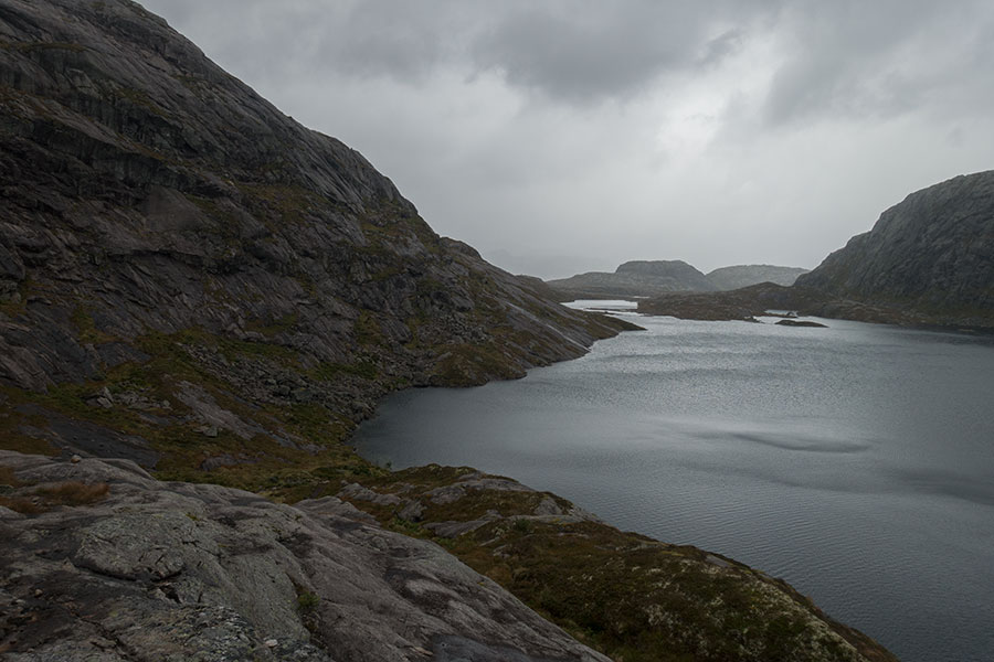
By late afternoon, all the brightness starts to disappear: the route comes down to a dammed lake, it meets a power line and clouds start gathering. I don’t think any sunshine would have helped with the somber feeling anyway.
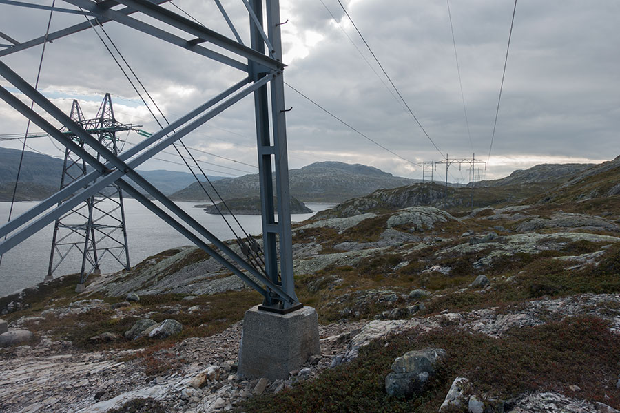
Big spoiler
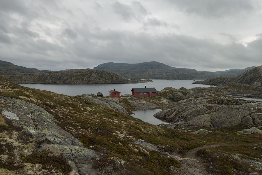
Eventually I reach a gravel road that serves the hydro schemes and at least I can make it quick out of this area, all the way to the actual dam, that I need to cross.
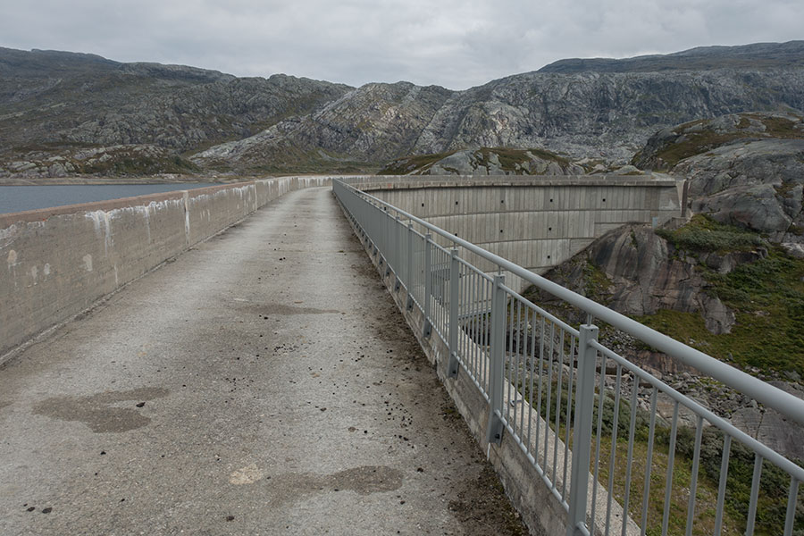
Sandvatnet dam
From the dam, I get a view of what will be my way down off the highlands. It doesn’t feel welcoming. It may have to do with the darkening vibe but I think it was also about the feeling of being off any main thoroughfare and into potentially tough terrain.
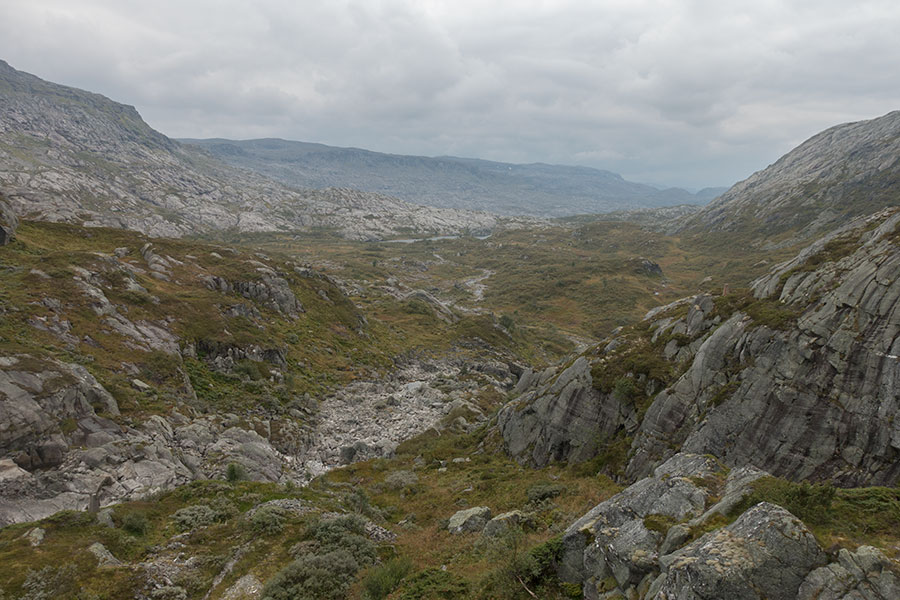
The way down
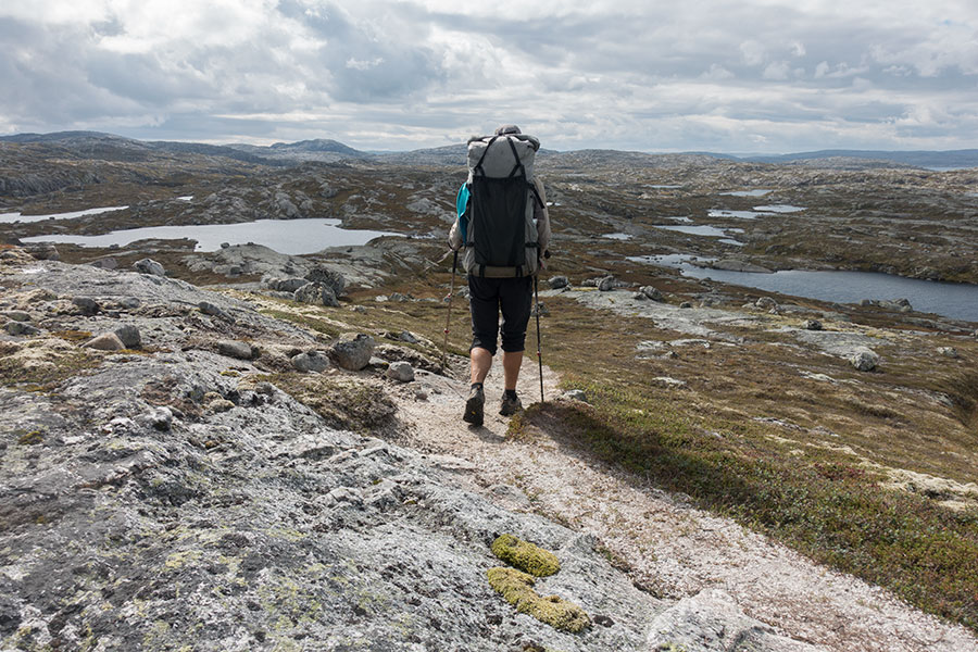
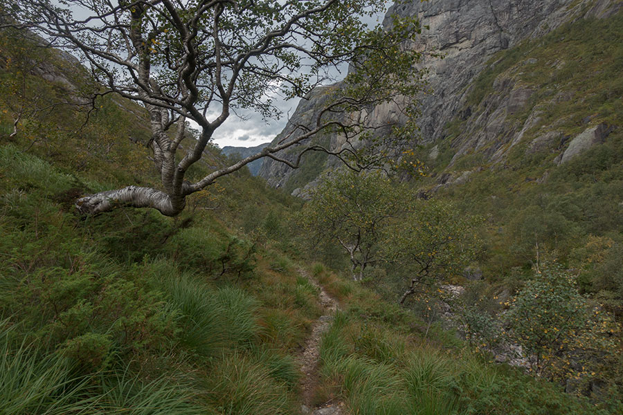
I’ve been hiking in Norway before and I have a bit of a clue about what to expect in view of the terrain. In the highlands, the quality of the trails tends to be a minor factor, the vegetation is usually not an obstacle and the presence of an actual trail usually makes little difference other than the signaling easing the navigation and the bridges potentially saving your life. In lower land, the quality of the trail is everything. Untamed land may be difficult to traverse, not impossible because vegetation tends to be non-blocking but, together with the marshy terrain, it may make progress slow and very hard work.
I’m on a red-graded route, which is very standard and quite a guarantee of walkability, but I’m also aware there’s some elasticity to the grading systems. A red grade can get tough. I’m not happy about what I see ahead and I hold my breath as I get into the green maze crossing fingers for a good trail on a stretch that somehow feels off the beaten track.
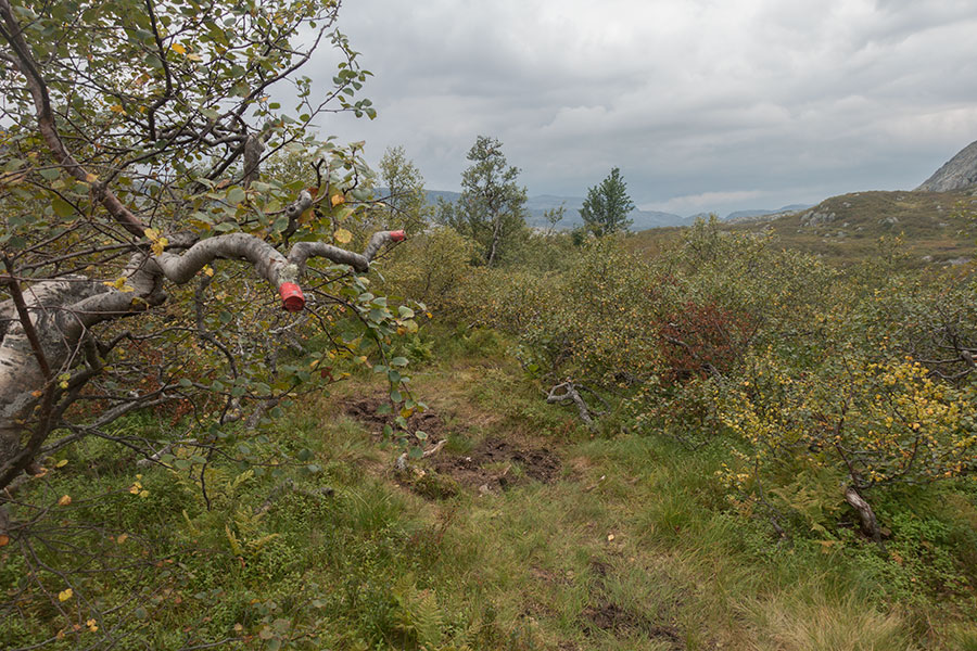
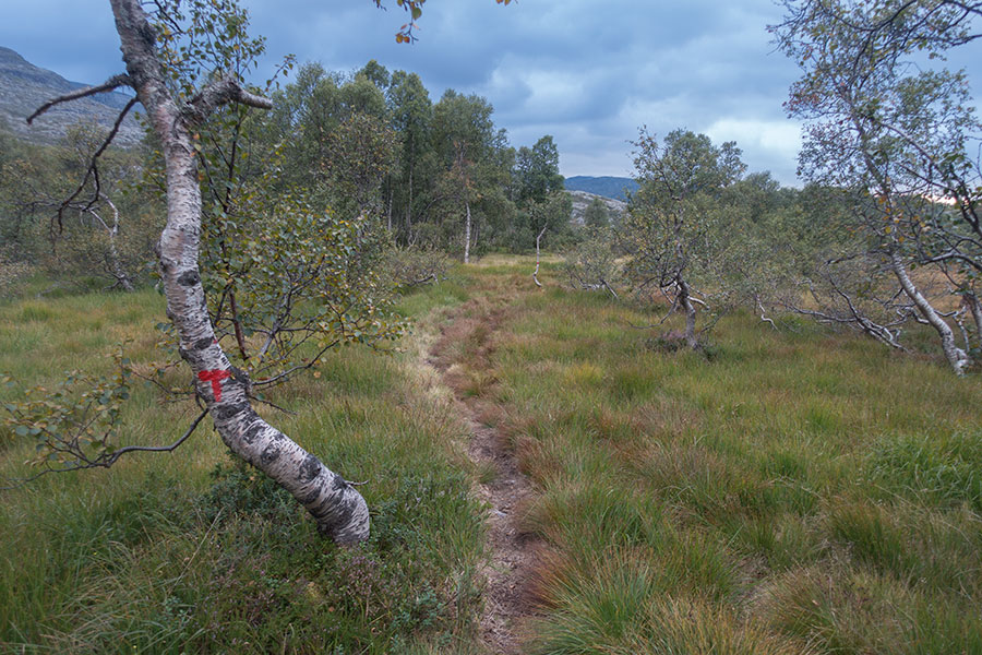
Into the birch woods
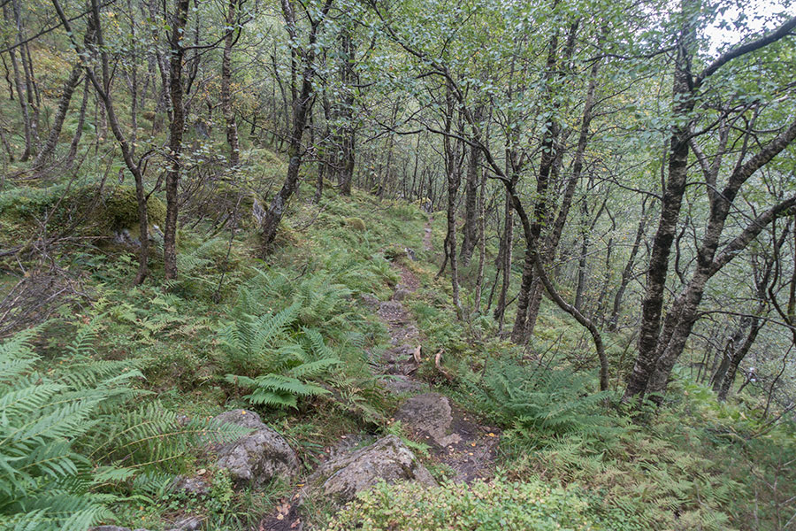
The trail is indeed rough with a chaotic mix of marsh, rock, grass and woods but I’m relieved to see the signaling is good and there’s infrastructure in key spots. It’s rather arduous but otherwise fine. Very empty anyway.
I’m not on my own
Limited engineering
When I checked the weather forecast in the morning and saw the pattern shifting to instability for the rest of the trip, I quickly devised a plan based on the hut network. Rainy weather is much more livable if you have the prospect of a warm, dry environment at the end of the day. The planning issue here is not about finding a hut to stay overnight but about meeting this with a tight and still demanding schedule. This is where building some mileage cushion while the weather was favourable turns key.
I now have a broad plan for the final days that includes a hut stay every night with demanding but very doable daily mileages. This is highly reassuring.
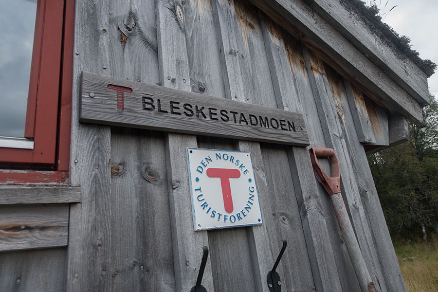
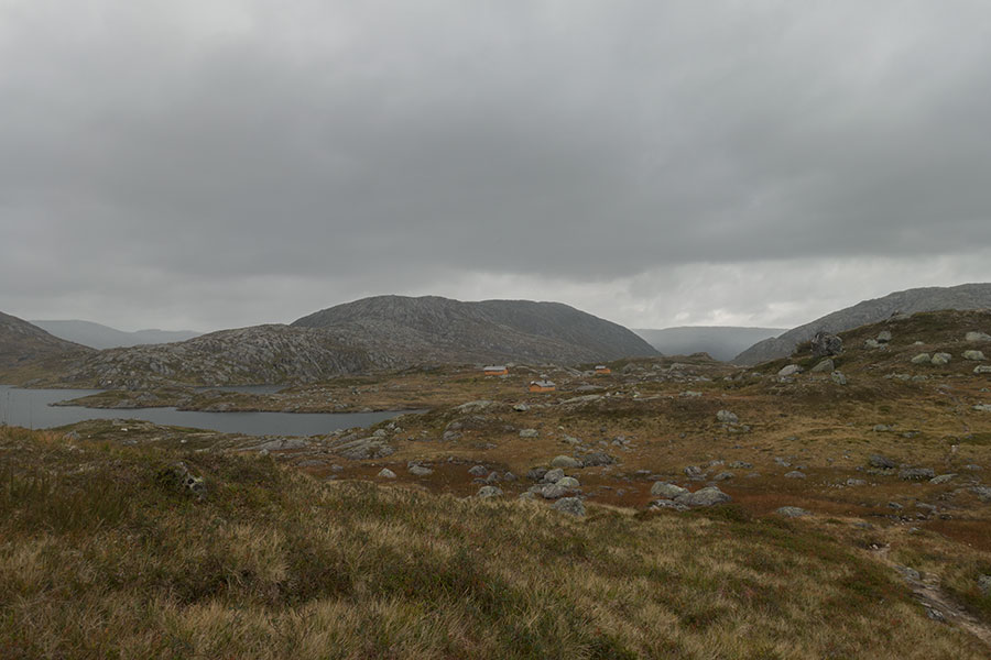
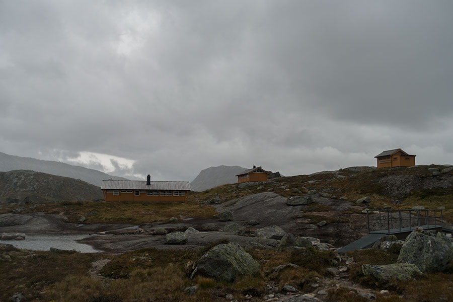
It’s overcast but mostly quiet and not raining as I spot a clearing in the birch woods with some buildings that include the Bleskestadmoen hut that I’ll be happy to use overnight.
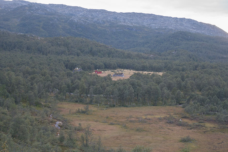
Bleskestadmoen
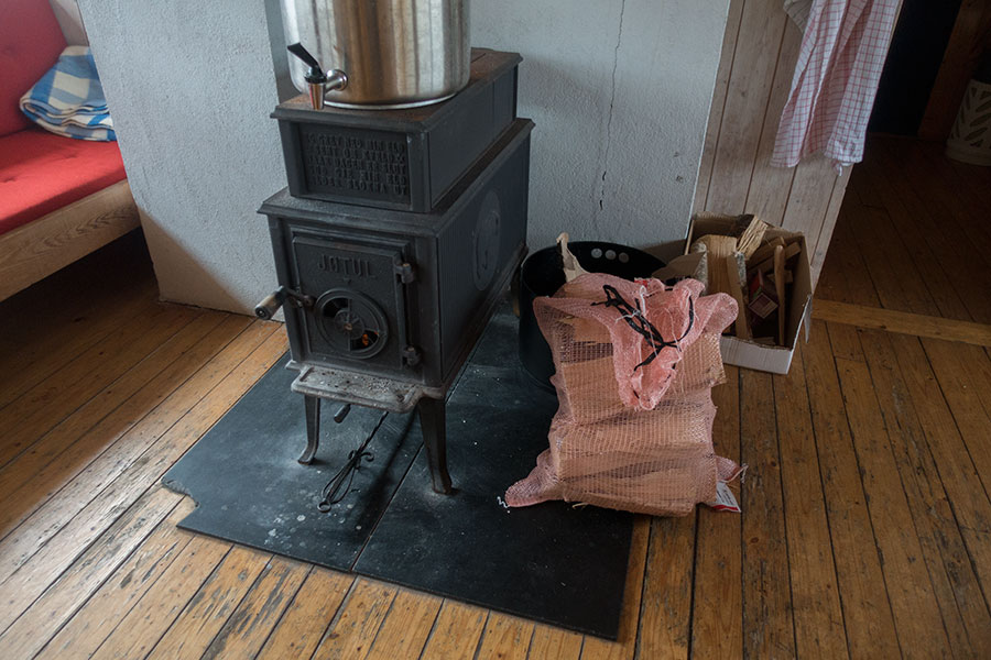
At just 700 m high, it’s the first time in the trip that I’m in proper woods among full size trees. It’s quite a shift that comes with some minor disadvantages: the water source is some ways away and I get a tick sometime during the outdoor work, quickly evicted before it had the chance to bite. Once installed inside, it’s all fine, the usual Norwegian quality for a good night’s rest. It’s been a 39 km day.
Home for the night
Transition stage
My memories of past trip sections in the lowlands are bleak. No regrets, it was all meaningful hiking, but it’s clear to me that I find my most glorious times in Norway while in the highlands. This current trip was meant to be a strict highlander except for this brief incursion down the valleys draining west to Suldalsvatnet that had no highland alternative unless I’d go cross-country. I prefer to stick to the established route and trust I’ll be back in the open soon.
It doesn’t look like it’s rained much or at all overnight, which is very good, wet vegetation can be worse than the rain itself. I leave Bleskestadmoen on a good trail through the birch woods and under very grey skies.
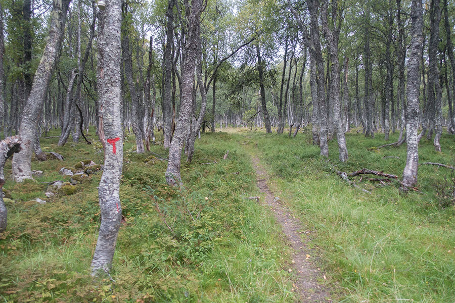
700 m high in southern Norway
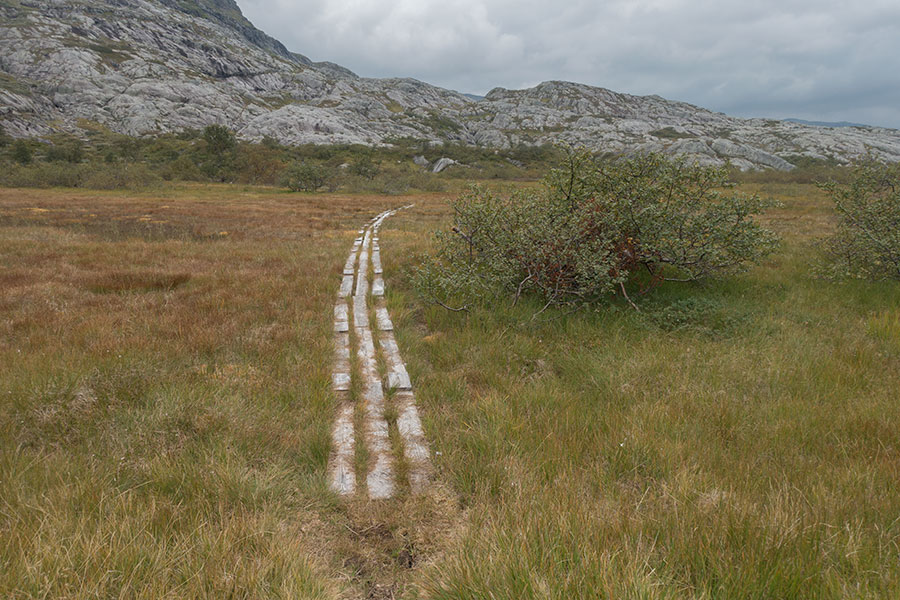
I’m real glad to find a good trail all the way up from the valley onto a brief upland section before the route comes down to another valley in the same watershed where I soon enter the birch woods again while sharing the trail with the local sheep.
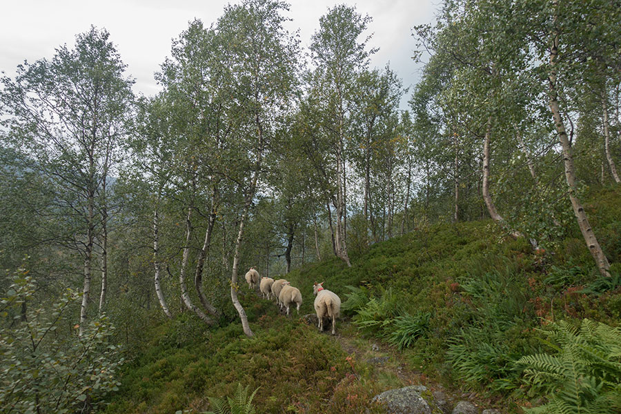
Multi-use trail
This time the route goes as low as 600 m to mix woods of birch and pine with good size trees and farming activity at the tail end of a gravel track.
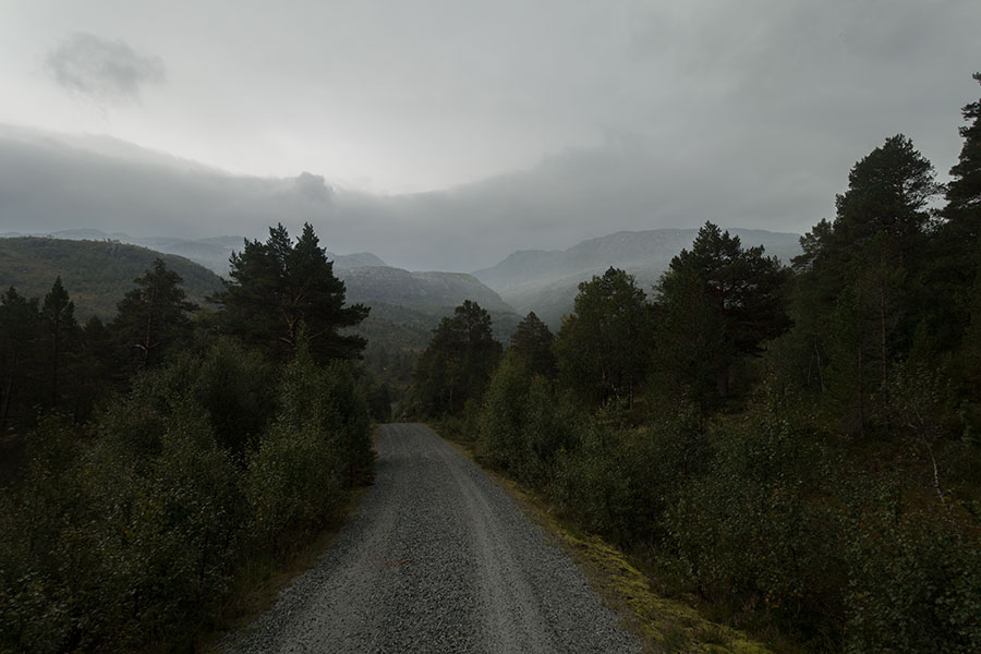
600 m high in southern Norway
It starts raining just on time to get me wet before I can get under cover in Jonstolen, a modern-looking DNT1 hut that comes very handy for a mid-day break. I have a hefty lunch so I don’t need to stop anymore in case the rest of the day is too wet. It’s stopped raining by the time I leave the hut and I proceed upstream along a beautiful water course.
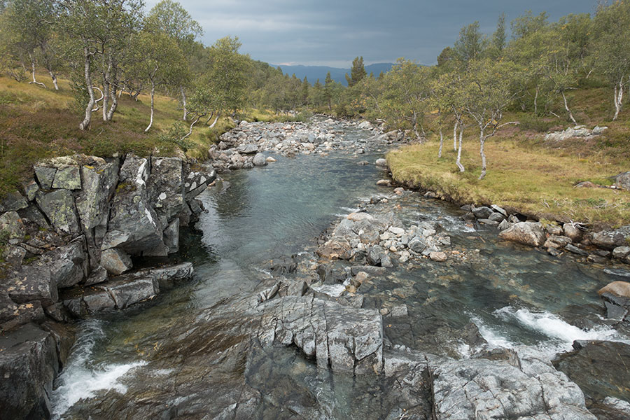
Streams of Norway
It’ll be 15 more km to the next hut where I plan to stop for the night and I feel like it shouldn’t be too bad, no matter the weather.
It doesn’t take long to be out of the woods and straight onto familiar highland terrain. The route takes upstream into Steindalen, the valley of stones, a very popular name in Norway for some reason. Its way out is over Kyrkjesteinskaret, the stone church notch, a very alpine looking pass.
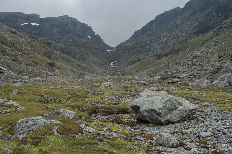
The Valley of Stones and the Stone Church notch
It’s tough work up the pass but very entertaining and I kind of welcome the change of scenario.
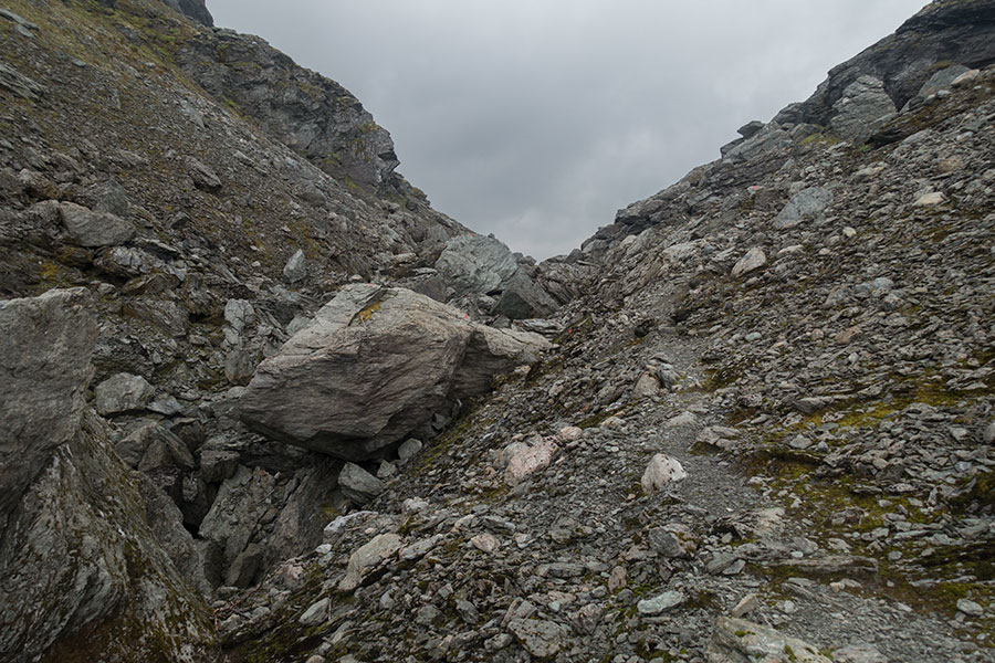
Big boulders in the gully
The rock plateau
The pass is an access point to the highlands and the way down is open with little height loss. For a while, it seems it’s gonna be a breeze from here on.
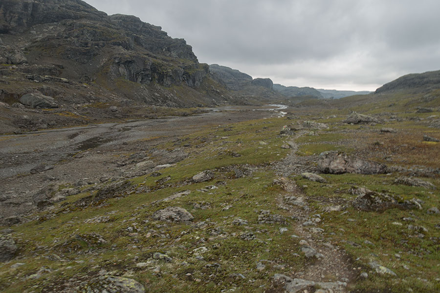
Back in the highlands
It’s just south of the pass area that the view opens and the feeling changes radically. It’s a view of a massive rock plateau, convoluted and crisscrossed by an endless number of seemingly deep gullies. I realize it can be tough hiking ahead.
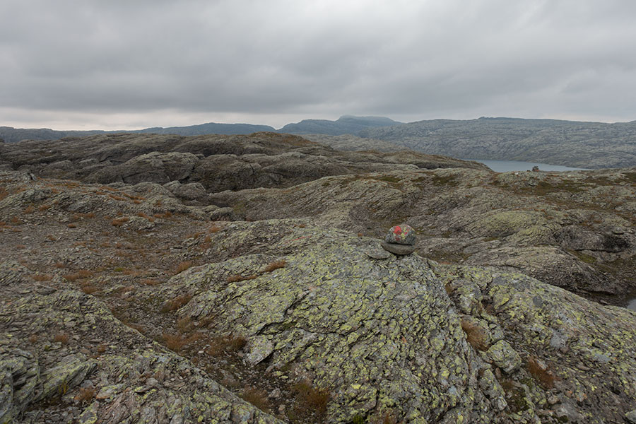
A massive block of rock
I keep going hoping the micro scale won’t be as tragic as it looks from the distance and there’ll mostly be a decent passage through the apparent maze that the route designers will have surely taken. I can now say there wasn’t. The trail kept climbing down and up an endless series of gullies that were transversal to the direction of travel and unnegotiable anyhow else. It was slow progress but I found the area mesmerizingly beautiful.
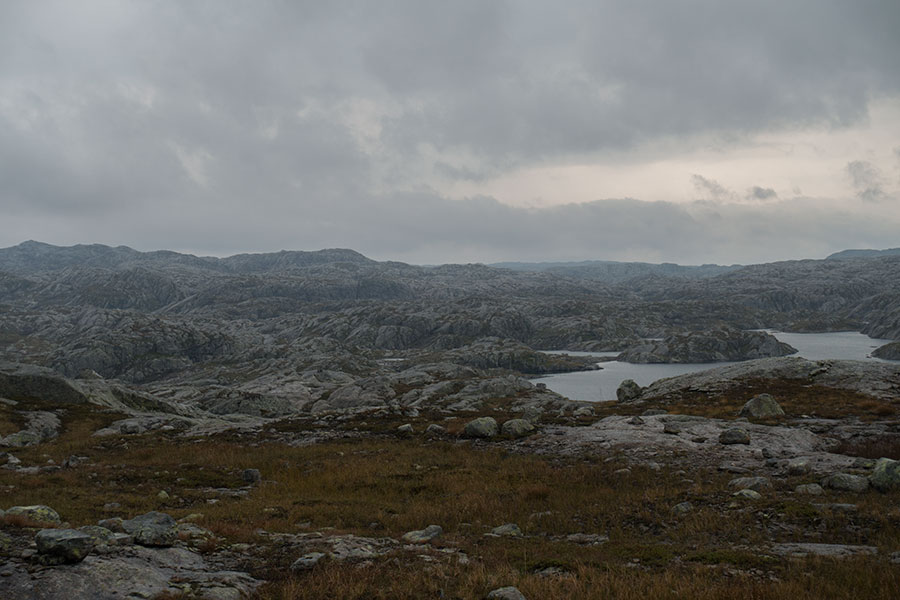
Wide view of the rock plateau
It was about being patient. I got to the Krossvatn hut in good time but, I must add, kind of relieved that I made it. There would be more rock surfing upcoming but that’d be left for the next day.
Krossvatn hut
It’ll be a very good time to be inside. Dark, cold and unpleasant outside.
Keep rocking
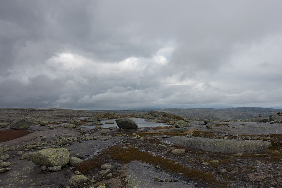
Contrary to other regions with different patterns, the nighttime tends to mean little, weather wise, in Norway. It may be partly because nights are rather short in the Norwegian summer and, if the sky is covered, even the temperature tends to vary little between night and day. It’s still overcast when I resume the hiking in the early morning but later the clouds start to show breaks big enough for the sun to shine through. Then, the rock world of the Ryfylke plateau shows a very different face.
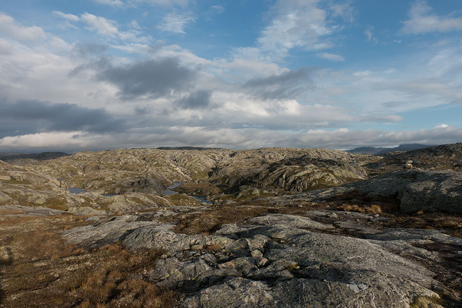
Light returns
There are still dark cloud areas but there’s a clear trend to a brightening morning. I get confident enough to pack the waterproofs and get ready to enjoy the ride. Adding to the series of good news, the micro-scale topography gets somewhat less convoluted, still rough underfoot but more like business-as-usual. It’s mostly rock and water, shining bright when the sun hits.
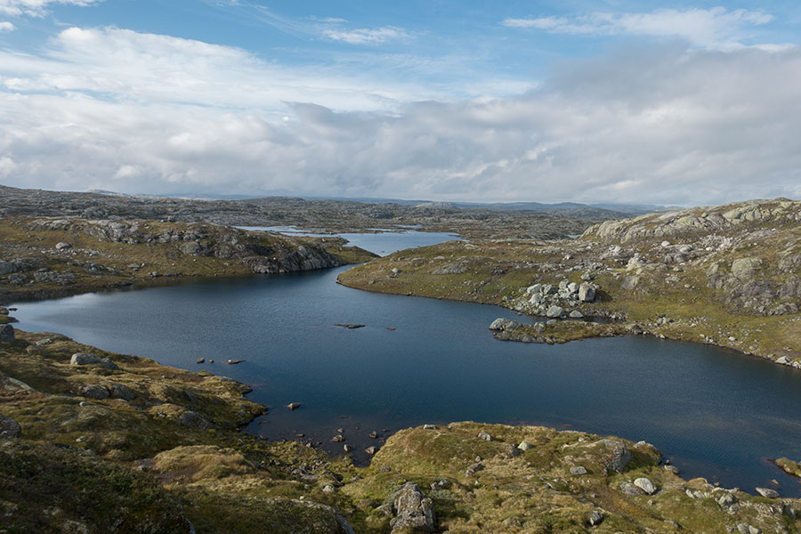
Getting better in all accounts
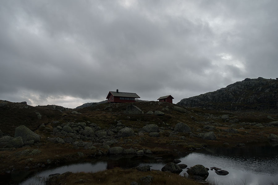
It’s a valid time for lunch when I go by a hut where I had planned to hide in case of rain but this time I have my break outside. When I resume the hiking, I need to move quick to recover body temp. It’s certainly bright but still windy and rather chilly.
Spot the hut
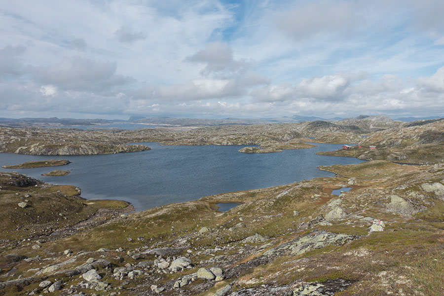
Altogether, it’s a good time on the trails. The Ryfylke plateau is a spectacular place and I’m glad I can enjoy it in these mostly favourable conditions.
Good times on the trails
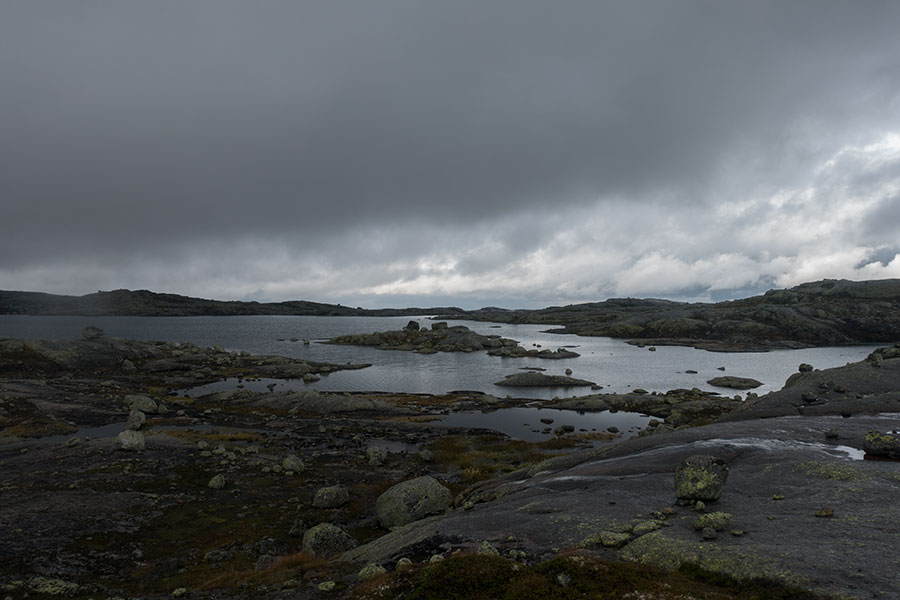
I meet a couple of hikers who announce there’s rain upcoming in the evening, which reinforces my idea of yet another hut night, well within reach at the modest price of a 30 km day, very doable without stress in normal hiking conditions. Before I get there though, I need to go by the hydro schemes around Storevassdammen, which really spoil my mood. The gathering of cloud doesn’t help.
By the time I’m past the dams, I’ve lost some altitude and I’m not anymore on top of the plateau. The clouds have thickened and it starts raining with the Storsteinen hut already in sight.
Storsteinen
Last pic before I run for cover
At long last, I get some proper rain on this trip, heavy, long lasting and with some strong wind joining the party on occasion. Guess what, I’m so happy to be inside.
Stove weather in Storsteinen
I’m at this point in the trip where I can allow myself to start thinking about the intended finish line, which is only 38 km away. With two full days available, it feels like I’m already through most of the hard work but there’s still some tough hiking ahead and the weather is now rough. I have no data coverage so no intel on the forecast but I know it’s bound to keep unstable. We’ll see tomorrow.
Final leg
There will be one more night for me on the trail and, if I mean to stay in a hut, my best and pretty much only bet is Litle Auradal, which is only 13 km from Storsteinen. That’s a short second-to-last day. For the first time on the trip, I’m in no hurry to get going and I spare the usual early wake-up call. More so, when I do wake up and peek outside to find it’s raining hard, I take it deliberately easy, hoping for the rain to ease.
Not very eager to get out
The rain is occasionally heavy but also intermittent and I take a lull to gain the courage to step outside with the firm intention of not looking back.
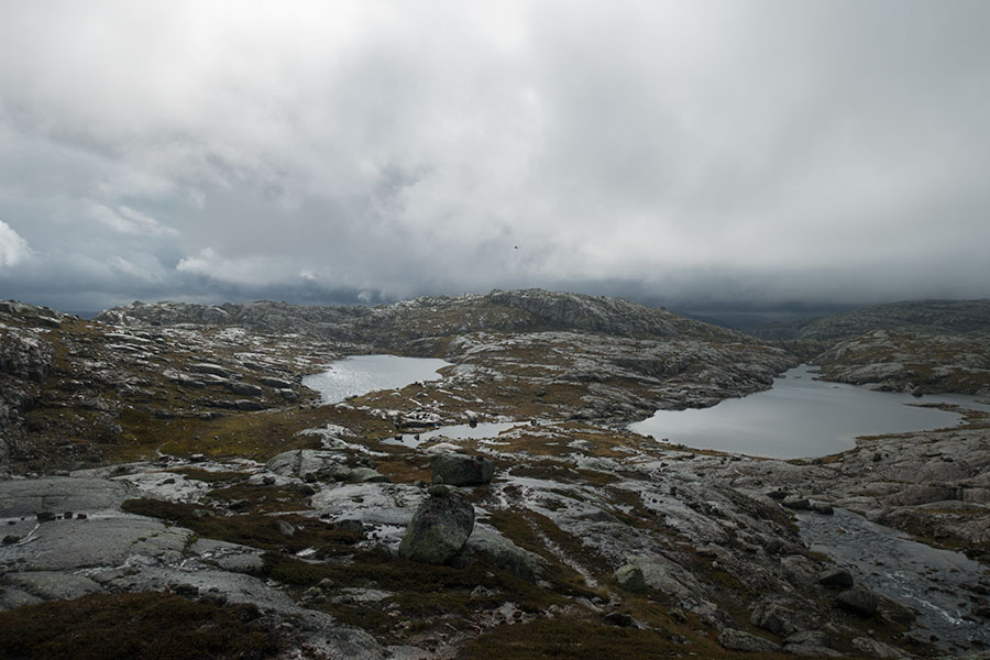
The ground is saturated, puddles and impromptu streams all over the place and wet feet are guaranteed as well as the least of my problems. It rains again as I make my way back up to the plateau and visibility is limited. I keep climbing well conscious that it can be a tough 13 km. Not taking any pics.
By the time I reach the plateau, things get better. Clouds have lifted well above the ground, the rain has turned to intermittent drizzle and visibility is much better. I can produce the camera again.
Up in the plateau
Against all odds, this upland crossing turns into a great time. The place is spectacular and the occasional thinning of the cloud cover makes the wet rock shine. Somehow, the trip always delivers.
Mostly dark
Mostly shiny
By the time I get to the edge of the plateau crossing, there’s even direct sunlight hitting the ground in selected spots. Down there, I can already spot the hut.
Litle Auradalen
It’s only mid afternoon when I step inside the Litle Auradal hut with the clear intention of getting a good break to dry up and get fed but after that I start pondering my options. The weather has improved dramatically and it hurts a bit to call it quits for the day in these now rather favourable conditions but going on would mean I’d need to camp for the night, which may still be a wet, tough affair. It’s only 25 km to trip end in Lysefjord. After almost two weeks of pushing hard every day, staying put at 3 PM requires a bit of mental adaptation but I must acknowledge it makes best sense. Plus, the hut has a great porch where I can sit and contemplate.
Litle Auradal
It will be a very nice, almost celebratory time.
Last but not least
There’s no rain in the morning but the vibe is gloomy. If I had any hopes of an easy, glorious final day, I need to wake up and get ready for some more hard work. I’m on the trail just past 7 AM after a hefty breakfast that should be enough to power me all the way through.
Dark again
It’s a short climb to exit the shallow valley and get up to the plateau again, where I get expansive views of the great grey cloud. It rains on and off.
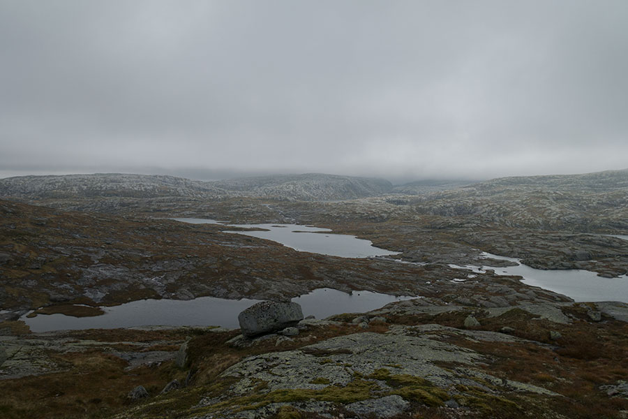
The great grey cloud
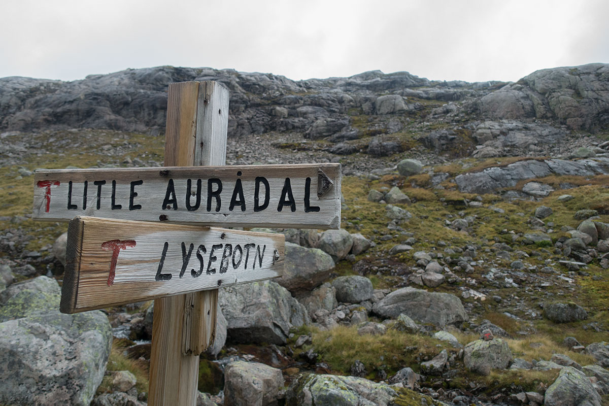
I’ve been hiking for more than a 400 km straight, I’ve gone through many junctions and I’ve read many names in the signposts. I had been daydreaming about the time and place where the name in the signpost was not anymore an intermediate point but the final one and here it is:

Lysebotn this way
From this junction, it’s a short climb to go over 1000 m high one final time, then a sharp down to sea level. I hadn’t realized this very section is graded Black in the Norwegian system, meaning it’s somehow more difficult than the most standard Red I had been following all the way. At the time, it felt like an annoyance additional to the wet, moody weather. In the end, it was about a steep section, some sketchy signaling and long rock fields while siding lakes.
Siding lakes
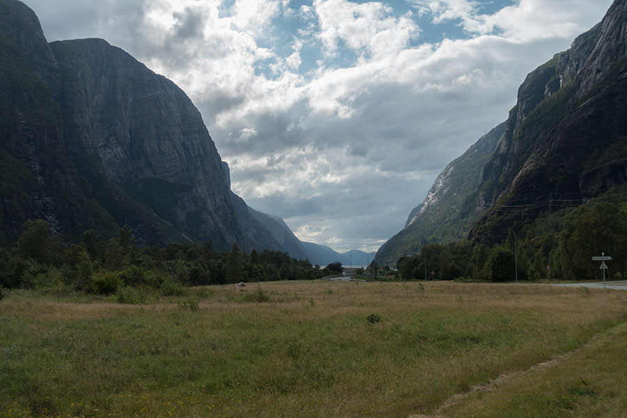
It wouldn’t look likely but at some point the clouds break and there’s some light so I can say bye to the highlands in bright style. The notch in front is the way down to the fjord.
Still in my waterproofs though
Then it’s down, down, down, soon into long grass, fern, then birch trees. It’s a decent trail.
Down to the fjord
Birch woods
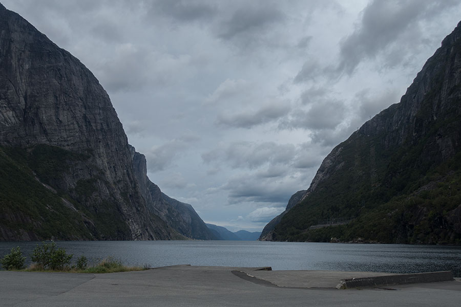
Eventually, the trail leads to a gravel track and shortly after, a tarmac road. At some point, I can see water in the distance and it’s not a lake. The light does not help the picture and there’s a power station on the way but it’s a milestone I need to capture:
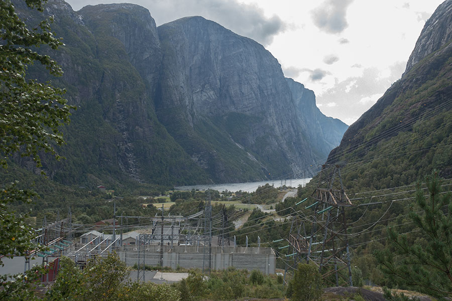
Lysefjord
Lysebotn
You might guess I went straight to the water edge to consider my trip done, I’d have certainly guessed that myself but I didn’t. I stopped 200 m short.
Home for the last night
Lysebotn
Did I mention daydreaming? Around mid-trip, Lysefjord was promoted from a best effort idea to a commitment. From that time on, I pictured myself showing up in front of this desk and saying it:
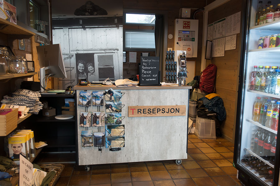
I have a booking for tonight
It became the epitome of a job well done and the promise of some well deserved rest.
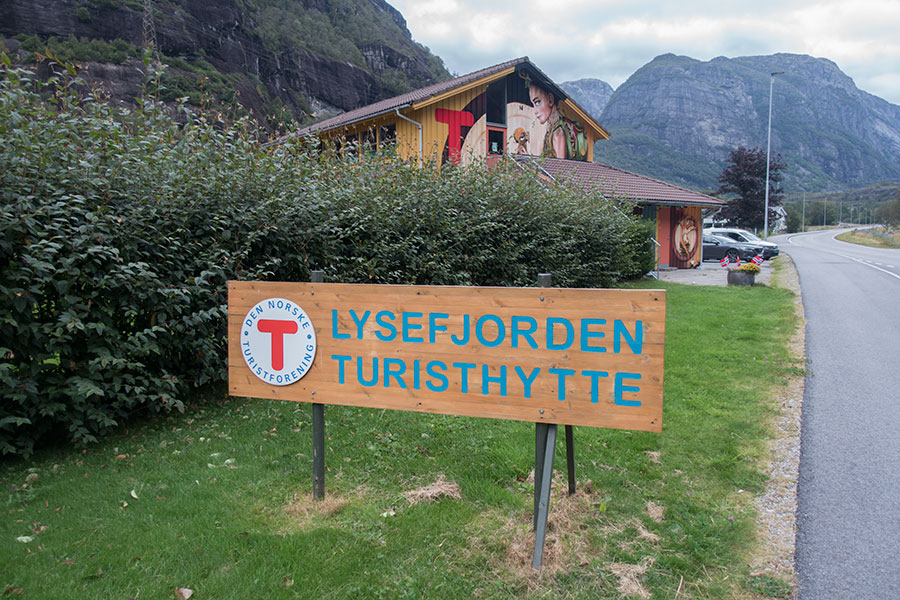
The DNT hut in Lysebotn was not busy that Friday evening. It was a lovely stay. There was dinner and there surely was the additional 200 m hike:
Lysefjord
 RSS – Posts
Say what you want