


This text below is a match between a satellite view over the Continental Divide and my own memories of the outstanding geographical units along the way on the grand scheme of CDT things.
Category: Trips Page 2 of 4

Some random thoughts beneath the surface of a Continental Divide Trail thru-hike.
Southbound is the way to go
Snow being the potential show stopper, I’m aware it really depends on the year but after having hiked the trail I find it odd that Northbound is so much more popular than SoBo. The window is tight either way but my impression is that going SoBo it opens nicely in front of you as go. NoBo, you get a good slam when you reach Southern Colorado.
It seems common that northbounders end up short-cutting or flip-flopping sections. If you value a continuous trip over the actual divide trail, definitely go Southbound.

Places, facts and feelings that stand out as I look back on my trip on the Continental Divide Trail, in no particular order other than a geographical north to south, where applicable.
Glacier National Park
If you start southbound on the CDT, you begin with a shock: the most impressive and postal-worthy scenery of the whole trip, right away, straight from the trailhead. It’s vertical walls, pointy peaks, deep valleys, endless woods, lakes and waterfalls. Glaciers too.

Hiking is inherently rhythmic. If there’s rhythm, there’s music.
Music goes wonderfully well with the hiking. I let them both blend in and develop, free of external stimulae other than the environment I’m in, a world away from the constant over-stimulation of modern urban life. This I find a very interesting exercise: let my mind wander and let it choose the music so I become my own algorithm.

It’s interesting how the mind works and how body and mind go together. Southern New Mexico had been very hard on both after my decision of sticking to the main CDT trail, avoiding all the easier/shorter alternates. My mind then focused on making it to Silver City, NM as a reasonable, meaningful mid-term goal. When I got there, I was relieved and happy. When I tried to keep going after a short break, it was like I couldn’t make it anymore.

The high desert of Southern New Mexico

The CDT is certainly hard work and some technical know-how about being out there for extended periods of time. At the same time, it’s all become quite predictable after the wealth of information we have at our hands, including on line updates about important aspects like trail conditions or water availability. You typically leave town knowing how long it will take to get to the next.

Water in the dry grasslands

Shortly after I crossed the Colorado-New Mexico border, I climbed somewhere over 11 K feet for the last time on the trip. One would say it was all downhill from there and, in a way, it was.

All downhill now

Southern Colorado is probably the main key to a successful southbound CDT hike. The mountains are high, the trail goes through exposed terrain and hikers are forced to be in the area late in the season. Indeed, as the saying goes, Winter Is Coming and it comes early when you are consistently between 11 and 13 K feet high.

Light, dark and alpine profiles in the San Juan Range

Three months and nearly two thousand miles after I started hiking on the Continental Divide Trail northern terminus in Waterton Park, I’m in Salida, Colorado. This trail is real hard work and it’s been only a few weeks since I feel like I’m finding my comfort zone within the hard work. Days are getting shorter and the Dawn-to-Dusk scheme is more necessary than ever before while all camp chores are by headlamp light and mornings get real chilly.

As I write this at the public library in Darby, MT it’s exactly one month since I started hiking from Waterton, AB but it feels like a year. Hiking is a slow thing for today’s standards but there’s a lot going on with every step. Here are a few things that stand out.
Glacier
Glacier National Park was a tough start for a long trip. The trails are excellent, the campsites are set, the environment feels under control and the mileage was set to be easy but the mountains are high, the passes are snowbound, the pack feels heavy and the stormy weather of mid June didn’t help. The end result: after 7 days I was exhausted, mosquito-bitten, happy and ready to take my first break day. In the Pacific Crest Trail, it took me one month to have my first break.

Glacier National Park
Bob Marshall Wilderness
Then it came The Bob, a huge chunk of wild land with no roads across it and my longer stage so far with 8 days worth of food in my pack. It felt even heavier than before and fact is it was. The weather was cold and stormy, it didn’t feel like summer and it was a wonderful struggle through rough trails, blow-downs and endless woods, either green or burnt. Bear prints on top of moose prints on top of human prints and the iconic Chinese Wall escarpment making for a perfect reminder that we’re hiking along the Continental Divide. We just need some summer weather for a perfect time.

Bob Marshall Wilderness
Helena & Butte
As the peaks lower in height, the trail jumps up to the divide with the treeline getting higher, way beyond 8 K feet or 2400 m. Woods, woods and more woods, very welcome for sun protection and storm shelter. Water goes from being a problem for being too much to being a problem for being scarce. It’s warmer but still stormy. I love long stages (7 days in this case) for the opportunity to be in the wilderness for an extended period so the following time I’ll have a coffee it’ll taste as good as it can get but once again my shoulders would hardly approve, tough initial days until my food weight comes down. Very stormy in the divide, still waiting for summer.

Typical camp in the woods
The Pintlers
The Continental Divide does funny loops and the trail follows. After the Butte orbital, we’re back to big mountains and patchy snow on the passes. This is another 7 day section for me and the good news is that midway through it the storms calm down eventually and we can have some relax in the hiking.

Tamarack larch in the Anaconda-Pintler Wilderness
I say “we” all the time. There’s a whole bunch of us aspiring thru-hikers going southbound, many of them fleeing from the Colorado snow after having hiked New Mexico in the early spring. Now that summer has finally arrived we’ll need to earn each step with sweat. It’s gonna be great.

What do you need for a 5 month trip? The short answer is pretty much the same as for any other shorter one with one additional, important factor in that it may be a trip through the seasons and different climate areas.
A fine-tuned 3 season kit should do, the same as for a shorter journey but greatest attention must go into maximizing versatility so the gear can cope with a wide range of conditions. A 5 month trip will be a great test to the validity of the kit described below.

I was at this point in life where life itself told me it was time for a break. Come such time, I have it clear what I need to do is hike.

Along the Continental Divide
 Initial stage of my trip on the Via Alpina 1: the Weisstannental and my first ever Swiss Alpine pass
 Stage 2 of my trip on the Via Alpina 1: from the Sernftal to Urner Boden
 Stage 3 of the Via Alpina 1: Klausenpass, a long descent and a big, flat valley plus my first real crisis of the trip
 Via Alpina 1, Stage 4: one high pass in the morning, a second one in the evening and everything in between
 Stage 5 of my trip on the Via Alpina 1: the Planplatten ridge, postcard panoramas and a camp spot guarded by the Wetterhorn
 Via Alpina 1, Stage 6: the two towers (a.k.a. Wetterhorn and Eiger)
 Day 7 on the Via Alpina: dark weather, dark rock and the toughest side of thru-hiking when the body doesn't work
 8 is the final day of my trip on the Via Alpina, coming out of illness to climb the last passes with the odd names

| Where | Switzerland |
| When | September |
| Distance | 268 km / 167 miles |
| Length | 8 days |

The Blümlisalp massif from Hohtürli, highest pass on the Via Alpina 1
| Start | Bundalp |
| End | Adelboden |
| Distance | 31 km / 19 m |
| Passes | Hohtürli, Bunderchrinde |
I wake up wondering if I’ll be fit for walking today. It’s difficult to say when nothing really hurts and a resting position makes everything feel right. Straight off bed I feel weak but that may be normal. I decide to give breakfast a go and see how it feels. It went down this well:

Alp breakfast

| Start | Lauterbrunnen |
| End | Bundalp |
| Distance | 24 km / 15 m |
| Passes | Sefinenfurkke |
For the first time in the trip, the day starts overcast. Chance of rain in the morning, getting dryer in the evening. Me, climbing right away, pretty much off the hostel door and up the glacial escarpment with interesting views back to Lauterbrunnen.

Lauterbrunnen from the other side

| Start | Wetterhorn base |
| End | Lauterbrunnen |
| Distance | 29 km / 18 m |
| Passes | Grosse Scheidegg, Kleine Scheidegg |
After the early night thunderstorm, the morning is crisp and clear. The Wetterhorn is still there.

Dawn on the Wetterhorn

| Start | Engstlensee |
| End | Wetterhorn foot |
| Distance | 33 km / 20 m |
| Passes | None |
I’m glad I slept under tree cover, the Alps are a surprisingly damp place! but my shelter is mostly dry in the early morning and I didn’t need to compromise on views.

Dawn on the Engstlensee, Jochpass at the far end

| Start | Brüsti |
| End | Engstlensee |
| Distance | 36 km / 22 m |
| Passes | Surenenpass, Jochpass |
Morning is brilliant blue and it doesn’t take as long as on previous mornings for the light to shine, it’s the first time on the trip that I don’t sleep on the valley floor. I couldn’t arrange for tree cover overhead for the night but my shelter is dry nevertheless. Surenenpass is still there and it’s my next milestone.

Trailstar in the meadow, Surenenpass at the far end

| Start | Urnerboden |
| End | Brüsti - Attinghausen |
| Distance | 33 km / 20 m |
| Passes | Klausenpass |
In the morning, as expected, everything is dripping wet and I need to leave well before the sun shines so I pack a wet mess and a good excuse for an extended break in the sun later on the day. The setting is not idyllic, too close to human habitation but the valley is beautiful and very well worth a camp pic:

Dawn in Urner Boden

| Start | Elm |
| End | Urnerboden |
| Distance | 42 km / 26 m |
| Passes | Richetlipass |
Morning is dark inside the thick conifer woods where I’m camping just outside Elm village. I go through town in daylight but still well before the sun rises above the mountain tops. My legs are sore from day 1 efforts that no amount of stretching could heal but as soon as I warm them up, I can walk with reasonable dignity.

Morning in the conifer woods

| Start | Sargans |
| End | Elm |
| Distance | 36 km / 22 m |
| Passes | Foopass |
Sargans and nearby Mels sit in a wide, oddly flat valley confluence flanked by high peaks. The Via Alpina 1 enters the mountains along the Weisstannental in a course due west. This valley is narrow and deep, with a public road near stream level. The trail takes a different course on the upper floor, i.e. it makes an initial climb to the south-side slopes, then traverses along, linking the small communities and farms clinging to the hillside.
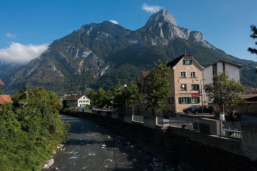
The Seez in Mels
It used to be called the Alpine Pass Route so you can bet the passes are an important feature. They always are on mountain terrain! They’re the main landmarks to help us break the trail down into meaningful stages, they’re the double-side viewpoints and they decide where the water goes. This is a power list of the passes I crossed on the Via Alpina.
Via Alpina 1 is the newer name for the trail formerly known as the Alpine Pass Route. It goes East to West along the northern edge of the Swiss Alps from Liechtenstein to Lac Leman for a length of about 360 km, more or less depending on a few existing options.

The Via Alpina 1, also known as the Alpine Pass Route goes east to west across Switzerland through the Glarner and Berner sections of the Alps for about 360 km, give or take some depending on options and starting point. I hiked along in mid September, 2018 with the loose, ambitious idea of completing it in a week. I didn’t make it to the opposite end but I did make a lot of other stuff. This here is a list of the aspects that left a lasting impression on me. It’s about the land, the mountains and the trail and it’s mostly about myself and how I was feeling at the time.
Starting mid September, I’ll be hiking on the Via Alpina 1 all the way across Switzerland. Background, motivation and rough plan below.

The Hecho valley is on the Western Pyrenees. It’s the westernmost pyrenean area of consistently dramatic mountain scenery and some features make it special: there are no through roads across the range and there are no ski resorts. It is a wild and quiet place. What the mountains are meant to be.
 The first section of my hike on the Newfoundland IAT goes across two mountain groups: the Lewis Hills and the Blow-me-Down Mountains. Wild and remote country in western Newfoundland.
 The second section of my IAT trip goes across the North Arm Hills, a group of mountains north of the Bay of Islands in Western Newfoundland. This story accounts for days 6 to 8 in the trip and starts in a Corner Brook town hotel.
 This section was a necessary transition in both space and time. I needed to get myself from Trout River to Rocky Harbour, Western Newfoundland and sort out some logistics along the way.
 The Northern Traverse and the Long Range Traverse are the two flagship wilderness routes in the Gros Morne National Park. They're a great way of experiencing the highlands of the Long Range Mountains in a sort of controlled environment while keeping the wilderness flavor.
 What can you do for a full day in St. John's when you can barely walk? St. John's is a lovely town with super nice summer weather. If airline schedules mean I have to spend a day here, It'll be a great time no matter what.
| Where | Newfoundland |
| When | July/August |
| Distance | 415 km / 258 miles |
| Length | 16 days |

Western Brook Pond

This one goes to those characters that deserve a mention after all the help, the concern and the good vibes I got from them. Roughly in order of appearance as the story went:

There’s not much information on this route on the net, nothing in print as far as I’m aware. These below are the best resources I found along the way. The information is up to date at the time of writing (March 2018)

I fly into St. John’s in the very early morning, then fly home late at night. What can you do for a full day in St. John’s when you can barely walk1?
St. John’s is a lovely town with super nice summer weather. If airline schedules mean I have to spend a day here, it’ll be a great time no matter what.

St. John’s harbour

The Northern Traverse and the Long Range Traverse are the two flagship wilderness routes in the Gros Morne National Park. They’re a great way of experiencing the highlands of the Long Range Mountains in a sort of controlled environment while keeping the wilderness flavor. The area is high enough for the vegetation to be passable so all you need is an access trail from the lowlands, then you’re good to go.
This section is bound to be the grand finale for my Newfoundland trip. It will include the now popular Long Range Traverse, that I already hiked in my previous visit in 2003, and the Northern (formerly North Rim) Traverse. I have a limit of 5 full hiking days that will account for days 12 to 16 of my trip.

This section was a necessary transition in both space and time. I didn’t want my trip to become a series of unconnected multi-day hikes, I wanted my trip to be a real A to B. I could accept the exception of the Bay of Islands gap, even if half of it was an overland detour rather than a water crossing but I kept to my compromise of hiking every bit that was on my intended line of travel and was not over water.
Now I needed to get myself from Trout River to Rocky Harbour, Western Newfoundland.

To Rocky Harbour

The second section of my IAT trip goes across the North Arm Hills, a group of mountains north of the Bay of Islands in Western Newfoundland.


This was bound to be the typical trip gear review article until something unexpected happened: I lost nearly all my gear on the flight into Newfoundland. I couldn’t do gear review articles without gear so I set out, got a whole new kit on the spot and I went hiking with it. Then, this otherwise typical review article got somewhat wicked and probably a lot more interesting.

Chart from lighterpack.com
Newfoundland is a very special place that I want to try to portray as best as I can from the perspective of my trips there. Before I dive into gear technicalities or the depths of trail diaries, I want to put together some impressions and thoughts. This is a very personal account of my experience while hiking in Newfoundland, the Long Range Mountains and the International Appalachian Trail. It’s all here: the good, the bad and the beauty.
In July-August 2017 I had a finely tuned plan to hike the International Appalachian Trail in Newfoundland. It was devised as a rather open, do-as-you-go idea from the moment I’d set foot on the trail but carefully designed to minimize travel time to the trail head. It all went down the drain when the St. John’s airport belt stopped and my pack didn’t show up. Then a whole new trip began.

Boarding everybody but not everything
If you’ve ever wondered what kind of a place Newfoundland is for hiking and backpacking, you can find here some general info on the island and insights into the Long Range Mountains and the International Appalachian Trail as it goes along.

Climbing out of canyons on the Newfoundland IAT
This is an initial, quick summary of what this trip has meant for me.

Hiking in Newfoundland
I’ll be hiking in Newfoundland in the summer of 2017. If you’d ever wonder which gear a lightweight, long distance backpacker would take to a place like Newfoundland, you can see my version here.
My intended route will be based on the International Appalachian Trail / Sentier International des Appalaches (IAT/SIA) as it goes along the western flank of Newfoundland all the way from Port aux Basques in the south to L’Anse aux Meadows at the northern tip of the western Peninsula. I plan to take the high level alternative wherever there is one as well as some other highland traverses that are not part of the IAT/SIA official selection.
During the summer of 2017 I’ll be hiking in Newfoundland over the International Appalachian Trail (IAT) starting from the southern end in Port Aux Basques and going as far north as I can.

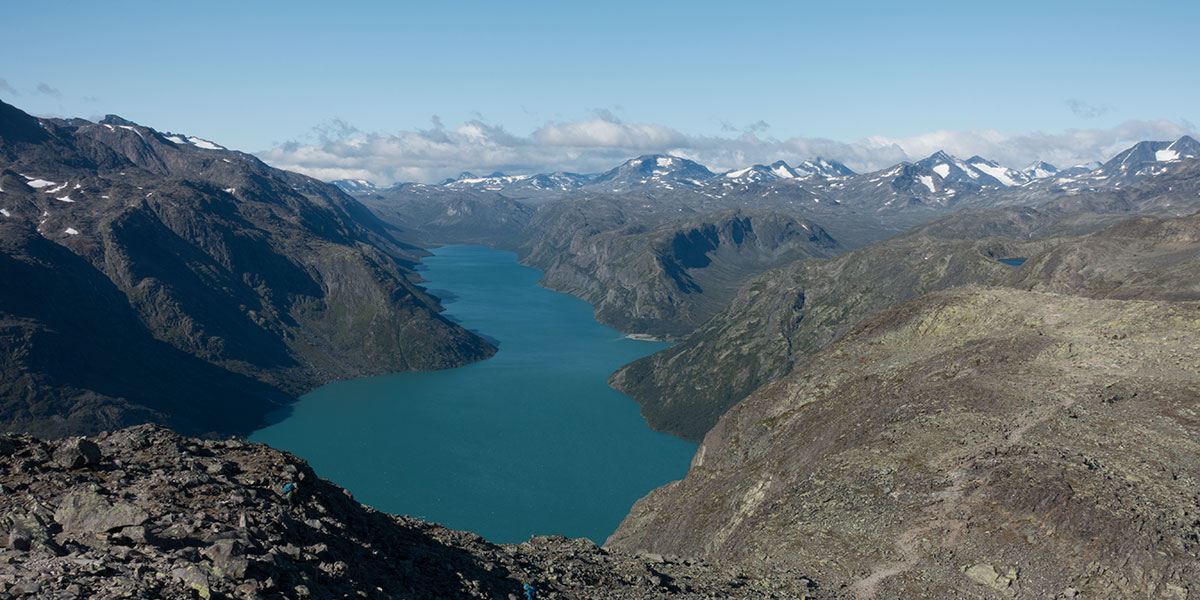
Norges Ryggrad
A two week hike from Gjendesheim to Lysefjord across Jotunheimen, Skarvheimen, Hardangervidda and the Ryfylke plateau in South-Central Norway

St. Moritz to Zermatt
A two week hike from St. Moritz to Zermatt along the mountains in the Swiss/Italian border

Norge Midt
A four week hike from Sulitjelma, County Nordland to As i Tydal, County Trondelag across Junkerdal, Saltfjellet, Borgefjell and Skjaekerfjell, among others, in North-Central Norway

Trollheimen to Hedmarksvidda
A two week hike from Oppdal, County Trondelag to Hamar, Innlandet County across Trollheimen, Dovrefjell, Rondane and Hedmarksvidda in South-Central Norway

Cantabrian High Route
A two week, self-supported trek of the Cantabrian Divide in the north of the Iberian Peninsula

Iberia Empty Quarter
An off-the-beaten-track route through the most sparsely human-inhabited regions of the Iberian Peninsula, away from the big mountains, inspired on my trips in similar areas in North America, enabled by the need to stay local in 2020 pandemic times.

Continental Divide Trail
The Continental Divide Trail follows the US Rocky Mountains along the Atlantic-Pacific watershed for 3000+ miles. In 2019, I walked them all.
Via Alpina 1
Trail number 1 in the Via Alpina Project traverses the northern edge of the Swiss Alps, crossing Switzerland east to west. I tried to hike it all in one week

Newfoundland IAT
Western Newfoundland is about wilderness, maddening bush and walking on the earth's mantle. It's now part of the International Appalachian Trail

Iceland North to South
Crossing Iceland coast to coast, north to south, from the Arctic ocean to the Atlantic, skirting volcanos and icefields

Cantabrian High Route East
The Cantabrian ranges are the place where limestone and meadows meet. The High Route is as wild as it gets

GR 5 Alpine Traverse
Number 5 in the French system goes along the western arc of the Alps in some sort of Coast to Coast: from Lake Leman to the Mediterranean sea it's all mountains

Colorado Trail
The Rockies are a huge range. One of its highest sections is in Colorado. The Colorado Trail is the route where you'll barely get below 3K m for several weeks in a row

Nordkalottleden
There's life beyond the Arctic Circle and there's also trails. Nordkalottleden takes the hiker across the last true wilderness area in Western Europe

Pacific Crest Trail
Two thousand six hundred miles of mountains and a trail to traverse them all. Everything is big in America

Pyrenean High Route
The High Pyrenean Route is about traversing the Pyrenees over the highest possibly walkable line. You might still need to use your hands occasionally
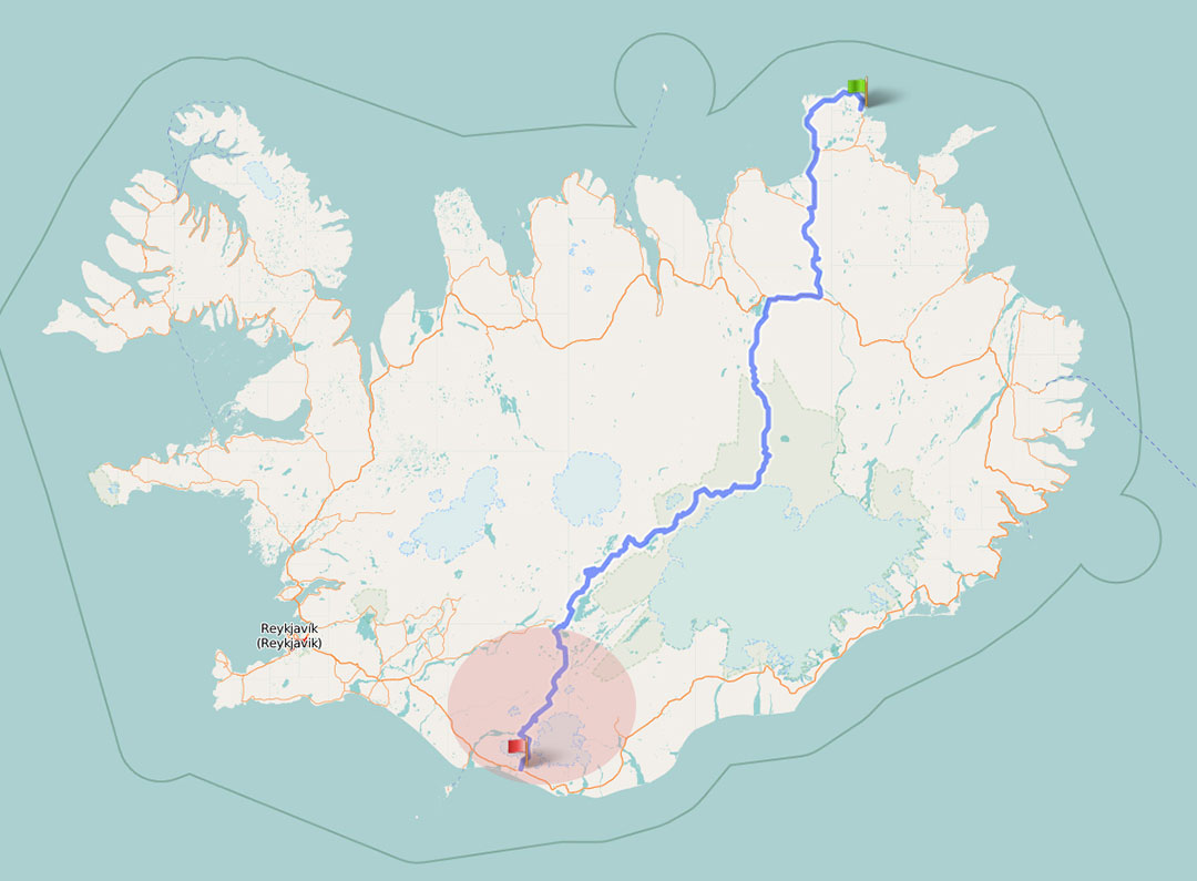
Distance covered: 27 miles
Today there’s two distinct sections: first I need to finish the Laugavegur, a mostly downhill affaire to the coastal valley of Thorsmork. Then, the steepest, longest climb of the trip to go over the Fimmvorduhals pass and down to trip end in Skogar. The potential for trouble lies in this second half with a pass above 1000 metres and a stormy forecast.
Distance covered: 23 miles
You can get up as early as you want in the Iceland summer. I never got a precise account of what time the sun did rise but I think some “nights” I got to feel ambient light around 3 am before turning back to sleep. Most nights I’m on my own and don’t relate to anyone so it’s not obvious whether I got up early or not if I don’t look at the watch. Today I’m in a tent town that’s still quiet and still when I leave. It must be early even though we’re in full daylight. It’s clear and bright and I get ready for a memorable hiking day.
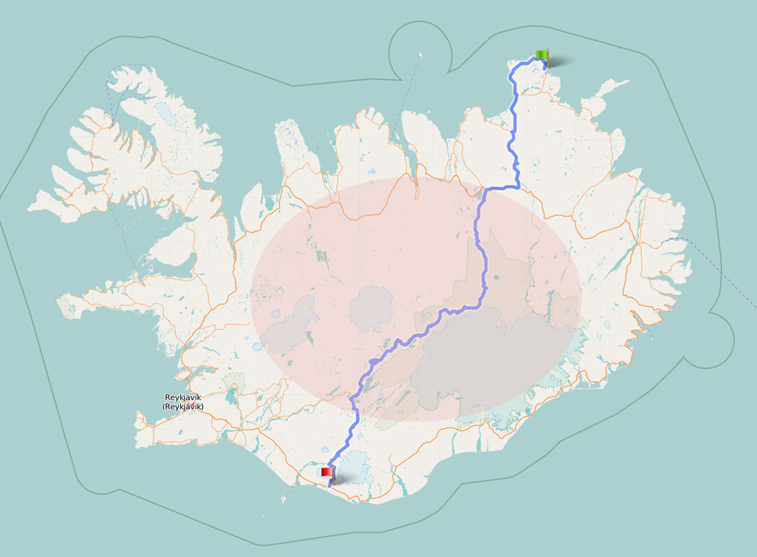
Distance covered: 19 miles
The day starts dark and moody. Rain spares my packing up but that’s all the respite I get as it soon starts coming down. I’m in high ground so I can see far to south and west and all I see is dark cloud. I get mentally ready for a wet march to Landmannalaugar.
 RSS – Posts